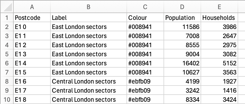
You can import postcode data from a spreadsheet. Our nifty importer will apply an algorithm to collect your unique labels and apply key colours automatically in an instant. This is a great feature if you’ve been working with spreadsheet postcode data in another system and want to import your data.
Download spreadsheet import templates for postcode areas, districts and sectors
Spreadsheet structure
- Supported formats: CSV, Excel (.csv,.xlsx, .xls)
- Postcodes can be at Area (e.g., BA), District (e.g., BA1), or Sector (e.g., BA1 0) level
- Column headers that will be automatically recognised: Postcode/Area/District/Sector, Label/Name, Colour
- Add a Label column to group postcodes (up to 200+ colours can be automatically assigned)
- Add a Colour column if you want to map with your own custom colours
- Colours can be expressed as hex codes (#FF0000), RGB/RGBA (rgba(255,0,0,1)), or names (red, blue, etc – see Easy Colours)
- No column headers? No problem – the system will help you to organise the column data regardless
- Minimum: if you provide a list of postcodes in one column, without any other data, our system will colour them en masse in a single colour
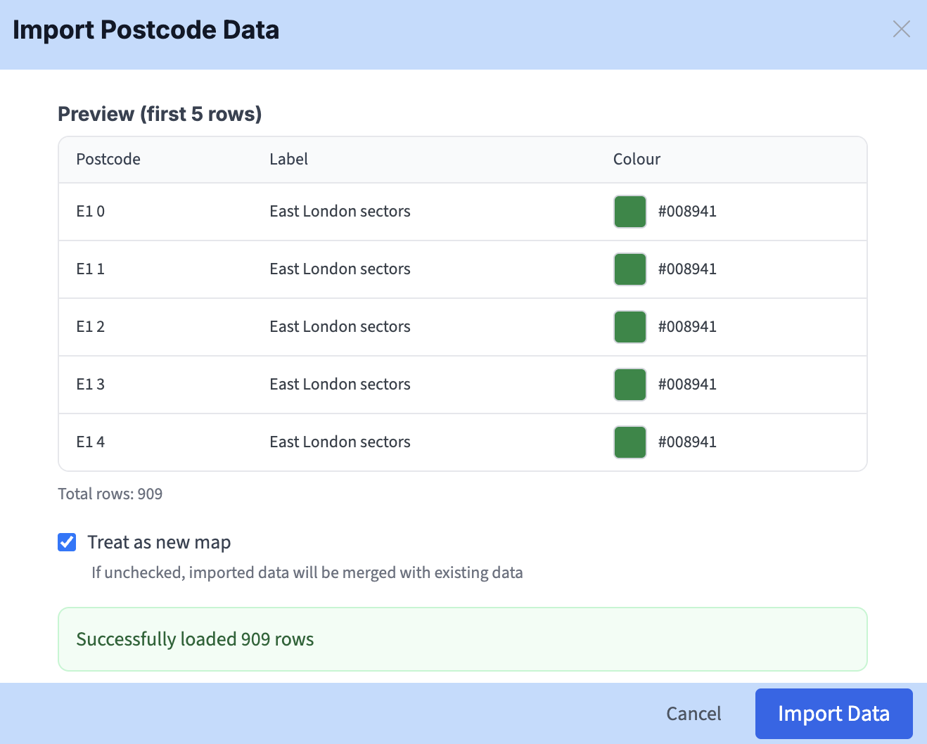
By default, the importer will clear any existing colours and treat the imported data as a new map. Uncheck to let the imported data be merged with existing data. If you are concerned about the possible effects of a merge, duplicate your map first as a backup before the merge operation.
Is your postcodes data in a different format to our templates (e.g. grouped in rows or cells rather than columns)? We offer bespoke services to help reformat data coming from other systems. Contact [email protected] for a quote.
Export data including population and household counts for your selected postcodes
Click Export Data on the top bar to download your postcode data in a spreadsheet including your labels and colours, plus population and household counts. This data will relate to your current postcode level setting – Area, District or Sector.