Shop
Showing 1–150 of 251 results
-
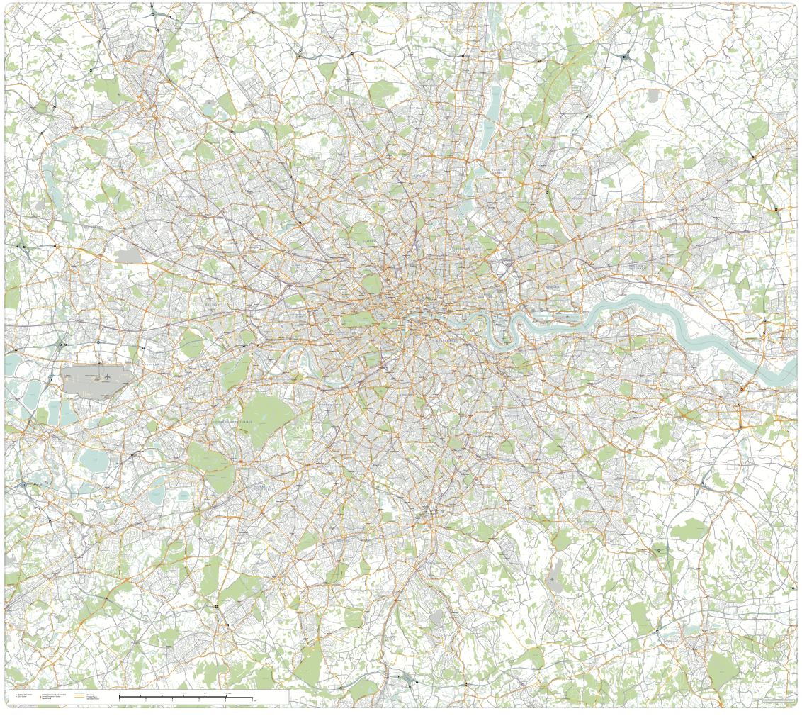
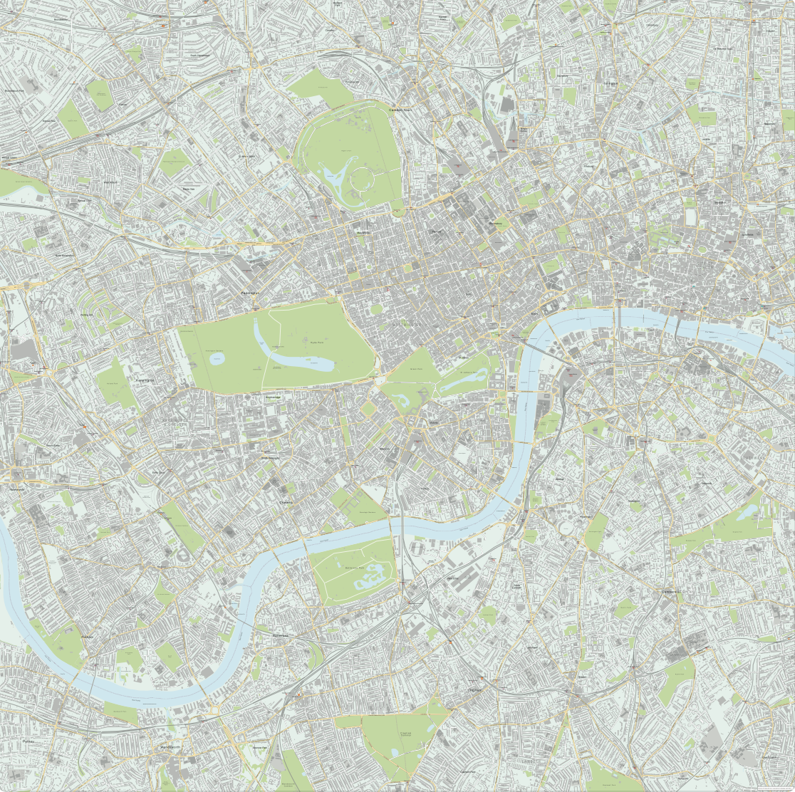
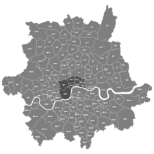
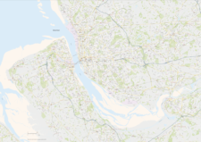
Greater London detailed map with all roads, transport, institutions, green areas
£150.00Detailed vector map of the whole of Greater London – all roads, stations, airports, rivers, green areas. A fantastic resource for professional designers and commercial projects. Provided in 2 versions for different scaling needs.
PDFsSVGLayered AI file -

Supersize map of Greater London postcode districts with full road network
£75.00Editable postcodes artwork scaled at 4.3 x 3.8 metres in its opening state. The full road network of Greater London is the backdrop, with major road names legible at large-scale printing.
PDFsLayered AI file -

Interactive map of London Low and Ultra-low Emission Zones (LEZ / ULEZ), Congestion Charge Zone (CCZ), with all postcodes
£45.00London’s Low Emission Zone and Driver Vision Standard (LEZ / DVS), Ultra-low Emission Zone (ULEZ), and Congestion Charge Zone (CCZ) juxtaposed with postcodes and local authority / London borough boundaries – this interactive online map is aimed primarily at businesses needing help to plan deliveries, driving routes and sales territories through and around London.
-

Map of London boroughs
£20.00All the London boroughs with options for showing the Thames.
PDFsSVGLayered AI file -
Map of Greater London districts and boroughs
£25.00Our editable vector map of Greater London has all the London boroughs and main towns, districts and suburbs within the M25.
PDFsSVGLayered AI file -
Map of Greater London postcode districts plus boroughs and major roads
£30.00All the postcode districts in Greater London, shown in context with the London boroughs, post towns, major roads and surrounding counties. Scaled for A3 and above.
PDFsSVGLayered AI file -
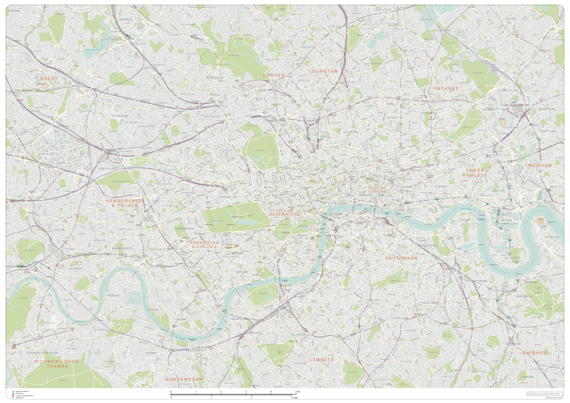
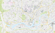
London map with roads, buildings, districts, boroughs, transport, landmarks
£100.00A superb general purpose editable map of London, with a wealth of detail including buildings, roads, railway lines, train stations, borough boundaries, rivers, canals, parks and landmarks
PDFsLayered AI file -
Central London detailed street map
£75.00Our most detailed map of central London, including buildings and street names across a large area
PDFsSVGLayered AI file -
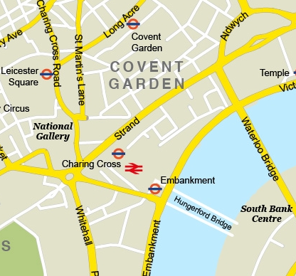
Central London – simple map with major features
£35.00Major roads, landmarks, Tube stations etc of central London
PDFsSVGLayered AI file -
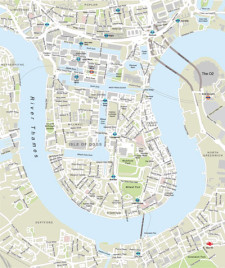
London Docklands with Canary Wharf map
£35.00Focus on the business area of Canary Wharf and Docklands, with a locator map showing the district’s geographicl relationship with the rest of London
PDFsSVGLayered AI file -

UK Local Authorities + Postcodes Map from April 2023
£60.00UK Local Authorities juxtaposed with postcodes districts, plus a Limited Free Pass for the Dynamic Mapping Suite giving access to online Local Authority maps and mapping tools.
PDFSVGLayered AI file -
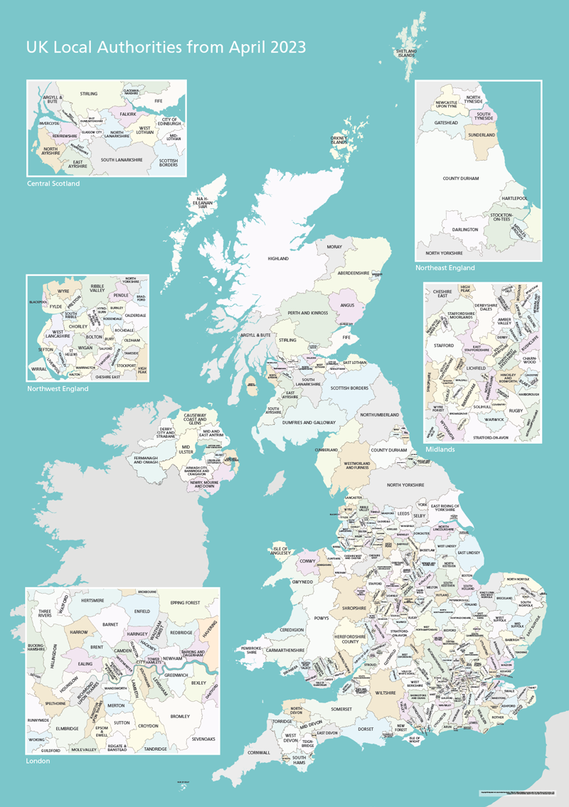
UK Local Authorities Map from April 2023
£40.00Shows all of the UK’s Local Authorities updated from April 2023. Sold in a package with simple poster versions and detailed context with towns and major roads. High-resolution PDFs, AI and SVG formats. All artwork layers can be edited. Also bundled with online Local Authority maps for super detail and dynamic mapping from spreadsheet.
PDFsSVGLayered AI file -
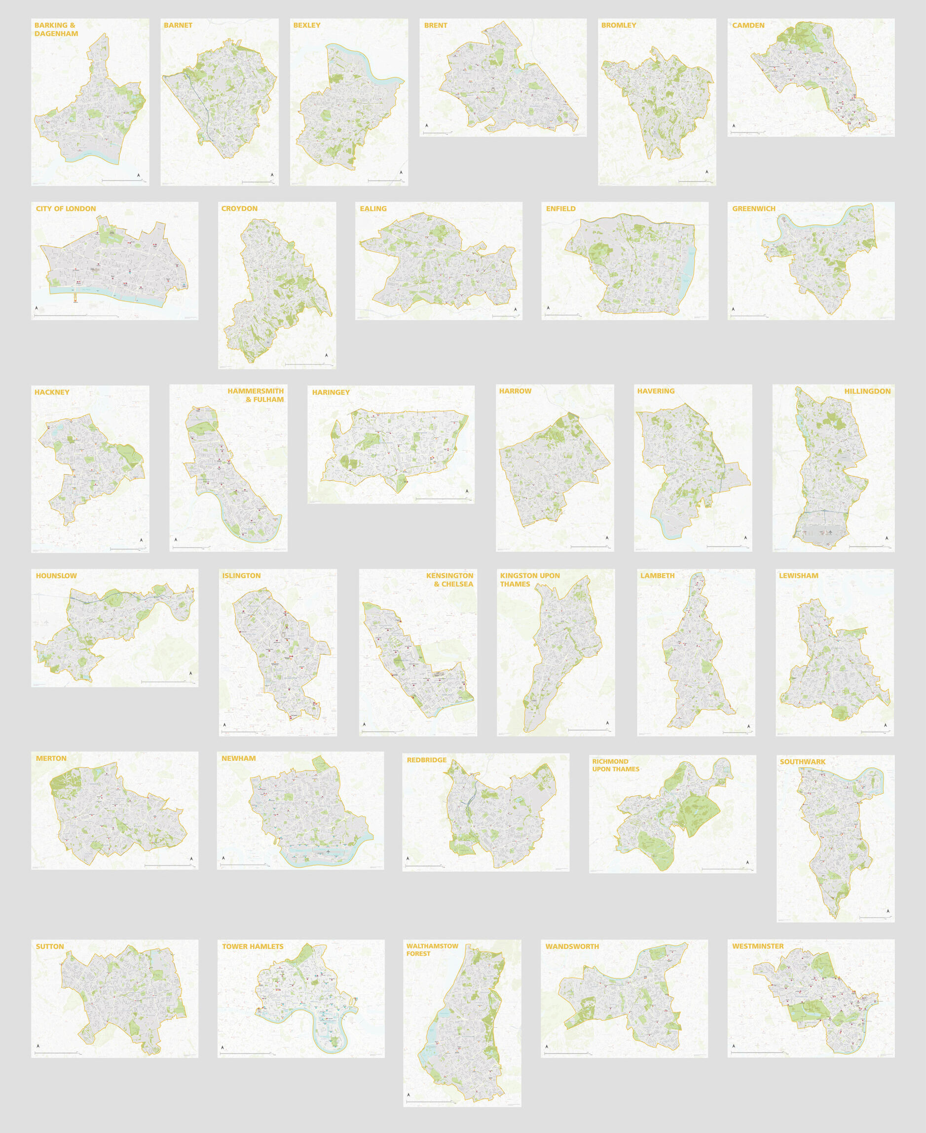
London Borough Maps: FULL SET of 34 maps
£300.00PDFsSVGLayered AI file -
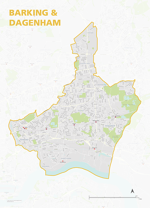
Barking & Dagenham – London borough map
£40.00Map of the London Borough of Barking and Dagenham, detailing the road and public transport network, as well as parks and other open areas. Designed for A1+ printing or editing for other uses.
PDFSVGLayered AI file -
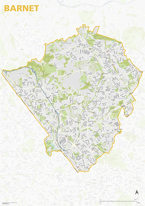
Barnet – London borough map
£40.00Map of the London Borough of Barnet, detailing the road and public transport network, as well as parks and other open areas. Designed for A1+ printing or editing for other uses.
PDFSVGLayered AI file -
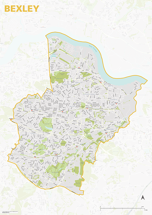
Bexley – London borough map
£40.00Map of the London Borough of Bexley, detailing the road and public transport network, as well as parks and other open areas. Designed for A1+ printing or editing for other uses.
PDFSVGLayered AI file -
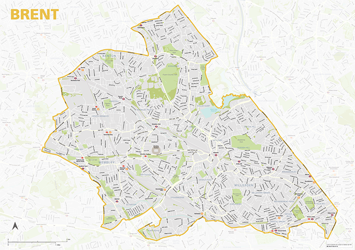
Brent – London borough map
£40.00Map of the London Borough of Brent, detailing the road and public transport network, as well as parks and other open areas. Designed for A1+ printing or editing for other uses.
PDFSVGLayered AI file -
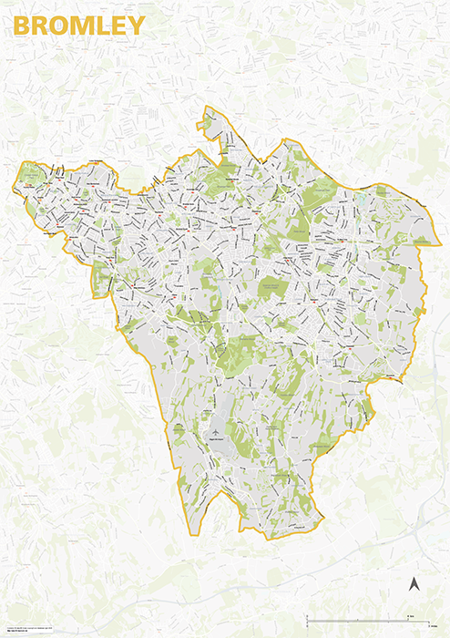
Bromley – London borough map
£40.00Map of the London Borough of Brent, detailing the road and public transport network, as well as parks and other open areas. Designed for A1+ printing or editing for other uses.
PDFSVGLayered AI file -

Camden – London borough map
£40.00Map of the London Borough of Camden, detailing the road and public transport network, as well as parks and other open areas. Designed for A1+ printing or editing for other uses.
PDFSVGLayered AI file -
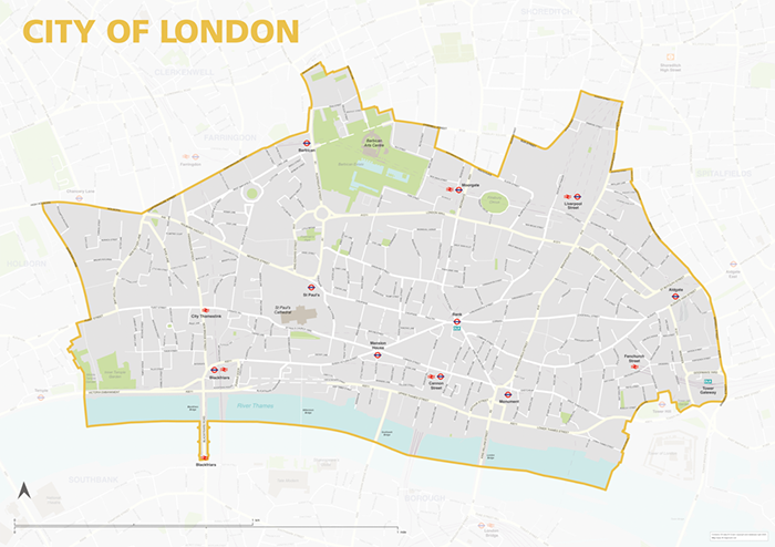
City of London – borough style map
£40.00Map of the City of London, detailing the road and public transport network, as well as park squares and other open areas. Designed for A1+ printing or editing for other uses.
PDFSVGLayered AI file -
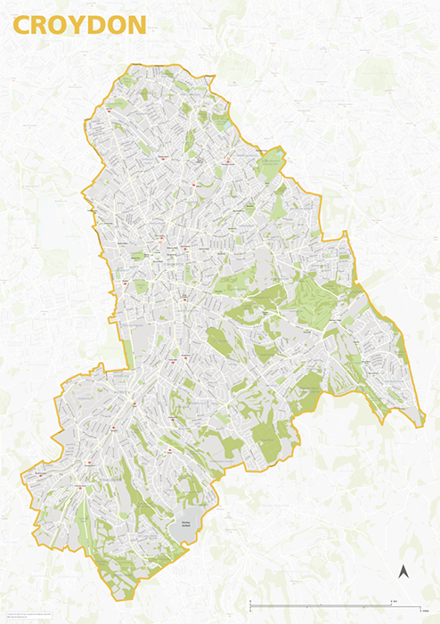
Croydon – London borough map
£40.00Map of the London Borough of Croydon, detailing the road and public transport network, as well as parks and other open areas. Designed for A1+ printing or editing for other uses.
PDFSVGLayered AI file -
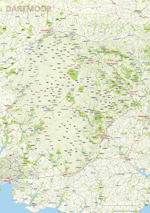
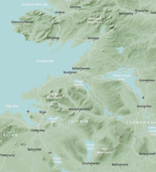
Dartmoor National Park map
£60.00Dartmoor National Park is highlighted along with towns, villages, roads, railway lines, lakes, rivers, woodland and green spaces. Natural features, such as tors, downs, and commons, are labelled too, as well as the historical and archaeological sites and churches in the vicinity. Principal car parks are also plotted. Scaled for A1+ printing
PDFsSVGLayered AI file -
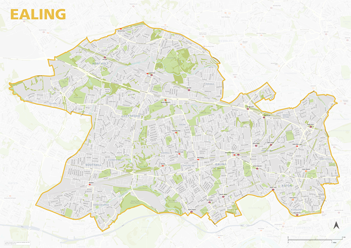
Ealing – London borough map
£40.00Map of the London Borough of Ealing, detailing the road and public transport network, as well as parks and other open areas. Designed for A1+ printing or editing for other uses.
PDFSVGLayered AI file -
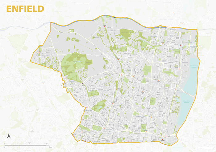
Enfield – London borough map
£40.00Map of the London Borough of Enfield, detailing the road and public transport network, as well as parks and other open areas. Designed for A1+ printing or editing for other uses.
PDFSVGLayered AI file -
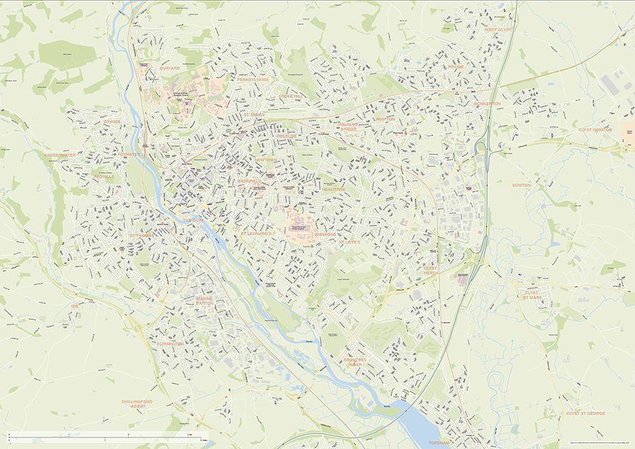
Exeter Street Maps
£60.00Editable street maps of Exeter and of Exeter and its environs (including Topsham, Exmouth and Dawlish). Supplied as flattened PDFs for immediate printing, and fully layered Illustrator, PDF and SVG formats. The map bases include a wealth of detail, including the full road network, railway lines, canals and rivers, parks and building shapes.
PDFsSVGLayered AI file -
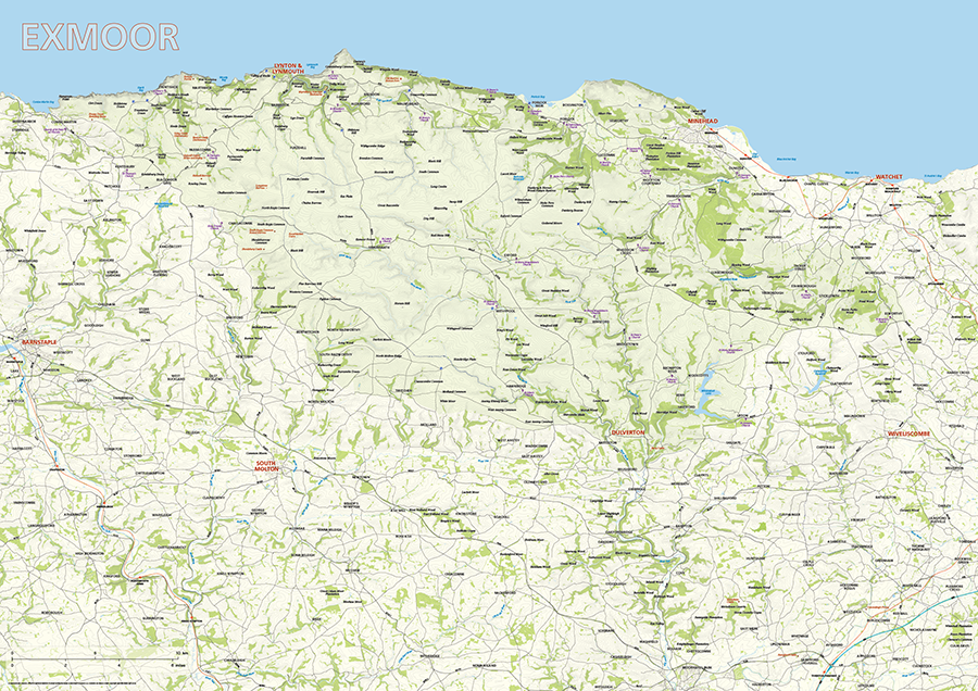
Exmoor National Park map
£60.00Exmoor National Park is highlighted along with towns, villages, roads, railway lines, lakes, rivers, woodland and green spaces. Natural features, such as hilltops, downs, and commons, are labelled too, as well as the smattering of archaeological sites in the vicinity. Scaled for A1+ printing
PDFsSVGLayered AI file -
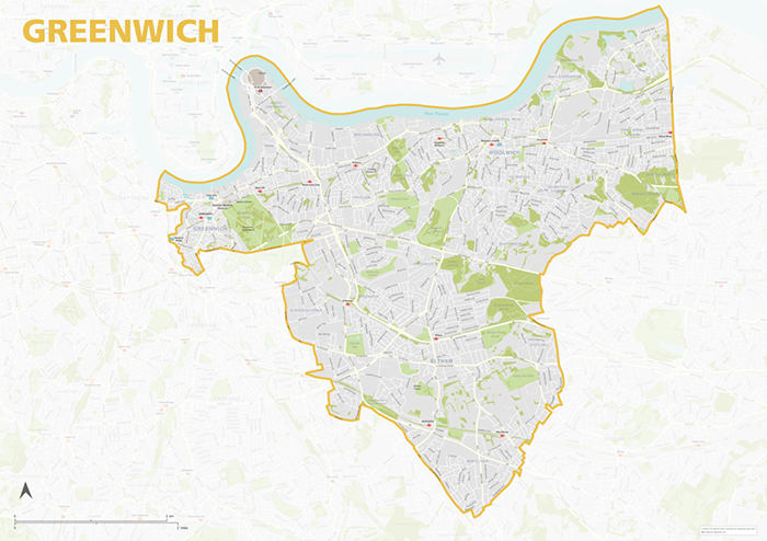
Greenwich – London borough map
£40.00Map of the London Borough of Greenwich, detailing the road and public transport network, as well as parks and other open areas. Designed for A1+ printing or editing for other uses.
PDFSVGLayered AI file -
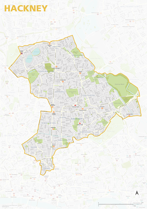
Hackney – London borough map
£40.00Map of the London Borough of Hackney, detailing the road and public transport network, as well as parks and other open areas. Designed for A1+ printing or editing for other uses.
PDFSVGLayered AI file -
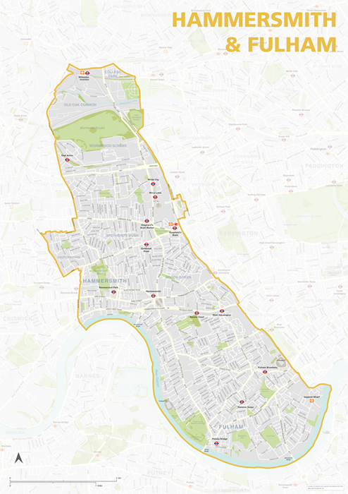
Hammersmith & Fulham – London borough map
£40.00Map of the London Borough of Hammersmith & Fulham, detailing the road and public transport network, as well as parks and other open areas. Designed for A1+ printing or editing for other uses.
PDFSVGLayered AI file -
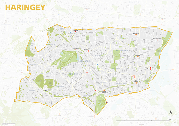
Haringey – London borough map
£40.00Map of the London Borough of Haringey, detailing the road and public transport network, as well as parks and other open areas. Designed for A1+ printing or editing for other uses.
PDFSVGLayered AI file -
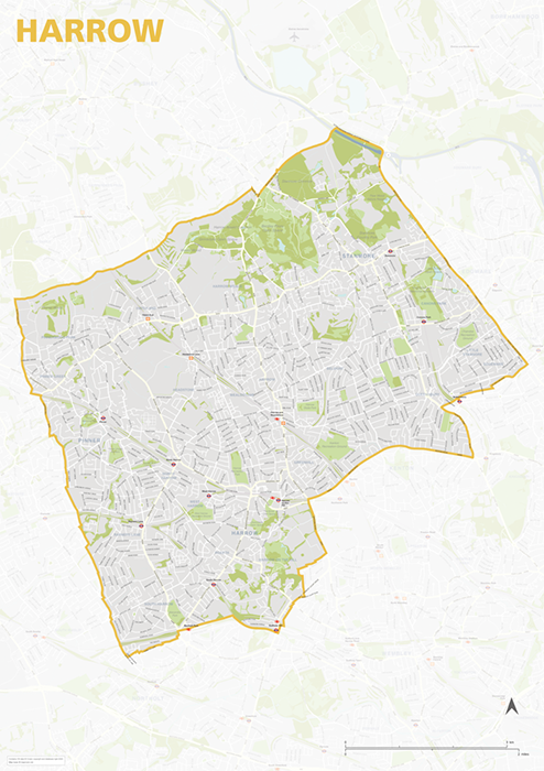
Harrow – London borough map
£40.00Map of the London Borough of Harrow, detailing the road and public transport network, as well as parks and other open areas. Designed for A1+ printing or editing for other uses.
PDFSVGLayered AI file -
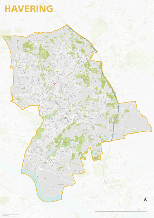
Havering – London borough map
£40.00Map of the London Borough of Havering, detailing the road and public transport network, as well as parks and other open areas. Designed for A1+ printing or editing for other uses.
PDFSVGLayered AI file -
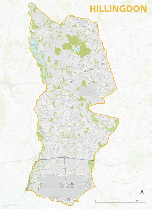
Hillingdon – London borough map
£40.00Map of the London Borough of Hillingdon, detailing the road and public transport network, as well as parks and other open areas. Designed for A1+ printing or editing for other uses.
PDFSVGLayered AI file -
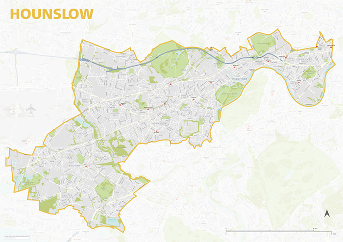
Hounslow – London borough map
£40.00Map of the London Borough of Hounslow, detailing the road and public transport network, as well as parks and other open areas. Designed for A1+ printing or editing for other uses.
PDFSVGLayered AI file -
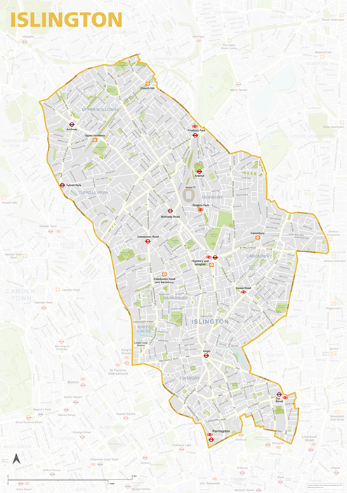
Islington – London borough map
£40.00Map of the London Borough of Islington, detailing the road and public transport network, as well as parks and other open areas. Designed for A1+ printing or editing for other uses.
PDFSVGLayered AI file -
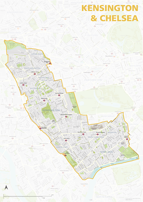
Kensington & Chelsea – London borough map
£40.00Map of the London Borough of Kensington & Chelsea, detailing the road and public transport network, as well as parks and other open areas. Designed for A1+ printing or editing for other uses.
PDFSVGLayered AI file -
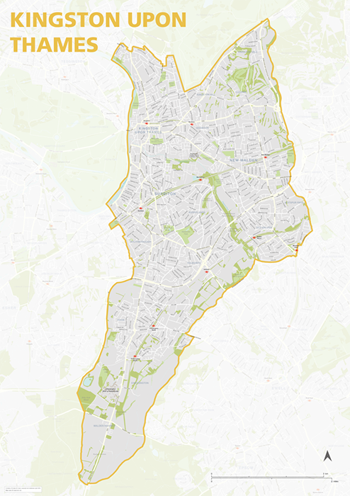
Kingston upon Thames – London borough map
£40.00Map of the London Borough of Kingston upon Thames, detailing the road and public transport network, as well as parks and other open areas. Designed for A1+ printing or editing for other uses.
PDFSVGLayered AI file -
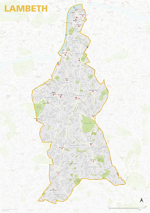
Lambeth – London borough map
£40.00Map of the London Borough of Lambeth, detailing the road and public transport network, as well as parks and other open areas. Designed for A1+ printing or editing for other uses.
PDFSVGLayered AI file -
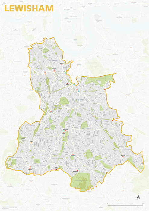
Lewisham – London borough map
£40.00Map of the London Borough of Lewisham, detailing the road and public transport network, as well as parks and other open areas. Designed for A1+ printing or editing for other uses.
PDFSVGLayered AI file -
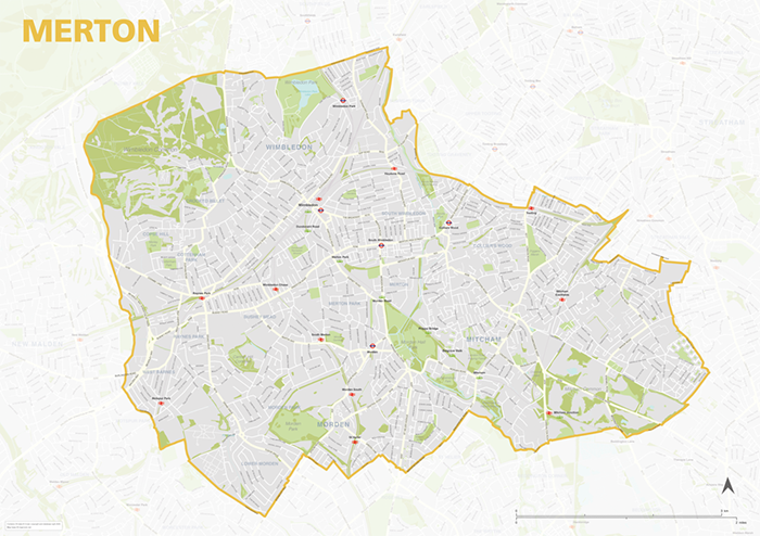
Merton – London borough map
£40.00Map of the London Borough of Merton, detailing the road and public transport network, as well as parks and other open areas. Designed for A1+ printing or editing for other uses.
PDFSVGLayered AI file -
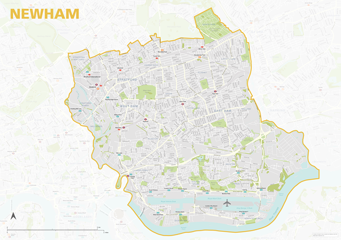
Newham – London borough map
£40.00Map of the London Borough of Newham, detailing the road and public transport network, as well as parks and other open areas. Designed for A1+ printing or editing for other uses.
PDFSVGLayered AI file -
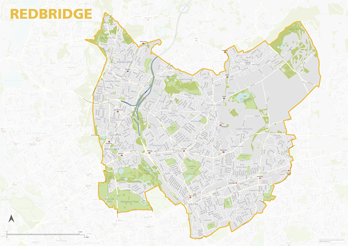
Redbridge – London borough map
£40.00Map of the London Borough of Redbridge, detailing the road and public transport network, as well as parks and other open areas. Designed for A1+ printing or editing for other uses.
PDFSVGLayered AI file -
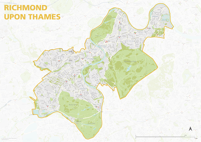
Richmond upon Thames – London borough map
£40.00Map of the London Borough of Richmond upon Thames, detailing the road and public transport network, as well as parks and other open areas. Designed for A1+ printing or editing for other uses.
PDFSVGLayered AI file -
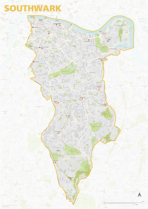
Southwark – London borough map
£40.00Map of the London Borough of Southwark, detailing the road and public transport network, as well as parks and other open areas. Designed for A1+ printing or editing for other uses.
PDFSVGLayered AI file -
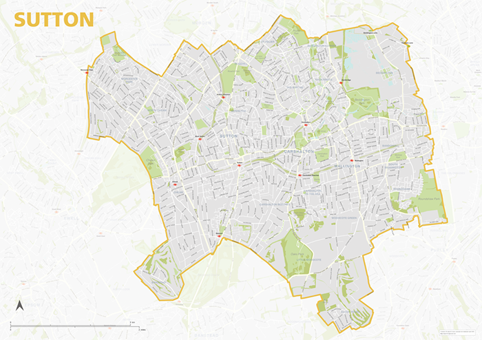
Sutton – London borough map
£40.00Map of the London Borough of Sutton, detailing the road and public transport network, as well as parks and other open areas. Designed for A1+ printing or editing for other uses.
PDFSVGLayered AI file -
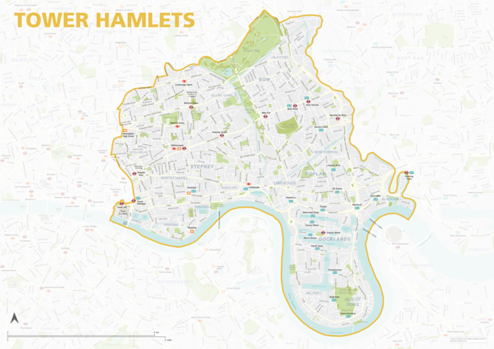
Tower Hamlets – London borough map
£40.00Map of the London Borough of Tower Hamlets, detailing the road and public transport network, as well as parks and other open areas. Designed for A1+ printing or editing for other uses.
PDFSVGLayered AI file -
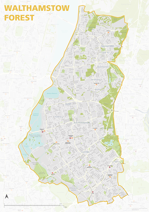
Waltham Forest – London borough map
£40.00Map of the London Borough of Tower Hamlets, detailing the road and public transport network, as well as parks and other open areas. Designed for A1+ printing or editing for other uses.
PDFSVGLayered AI file -
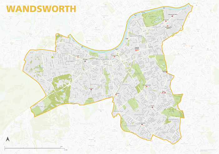
Wandsworth – London borough map
£40.00Map of the London Borough of Wandsworth, detailing the road and public transport network, as well as parks and other open areas. Designed for A1+ printing or editing for other uses.
PDFSVGLayered AI file -
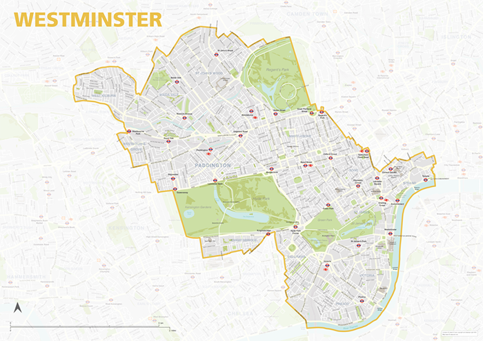
Westminster – London borough map
£40.00Map of the London Borough of Westminster, detailing the road and public transport network, as well as parks and other open areas. Designed for A1+ printing or editing for other uses.
PDFSVGLayered AI file -
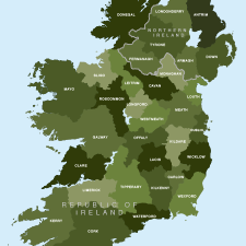
Map of Irish counties
£40.00All the counties in the Republic of Ireland and Northern Ireland
PDFsSVGLayered AI file -
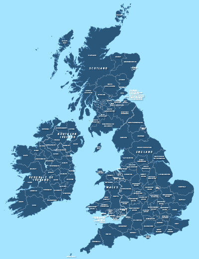
County maps of Britain and Ireland
£45.00Shows all the counties of Britain and Ireland and includes option layers for changing the colour fills and showing county boundaries.
PDFsSVGLayered AI file -
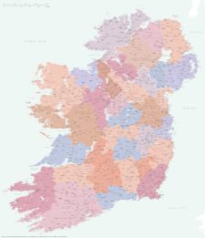
Best detailed map of Ireland
£70.00Approximately 1,400 towns and villages, 17,000+ roads, all the counties and a huge wealth of coastal detail, rivers, urban backdrop and green areas are plotted on our most detailed map of Ireland.
PDFsSVGLayered AI file -
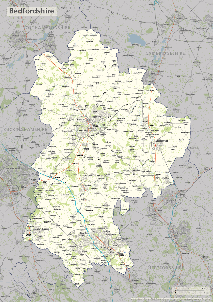
Bedfordshire county map
£40.00The ceremonial county of Bedfordshire is highlighted along with towns, villages, roads, railway lines, lakes, rivers, woodland and green spaces. Scaled for A3+ printing
PDFSVGLayered AI file -
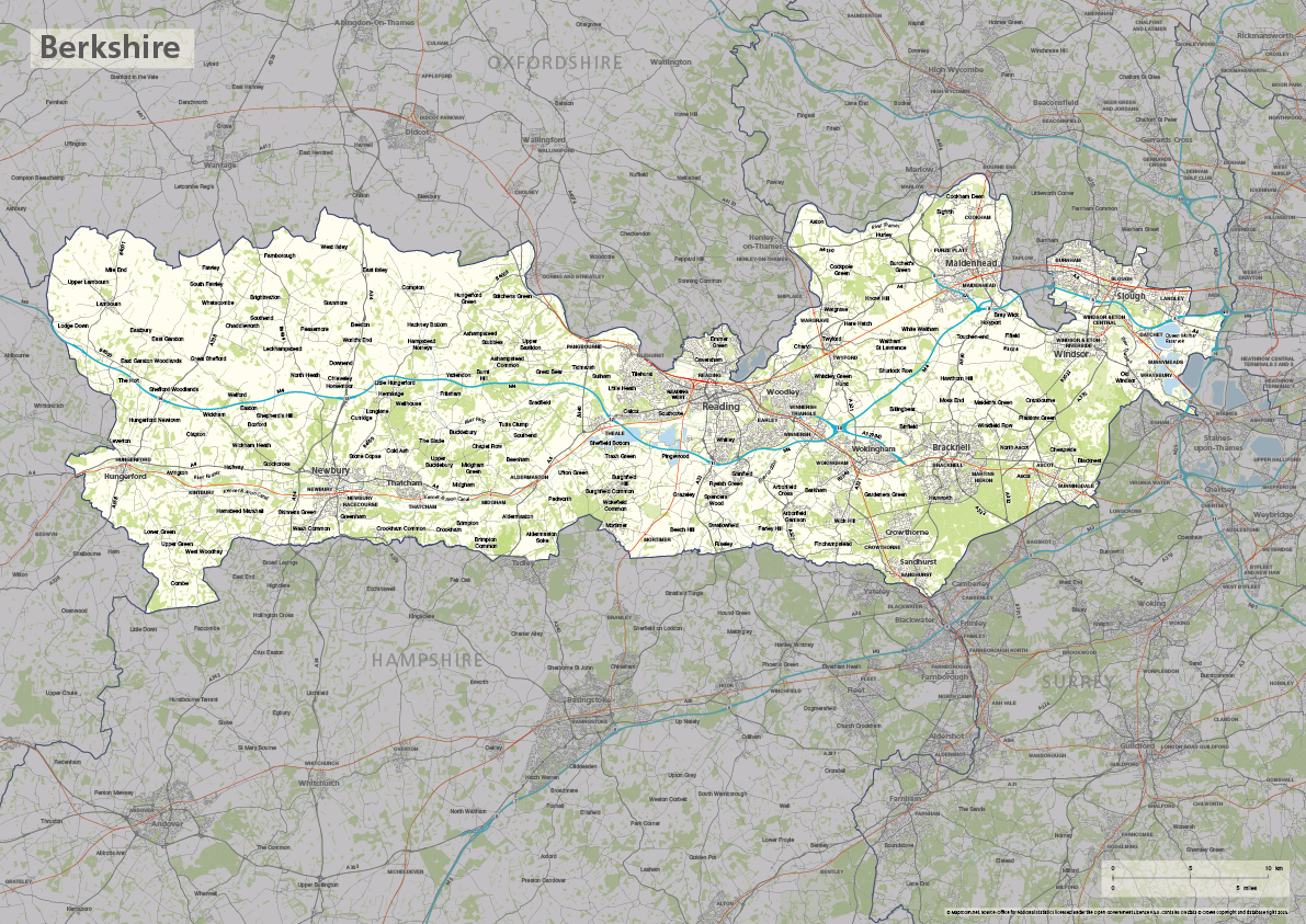
Berkshire county map
£40.00The ceremonial county of Berkshire is highlighted along with towns, villages, roads, railway lines, lakes, rivers, woodland and green spaces. Scaled for A3+ printing
PDFSVGLayered AI file -
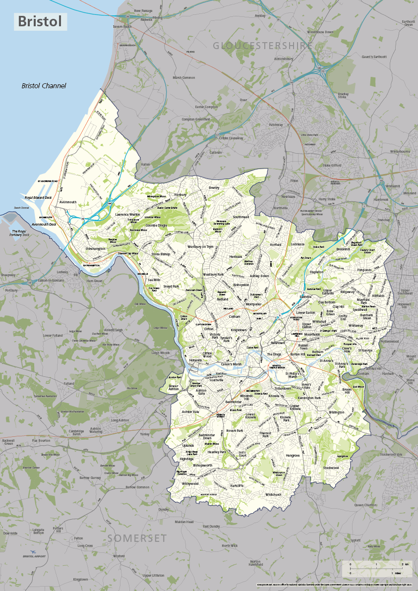
Bristol county map
£40.00The ceremonial county / unitary authority of Bristol is highlighted along with towns, villages, roads, railway lines, lakes, rivers, woodland and green spaces. Scaled for A3+ printing
PDFSVGLayered AI file -

Buckinghamshire county map
£40.00The ceremonial county of Buckinghamshire is highlighted along with towns, villages, roads, railway lines, lakes, rivers, woodland and green spaces. Scaled for A3+ printing
PDFSVGLayered AI file -
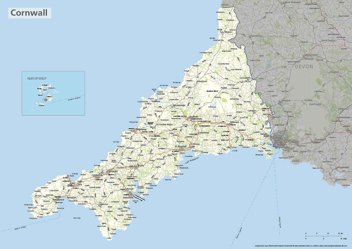
Cornwall county map with Isles of Scilly
£40.00The ceremonial county of Cornwall is highlighted along with towns, villages, roads, railway lines, lakes, rivers, woodland and green spaces. The Isles of Scilly are optionally shown in their natural geographic position or in an inset box. Scaled for A3+ printing
PDFSVGLayered AI file -

Devon county map
£40.00The ceremonial county of Devon is highlighted along with towns, villages, roads, railway lines, lakes, rivers, woodland and green spaces. Scaled for A3+ printing
PDFSVGLayered AI file -
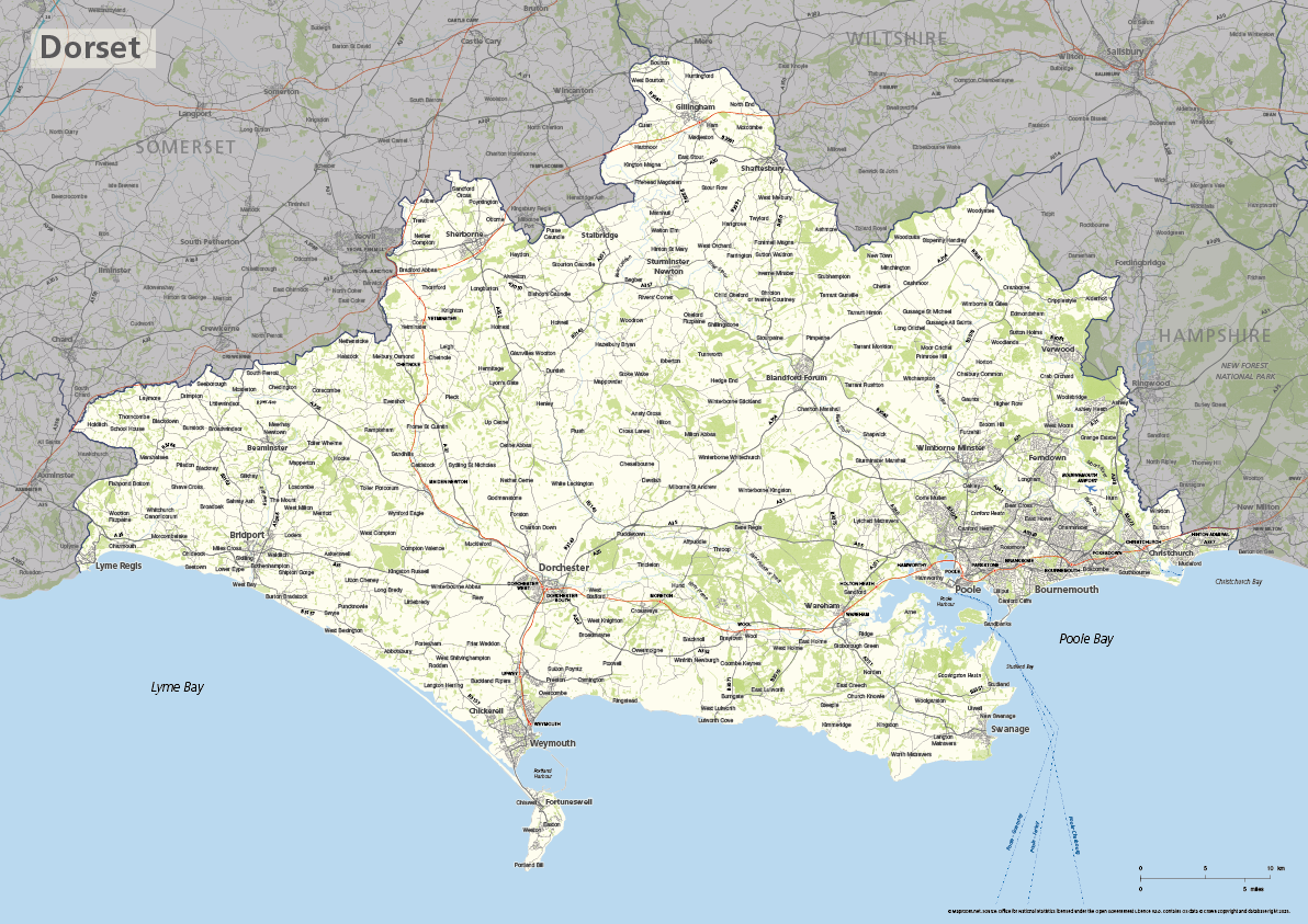
Dorset county map
£40.00The ceremonial county of Dorset is highlighted along with towns, villages, roads, railway lines, lakes, rivers, woodland and green spaces. Scaled for A3+ printing
PDFSVGLayered AI file -
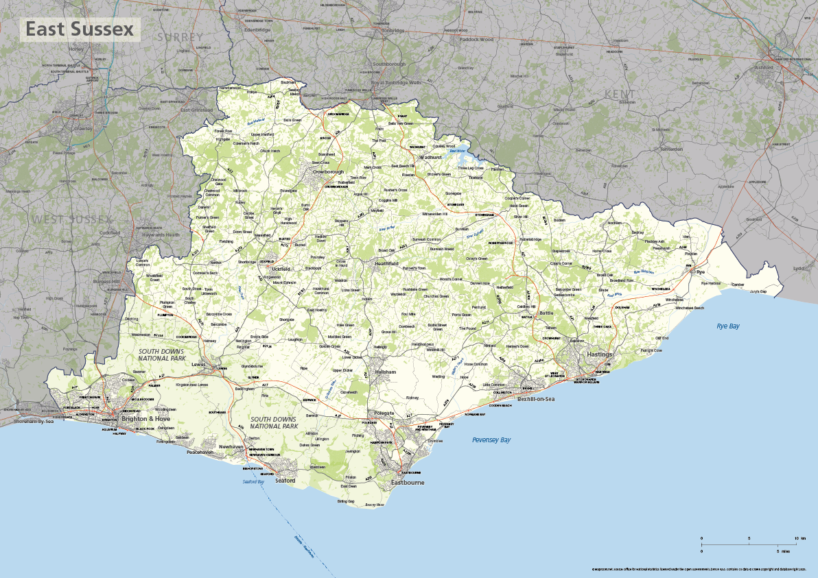
East Sussex county map
£40.00The ceremonial county of East Sussex is highlighted along with towns, villages, roads, railway lines, lakes, rivers, woodland and green spaces. Scaled for A3+ printing
PDFSVGLayered AI file -
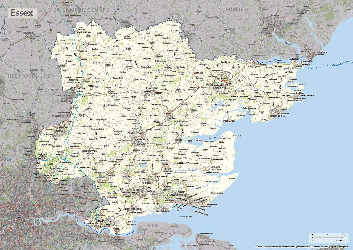
Essex county map
£40.00The ceremonial county of Essex is highlighted along with towns, villages, roads, railway lines, lakes, rivers, woodland and green spaces. Scaled for A3+ printing
PDFSVGLayered AI file -
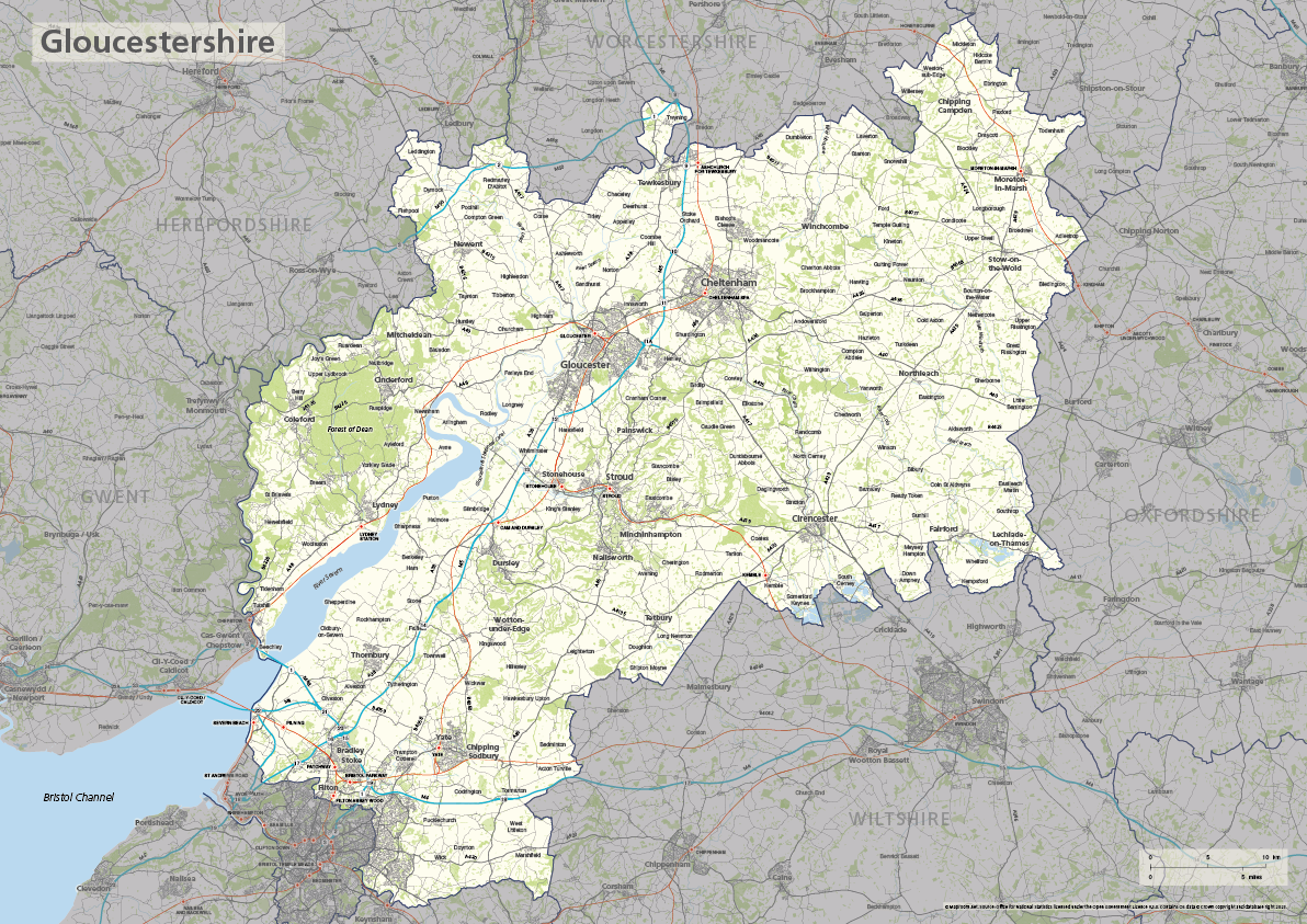
Gloucestershire county map
£40.00The ceremonial county of Gloucestershire is highlighted along with towns, villages, roads, railway lines, lakes, rivers, woodland and green spaces. Scaled for A3+ printing
PDFSVGLayered AI file -
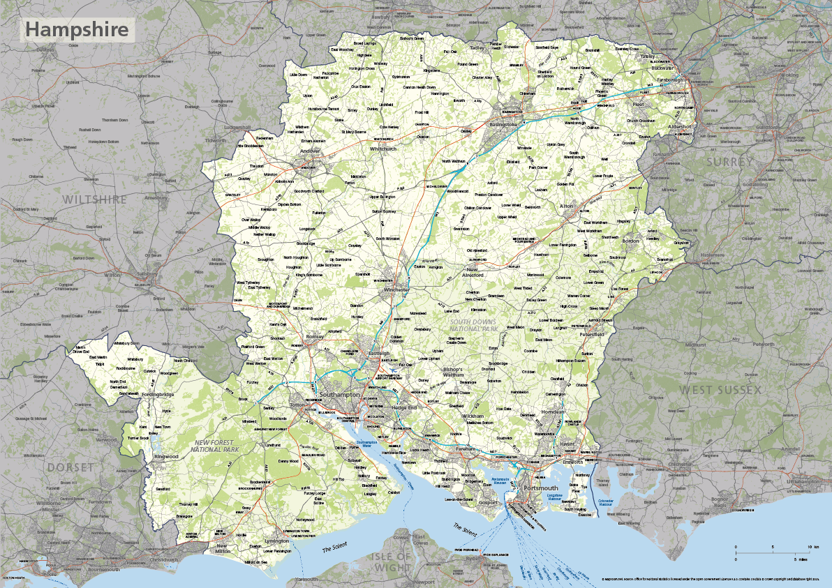
Hampshire county map
£40.00The ceremonial county of Hampshire is highlighted along with towns, villages, roads, railway lines, lakes, rivers, woodland and green spaces. Scaled for A3+ printing
PDFSVGLayered AI file -
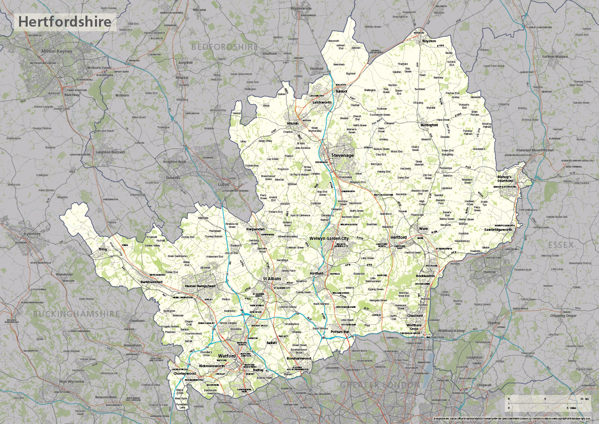
Hertfordshire county map
£40.00The ceremonial county of Hertfordshire is highlighted along with towns, villages, roads, railway lines, lakes, rivers, woodland and green spaces. Scaled for A3+ printing
PDFSVGLayered AI file -
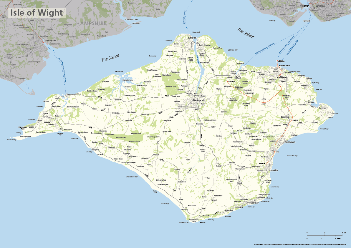
Isle of Wight map
£40.00The ceremonial county of the Isle of Wight is highlighted along with towns, villages, roads, railway lines, lakes, rivers, woodland and green spaces. Scaled for A3+ printing
PDFSVGLayered AI file -

Kent county map
£40.00The ceremonial county of Kent is highlighted along with towns, villages, roads, railway lines, lakes, rivers, woodland and green spaces. Scaled for A3+ printing
PDFSVGLayered AI file -
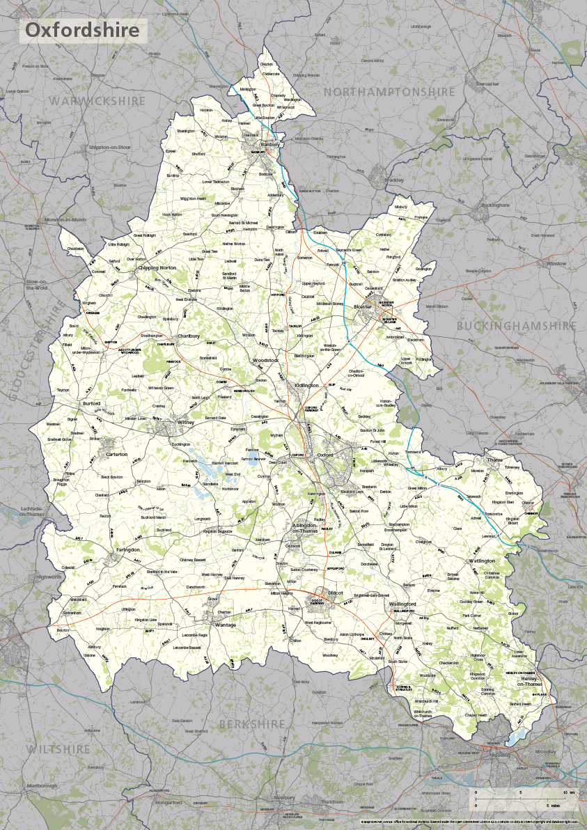
Oxfordshire county map
£40.00The ceremonial county of Oxfordshire is highlighted along with towns, villages, roads, railway lines, lakes, rivers, woodland and green spaces. Scaled for A3+ printing
PDFSVGLayered AI file -
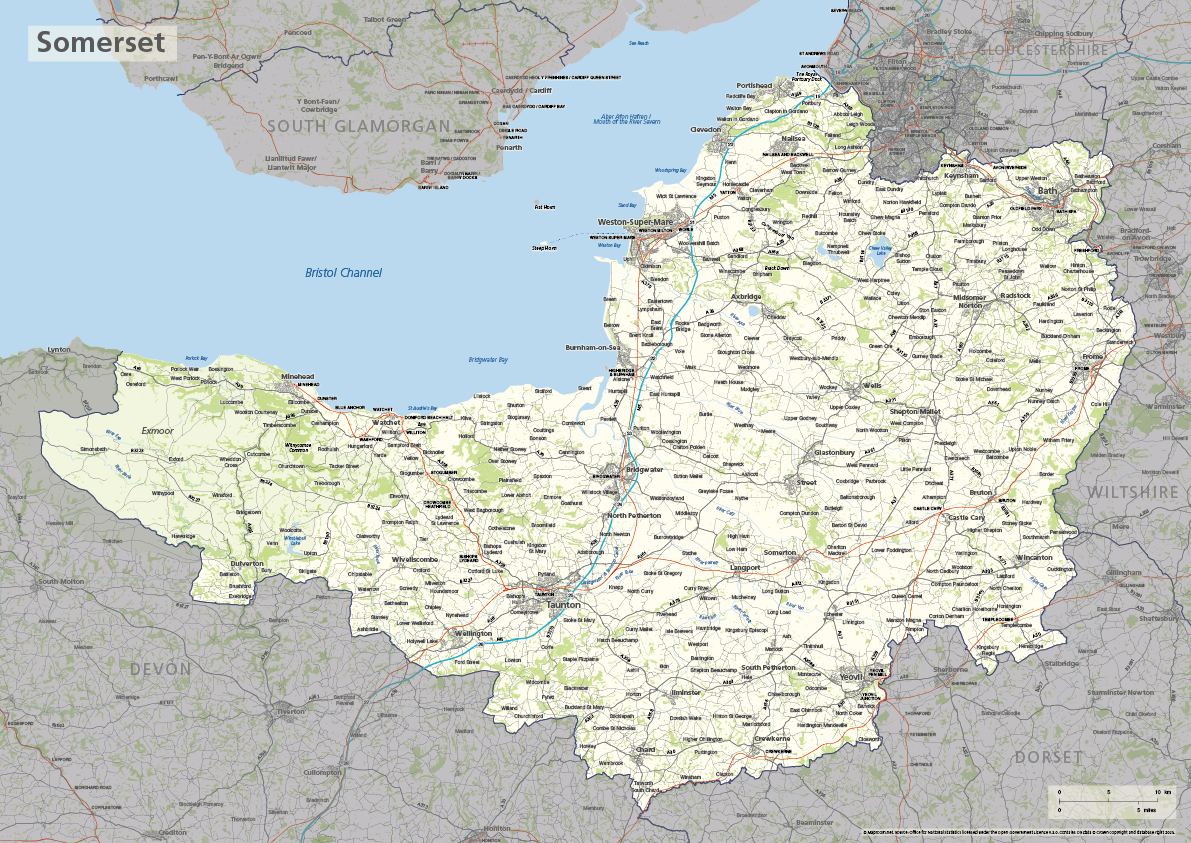
Somerset county map
£40.00The ceremonial county of Somerset is highlighted along with towns, villages, roads, railway lines, lakes, rivers, woodland and green spaces. Scaled for A3+ printing
PDFSVGLayered AI file -
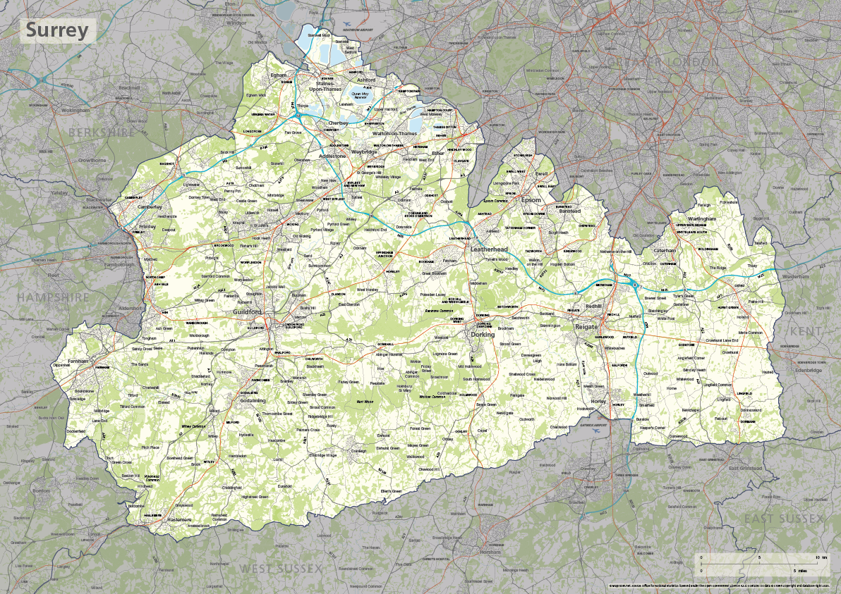
Surrey county map
£40.00The ceremonial county of Surrey is highlighted along with towns, villages, roads, railway lines, lakes, rivers, woodland and green spaces. Scaled for A3+ printing
PDFSVGLayered AI file -
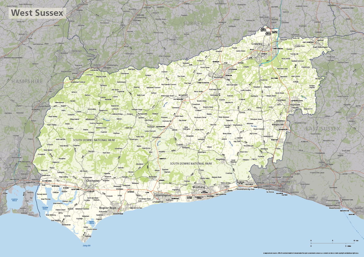
West Sussex county map
£40.00The ceremonial county of West Sussex is highlighted along with towns, villages, roads, railway lines, lakes, rivers, woodland and green spaces. Scaled for A3+ printing
PDFSVGLayered AI file -
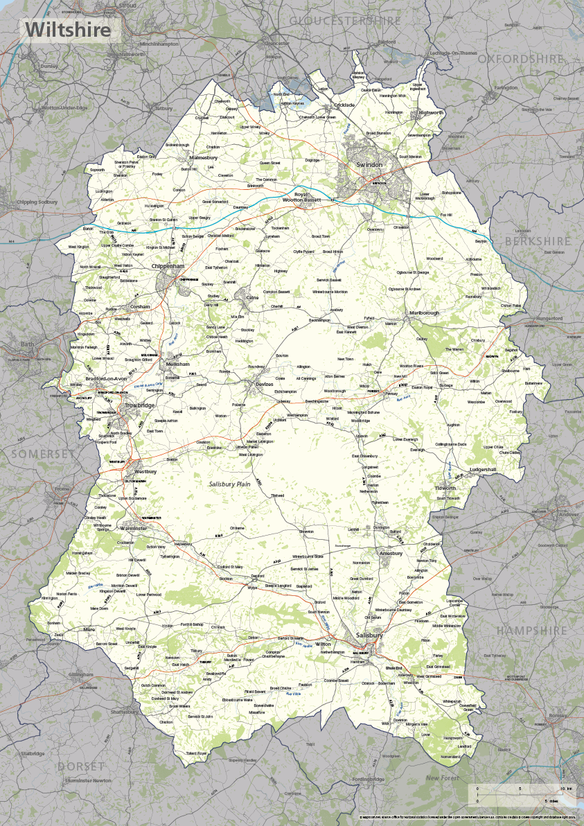
Wiltshire county map
£40.00The ceremonial county of Wiltshire is highlighted along with towns, villages, roads, railway lines, lakes, rivers, woodland and green spaces. Scaled for A3+ printing
PDFSVGLayered AI file -
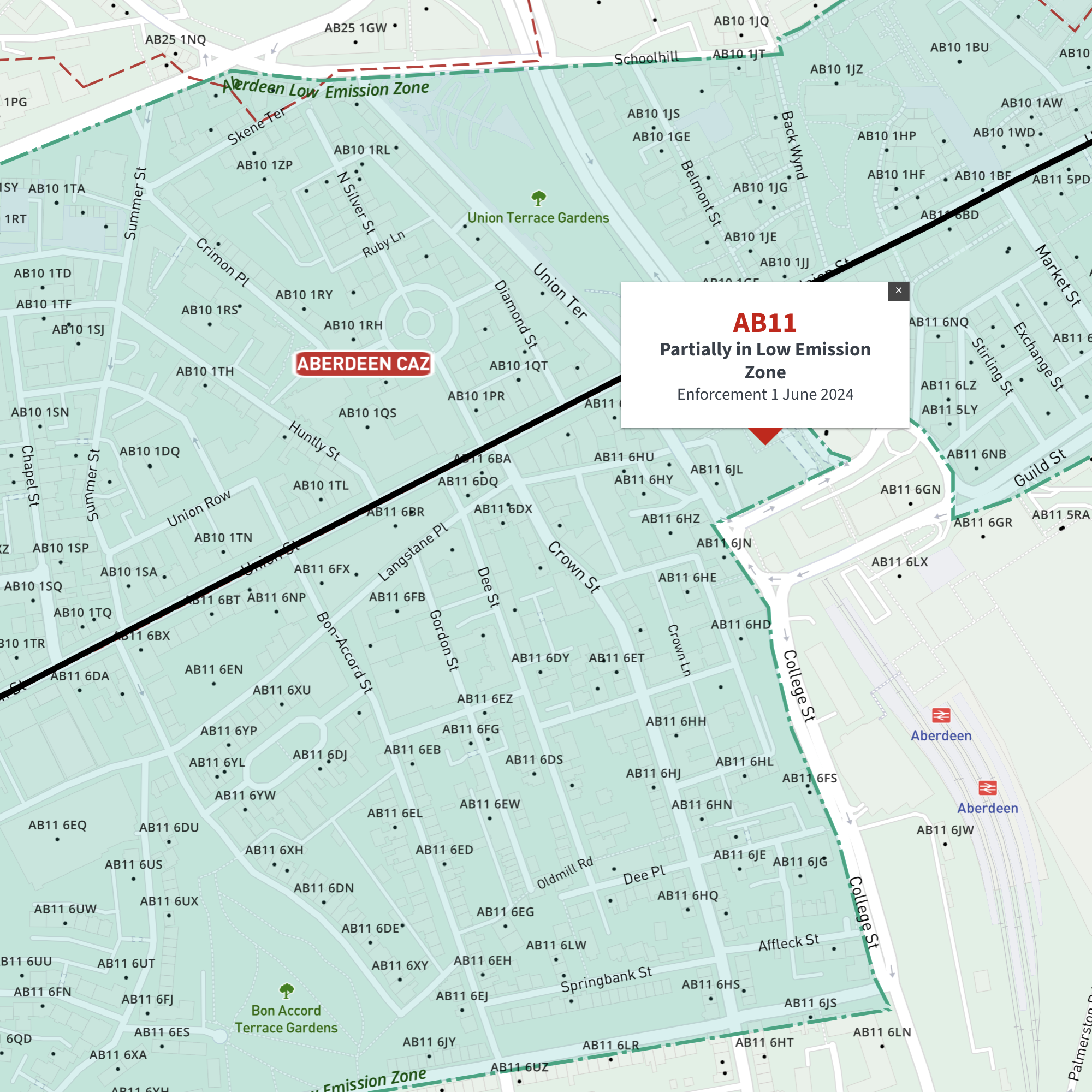
Interactive map of Aberdeen Low Emission Zone and all AB postcodes
£35.00Online deep-zoom map of Aberdeen Low Emission Zone (LEZ) with AB postcode districts, sectors and units available in the Dynamic Mapping Suite
-
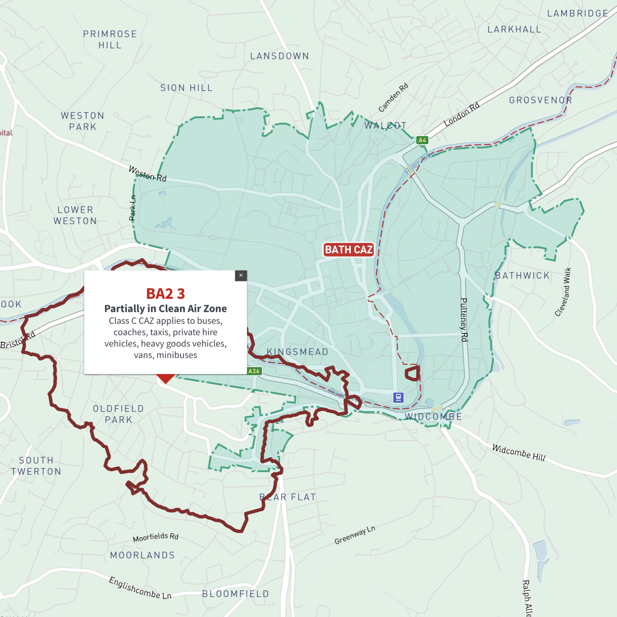
Interactive map of Bath Clean Air Zone and all BA postcodes
£35.00Online deep-zoom map of Bath Clean Air Zone (CAZ) with BA postcode districts, sectors and units available in the Dynamic Mapping Suite
-
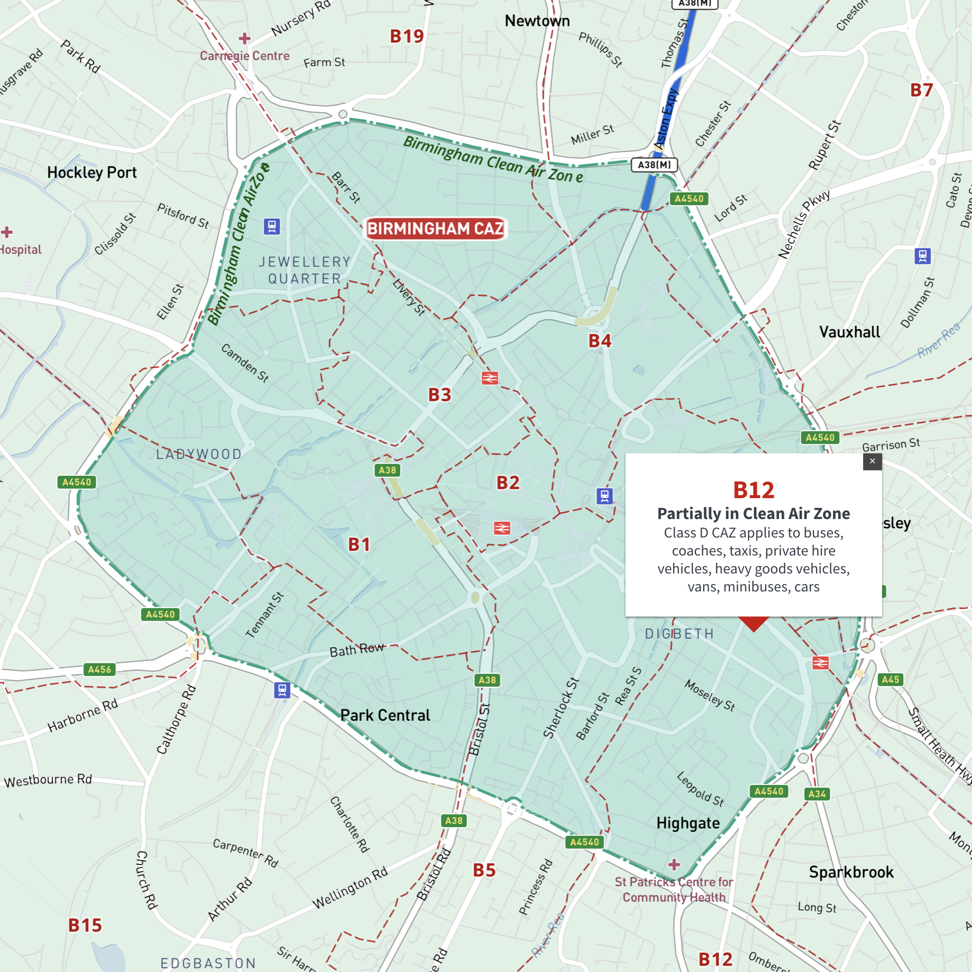
Interactive map of Birmingham Clean Air Zone with postcodes
£35.00This interactive street map of Birmingham has overlays and popups showing the Clean Air Zone juxtaposed with postcodes. It is aimed primarily at businesses needing reference to plan deliveries, driving routes and sales territories in and around Birmingham’s Clean Air Zone.
-
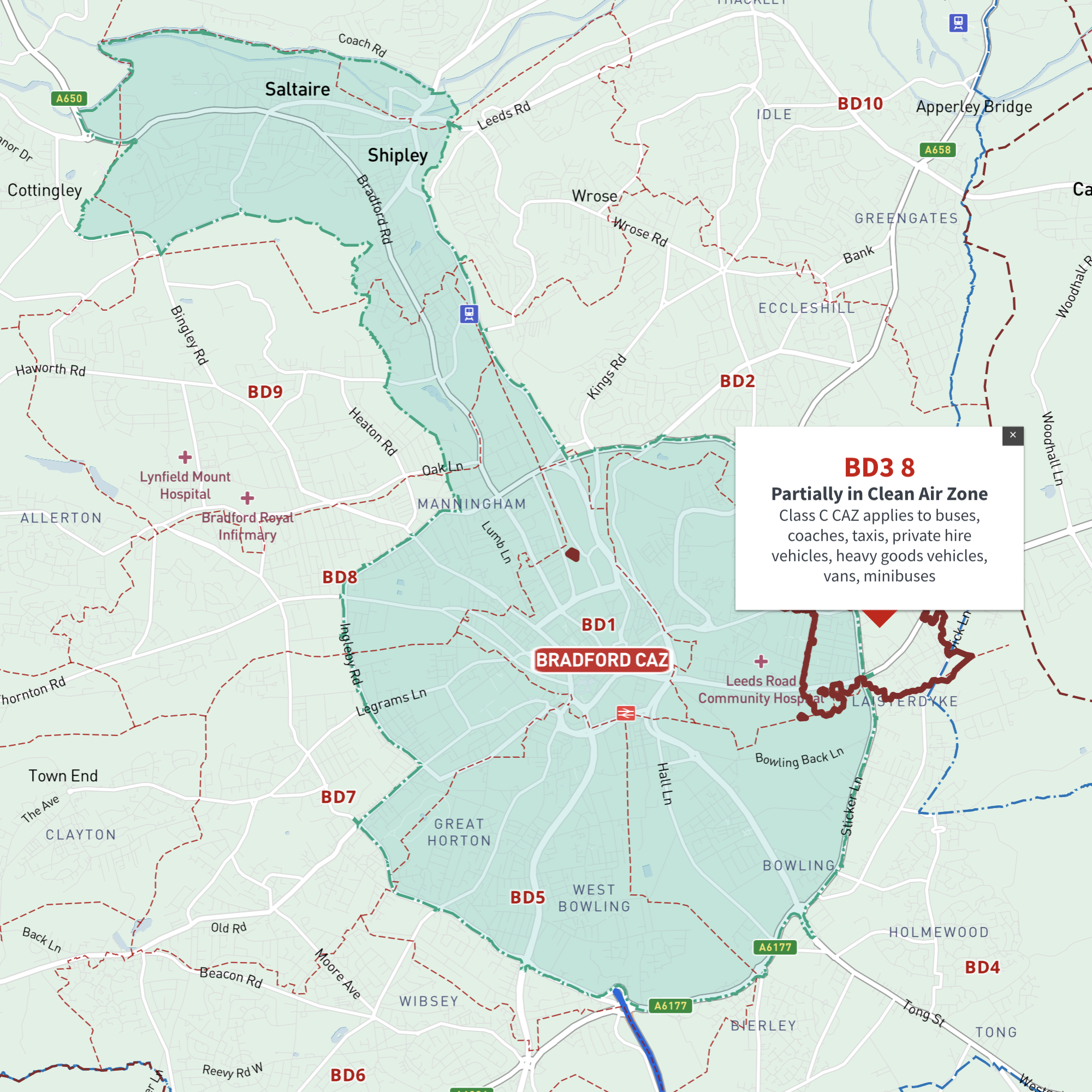
Interactive map of Bradford Clean Air Zone and all BD postcodes
£35.00Online deep-zoom map of Bradford Clean Air Zone (CAZ) with BD postcode districts, sectors and units available in the Dynamic Mapping Suite
-
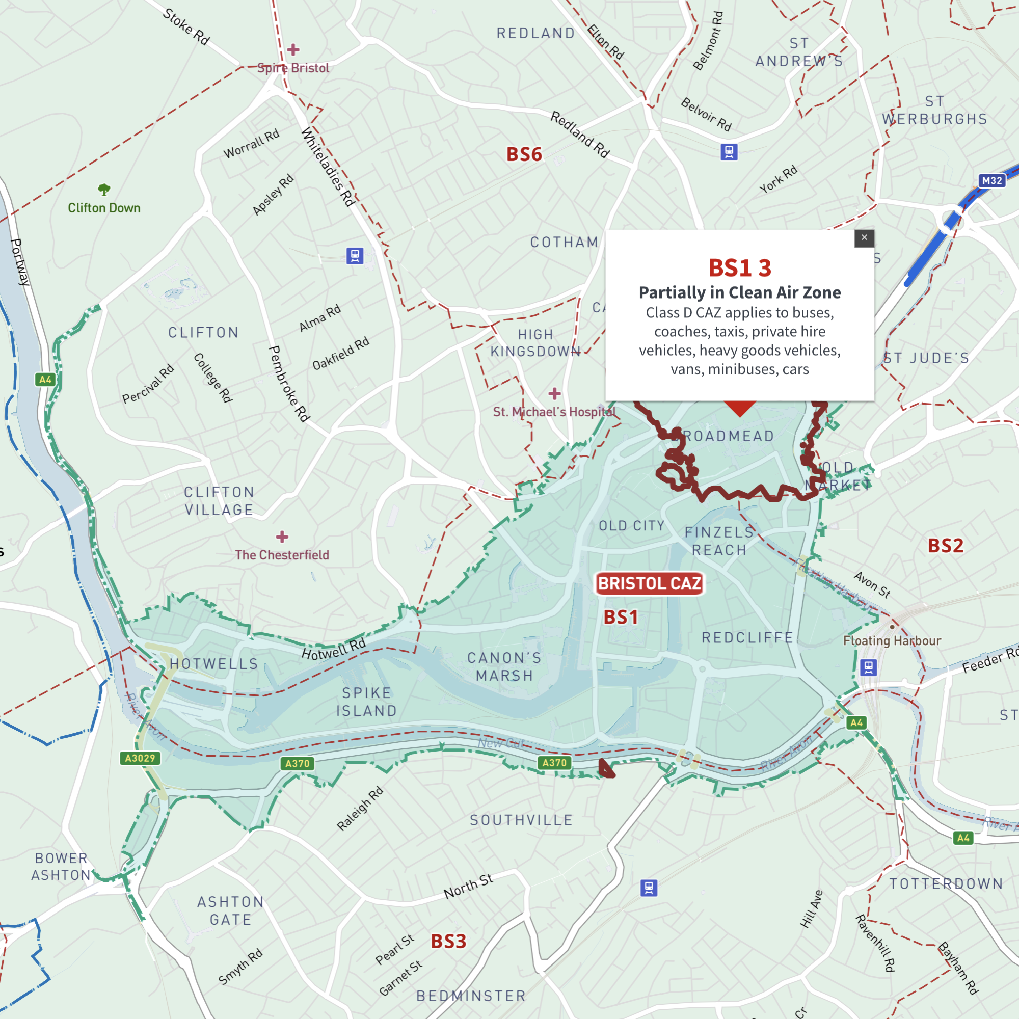
Interactive map of Bristol Clean Air Zone and all BS postcodes
£35.00Online deep-zoom map of Bristol Clean Air Zone (CAZ) with BS postcode districts, sectors and units available in the Dynamic Mapping Suite
-
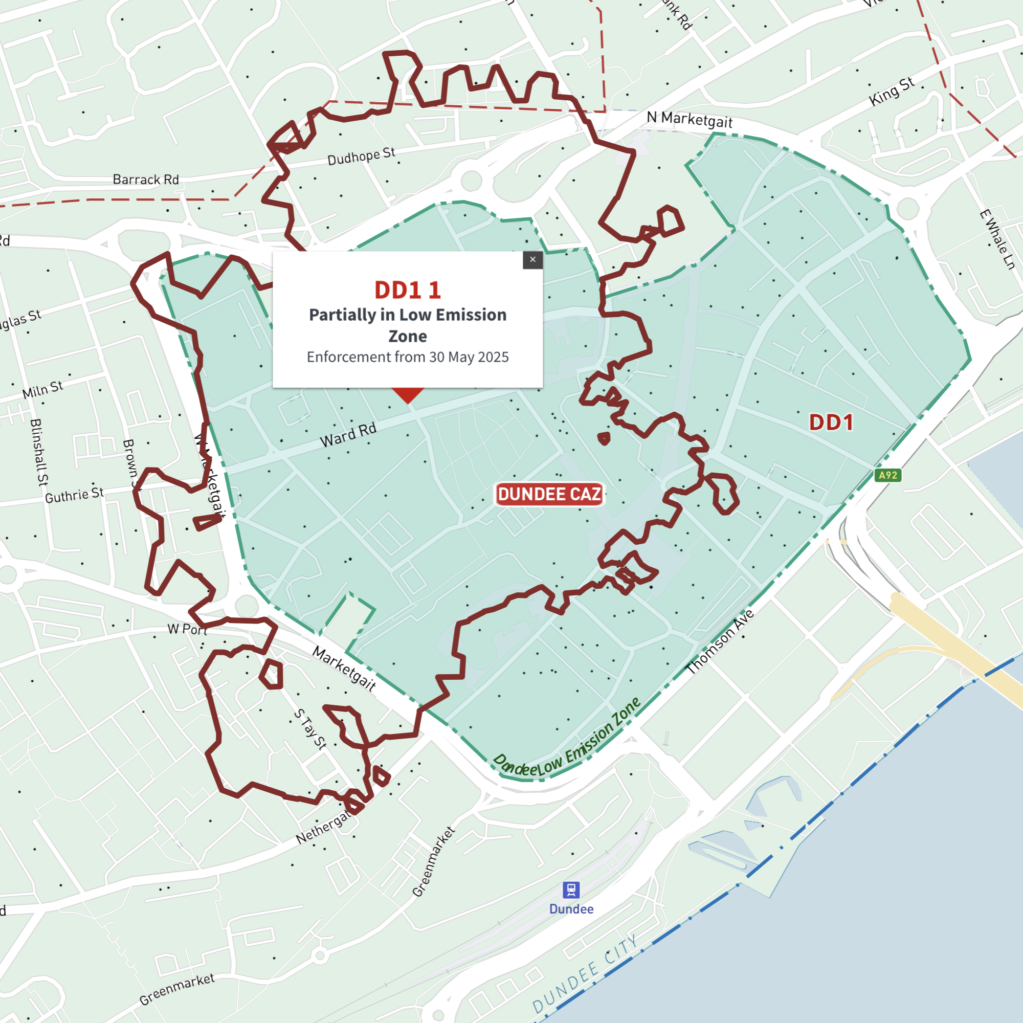
Interactive map of Dundee Low Emission Zone and all DD postcodes
£35.00Online deep-zoom map of Dundee Low Emission Zone (LEZ) with DD postcode districts, sectors and units available in the Dynamic Mapping Suite
-
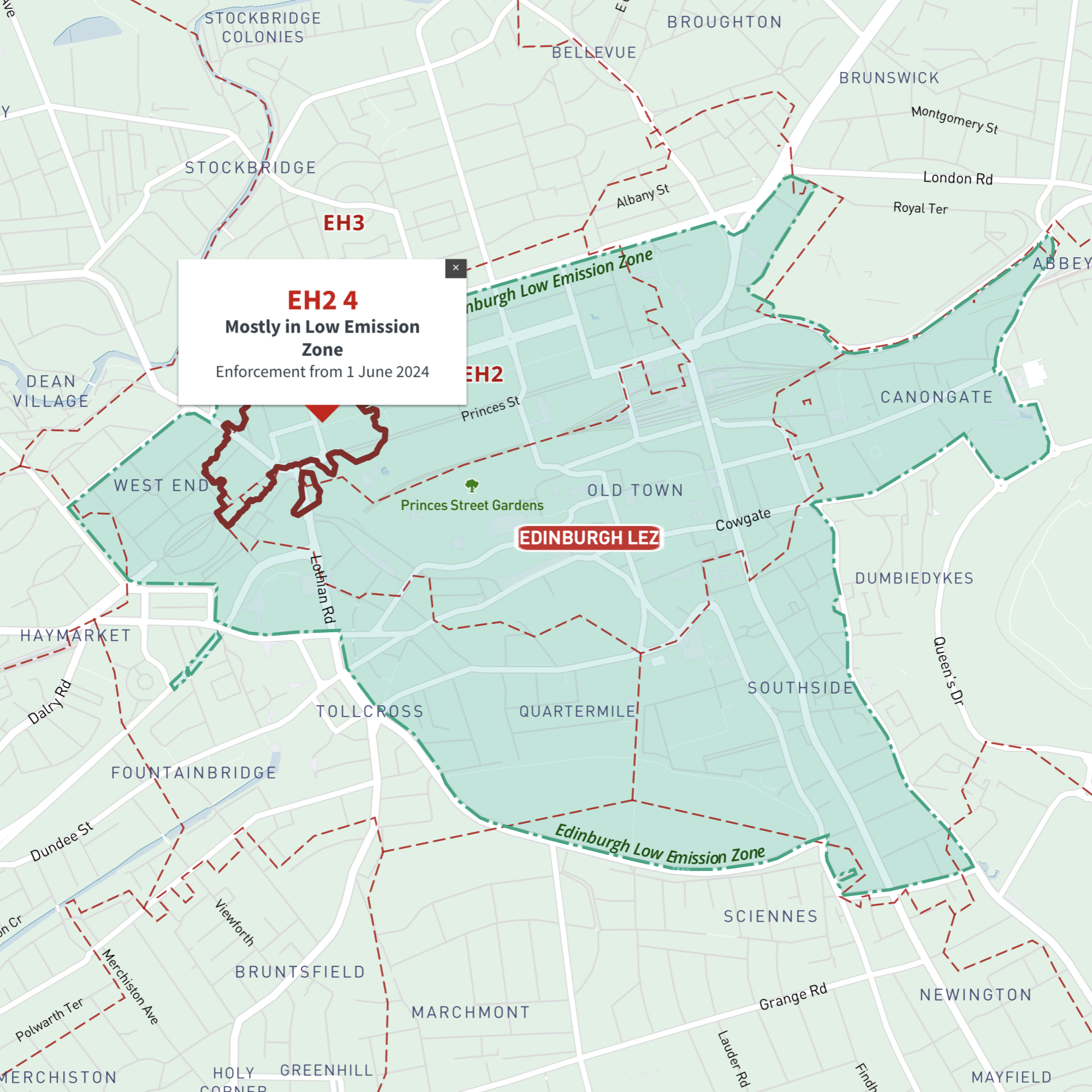
Interactive map of Edinburgh Low Emission Zone and all EH postcodes
£35.00Online deep-zoom map of Edinburgh Low Emission Zone (LEZ) with EH postcode districts, sectors and units available in the Dynamic Mapping Suite
-
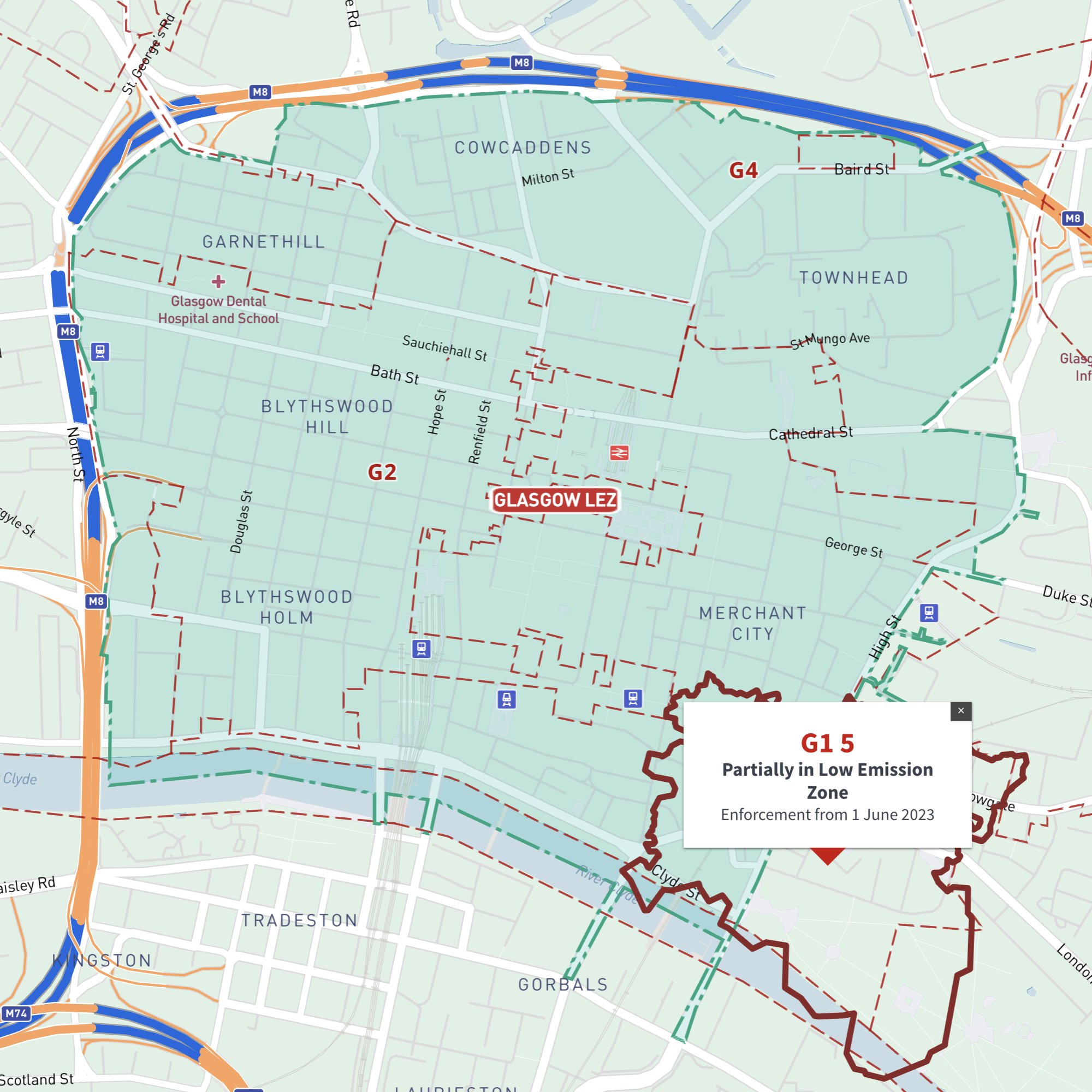
Interactive map of Glasgow Low Emission Zone and all G postcodes
£35.00Online deep-zoom map of Glasgow Low Emission Zone (LEZ) with G postcode districts, sectors and units available in the Dynamic Mapping Suite
-

Interactive map of Greater Manchester Clean Air Zone and all M, BL, OL, SK, WA and WN postcodes
£35.00Online deep-zoom map of Greater Manchester Clean Air Zone (CAZ) with M, BL, OL, SK, WA and WN postcode districts, sectors and units available in the Dynamic Mapping Suite
-
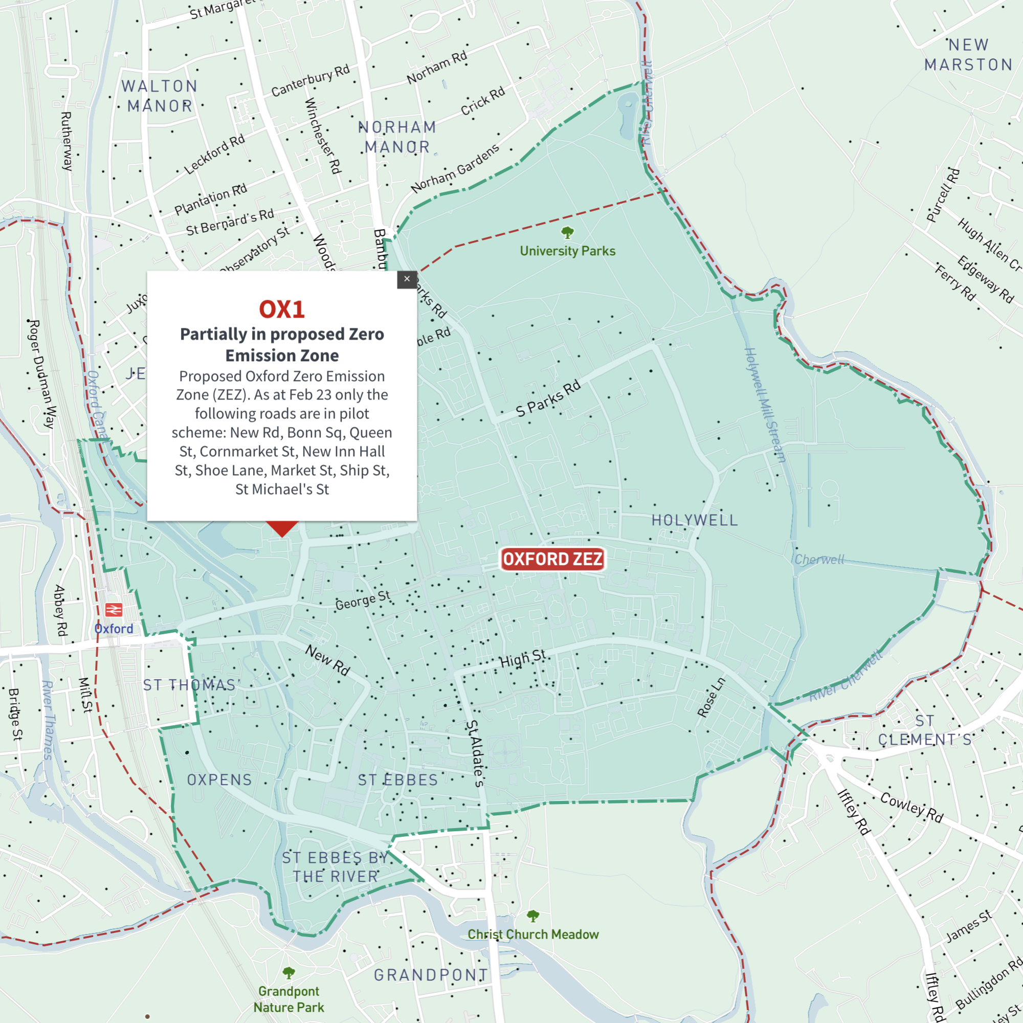
Interactive map of Oxford Zero Emission Zone and all OX postcodes
£35.00Online deep-zoom map of Oxford Zero Emission Zone (ZEZ) with OX postcode districts, sectors and units available in the Dynamic Mapping Suite
-

Interactive map of Portsmouth Clean Air Zone and all PO postcodes
£35.00Online deep-zoom map of Portsmouth Clean Air Zone (CAZ) with PO postcode districts, sectors and units available in the Dynamic Mapping Suite
-
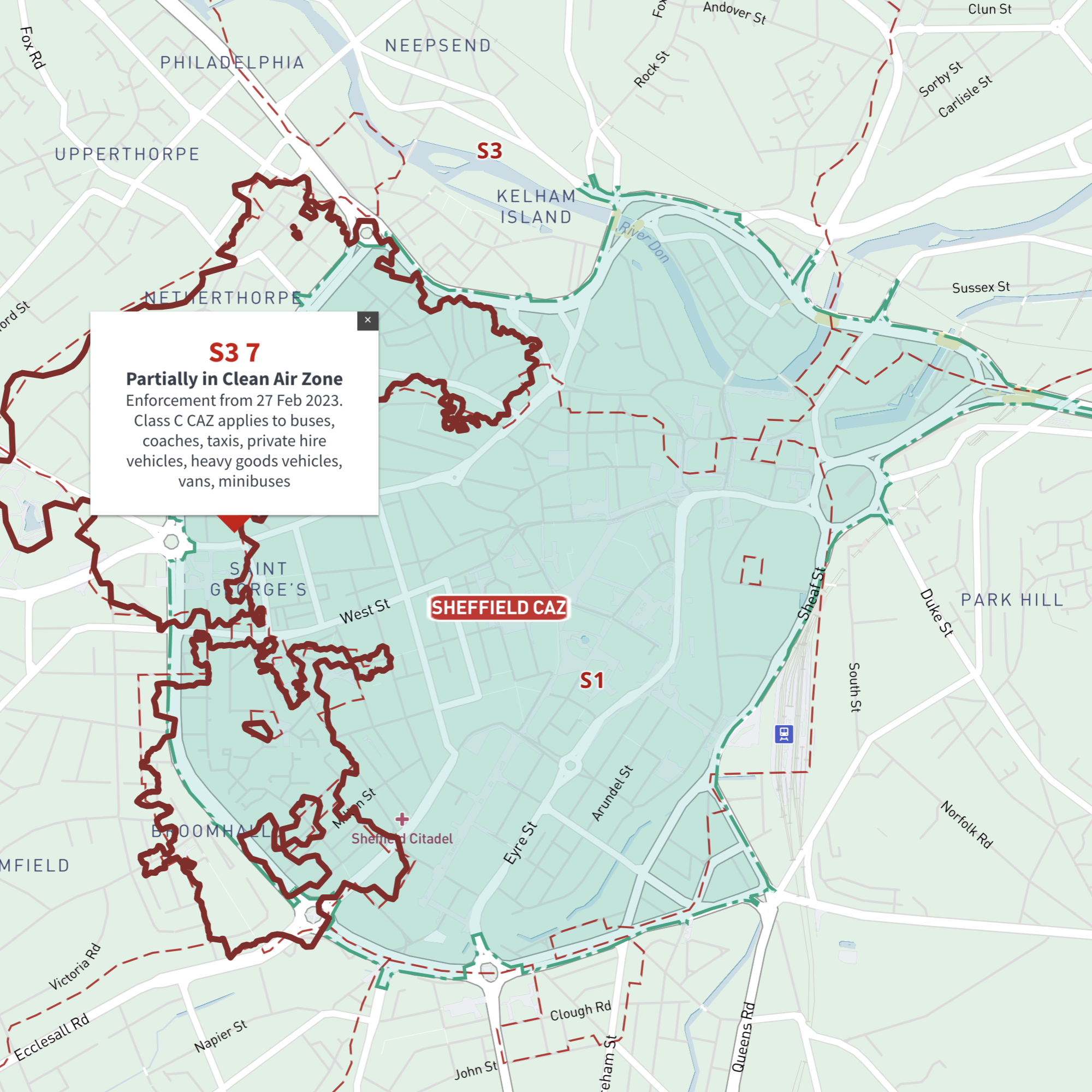
Interactive map of Sheffield Clean Air Zone and all S postcodes
£35.00Online deep-zoom map with S postcode districts, sectors and units available in the Dynamic Mapping Suite
-
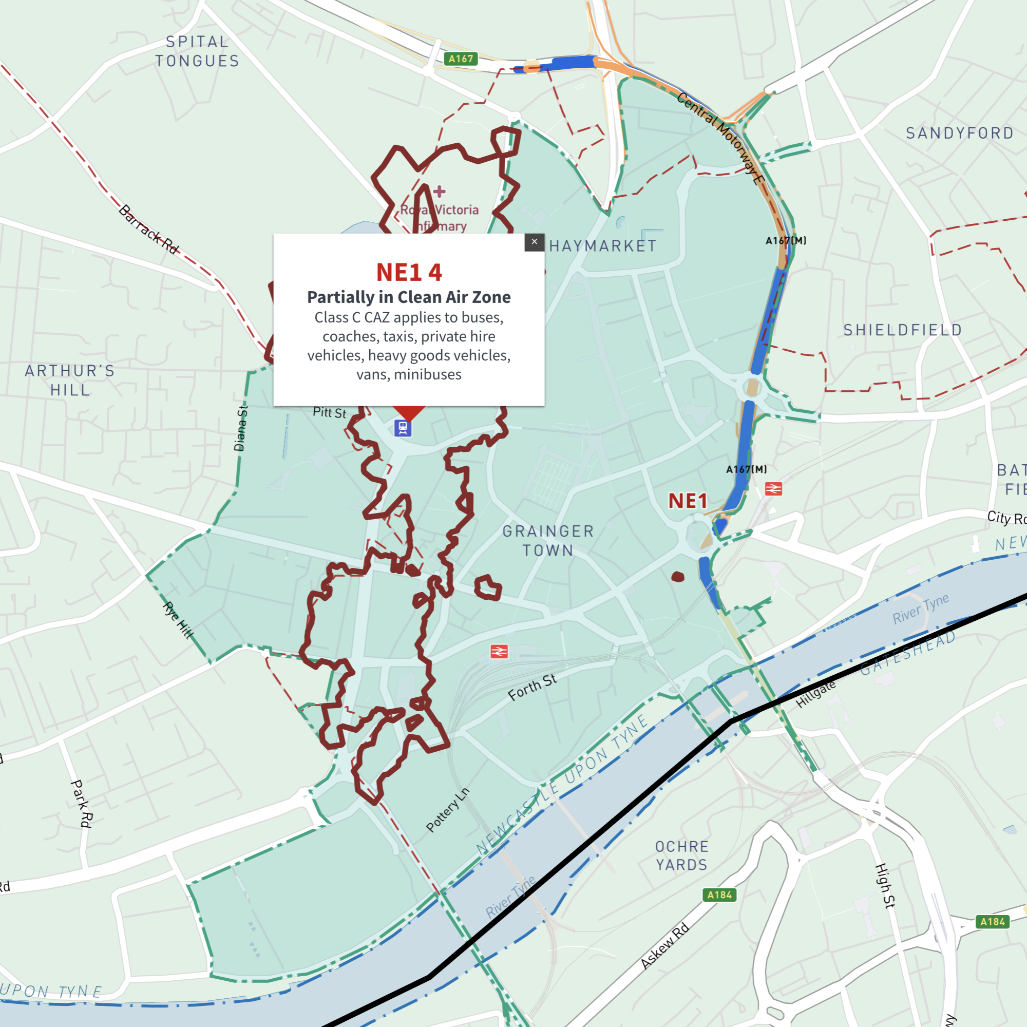
Interactive map of Tyneside (Newcastle and Gateshead) Clean Air Zone and all NE postcodes
£35.00Online deep-zoom map of Newcastle and Gateshead / Tyneside Clean Air Zone (CAZ) with NE postcode districts, sectors and units available in the Dynamic Mapping Suite
-
Birmingham Street Maps
£60.00Editable street maps of Birmingham city centre and environs reaching out to West Bromwich and Solihull. Supplied as PDF examples and fully layered Illustrator and SVG formats. The map bases include a wealth of detail including roads, railway and tram lines, canals, parks and building shapes.
PDFsSVGLayered AI file -
UK postcode areas map for printing “A” format
£15.00Scaled for printing at A4 and above, this map has white postcode areas specially for sales & marketing folk to scribble over with colour pens. Professional designers can edit it too and print it as a wall poster.
PDFs -
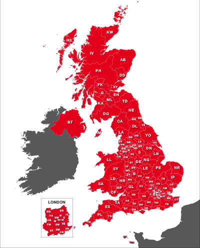
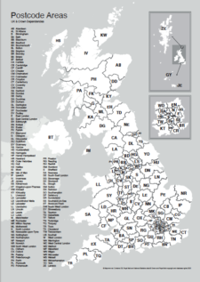
Maps of UK postcode areas
£20.00All the UK two-character postcode areas – 124 areas in total – in five ready-to-use PDF styles, plus access to dynamic postcodes. A bestselling bundle!
PDFsSVGLayered AI file -
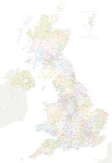
Best UK postcodes map with all the postcode districts, post towns and major roads
£75.00Our most detailed downloadable single-image UK postcodes map at a bargain price. Shows all the 4-digit postcode districts in context with post towns, major roads and counties. Five styles are included, or you can use your own colours and fonts.
PDFsSVGLayered AI file -
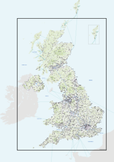
Best detailed map base of the UK / United Kingdom
£75.00This highly detailed base map of the UK has 1,850 town points, 5,500 roads, admin boundaries and a wealth of natural features. Altogether there are more than 4.29 million vector anchor points making this a superb resource for professional designers.
PDFsSVGLayered AI file -
Brighton and Hove Street Map
£60.00Highly detailed layered vector artwork street map of Brighton and Hove. Includes all local roads and building shapes, with all elements fully editable in Adobe Illustrator.
PDFsSVGLayered AI file -
Bristol Street Maps
£60.00These editable street maps of Bristol and environs are for professional and commercial uses. All of Bristol’s roads, buildings, rivers, parks and transport hubs are plotted in detail. The wealth of detail extends out to Avonmouth and Bristol Airport.
PDFsSVGLayered AI file -
Britain and Ireland physical map with hillshading / relief layer (high-resolution)
£60.00Detailed map of Britain and Ireland with a hillshading / relief layer giving a beautiful sculpted backdrop for the landmass. Every part of the map is editable and suitable for high-resolution professional printing up to A0 poster size.
PDFsSVGLayered AI file -
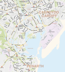
Cardiff Street Maps
£60.00Street maps of Cardiff city centre and environs reaching out to Cardiff Airport and northern suburbs
PDFsSVGLayered AI file -

Detailed outline map of Britain and Ireland (British Isles)
£20.00Superb coastline detail with literally hundreds of islands. Scale it from thumbnail up to poster size if you want.
PDFsSVGLayered AI file -
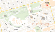
Edinburgh Street Maps
£60.00Street maps of Edinburgh and its environs including Edinburgh Airport, Leith, Queensferry and Musselburgh, with a huge amount of detail including the full road network and building shapes.
PDFsSVGLayered AI file -

Glasgow Street Maps
£60.00Street maps of Glasgow city centre and environs reaching out to Glasgow Airport, Clydebank, Bearsden, Bishopbriggs, Lenzie, Rutherglen, Barrhead and Paisley. Subway stations are included.
PDFsSVGLayered AI file -

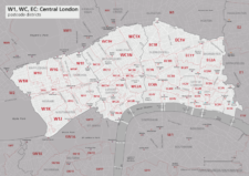
Best maps of central London postcode districts – W1, WC, EC – including street names
£25.00See the road names and other street level details of London’s densely packed W1, WC and EC postcode districts overlaid with clear labels, district boundaries and underlying polygons for colour editing.
PDFSVGLayered AI file -
Map of London postcodes – interlocking shapes
£15.00All the London postcode areas including the central sub-districts are included with accurate, interlocking vector shapes.
PDFsSVGLayered AI file -
Map of central London postcode districts – W1, WC, EC
£20.00Central London postcode districts – W1, WC, EC – scaled for A4+ printing
PDF -
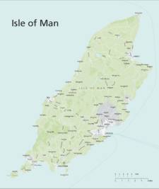
Isle of Man maps
£20.00Maps of the Isle of Man with editable layers for roads, urban background, green areas, rivers, ferry routes and more. The bundle includes the IM postcode districts map version.
PDFsSVGLayered AI file -
UK postcode maps for easy A4 printing – FULL SET with 126 maps
£125.00Full set of the “A” format postcode district maps – 126 maps in total at a huge discount.
PDFs -
Liverpool Street Maps
£60.00Street maps of Liverpool city centre and environs taking in the whole Wirral Peninsula, Ellesmere Port, Liverpool Airport, Runcorn, Frodsham, Widnes, St Helens, Haydock, Kirkby, Bootle and Crosby
PDFsSVGLayered AI file -

Manchester Street Maps
£60.00Editable street map of the city of Manchester, perfect for graphic designers using Illustrator. Includes neighbouring Salford and environs, all roads, railway and tram lines, building shapes.
PDFsSVGLayered AI file -

Map of AB postcode districts – Aberdeen
£15.00The AB – Aberdeen postcode districts scaled for A4+ printing
PDF -
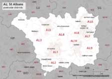
Map of AL postcode districts – St Albans
£15.00The AL – St Albans postcode districts scaled for A4+ printing
PDF -
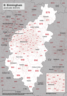
Map of B postcode districts – Birmingham
£15.00The B – Birmingham postcode districts scaled for A4+ printing
PDF -
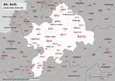
Map of BA postcode districts – Bath
£15.00The BA – Bath postcode districts scaled for A4+ printing
PDF -
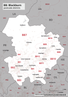
Map of BB postcode districts – Blackburn
£15.00The BB – Blackburn postcode districts scaled for A4+ printing
PDF -
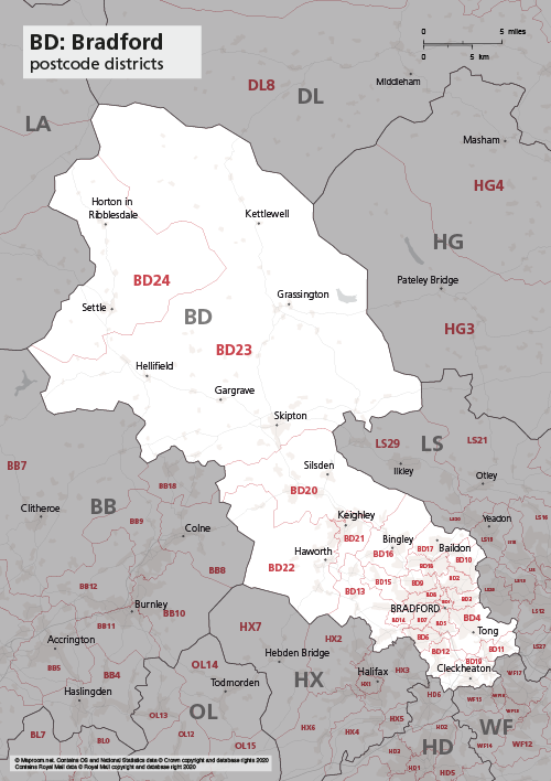
Map of BD postcode districts – Bradford
£15.00The BD – Bradford postcode districts scaled for A4+ printing
PDF -
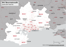
Map of BH postcode districts – Bournemouth
£15.00The BH – Bournemouth postcode districts scaled for A4+ printing
PDF -
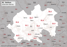
Map of BL postcode districts – Bolton
£15.00The BL – Bolton postcode districts scaled for A4+ printing
PDF -
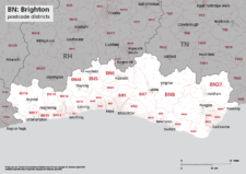
Map of BN postcode districts – Brighton
£15.00The BN – Brighton postcode districts scaled for A4+ printing
PDF -
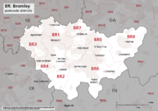
Map of BR postcode districts – Bromley
£15.00The BR – Bromley postcode districts scaled for A4+ printing
PDF -

Map of Britain and Ireland with cities and roads
£25.00A great value map showing the cities, major towns and arterial routes of Britain and Ireland.
PDFsSVGLayered AI file -
Map of British and Irish rivers and lakes
£20.00Hundreds of lakes and rivers, plus coastal features. Good for educational materials and water-activity themes.
PDFsSVGLayered AI file -

Map of BS postcode districts – Bristol
£15.00The BS – Bristol postcode districts scaled for A4+ printing
PDF -
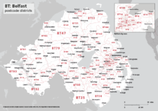
Map of BT postcode districts – Belfast
£15.00The BT – Belfast postcode districts scaled for A4+ printing
PDF -
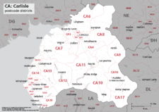
Map of CA postcode districts – Carlisle
£15.00The CA – Carlisle postcode districts scaled for A4+ printing
PDF -

Map of CB postcode districts – Cambridge
£15.00The CB – Cambridge postcode districts scaled for A4+ printing
PDF -
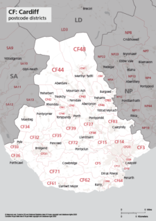
Map of CF postcode districts – Cardiff
£15.00The CF – Cardiff postcode districts scaled for A4+ printing
PDF -

Map of CH postcode districts – Chester
£15.00The CH – Chester postcode districts scaled for A4+ printing
PDF -
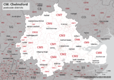
Map of CM postcode districts – Chelmsford
£15.00The CM – Chelmsford postcode districts scaled for A4+ printing
PDF -
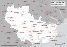
Map of CO postcode districts – Colchester
£15.00The CO – Colchester postcode districts scaled for A4+ printing
PDF -
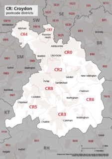
Map of CR postcode districts – Croydon
£15.00The CR – Croydon postcode districts scaled for A4+ printing
PDF -
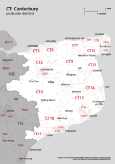
Map of CT postcode districts – Canterbury
£15.00The CT – Canterbury postcode districts scaled for A4+ printing
PDF -
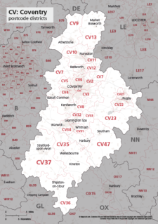
Map of CV postcode districts – Coventry
£15.00The CV – Coventry postcode districts scaled for A4+ printing
PDF -
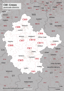
Map of CW postcode districts – Crewe
£15.00The CW – Crewe postcode districts scaled for A4+ printing
PDF -
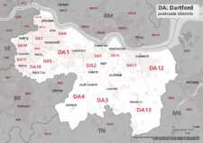
Map of DA postcode districts – Dartford
£15.00The DA – Dartford postcode districts scaled for A4+ printing
PDF -
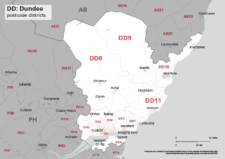
Map of DD postcode districts – Dundee
£15.00The DD – Dundee postcode districts scaled for A4+ printing
PDF -
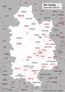
Map of DE postcode districts – Derby
£15.00The DE – Derby postcode districts scaled for A4+ printing
PDF -
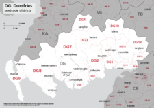
Map of DG postcode districts – Dumfries
£15.00The DG – Dumfries postcode districts scaled for A4+ printing
PDF -
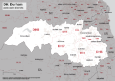
Map of DH postcode districts – Durham
£15.00The DH – Durham postcode districts scaled for A4+ printing
PDF -
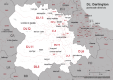
Map of DL postcode districts – Darlington
£15.00The DL – Darlington postcode districts scaled for A4+ printing
PDF -
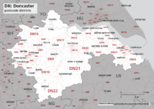
Map of DN postcode districts – Doncaster
£15.00The DN – Doncaster postcode districts scaled for A4+ printing
PDF -
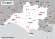
Map of DT postcode districts – Dorchester
£15.00The DT – Dorchester postcode districts scaled for A4+ printing
PDF -
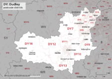
Map of DY postcode districts – Dudley
£15.00The DY – Dudley postcode districts scaled for A4+ printing
PDF -
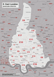
Map of E postcode districts – East London
£15.00The E – East London postcode districts scaled for A4+ printing
PDF -
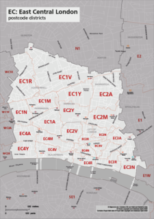
Map of EC postcode districts – East Central London
£15.00The EC – East Central London postcode districts scaled for A4+ printing
PDF -
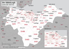
Map of EH postcode districts – Edinburgh
£15.00The EH – Edinburgh postcode districts scaled for A4+ printing
PDF -
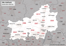
Map of EN postcode districts – Enfield
£15.00The EN – Enfield postcode districts scaled for A4+ printing
PDF -
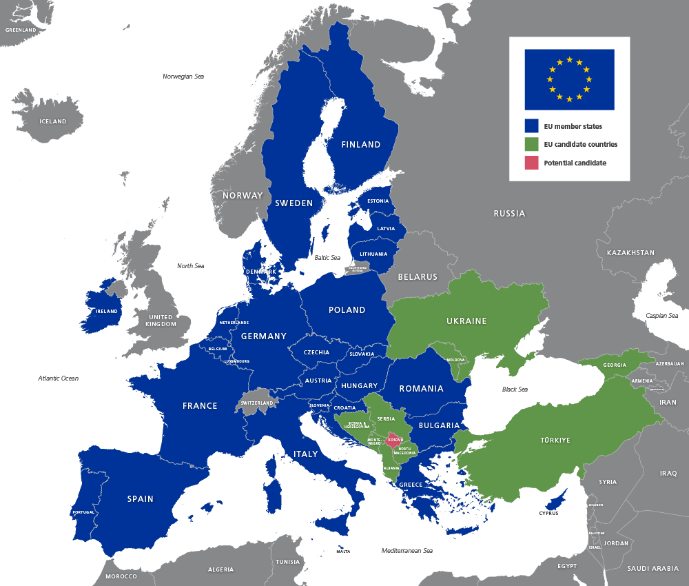
Map of EU countries 2026
£20.00Up-to-date map of the European Union including candidate countries
PDFsSVGLayered AI file -
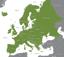
Maps of Europe with country outlines – geographic and political
£25.00Superbly detailed vector maps of Europe with all the individual countries and mini-states. Multiple styles included in the package, including EU states, and a version with finely detailed coastlines, good for zooming. Incredible value.
PDFsSVGLayered AI file -
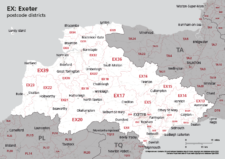
Map of EX postcode districts – Exeter
£15.00The EX – Exeter postcode districts scaled for A4+ printing
PDF -
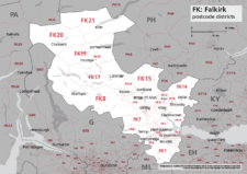
Map of FK postcode districts – Falkirk
£15.00The FK – Falkirk postcode districts scaled for A4+ printing
PDF -
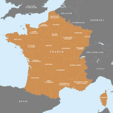
Map of France – French regions
£15.00A beautifully detailed outline of France and her main administrative regions
PDFsSVGLayered AI file -
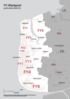
Map of FY postcode districts – Blackpool
£15.00The FY – Blackpool postcode districts scaled for A4+ printing
PDF -
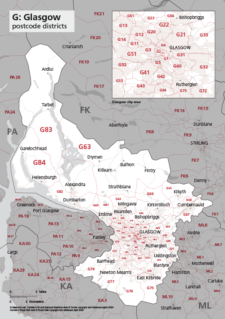
Map of G postcode districts – Glasgow
£15.00The G – Glasgow postcode districts scaled for A4+ printing
PDF -
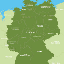
Map of Germany – German states / Bundesländer
£15.00Map of Germany with the boundaries of the 16 federal states / Bundesländer
PDFsSVGLayered AI file -
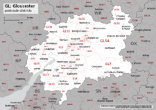
Map of GL postcode districts – Gloucester
£15.00The GL – Gloucester postcode districts scaled for A4+ printing
PDF -
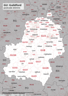
Map of GU postcode districts – Guildford
£15.00The GU – Guildford postcode districts scaled for A4+ printing
PDF