Maps of England
Showing all 26 results
-
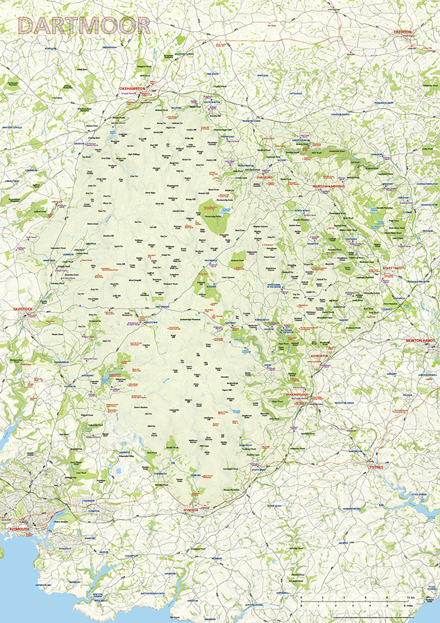
Dartmoor National Park map
£60.00Dartmoor National Park is highlighted along with towns, villages, roads, railway lines, lakes, rivers, woodland and green spaces. Natural features, such as tors, downs, and commons, are labelled too, as well as the historical and archaeological sites and churches in the vicinity. Principal car parks are also plotted. Scaled for A1+ printing
PDFsSVGLayered AI file -
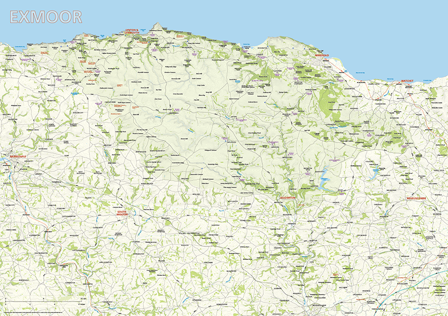
Exmoor National Park map
£60.00Exmoor National Park is highlighted along with towns, villages, roads, railway lines, lakes, rivers, woodland and green spaces. Natural features, such as hilltops, downs, and commons, are labelled too, as well as the smattering of archaeological sites in the vicinity. Scaled for A1+ printing
PDFsSVGLayered AI file -
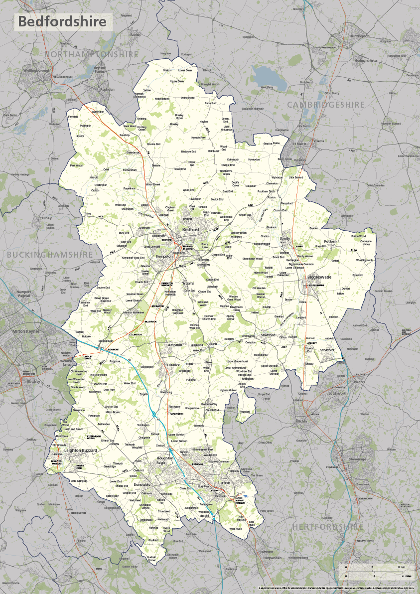
Bedfordshire county map
£40.00The ceremonial county of Bedfordshire is highlighted along with towns, villages, roads, railway lines, lakes, rivers, woodland and green spaces. Scaled for A3+ printing
PDFSVGLayered AI file -
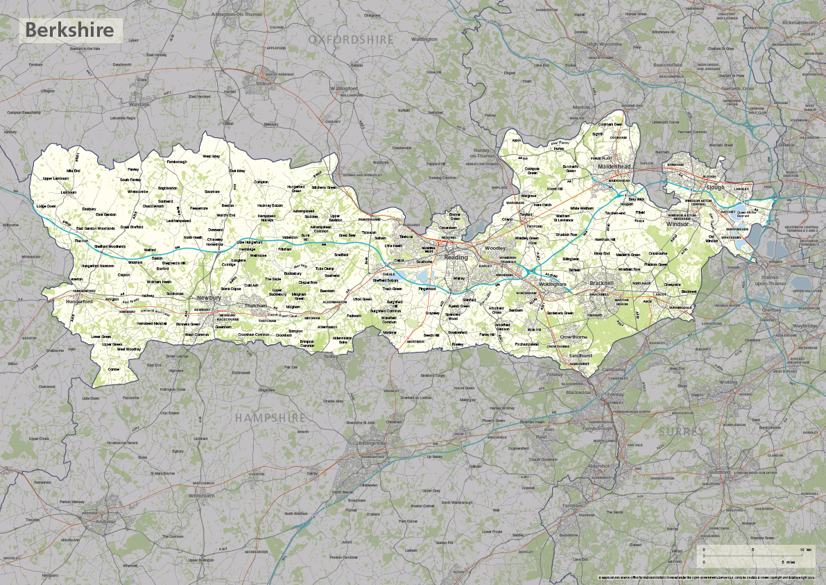
Berkshire county map
£40.00The ceremonial county of Berkshire is highlighted along with towns, villages, roads, railway lines, lakes, rivers, woodland and green spaces. Scaled for A3+ printing
PDFSVGLayered AI file -
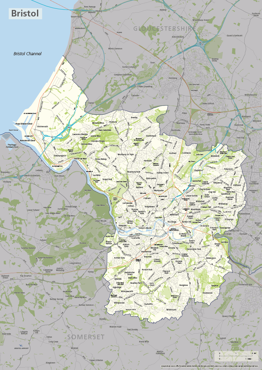
Bristol county map
£40.00The ceremonial county / unitary authority of Bristol is highlighted along with towns, villages, roads, railway lines, lakes, rivers, woodland and green spaces. Scaled for A3+ printing
PDFSVGLayered AI file -

Buckinghamshire county map
£40.00The ceremonial county of Buckinghamshire is highlighted along with towns, villages, roads, railway lines, lakes, rivers, woodland and green spaces. Scaled for A3+ printing
PDFSVGLayered AI file -
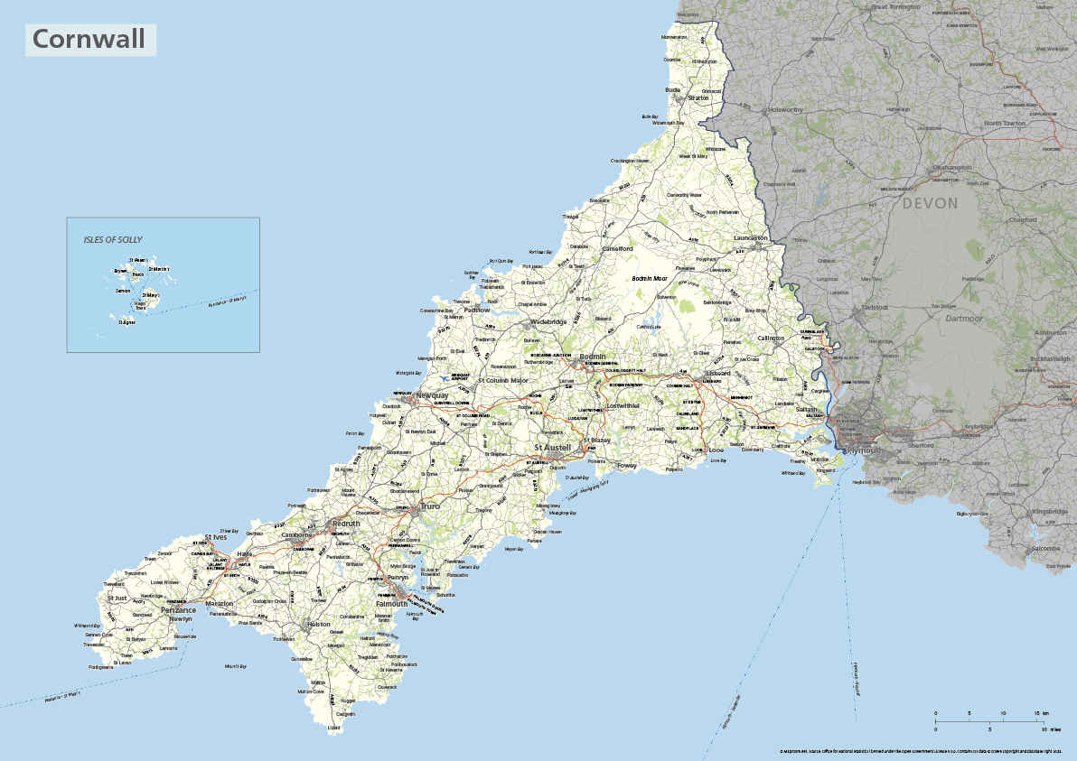
Cornwall county map with Isles of Scilly
£40.00The ceremonial county of Cornwall is highlighted along with towns, villages, roads, railway lines, lakes, rivers, woodland and green spaces. The Isles of Scilly are optionally shown in their natural geographic position or in an inset box. Scaled for A3+ printing
PDFSVGLayered AI file -

Devon county map
£40.00The ceremonial county of Devon is highlighted along with towns, villages, roads, railway lines, lakes, rivers, woodland and green spaces. Scaled for A3+ printing
PDFSVGLayered AI file -
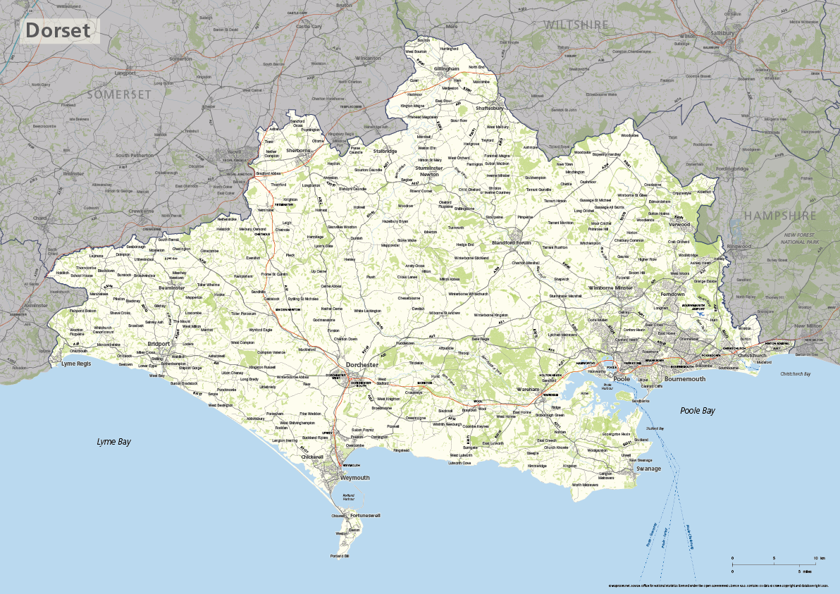
Dorset county map
£40.00The ceremonial county of Dorset is highlighted along with towns, villages, roads, railway lines, lakes, rivers, woodland and green spaces. Scaled for A3+ printing
PDFSVGLayered AI file -
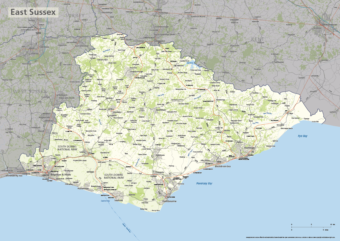
East Sussex county map
£40.00The ceremonial county of East Sussex is highlighted along with towns, villages, roads, railway lines, lakes, rivers, woodland and green spaces. Scaled for A3+ printing
PDFSVGLayered AI file -
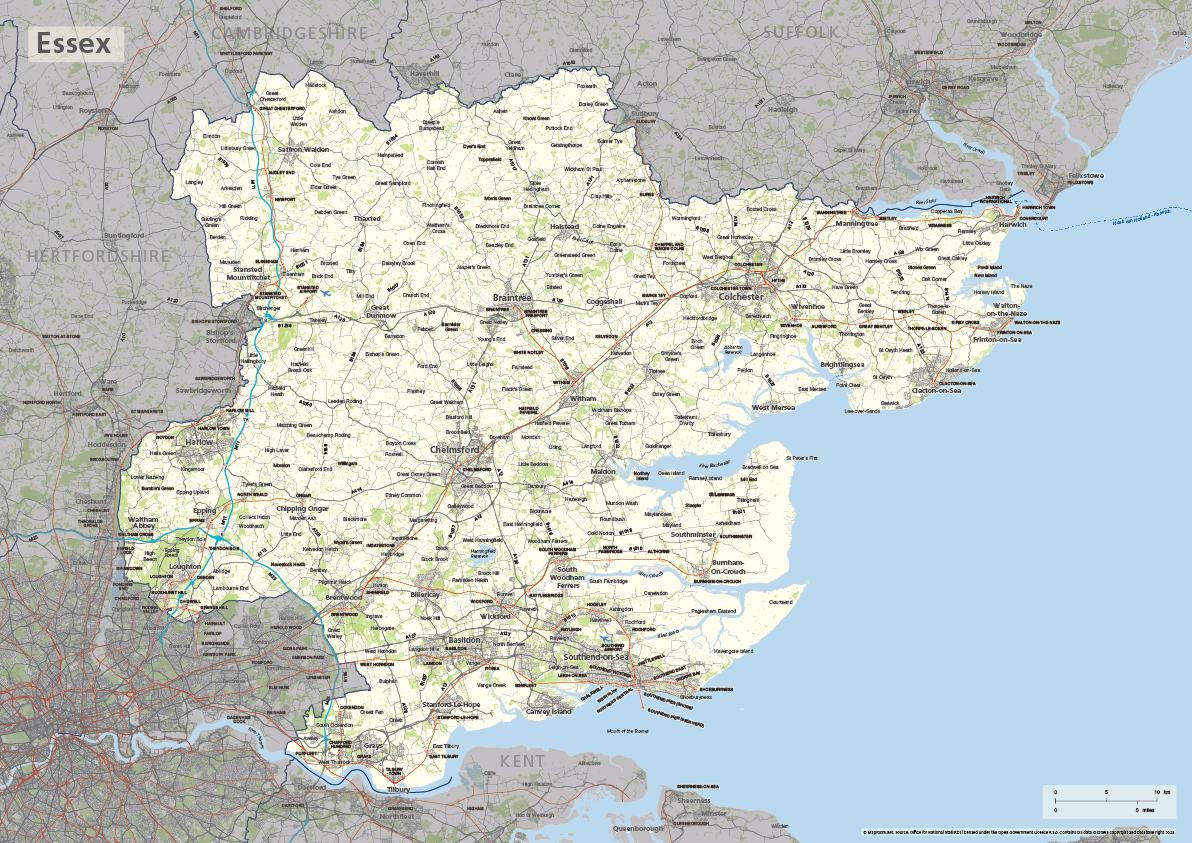
Essex county map
£40.00The ceremonial county of Essex is highlighted along with towns, villages, roads, railway lines, lakes, rivers, woodland and green spaces. Scaled for A3+ printing
PDFSVGLayered AI file -
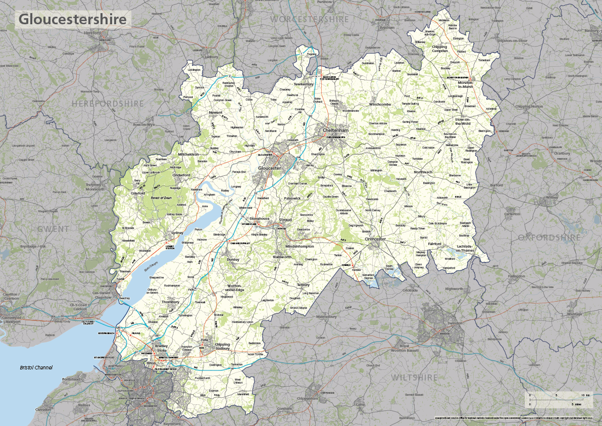
Gloucestershire county map
£40.00The ceremonial county of Gloucestershire is highlighted along with towns, villages, roads, railway lines, lakes, rivers, woodland and green spaces. Scaled for A3+ printing
PDFSVGLayered AI file -
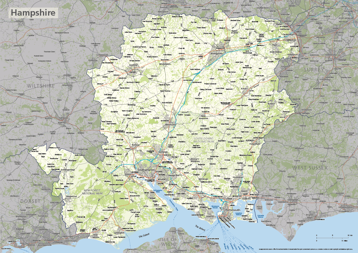
Hampshire county map
£40.00The ceremonial county of Hampshire is highlighted along with towns, villages, roads, railway lines, lakes, rivers, woodland and green spaces. Scaled for A3+ printing
PDFSVGLayered AI file -
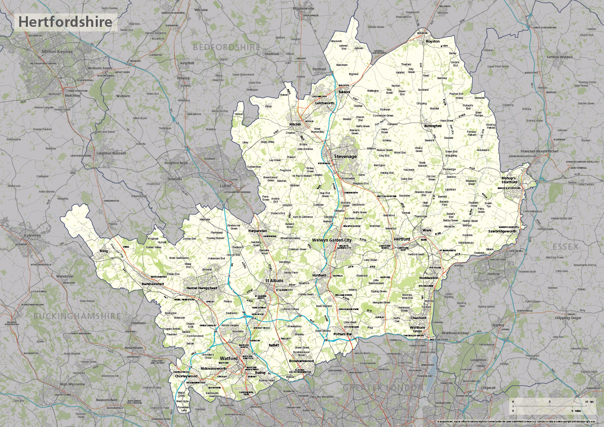
Hertfordshire county map
£40.00The ceremonial county of Hertfordshire is highlighted along with towns, villages, roads, railway lines, lakes, rivers, woodland and green spaces. Scaled for A3+ printing
PDFSVGLayered AI file -
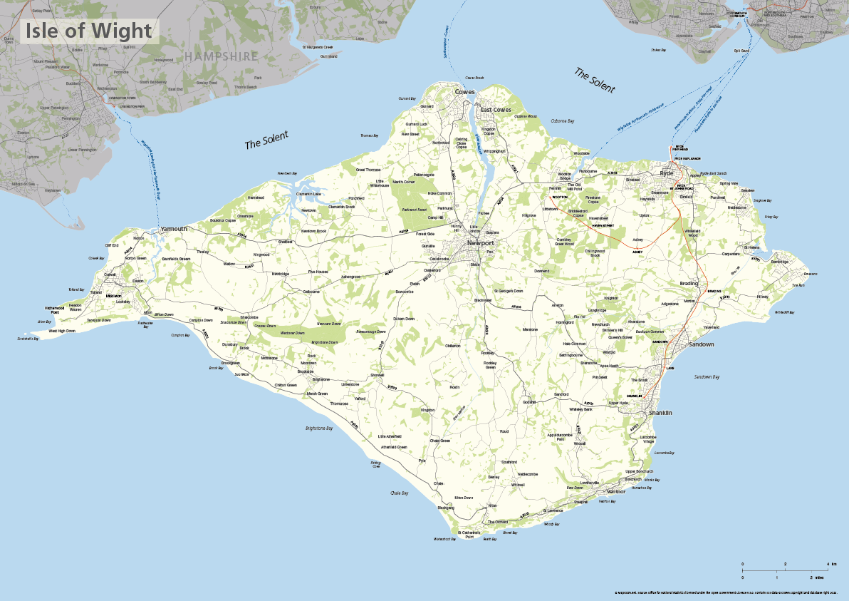
Isle of Wight map
£40.00The ceremonial county of the Isle of Wight is highlighted along with towns, villages, roads, railway lines, lakes, rivers, woodland and green spaces. Scaled for A3+ printing
PDFSVGLayered AI file -

Kent county map
£40.00The ceremonial county of Kent is highlighted along with towns, villages, roads, railway lines, lakes, rivers, woodland and green spaces. Scaled for A3+ printing
PDFSVGLayered AI file -
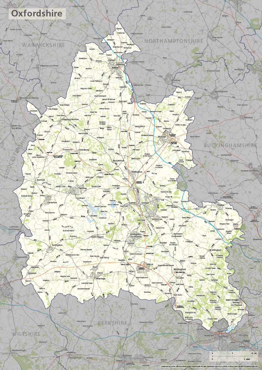
Oxfordshire county map
£40.00The ceremonial county of Oxfordshire is highlighted along with towns, villages, roads, railway lines, lakes, rivers, woodland and green spaces. Scaled for A3+ printing
PDFSVGLayered AI file -
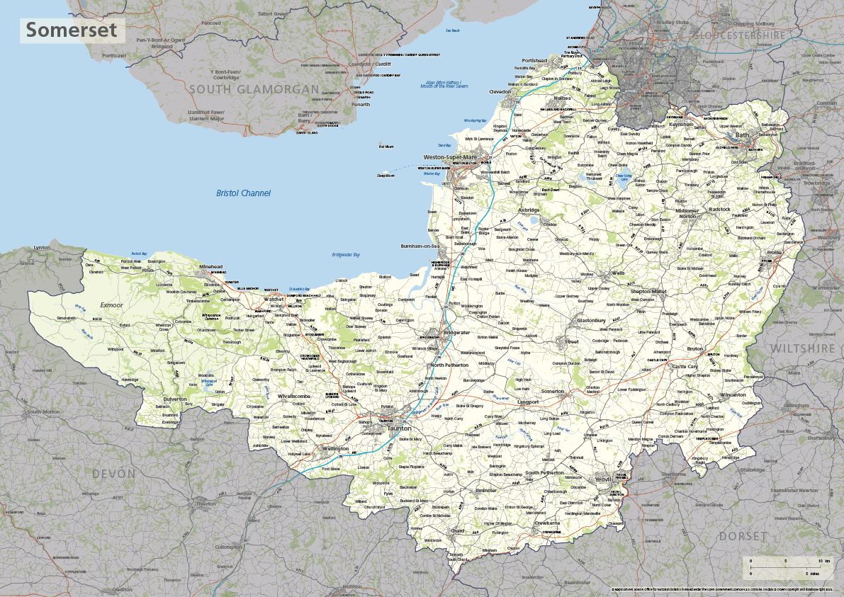
Somerset county map
£40.00The ceremonial county of Somerset is highlighted along with towns, villages, roads, railway lines, lakes, rivers, woodland and green spaces. Scaled for A3+ printing
PDFSVGLayered AI file -
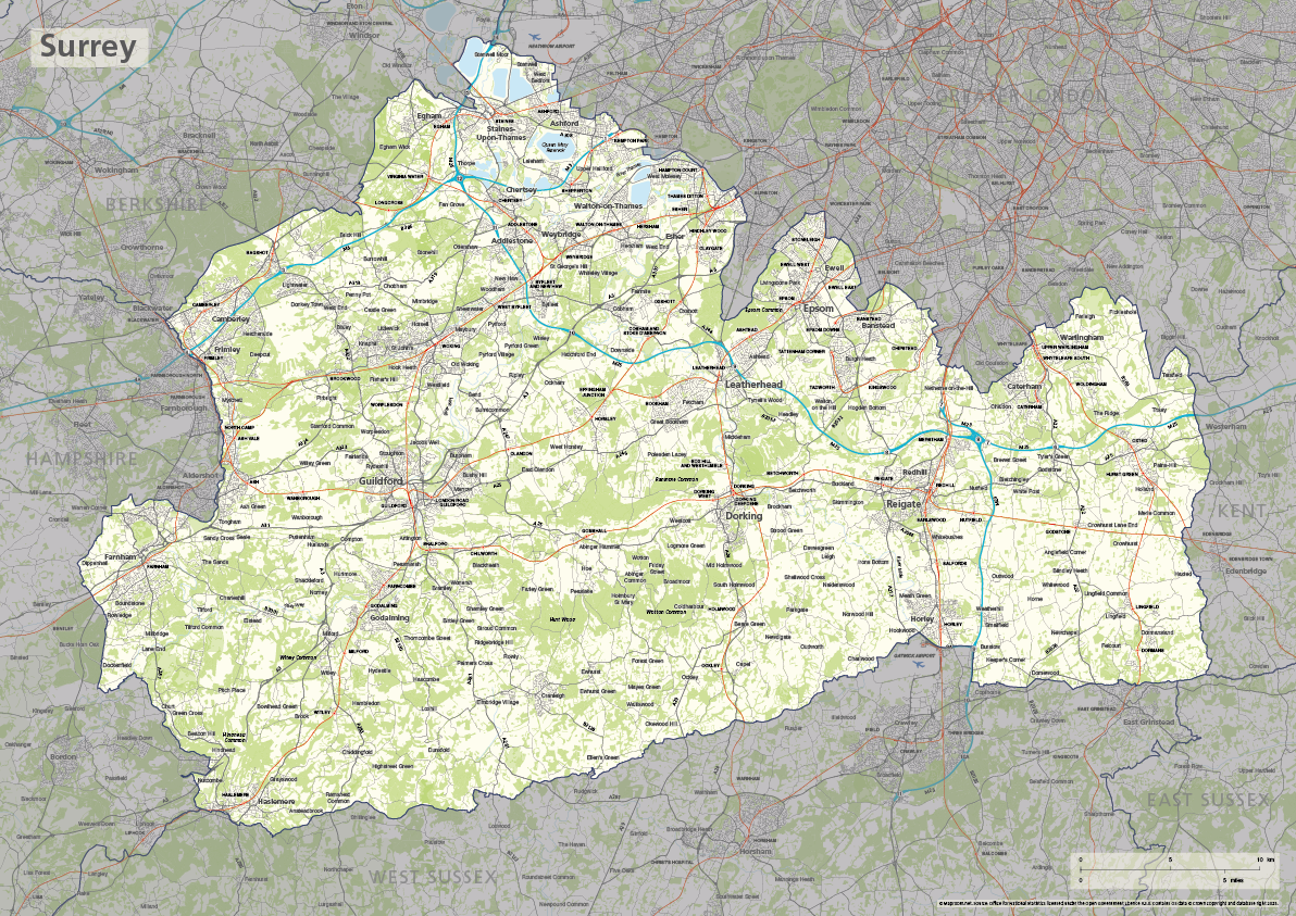
Surrey county map
£40.00The ceremonial county of Surrey is highlighted along with towns, villages, roads, railway lines, lakes, rivers, woodland and green spaces. Scaled for A3+ printing
PDFSVGLayered AI file -
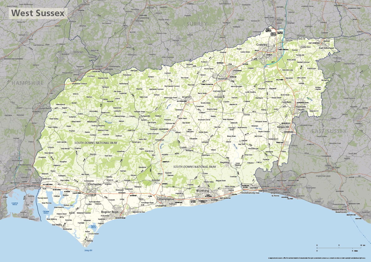
West Sussex county map
£40.00The ceremonial county of West Sussex is highlighted along with towns, villages, roads, railway lines, lakes, rivers, woodland and green spaces. Scaled for A3+ printing
PDFSVGLayered AI file -
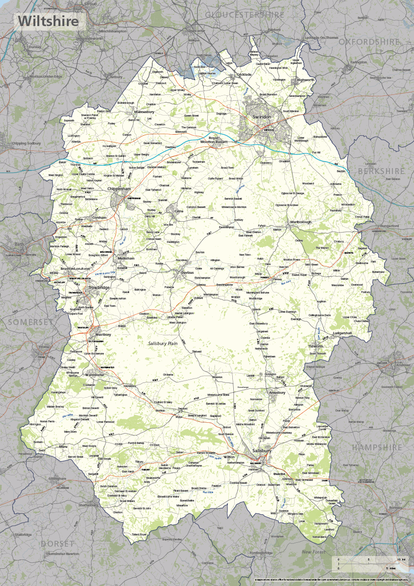
Wiltshire county map
£40.00The ceremonial county of Wiltshire is highlighted along with towns, villages, roads, railway lines, lakes, rivers, woodland and green spaces. Scaled for A3+ printing
PDFSVGLayered AI file -
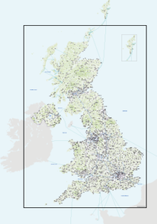
Best detailed map base of the UK / United Kingdom
£75.00This highly detailed base map of the UK has 1,850 town points, 5,500 roads, admin boundaries and a wealth of natural features. Altogether there are more than 4.29 million vector anchor points making this a superb resource for professional designers.
PDFsSVGLayered AI file -
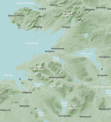
Britain and Ireland physical map with hillshading / relief layer (high-resolution)
£60.00Detailed map of Britain and Ireland with a hillshading / relief layer giving a beautiful sculpted backdrop for the landmass. Every part of the map is editable and suitable for high-resolution professional printing up to A0 poster size.
PDFsSVGLayered AI file -
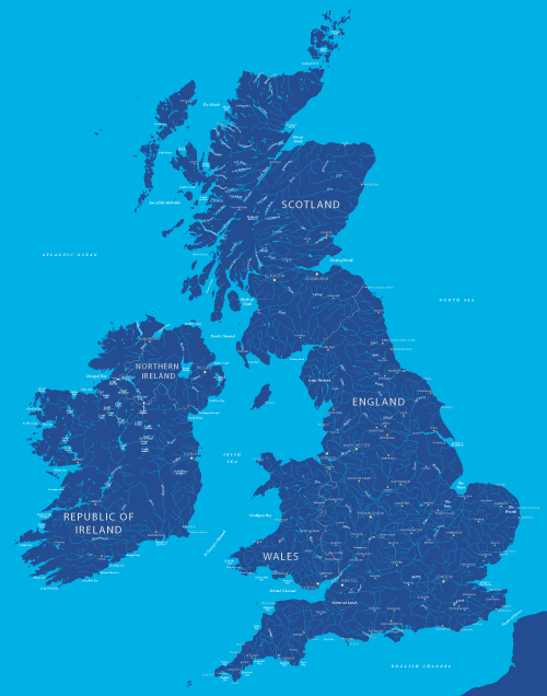
Map of British and Irish rivers and lakes
£20.00Hundreds of lakes and rivers, plus coastal features. Good for educational materials and water-activity themes.
PDFsSVGLayered AI file -
Outline map of England
£15.00A detailed outline map of England, with parts of the surrounding countries for context.
PDFsSVGLayered AI file -
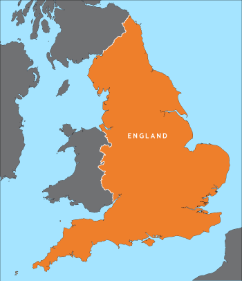
Political map of England
£40.00Shows all the counties of England, plus the principal towns and transport network.
PDFsSVGLayered AI file