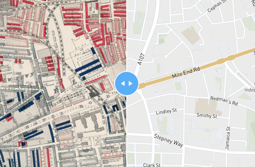
Dynamic online maps – also known as web maps and slippy maps – have capabilities to contain far more information than you could ever hope to fit onto a printed map, plus search, pop-up captions, filters and calculated data on the fly. With a dynamic map you can feed data into our cloud mapping system to change colours and captions automatically. This is state-of-the-art mapping.
A few examples

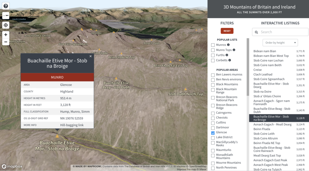

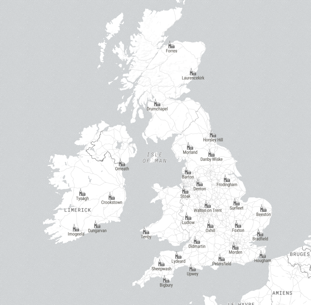
5 benefits of dynamic online maps
- The deeper you zoom, the more you interact, the more you see
- Dynamic keys, popups and searchable listings may be the ONLY way to map all your data
- Mapping with spreadsheets is fast and efficient for business users
- You may be able to embed dynamic maps on your website, and they will autoscale for legibility on all devices
- Dynamic mapping is the best option if you need to update maps on a regular basis