All downloadable postcode maps
These maps are available as downloadable PDFs which can be edited by graphic designers. They are all bundled with a free 7-Day Full Pass for dynamic online postcode maps.
Purchasing multiple postcode maps? Use coupon code multibuy-postcodes at checkout to get 50% discount on two or more downloadable postcode maps. Or buy the full set for easy A4 printing at a huge discount.
FILTERS: Postcode maps for "A" format printing | UK postcode maps | London postcode maps
Showing all 137 results
-

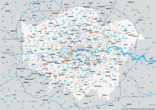
Supersize map of Greater London postcode districts with full road network
£75.00Editable postcodes artwork scaled at 4.3 x 3.8 metres in its opening state. The full road network of Greater London is the backdrop, with major road names legible at large-scale printing.
PDFsLayered AI file -

Interactive map of London Low and Ultra-low Emission Zones (LEZ / ULEZ), Congestion Charge Zone (CCZ), with all postcodes
£45.00London’s Low Emission Zone and Driver Vision Standard (LEZ / DVS), Ultra-low Emission Zone (ULEZ), and Congestion Charge Zone (CCZ) juxtaposed with postcodes and local authority / London borough boundaries – this interactive online map is aimed primarily at businesses needing help to plan deliveries, driving routes and sales territories through and around London.
-
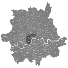
Map of Greater London postcode districts plus boroughs and major roads
£30.00All the postcode districts in Greater London, shown in context with the London boroughs, post towns, major roads and surrounding counties. Scaled for A3 and above.
PDFsSVGLayered AI file -

UK Local Authorities + Postcodes Map from April 2023
£60.00UK Local Authorities juxtaposed with postcodes districts, plus a Limited Free Pass for the Dynamic Mapping Suite giving access to online Local Authority maps and mapping tools.
PDFSVGLayered AI file -
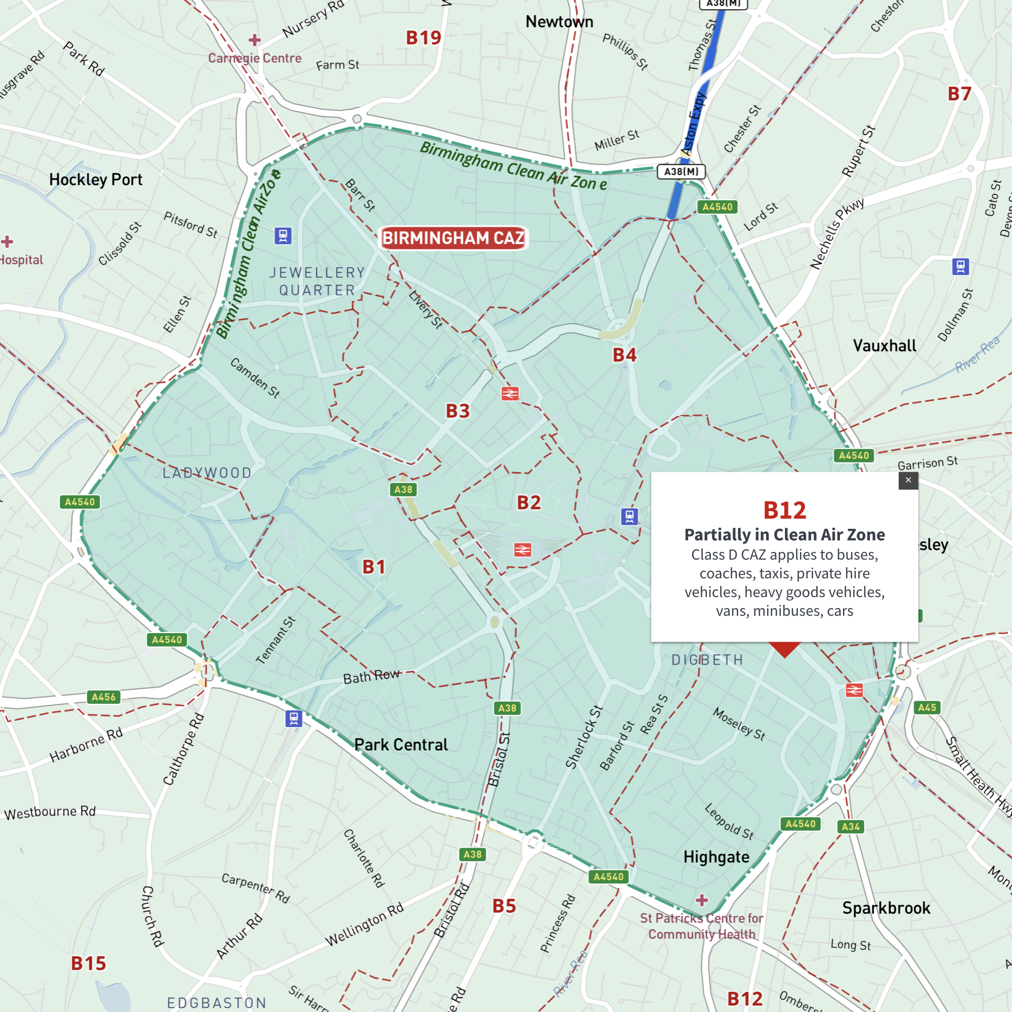
Interactive map of Birmingham Clean Air Zone with postcodes
£35.00This interactive street map of Birmingham has overlays and popups showing the Clean Air Zone juxtaposed with postcodes. It is aimed primarily at businesses needing reference to plan deliveries, driving routes and sales territories in and around Birmingham’s Clean Air Zone.
-
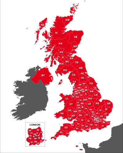
UK postcode areas map for printing “A” format
£15.00Scaled for printing at A4 and above, this map has white postcode areas specially for sales & marketing folk to scribble over with colour pens. Professional designers can edit it too and print it as a wall poster.
PDFs -
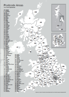
Maps of UK postcode areas
£20.00All the UK two-character postcode areas – 124 areas in total – in five ready-to-use PDF styles, plus access to dynamic postcodes. A bestselling bundle!
PDFsSVGLayered AI file -
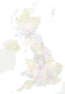
Best UK postcodes map with all the postcode districts, post towns and major roads
£75.00Our most detailed downloadable single-image UK postcodes map at a bargain price. Shows all the 4-digit postcode districts in context with post towns, major roads and counties. Five styles are included, or you can use your own colours and fonts.
PDFsSVGLayered AI file -

Best maps of central London postcode districts – W1, WC, EC – including street names
£25.00See the road names and other street level details of London’s densely packed W1, WC and EC postcode districts overlaid with clear labels, district boundaries and underlying polygons for colour editing.
PDFSVGLayered AI file -
Map of London postcodes – interlocking shapes
£15.00All the London postcode areas including the central sub-districts are included with accurate, interlocking vector shapes.
PDFsSVGLayered AI file -
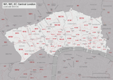
Map of central London postcode districts – W1, WC, EC
£20.00Central London postcode districts – W1, WC, EC – scaled for A4+ printing
PDF -
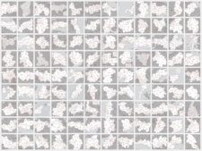
UK postcode maps for easy A4 printing – FULL SET with 126 maps
£125.00Full set of the “A” format postcode district maps – 126 maps in total at a huge discount.
PDFs -

Map of AB postcode districts – Aberdeen
£15.00The AB – Aberdeen postcode districts scaled for A4+ printing
PDF -
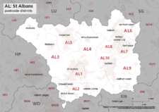
Map of AL postcode districts – St Albans
£15.00The AL – St Albans postcode districts scaled for A4+ printing
PDF -
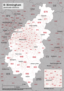
Map of B postcode districts – Birmingham
£15.00The B – Birmingham postcode districts scaled for A4+ printing
PDF -
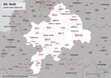
Map of BA postcode districts – Bath
£15.00The BA – Bath postcode districts scaled for A4+ printing
PDF -
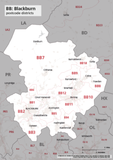
Map of BB postcode districts – Blackburn
£15.00The BB – Blackburn postcode districts scaled for A4+ printing
PDF -
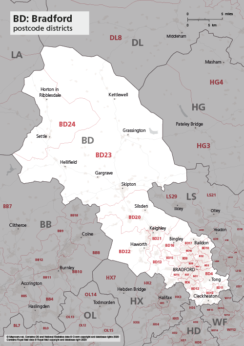
Map of BD postcode districts – Bradford
£15.00The BD – Bradford postcode districts scaled for A4+ printing
PDF -
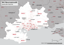
Map of BH postcode districts – Bournemouth
£15.00The BH – Bournemouth postcode districts scaled for A4+ printing
PDF -
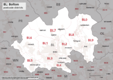
Map of BL postcode districts – Bolton
£15.00The BL – Bolton postcode districts scaled for A4+ printing
PDF -
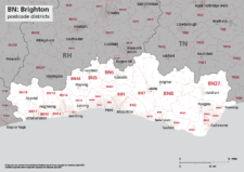
Map of BN postcode districts – Brighton
£15.00The BN – Brighton postcode districts scaled for A4+ printing
PDF -
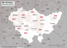
Map of BR postcode districts – Bromley
£15.00The BR – Bromley postcode districts scaled for A4+ printing
PDF -

Map of BS postcode districts – Bristol
£15.00The BS – Bristol postcode districts scaled for A4+ printing
PDF -
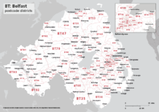
Map of BT postcode districts – Belfast
£15.00The BT – Belfast postcode districts scaled for A4+ printing
PDF -
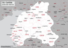
Map of CA postcode districts – Carlisle
£15.00The CA – Carlisle postcode districts scaled for A4+ printing
PDF -

Map of CB postcode districts – Cambridge
£15.00The CB – Cambridge postcode districts scaled for A4+ printing
PDF -
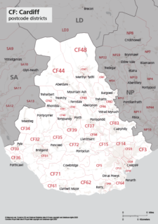
Map of CF postcode districts – Cardiff
£15.00The CF – Cardiff postcode districts scaled for A4+ printing
PDF -

Map of CH postcode districts – Chester
£15.00The CH – Chester postcode districts scaled for A4+ printing
PDF -
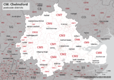
Map of CM postcode districts – Chelmsford
£15.00The CM – Chelmsford postcode districts scaled for A4+ printing
PDF -
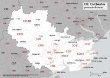
Map of CO postcode districts – Colchester
£15.00The CO – Colchester postcode districts scaled for A4+ printing
PDF -
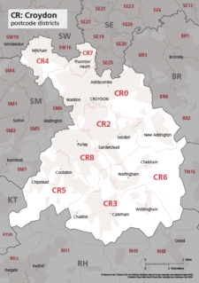
Map of CR postcode districts – Croydon
£15.00The CR – Croydon postcode districts scaled for A4+ printing
PDF -
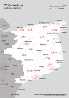
Map of CT postcode districts – Canterbury
£15.00The CT – Canterbury postcode districts scaled for A4+ printing
PDF -
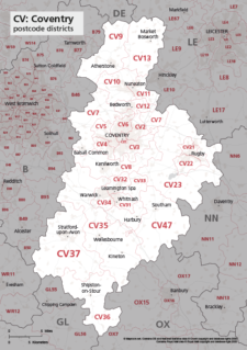
Map of CV postcode districts – Coventry
£15.00The CV – Coventry postcode districts scaled for A4+ printing
PDF -
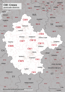
Map of CW postcode districts – Crewe
£15.00The CW – Crewe postcode districts scaled for A4+ printing
PDF -
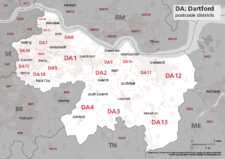
Map of DA postcode districts – Dartford
£15.00The DA – Dartford postcode districts scaled for A4+ printing
PDF -
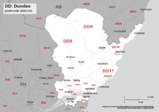
Map of DD postcode districts – Dundee
£15.00The DD – Dundee postcode districts scaled for A4+ printing
PDF -
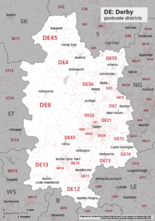
Map of DE postcode districts – Derby
£15.00The DE – Derby postcode districts scaled for A4+ printing
PDF -
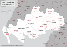
Map of DG postcode districts – Dumfries
£15.00The DG – Dumfries postcode districts scaled for A4+ printing
PDF -
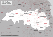
Map of DH postcode districts – Durham
£15.00The DH – Durham postcode districts scaled for A4+ printing
PDF -
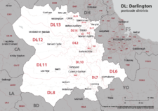
Map of DL postcode districts – Darlington
£15.00The DL – Darlington postcode districts scaled for A4+ printing
PDF -
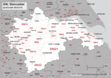
Map of DN postcode districts – Doncaster
£15.00The DN – Doncaster postcode districts scaled for A4+ printing
PDF -
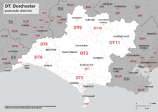
Map of DT postcode districts – Dorchester
£15.00The DT – Dorchester postcode districts scaled for A4+ printing
PDF -
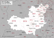
Map of DY postcode districts – Dudley
£15.00The DY – Dudley postcode districts scaled for A4+ printing
PDF -
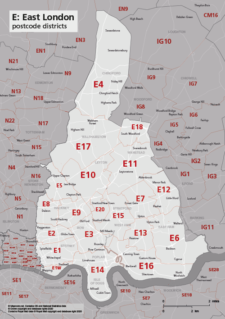
Map of E postcode districts – East London
£15.00The E – East London postcode districts scaled for A4+ printing
PDF -
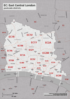
Map of EC postcode districts – East Central London
£15.00The EC – East Central London postcode districts scaled for A4+ printing
PDF -
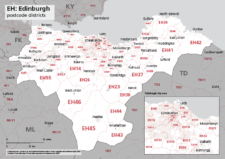
Map of EH postcode districts – Edinburgh
£15.00The EH – Edinburgh postcode districts scaled for A4+ printing
PDF -
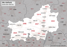
Map of EN postcode districts – Enfield
£15.00The EN – Enfield postcode districts scaled for A4+ printing
PDF -
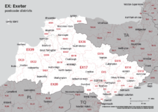
Map of EX postcode districts – Exeter
£15.00The EX – Exeter postcode districts scaled for A4+ printing
PDF -
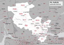
Map of FK postcode districts – Falkirk
£15.00The FK – Falkirk postcode districts scaled for A4+ printing
PDF -
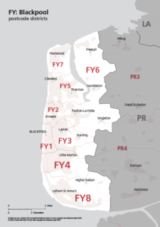
Map of FY postcode districts – Blackpool
£15.00The FY – Blackpool postcode districts scaled for A4+ printing
PDF -
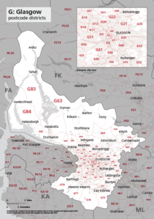
Map of G postcode districts – Glasgow
£15.00The G – Glasgow postcode districts scaled for A4+ printing
PDF -
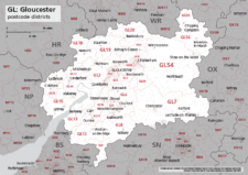
Map of GL postcode districts – Gloucester
£15.00The GL – Gloucester postcode districts scaled for A4+ printing
PDF -
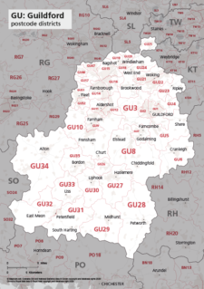
Map of GU postcode districts – Guildford
£15.00The GU – Guildford postcode districts scaled for A4+ printing
PDF -
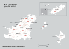
Map of GY postcode districts – Guernsey
£15.00The GY – Guernsey postcode districts scaled for A4+ printing
PDF -
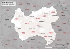
Map of HA postcode districts – Harrow
£15.00The HA – Harrow postcode districts scaled for A4+ printing
PDF -
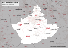
Map of HD postcode districts – Huddersfield
£15.00The HD – Huddersfield postcode districts scaled for A4+ printing
PDF -
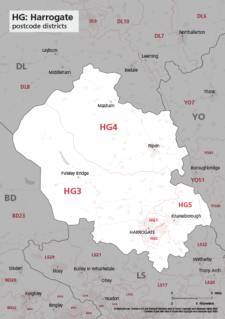
Map of HG postcode districts – Harrogate
£15.00The HG – Harrogate postcode districts scaled for A4+ printing
PDF -
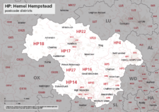
Map of HP postcode districts – Hemel Hempstead
£15.00The HP – Hemel Hempstead postcode districts scaled for A4+ printing
PDF -

Map of HR postcode districts – Hereford
£15.00The HR – Hereford postcode districts scaled for A4+ printing
PDF -
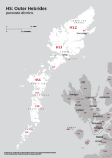
Map of HS postcode districts – Outer Hebrides
£15.00The HS – Outer Hebrides postcode districts scaled for A4+ printing
PDF -
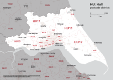
Map of HU postcode districts – Hull
£15.00The AB – Aberdeen postcode districts scaled for A4+ printing
PDF -
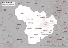
Map of HX postcode districts – Halifax
£15.00The HX – Halifax postcode districts scaled for A4+ printing
PDF -
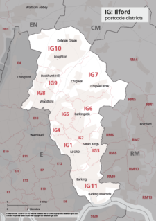
Map of IG postcode districts – Ilford
£15.00The IG – Ilford postcode districts scaled for A4+ printing
PDF -
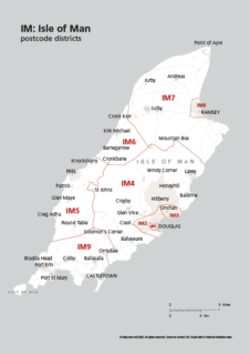
Map of IM postcode districts – Isle of Man
£15.00The IM – Isle of Man postcode districts scaled for A4+ printing
PDF -
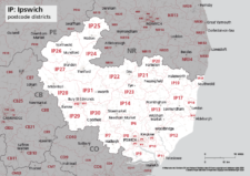
Map of IP postcode districts – Ipswich
£15.00The IP – Ipswich postcode districts scaled for A4+ printing
PDF -
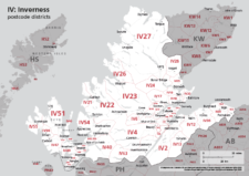
Map of IV postcode districts – Inverness
£15.00The IV – Inverness postcode districts scaled for A4+ printing
PDF -
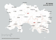
Map of JE postcode districts – Jersey
£15.00The JE – Jersey postcode districts scaled for A4+ printing
PDF -
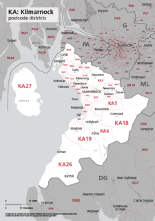
Map of KA postcode districts – Kilmarnock
£15.00The KA – Kilmarnock postcode districts scaled for A4+ printing
PDF -
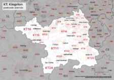
Map of KT postcode districts – Kingston-upon-Thames
£15.00The KT – Kingston upon Thames postcode districts scaled for A4+ printing
PDF -
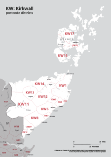
Map of KW postcode areas – Kirkwall
£15.00The KW – Kirkwall postcode districts scaled for A4+ printing
PDF -
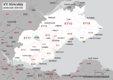
Map of KY postcode districts – Kirkcaldy
£15.00The KY – Kirkcaldy postcode districts scaled for A4+ printing
PDF -
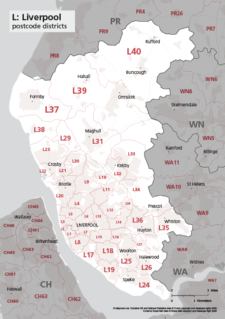
Map of L postcode districts – Liverpool
£15.00The L – Liverpool postcode districts scaled for A4+ printing
PDF -
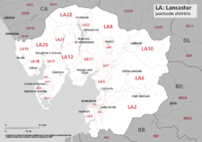
Map of LA postcode districts – Lancaster
£15.00The LA – Lancaster postcode districts scaled for A4+ printing
PDF -
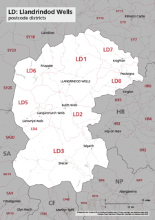
Map of LD postcode districts – Llandrindod Wells
£15.00The LD – Llandrindrod Wells postcode districts scaled for A4+ printing
PDF -
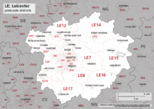
Map of LE postcode districts – Leicester
£15.00The LE – Leicester postcode districts scaled for A4+ printing
PDF -
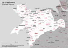
Map of LL postcode districts – Llandudno
£15.00The LL – Llandudno postcode districts scaled for A4+ printing
PDF -
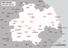
Map of LN postcode districts – Lincoln
£15.00The LN – Lincoln postcode districts scaled for A4+ printing
PDF -
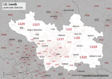
Map of LS postcode districts – Leeds
£15.00The LS – Leeds postcode districts scaled for A4+ printing
PDF -
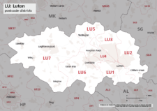
Map of LU postcode districts – Luton
£15.00The LU – Luton postcode districts scaled for A4+ printing
PDF -
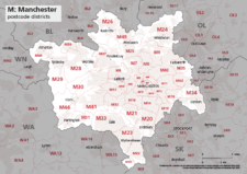
Map of M postcode districts – Manchester
£15.00The M – Manchester postcode districts scaled for A4+ printing
PDF -
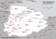
Map of ME postcode districts – Rochester / Medway
£15.00The ME – Maidstone postcode districts scaled for A4+ printing
PDF -
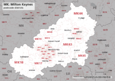
Map of MK postcode districts – Milton Keynes
£15.00The MK – Milton Keynes postcode districts scaled for A4+ printing
PDF -
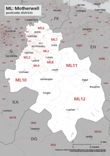
Map of ML postcode districts – Motherwell
£15.00The ML – Motherwell postcode districts scaled for A4+ printing
PDF -
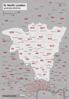
Map of N postcode districts – North London
£15.00The N – North London postcode districts scaled for A4+ printing
PDF -
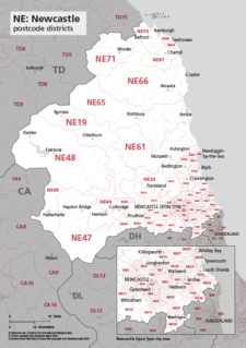
Map of NE postcode districts – Newcastle-upon-Tyne
£15.00The AB – Aberdeen postcode districts scaled for A4+ printing
PDF -
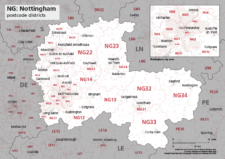
Map of NG postcode districts – Nottingham
£15.00The NG – Nottingham postcode districts scaled for A4+ printing
PDF -

Map of NN postcode districts – Northampton
£15.00The NN – Northampton postcode districts scaled for A4+ printing
PDF -
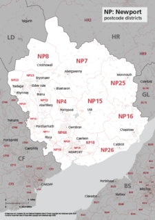
Map of NP postcode districts – Newport
£15.00The NP – Newport postcode districts scaled for A4+ printing
PDF -
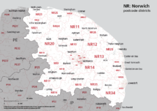
Map of NR postcode districts – Norwich
£15.00The NR – Norwich postcode districts scaled for A4+ printing
PDF -
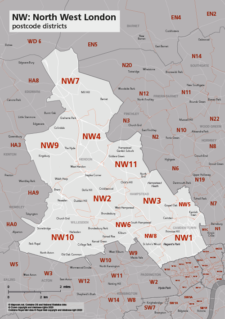
Map of NW postcode districts – North West London
£15.00The NW – North West London postcode districts scaled for A4+ printing
PDF -
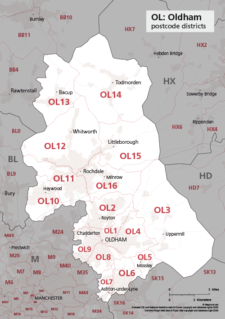
Map of OL postcode districts – Oldham
£15.00The OL – Oldham postcode districts scaled for A4+ printing
PDF -
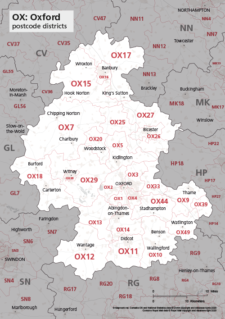
Map of OX postcode districts – Oxford
£15.00The OX – Oxford postcode districts scaled for A4+ printing
PDF -
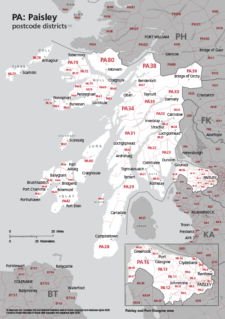
Map of PA postcode districts – Paisley
£15.00The PA – Paisley postcode districts scaled for A4+ printing
PDF -

Map of PE postcode districts – Peterborough
£15.00The PE – Peterborough postcode districts scaled for A4+ printing
PDF -
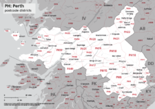
Map of PH postcode districts – Perth
£15.00The PH – Perth postcode districts scaled for A4+ printing
PDF -

Map of PL postcode districts – Plymouth
£15.00The PL – Plymouth postcode districts scaled for A4+ printing
PDF -
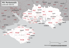
Map of PO postcode districts – Portsmouth
£15.00The PO – Portsmouth postcode districts scaled for A4+ printing
PDF -
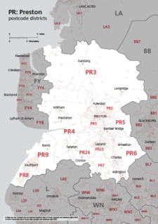
Map of PR postcode districts – Preston
£15.00The PR – Preston postcode districts scaled for A4+ printing
PDF -
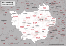
Map of RG postcode districts – Reading
£15.00The RG – Reading postcode districts scaled for A4+ printing
PDF -
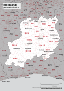
Map of RH postcode districts – Redhill
£15.00The RH – Redhill postcode districts scaled for A4+ printing
PDF -
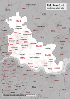
Map of RM postcode districts – Romford
£15.00The RM – Romford postcode districts scaled for A4+ printing
PDF -
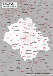
Map of S postcode districts – Sheffield
£15.00The S – Sheffield postcode districts scaled for A4+ printing
PDF -
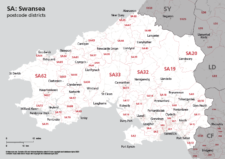
Map of SA postcode districts – Swansea
£15.00The SA – Swansea postcode districts scaled for A4+ printing
PDF -
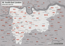
Map of SE postcode districts – South East London
£15.00The SE – South East London postcode districts scaled for A4+ printing
PDF -
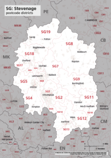
Map of SG postcode districts – Stevenage
£15.00The SG – Stevenage postcode districts scaled for A4+ printing
PDF -

Map of SK postcode districts – Stockport
£15.00The SK – Stockport postcode districts scaled for A4+ printing
PDF -
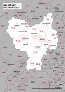
Map of SL postcode districts – Slough
£15.00The SL – Slough postcode districts scaled for A4+ printing
PDF -
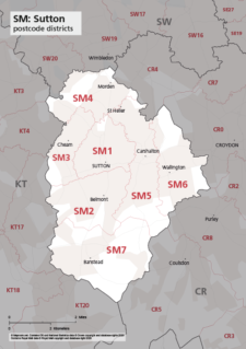
Map of SM postcode districts – Sutton
£15.00The SM – Sutton postcode districts scaled for A4+ printing
PDF -
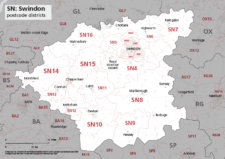
Map of SN postcode districts – Swindon
£15.00The SN – Swindon postcode districts scaled for A4+ printing
PDF -
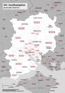
Map of SO postcode districts – Southampton
£15.00The SO – Southampton postcode districts scaled for A4+ printing
PDF -
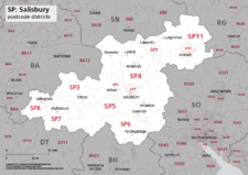
Map of SP postcode districts – Salisbury
£15.00The SP – Salisbury postcode districts scaled for A4+ printing
PDF -
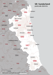
Map of SR postcode districts – Sunderland
£15.00The SR – Sunderland postcode districts scaled for A4+ printing
PDF -
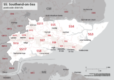
Map of SS postcode districts – Southend-on-Sea
£15.00The SS – Southend-on-Sea postcode districts scaled for A4+ printing
PDF -

Map of ST postcode districts – Stoke-on-Trent
£15.00The ST – Stoke-on-Trent postcode districts scaled for A4+ printing
PDF -
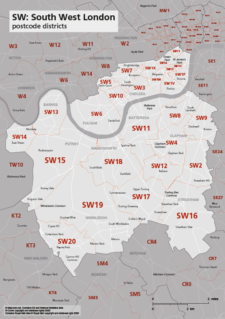
Map of SW postcode districts – South West London
£15.00The SW – South West London postcode districts scaled for A4+ printing
PDF -
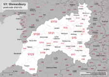
Map of SY postcode districts – Shrewsbury
£15.00The SY – Shrewsbury postcode districts scaled for A4+ printing
PDF -
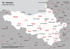
Map of TA postcode districts – Taunton
£15.00The TA – Taunton postcode districts scaled for A4+ printing
PDF -
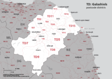
Map of TD postcode districts – Galashiels / Tweeddale
£15.00The TD – Galshiels postcode districts scaled for A4+ printing
PDF -
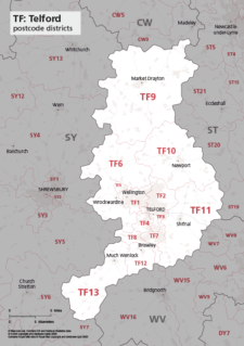
Map of TF postcode districts – Telford
£15.00The TF – Telford postcode districts scaled for A4+ printing
PDF -
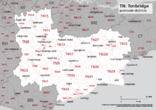
Map of TN postcode districts – Tonbridge
£15.00The TN – Tonbridge postcode districts scaled for A4+ printing
PDF -
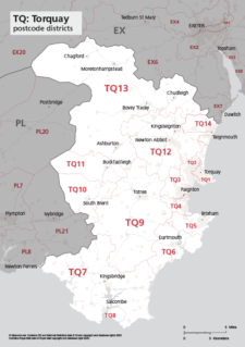
Map of TQ postcode districts – Torquay
£15.00The TQ – Torquay postcode districts scaled for A4+ printing
PDF -
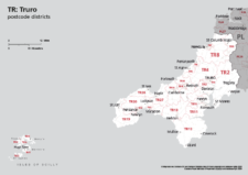
Map of TR postcode districts – Truro
£15.00The TR – Truro postcode districts scaled for A4+ printing
PDF -
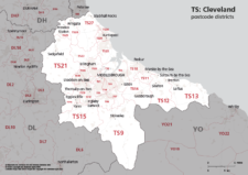
Map of TS postcode districts – Cleveland / Teesside
£15.00The TS – Cleveland postcode districts scaled for A4+ printing
PDF -
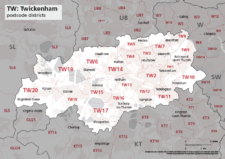
Map of TW postcode districts – Twickenham
£15.00The TW – Twickenham postcode districts scaled for A4+ printing
PDF -
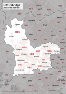
Map of UB postcode districts – Uxbridge / Southall
£15.00The UB – Uxbridge postcode districts scaled for A4+ printing
PDF -
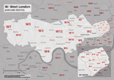
Map of W postcode districts – West London
£15.00The W – West London postcode districts scaled for A4+ printing
PDF -
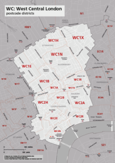
Map of WC postcode districts – West Central London
£15.00The WC – West Central London postcode districts scaled for A4+ printing
PDF -
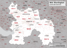
Map of WA postcode districts – Warrington
£15.00The WA – Warrington postcode districts scaled for A4+ printing
PDF -
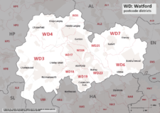
Map of WD postcode districts – Watford
£15.00The WD – Watford postcode districts scaled for A4+ printing
PDF -
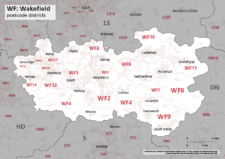
Map of WF postcode districts – Wakefield
£15.00The WF – Wakefield postcode districts scaled for A4+ printing
PDF -
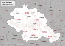
Map of WN postcode districts – Wigan
£15.00The WN – Wigan postcode districts scaled for A4+ printing
PDF -
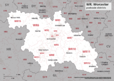
Map of WR postcode districts – Worcester
£15.00The WR – Worcester postcode districts scaled for A4+ printing
PDF -
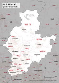
Map of WS postcode districts – Walsall
£15.00The WS – Walsall postcode districts scaled for A4+ printing
PDF -
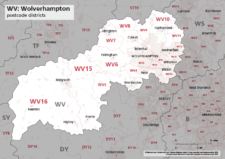
Map of WV postcode districts – Wolverhampton
£15.00The WV – Wolverhampton postcode districts scaled for A4+ printing
PDF -
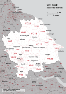
Map of YO postcode districts – York
£15.00The YO – York postcode districts scaled for A4+ printing
PDF -

Map of ZE postcode districts – Lerwick
£15.00The ZE – Lerwick postcode districts scaled for A4+ printing
PDF -
UK postcodes – Esri shapefiles and geojson sets for postcode areas and districts
£1,000.00All the UK postcode areas, districts, sectors and units in formats for developers and geocoders. A valuable and comprehensive GIS dataset that is capable of deep zooming down to street level. Includes Northern Ireland. Licensing restrictions apply.