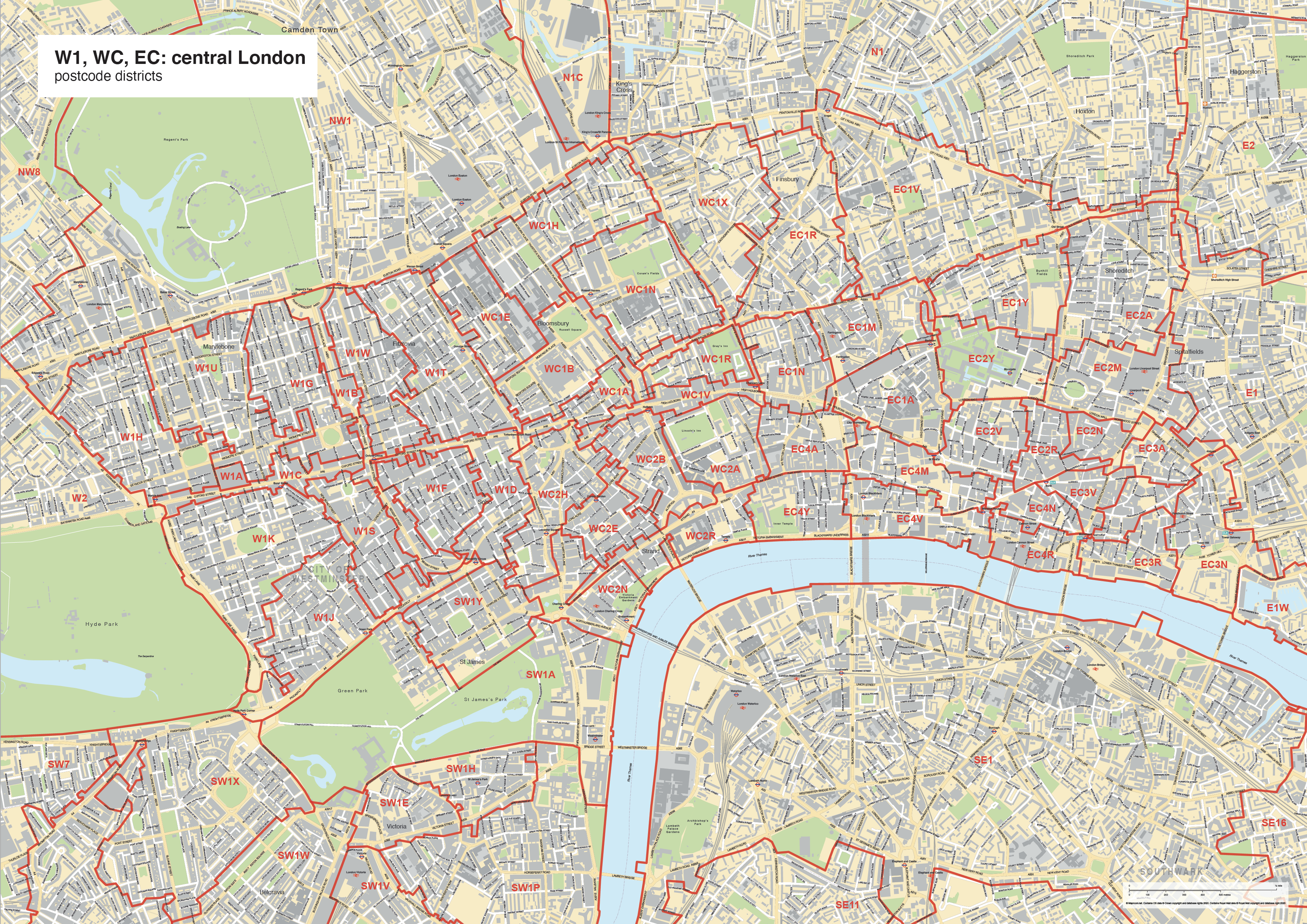
Best maps of central London postcode districts – W1, WC, EC – including street names
Downloadable royalty free vector artwork High-resolution PDFSVGLayered Adobe Illustrator file Bundled with 7-Day Pass for Dynamic Mapping Suite iPrice £25.00
Zoom preview showing full area of coverage (low-resolution)
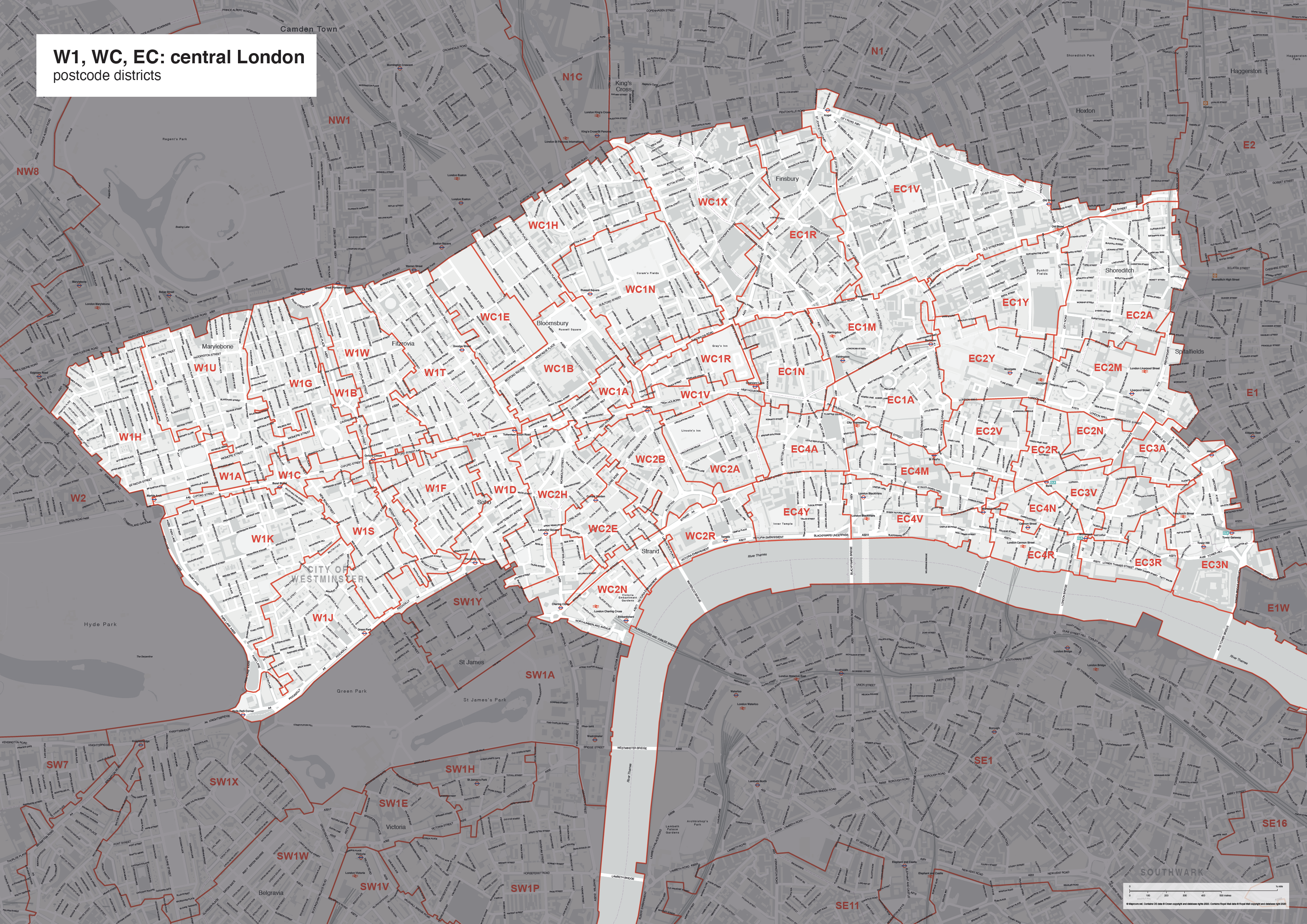
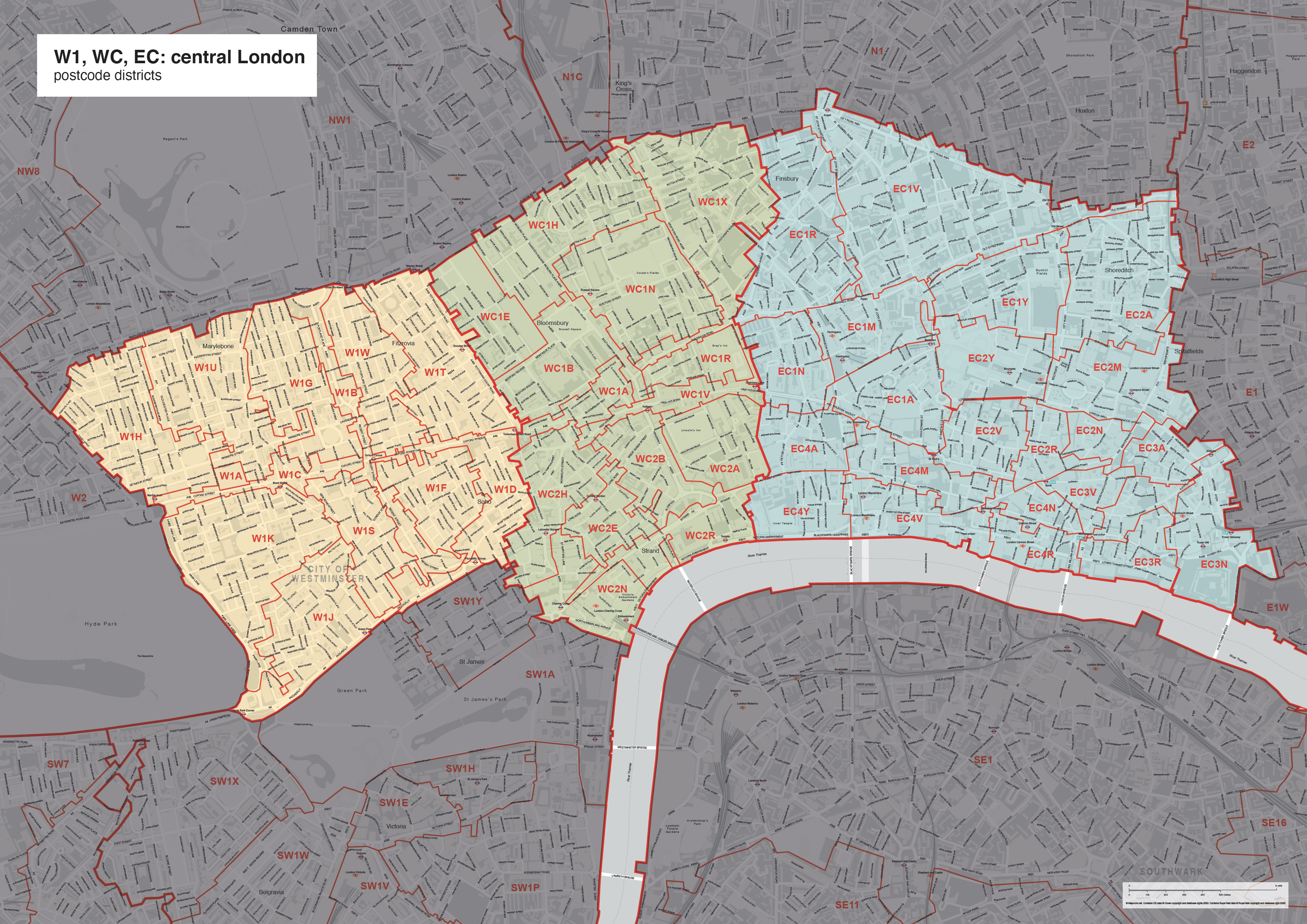

Pan to zoom / click or tap to switch
Examples of styling in the zoom previews are included as ready to use high-resolution PDF files in the download package. You can edit all colours, fonts and other elements using Adobe Illustrator or other SVG editing software.
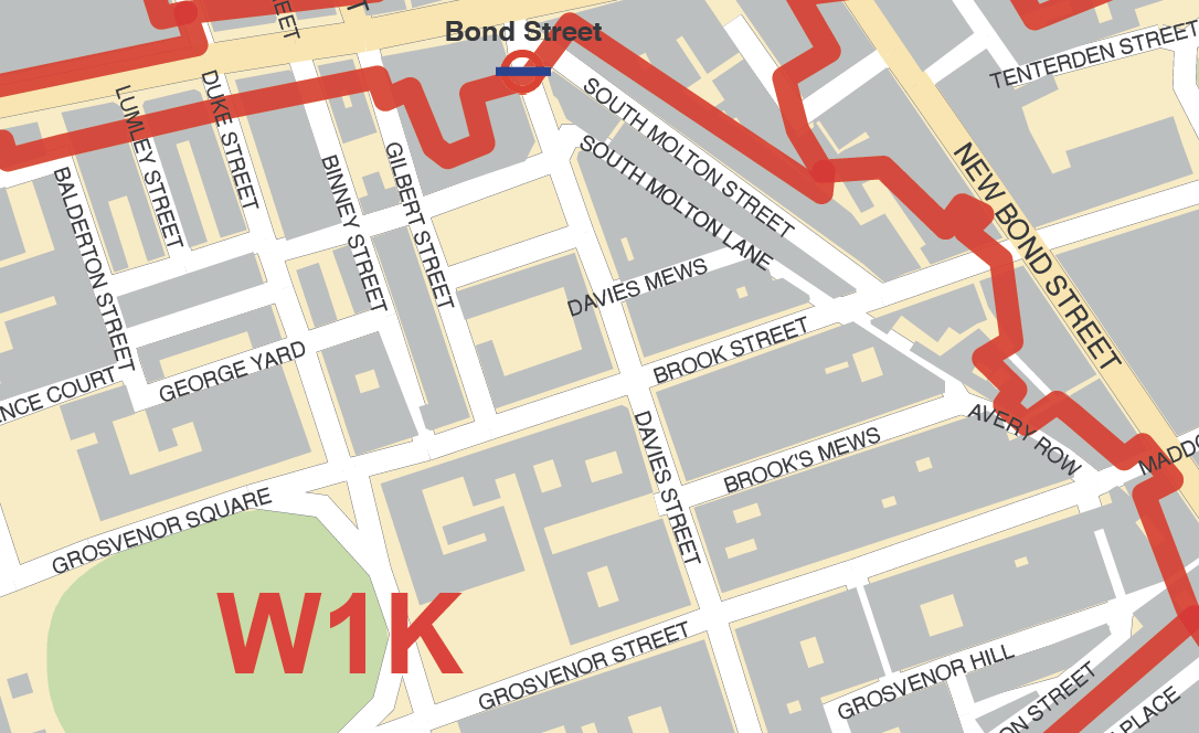
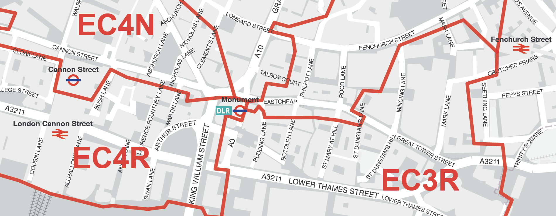
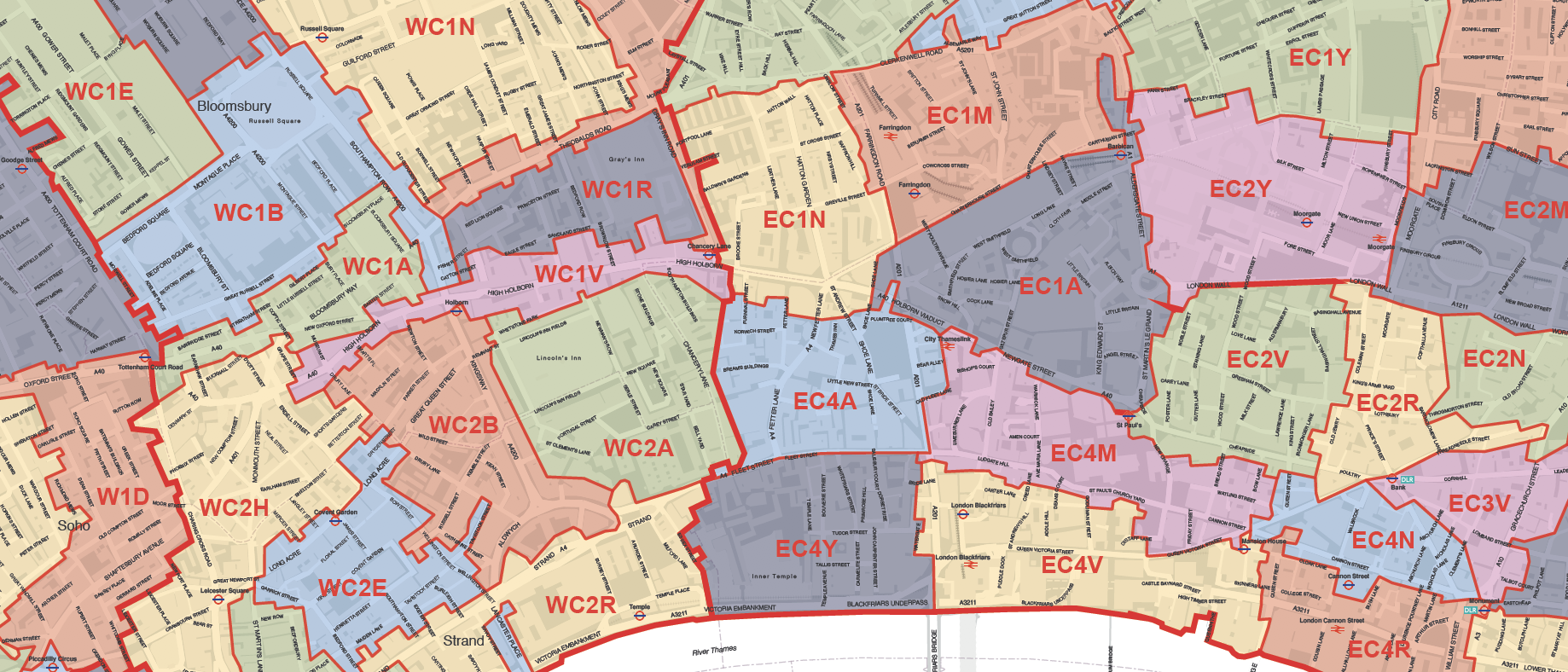
Supplied in four PDF styles as shown, this map covers London’s densely packed W1, WC and EC postcode districts juxtaposed with a street map including road names, clear labels, postcode district boundaries and underlying polygons with the possibility of colour editing in Illustrator or other SVG editing software. The map is scaled for legibility at A0 printing size (84.1 x 118.9 cm), though you can zoom in or tile it.
(The underlying streets are labelled on this map. If you do not require the street names for orientation at street level, you may prefer the cheaper version here without street names, which is legible at A4 printing.)
A Limited Free Pass for our dynamic online postcode maps gives you access to further postcode mapping tools.
Specifications
Licensing terms
This editable map base is suitable for commercial and professional uses
See standard royalty free terms for downloadable maps
How to edit
Adobe Illustrator, CorelDRAW, PDF editors etc
See how to edit the downloadable maps
Recommended scaling
A0 or tiled or zoomed areas
For more guidance see scaling recommendations
Access to Dynamic Mapping Suite
A 7-Day Full Pass for the Dynamic Mapping Suite is bundled with this map. The Dynamic Mapping Suite is a separate system that includes a set of online mapping tools geared to visualising data for UK administrative areas.
You may also like…
-
Map of Greater London postcode districts plus boroughs and major roads
£30.00All the postcode districts in Greater London, shown in context with the London boroughs, post towns, major roads and surrounding counties. Scaled for A3 and above.
PDFsSVGLayered AI file -

Supersize map of Greater London postcode districts with full road network
£75.00Editable postcodes artwork scaled at 4.3 x 3.8 metres in its opening state. The full road network of Greater London is the backdrop, with major road names legible at large-scale printing.
PDFsLayered AI file -
Best UK postcodes map with all the postcode districts, post towns and major roads
£75.00Our most detailed downloadable single-image UK postcodes map at a bargain price. Shows all the 4-digit postcode districts in context with post towns, major roads and counties. Five styles are included, or you can use your own colours and fonts.
PDFsSVGLayered AI file -
UK postcode maps for easy A4 printing – FULL SET with 126 maps
£125.00Full set of the “A” format postcode district maps – 126 maps in total at a huge discount.
PDFs