Maps of the Channel Islands
The Channel Islands are Jersey, Guernsey, Sark, Alderney, Herm, Jethou and Brecqhou. Though geographically closer to France than Britain, they are British Crown Dependencies. However, they are not part of the United Kingdom, therefore we have mapped them separately to our UK maps.
Showing all 5 results
-
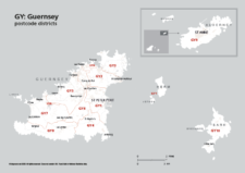
Map of GY postcode districts – Guernsey
£15.00The GY – Guernsey postcode districts scaled for A4+ printing
PDF -
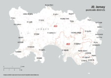
Map of JE postcode districts – Jersey
£15.00The JE – Jersey postcode districts scaled for A4+ printing
PDF -
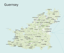
Maps of Guernsey
£30.00Editable maps of Guernsey and the Bailiwick of Guernsey which includes Alderney, Sark, Herm, Jethou and Brecqhou
PDFsSVGLayered AI file -
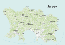
Maps of Jersey
£30.00Maps of Jersey with towns, villages, roads, parishes, postcode districts, urban and green areas, airport and ferry routes
PDFsSVGLayered AI file -
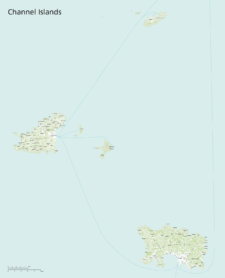
Maps of the Channel Islands
£40.00This superb value bundle of maps for the Channel Islands includes 11 ready-to-use PDF versions plus raw Illustrator base files
PDFsSVGLayered AI file