Maps of Bristol
Showing all 4 results
-
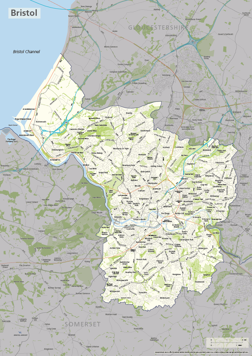
Bristol county map
£40.00The ceremonial county / unitary authority of Bristol is highlighted along with towns, villages, roads, railway lines, lakes, rivers, woodland and green spaces. Scaled for A3+ printing
PDFSVGLayered AI file -
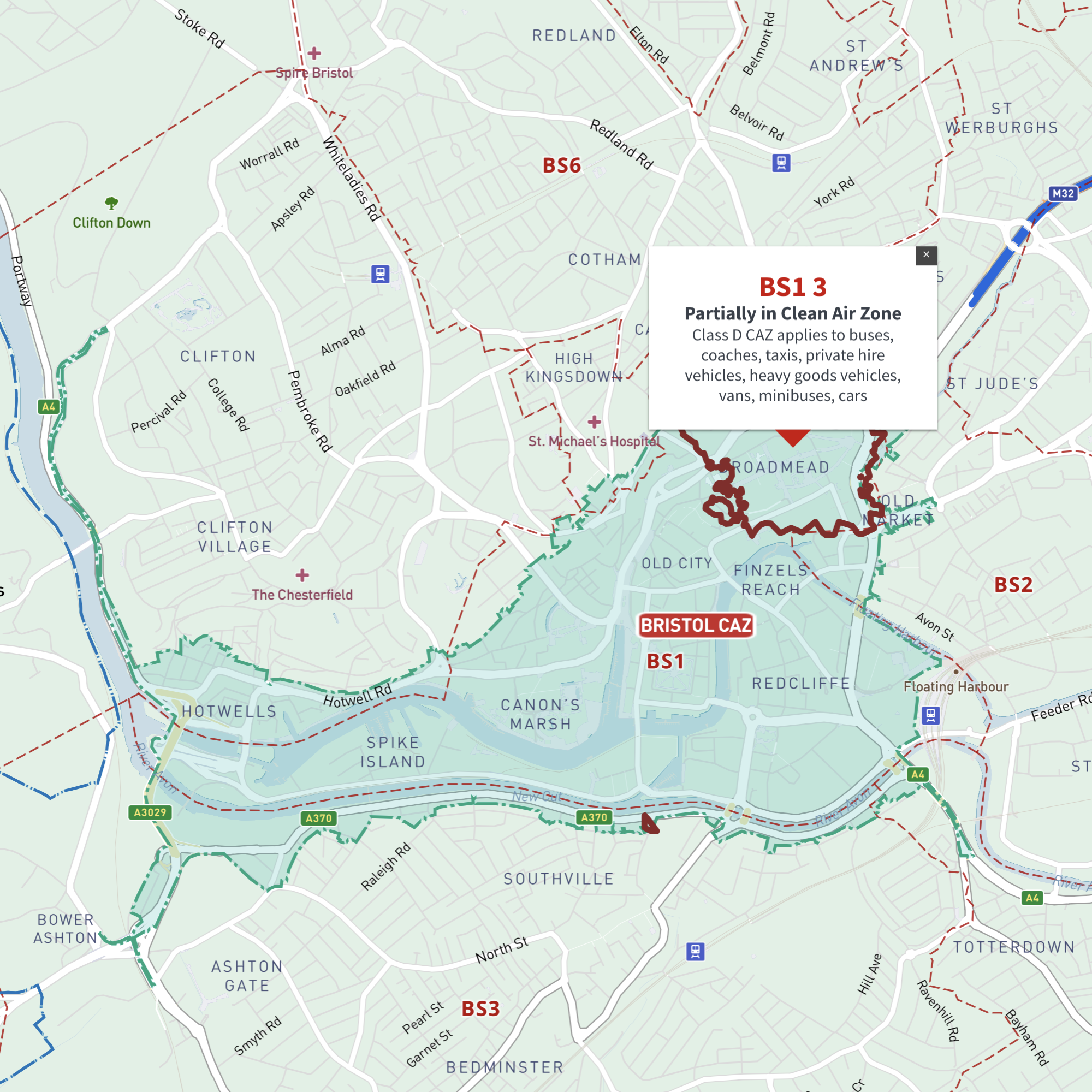
Interactive map of Bristol Clean Air Zone and all BS postcodes
£35.00Online deep-zoom map of Bristol Clean Air Zone (CAZ) with BS postcode districts, sectors and units available in the Dynamic Mapping Suite
-
Bristol Street Maps
£60.00These editable street maps of Bristol and environs are for professional and commercial uses. All of Bristol’s roads, buildings, rivers, parks and transport hubs are plotted in detail. The wealth of detail extends out to Avonmouth and Bristol Airport.
PDFsSVGLayered AI file -

Map of BS postcode districts – Bristol
£15.00The BS – Bristol postcode districts scaled for A4+ printing
PDF