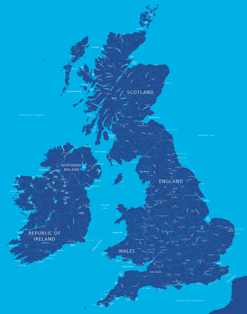
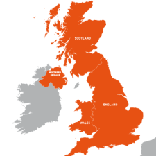
Maps of Britain and Ireland / British Isles
Our Britain and Ireland maps include Great Britain, the whole of Ireland, United Kingdom, Isle of Man and the Channel Islands.
Britain and Ireland terminology
British Isles – the full island group was historically called the British Isles, but this term is politically sensitive and usually avoided today.
Great Britain – refers specifically to England, Scotland and Wales including all the islands of these countries. The term does not cover any part of Ireland, Isle of Man or Channel Islands.
Mainland Britain – specifically the main island of Great Britain excluding all the Scottish islands, Isle of Wight, Isle of Anglesey etc.
United Kingdom (UK) – refers specifically to the United Kingdom of Great Britain and Northern Ireland. Does not cover the Isle of Man, Channel Islands or Republic of Ireland.
Crown Dependencies – the Isle of Man and Channel Islands.
British Overseas Territories – Anguilla, Bermuda, British Antarctic Territory, British Indian Ocean Territory, British Virgin Islands, Cayman Islands, Falkland Islands, Gibraltar, Montserrat, Pitcairn, Henderson, Ducie and Oeno Islands, Saint Helena, Ascension and Tristan da Cunha Islands, South Georgia and the South Sandwich Islands, Sovereign Base Areas of Akrotiri and Dhekelia, Turks and Caicos Islands.
Britain – the loosest term usually referring to the UK but could mean just Great Britain without Northern Ireland, or the UK with Crown Dependencies, or the UK with Crown Dependencies and the British Overseas Territories too.
See also our map sets for the UK, England, Scotland, Wales, Ireland, Northern Ireland, Isle of Man, Channel Islands.
Showing all 26 results
-

UK Local Authorities + Postcodes Map from April 2023
£60.00UK Local Authorities juxtaposed with postcodes districts, plus a Limited Free Pass for the Dynamic Mapping Suite giving access to online Local Authority maps and mapping tools.
PDFSVGLayered AI file -
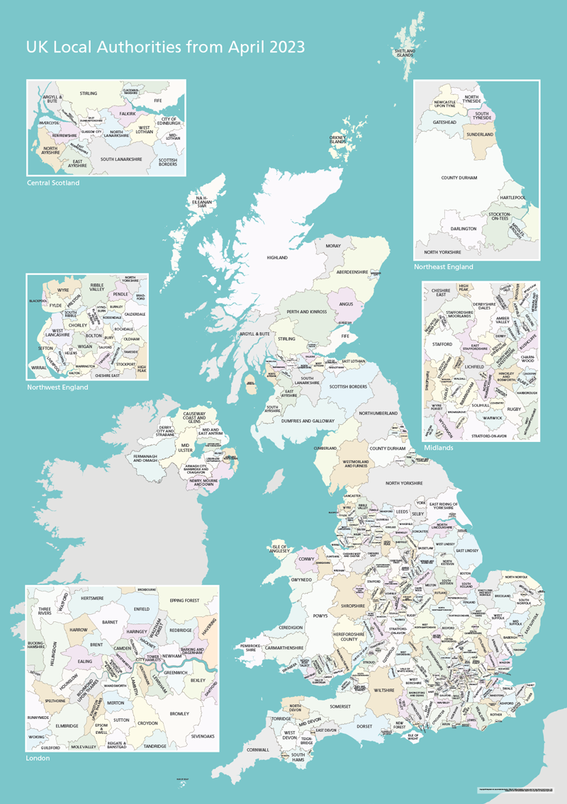
UK Local Authorities Map from April 2023
£40.00Shows all of the UK’s Local Authorities updated from April 2023. Sold in a package with simple poster versions and detailed context with towns and major roads. High-resolution PDFs, AI and SVG formats. All artwork layers can be edited. Also bundled with online Local Authority maps for super detail and dynamic mapping from spreadsheet.
PDFsSVGLayered AI file -
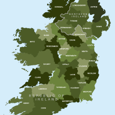
Map of Irish counties
£40.00All the counties in the Republic of Ireland and Northern Ireland
PDFsSVGLayered AI file -
County maps of Britain and Ireland
£45.00Shows all the counties of Britain and Ireland and includes option layers for changing the colour fills and showing county boundaries.
PDFsSVGLayered AI file -
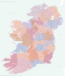
Best detailed map of Ireland
£70.00Approximately 1,400 towns and villages, 17,000+ roads, all the counties and a huge wealth of coastal detail, rivers, urban backdrop and green areas are plotted on our most detailed map of Ireland.
PDFsSVGLayered AI file -
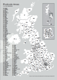
UK postcode areas map for printing “A” format
£15.00Scaled for printing at A4 and above, this map has white postcode areas specially for sales & marketing folk to scribble over with colour pens. Professional designers can edit it too and print it as a wall poster.
PDFs -
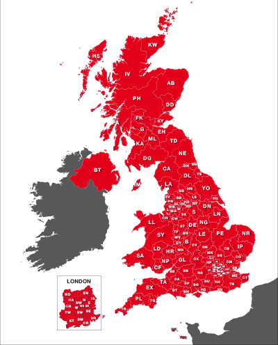
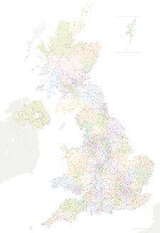
Maps of UK postcode areas
£20.00All the UK two-character postcode areas – 124 areas in total – in five ready-to-use PDF styles, plus access to dynamic postcodes. A bestselling bundle!
PDFsSVGLayered AI file -
Best UK postcodes map with all the postcode districts, post towns and major roads
£75.00Our most detailed downloadable single-image UK postcodes map at a bargain price. Shows all the 4-digit postcode districts in context with post towns, major roads and counties. Five styles are included, or you can use your own colours and fonts.
PDFsSVGLayered AI file -
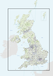
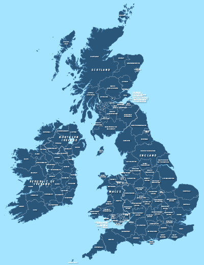
Best detailed map base of the UK / United Kingdom
£75.00This highly detailed base map of the UK has 1,850 town points, 5,500 roads, admin boundaries and a wealth of natural features. Altogether there are more than 4.29 million vector anchor points making this a superb resource for professional designers.
PDFsSVGLayered AI file -
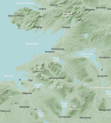
Britain and Ireland physical map with hillshading / relief layer (high-resolution)
£60.00Detailed map of Britain and Ireland with a hillshading / relief layer giving a beautiful sculpted backdrop for the landmass. Every part of the map is editable and suitable for high-resolution professional printing up to A0 poster size.
PDFsSVGLayered AI file -

Detailed outline map of Britain and Ireland (British Isles)
£20.00Superb coastline detail with literally hundreds of islands. Scale it from thumbnail up to poster size if you want.
PDFsSVGLayered AI file -
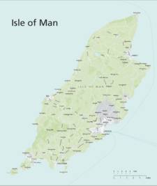
Isle of Man maps
£20.00Maps of the Isle of Man with editable layers for roads, urban background, green areas, rivers, ferry routes and more. The bundle includes the IM postcode districts map version.
PDFsSVGLayered AI file -
UK postcode maps for easy A4 printing – FULL SET with 126 maps
£125.00Full set of the “A” format postcode district maps – 126 maps in total at a huge discount.
PDFs -

Map of Britain and Ireland with cities and roads
£25.00A great value map showing the cities, major towns and arterial routes of Britain and Ireland.
PDFsSVGLayered AI file -
Map of British and Irish rivers and lakes
£20.00Hundreds of lakes and rivers, plus coastal features. Good for educational materials and water-activity themes.
PDFsSVGLayered AI file -
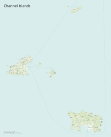
Maps of the Channel Islands
£40.00This superb value bundle of maps for the Channel Islands includes 11 ready-to-use PDF versions plus raw Illustrator base files
PDFsSVGLayered AI file -
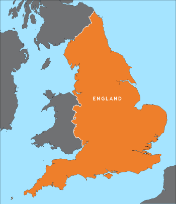
Outline map of England
£15.00A detailed outline map of England, with parts of the surrounding countries for context.
PDFsSVGLayered AI file -
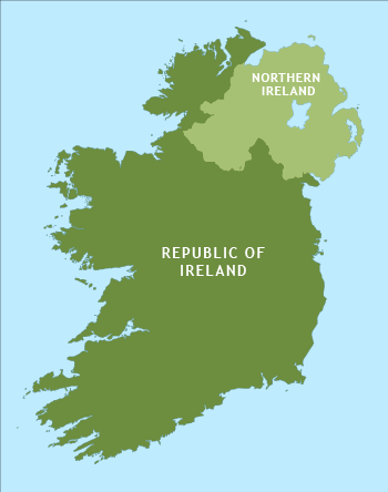
Outline map of Ireland
£15.00An outline map of Ireland with exceptional detail on the coastlines. Includes the border between the Republic and Northern Ireland.
PDFsSVGLayered AI file -
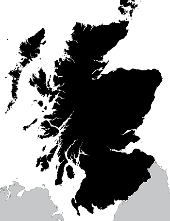
Outline map of Scotland
£15.00A highly detailed outline map of Scotland, with an exceptional number of islands plotted, including many that do not appear on popular online maps!
PDFsSVGLayered AI file -
Outline map of the UK / United Kingdom
£20.00A detailed outline map of the UK with paths for the component countries of England, Scotland, Wales and Northern Ireland.
PDFsSVGLayered AI file -
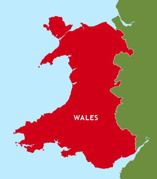
Outline map of Wales
£15.00A detailed outline map of Wales, which shows Anglesey separate from the mainland and includes the little Welsh islands. You can colour it however you want.
PDFsSVGLayered AI file -
Political map of England
£40.00Shows all the counties of England, plus the principal towns and transport network.
PDFsSVGLayered AI file -
Political map of Ireland
£40.00Shows all the counties plus the principal towns and transport systems across both the Republic of Ireland and Northern Ireland.
PDFsSVGLayered AI file -
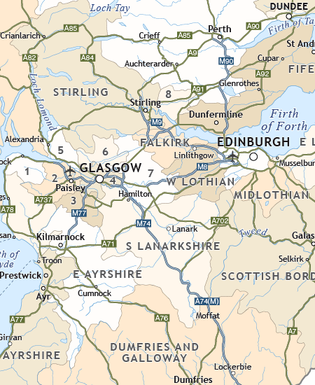
Political map of Scotland
£40.00Includes all the modern counties of Scotland, plus the principal towns and transport network.
PDFsSVGLayered AI file -
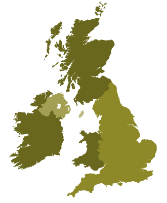
Simple outline map of Britain and Ireland
£15.00A simple outline map of Britain and Ireland with the main islands of the British Isles. Looks elegant and accurate when used as a small image up to about A5.
PDFsSVGLayered AI file -

Touring / physical map of Britain and Ireland (low-resolution)
£30.00Perfect for tourist industry projects with its coastal features, lakes, rivers, national parks, historic towns and resorts.
PDFsSVGLayered AI file