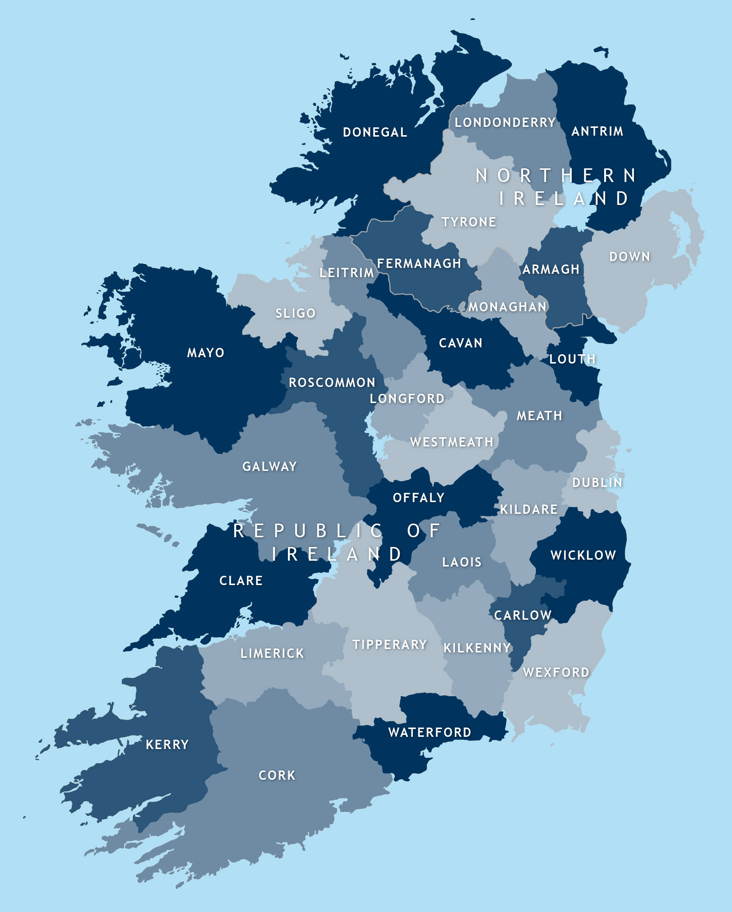
Map of Irish counties
Downloadable royalty free vector artwork High-resolution PDFsSVGLayered Adobe Illustrator file Bundled with 7-Day Pass for Dynamic Mapping Suite iPrice £40.00
Zoom preview showing full area of coverage (low-resolution)

Pan to zoom / click or tap to switch
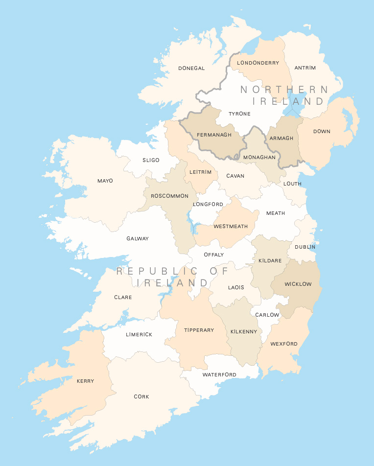
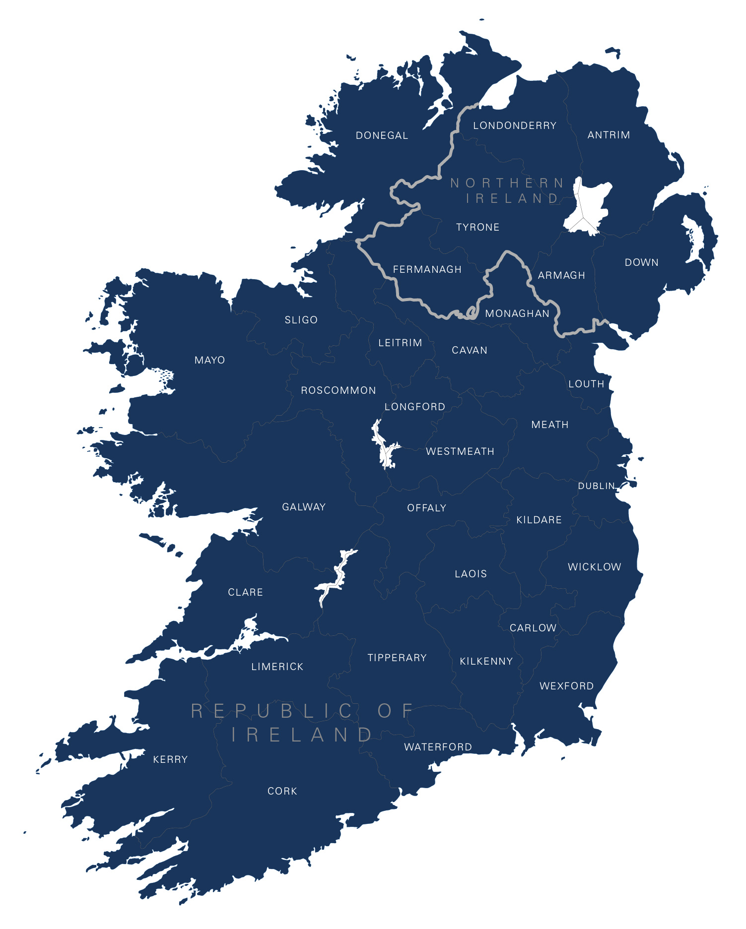
Examples of styling in the zoom previews are included as ready to use high-resolution PDF files in the download package. You can edit all colours, fonts and other elements using Adobe Illustrator or other SVG editing software.
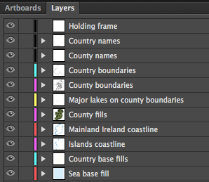
This editable map base has all the counties of Ireland, including layers for the Republic of Ireland and Northern Ireland. You can highlight individual counties in whatever colours you want or use one of the built-in colour schemes, or have all counties as a single colour with varying stroke weights for the boundaries.
The boundary between Northern Ireland and the Republic is included if you need it. You can also choose whether to show the major loughs that form some of the county boundaries or to have a solid landmass silhouette.
If you want to include cities and roads in addition to counties, see the political map of Ireland and our detailed map of Ireland. We also have a county map of Britain and Ireland if you want to show Northern Ireland in the context of the UK.
Specifications
Price £40.00
Product code: MR127
Licensing terms
This editable map base is suitable for commercial and professional uses
See standard royalty free terms for downloadable maps
How to edit
Adobe Illustrator, CorelDRAW, PDF editors etc
See how to edit the downloadable maps
Recommended scaling
A5 to poster size
For more guidance see scaling recommendations
Access to Dynamic Mapping Suite
A 7-Day Full Pass for the Dynamic Mapping Suite is bundled with this map. The Dynamic Mapping Suite is a separate system that includes a set of online mapping tools geared to visualising data for UK administrative areas.
Vector map layers in Illustrator