Showing all 5 results
-
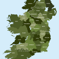
Map of Irish counties
£40.00All the counties in the Republic of Ireland and Northern Ireland
PDFsSVGLayered AI file -
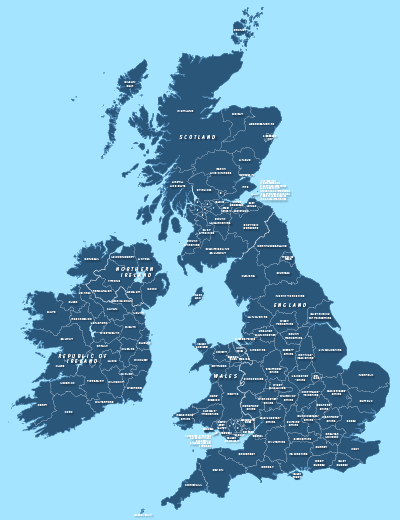
County maps of Britain and Ireland
£45.00Shows all the counties of Britain and Ireland and includes option layers for changing the colour fills and showing county boundaries.
PDFsSVGLayered AI file -
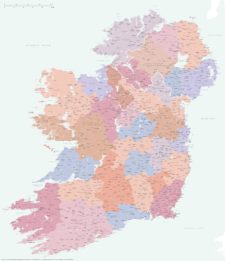
Best detailed map of Ireland
£70.00Approximately 1,400 towns and villages, 17,000+ roads, all the counties and a huge wealth of coastal detail, rivers, urban backdrop and green areas are plotted on our most detailed map of Ireland.
PDFsSVGLayered AI file -
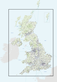
Best detailed map base of the UK / United Kingdom
£75.00This highly detailed base map of the UK has 1,850 town points, 5,500 roads, admin boundaries and a wealth of natural features. Altogether there are more than 4.29 million vector anchor points making this a superb resource for professional designers.
PDFsSVGLayered AI file -
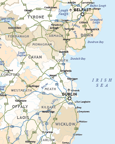
Political map of Ireland
£40.00Shows all the counties plus the principal towns and transport systems across both the Republic of Ireland and Northern Ireland.
PDFsSVGLayered AI file