We offer a number of mapping solutions based on geographies defined by the UK’s Office for National Statistics (ONS), local authorities and other public bodies. Public data is typically aimed at local and national government, but is also of great interest to many commercial companies and marketeers, particularly in combination with postcode mapping. You can commission us for bespoke dynamic web maps with data feeds using ONS-defined boundaries such as for local authorities, super output areas, counties, unitary authorities, NHS and ICB (old CCG) areas, parliamentary constituencies, wards, work zones and police force areas.

Public demo map of UK parliamentary constituencies and MPs
We published one of our ONS-based dynamic maps publicly, which rapidly rose to No.1 on Google, above the BBC’s election maps! This immensely popular online web map demonstrates how we can feed data from a spreadsheet to form interactive listings with popup info boxes.
Read about how we constructed this map
Dynamic ONS-based web maps available in the Dynamic Mapping Suite
At a similar level of detail and interactivity to our publicly published parliamentary constituencies map mentioned above, our other ONS-based web maps are available in the Dynamic Mapping Suite. Juxtaposed with postcode layers, these form a superb suite of reference maps for administrators and marketers needing both ONS and postcode datasets. You can also commission a bespoke map using these map bases, and even marry up your own data with ONS-coded boundary areas on the maps.
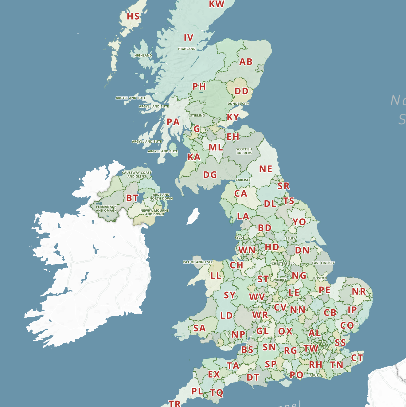
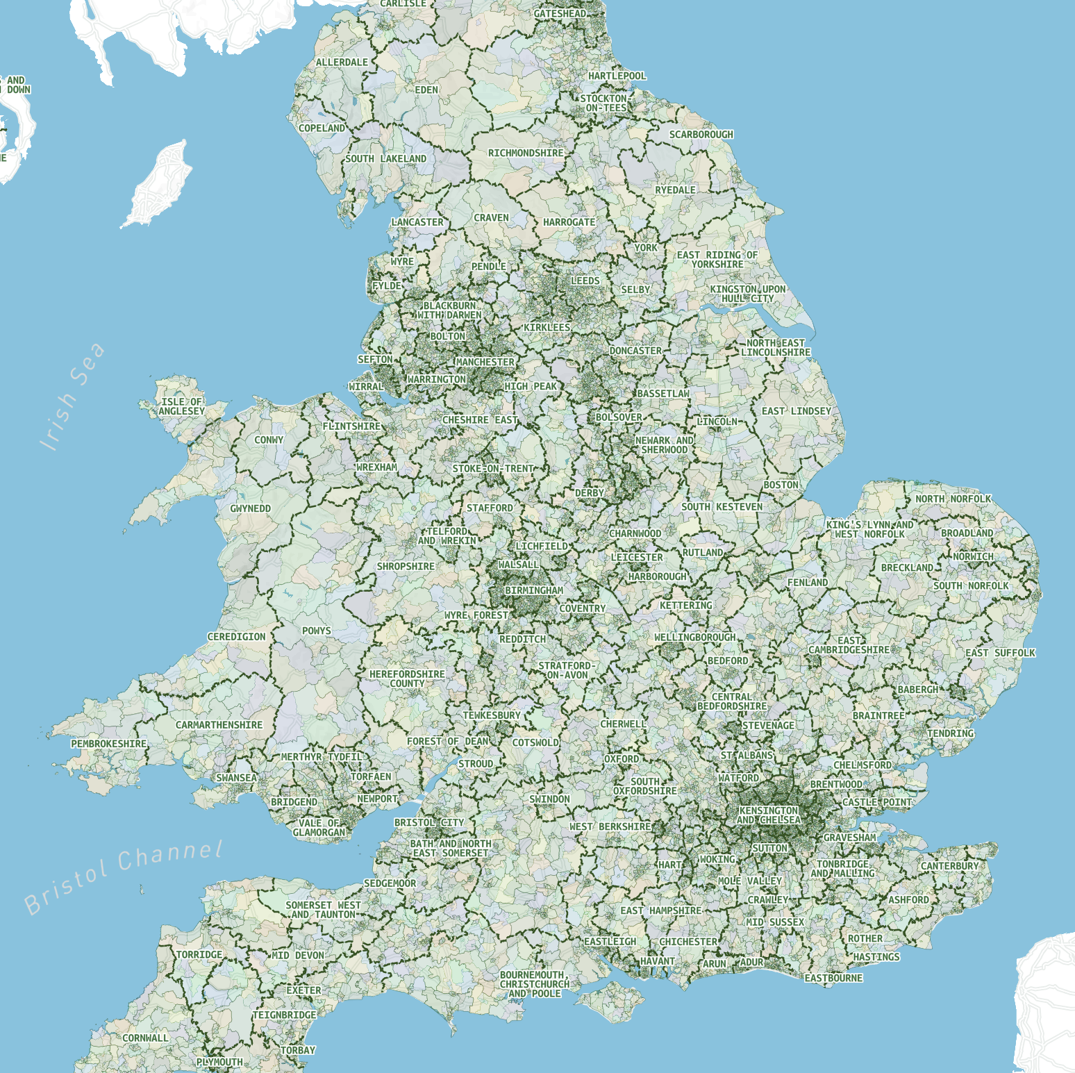
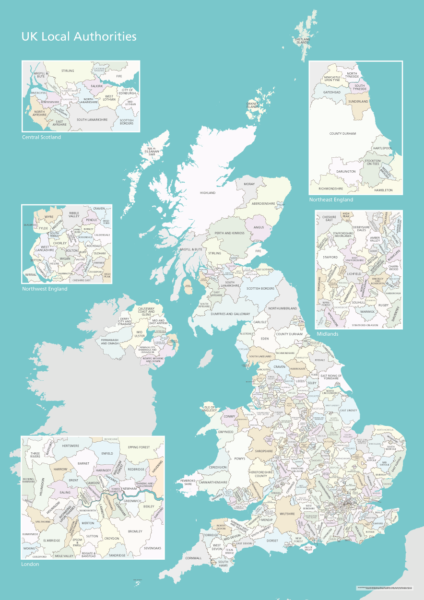
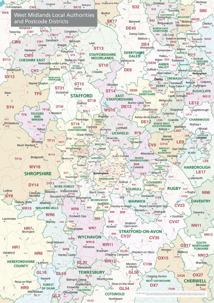
Local authorities of the United Kingdom
All the UK’s Local Authority Districts with popup info and postcode options.

Electoral Wards
The basic unit of UK administrative geography – 8,694 Wards in context with Constituency and Local Authority boundaries.
Super Output Areas
The Super Output Areas of England and Wales including 34,753 lower layer SOAs at street level.
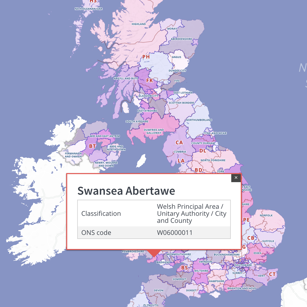
Counties and unitary authorities
A high tier of authority used by the ONS. Dynamic search plus postcodes and colour classification toggling.
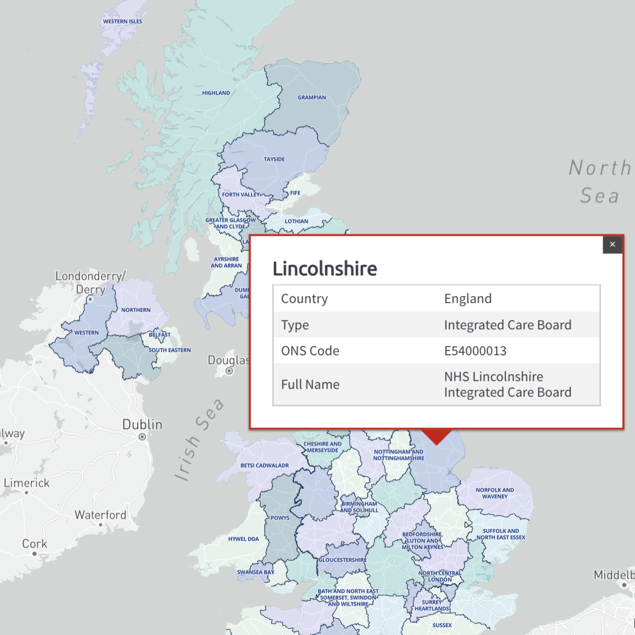
Health authorities
The 68 principal health authority areas of the UK, updated for 2022. Includes England’s new Integrated Care Boards and sub-Locations, plus old CCG boundaries.
Downloadable maps with ONS-based boundaries
Example of dynamic choropleth heat map using ONS data
Mouseover the local authorities for population data!