UK Local Authorities + Postcodes Map from April 2023
Downloadable royalty free vector artwork High-resolution PDFSVGLayered Adobe Illustrator file Bundled with 7-Day Pass for Dynamic Mapping Suite iPrice £60.00

This map is aimed at professional organisations, graphic designers and data analysts who need detailed visual map reference for the UK’s local authorities shown in context with towns, roads and postcode districts. The package includes a Limited Free Pass for our Dynamic Mapping Suite. In the Dynamic Mapping Suite you can feed in spreadsheet data to an online interactive version of this map, and see how the local authorities relate to postcodes at street level.
What you get
- 1 x detailed map of the UK showing all of the UK’s local authorities from April 2023, plus hundreds of towns and the boundary lines for more than 2,800 postcode districts. This large PDF can be used for on-screen reference and for editing and large-scale high-quality printing (if printed with the smallest labels legible at 100%, this map is more than 3 metres in height).
- Limited free pass for our Dynamic Mapping Suite.
Notes for graphic designers
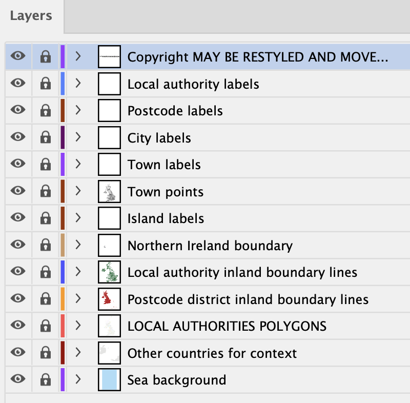
The PDF maps are saved with all layers editable using the most recent version of Adobe Illustrator. All elements are live, including labels and fonts. The local authority layers are available as both inland boundary lines and polygon fill areas for easy colour editing. The postcode districts are available as inland boundary lines only (not polygon fill areas).
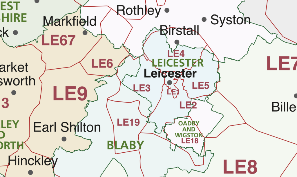
Coterminous and non-coterminous local authority and postcode boundaries
Local Authority boundaries and postcode districts are often related but not always coterminous – not even at country borders! Use our maps to see the relationship. For the best level of detail, use the online map which lets you zoom into street level.
Specifications
Price £60.00
Product code: MR157
Licensing terms
This editable map base is suitable for commercial and professional uses
See standard royalty free terms for downloadable maps
How to edit
Adobe Illustrator, CorelDRAW, PDF editors etc
See how to edit the downloadable maps
Recommended scaling
A-format posters, zoomed sections or tiles
For more guidance see scaling recommendations
Access to Dynamic Mapping Suite
A 7-Day Full Pass for the Dynamic Mapping Suite is bundled with this map. The Dynamic Mapping Suite is a separate system that includes a set of online mapping tools geared to visualising data for UK administrative areas.
Vector map layers in Illustrator