Maproom

Editable & interactive maps

  • About
  • Blog
  • Contact
  • 0 items
LOGIN | DYNAMIC MAPPING SUITE
  • Britain & Ireland maps
    • Britain and Ireland
    • UK - United Kingdom
    • Ireland
    • England
    • Scotland
    • Wales
    • Northern Ireland
    • Isle of Man
    • Channel Islands
  • City maps
    • Birmingham
    • Brighton
    • Bristol
    • Cardiff
    • Edinburgh
    • Glasgow
    • Liverpool
    • London
    • Manchester
    • New York
    • Oxford
  • ONS & admin maps
    • Office for National Statistics (ONS) maps
    • Local authority maps
    • County maps
  • Postcode maps
        • Overview of our postcode maps
        • Downloadable postcode maps

        • UK postcode maps
        • London postcode maps
        • Postcodes scaled for easy A4 printing
        • Dynamic online postcode maps

        • Postcode mapping tools
        • How to colour and caption postcode maps online
        • Dynamic library
        • Sample at street level
        • Demo of spreadsheet feed
        • Quote
  • World maps
    • World maps
    • Europe maps
    • Map of EU countries after Brexit
    • Maps of France
    • Maps of Germany
    • Maps of New York and environs
  • Dynamic maps
        • Dynamic maps showcase

        • Introduction to dynamic maps
        • Parliamentary constituencies
        • Listed buildings
        • Minimalist churches
        • 3d urban exploration
        • London vehicle zones
        • Postcodes coverage
        • Dynamic mapping suite

        • Dynamic maps for UK governance, business intelligence and marketing
        • Access options for the dynamic mapping suite
        • FAQs about dynamic maps
        • Get quote for a bespoke dynamic map
  • Go bespoke

Maps of Scotland

Showing all 5 results

  • UK detailed map artboard

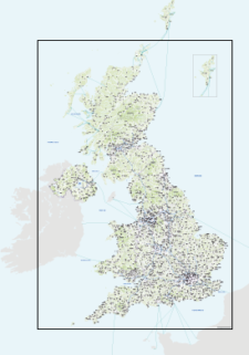
    Best detailed map base of the UK / United Kingdom

    £60.00

    This highly detailed base map of the UK has 1,850 town points, 5,500 roads, administrative boundaries, and a wealth of natural features. Altogether there are more than 4.29 million vector anchor points making this a superb resource for professional designers.

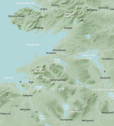
  • Britain and Ireland physical map with hillshading / relief layer (high-resolution)

    £60.00
  • Britain rivers map

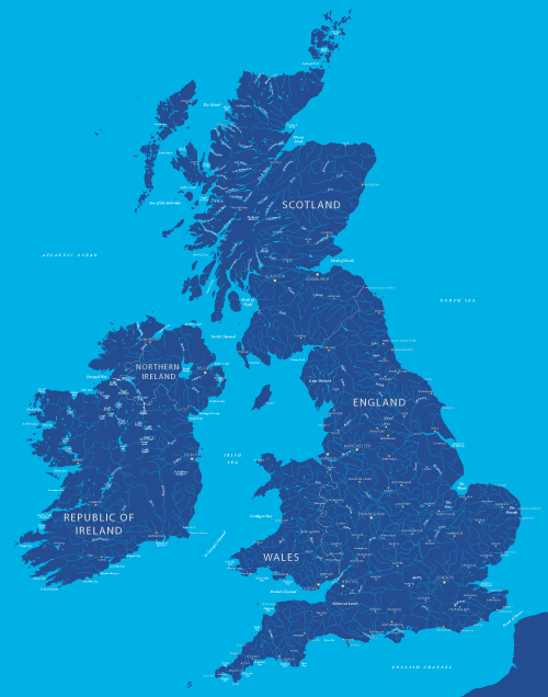
    Map of British and Irish rivers and lakes

    £24.99

    Hundreds of lakes and rivers, plus coastal features. Good for educational materials and water-activity themes.

  • Scotland outline map

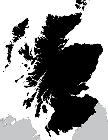
    Outline map of Scotland

    £8.99

    A highly detailed outline map of Scotland, with an exceptional number of islands plotted, including many that do not appear on popular online maps!

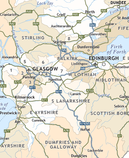
  • Political map of Scotland

    £19.99

    Includes all the modern counties of Scotland, plus the principal towns and transport network.

  • Standard royalty free terms for downloadable maps
  • Licensing terms for downloadable postcode maps
  • How to edit the downloadable maps
  • Access options for the dynamic mapping suite
  • Pricing & refund policies
  • Privacy & cookies

All content © Maproom at Thameside Media · Award winning media projects