Maps of Glasgow
Showing all 3 results
-
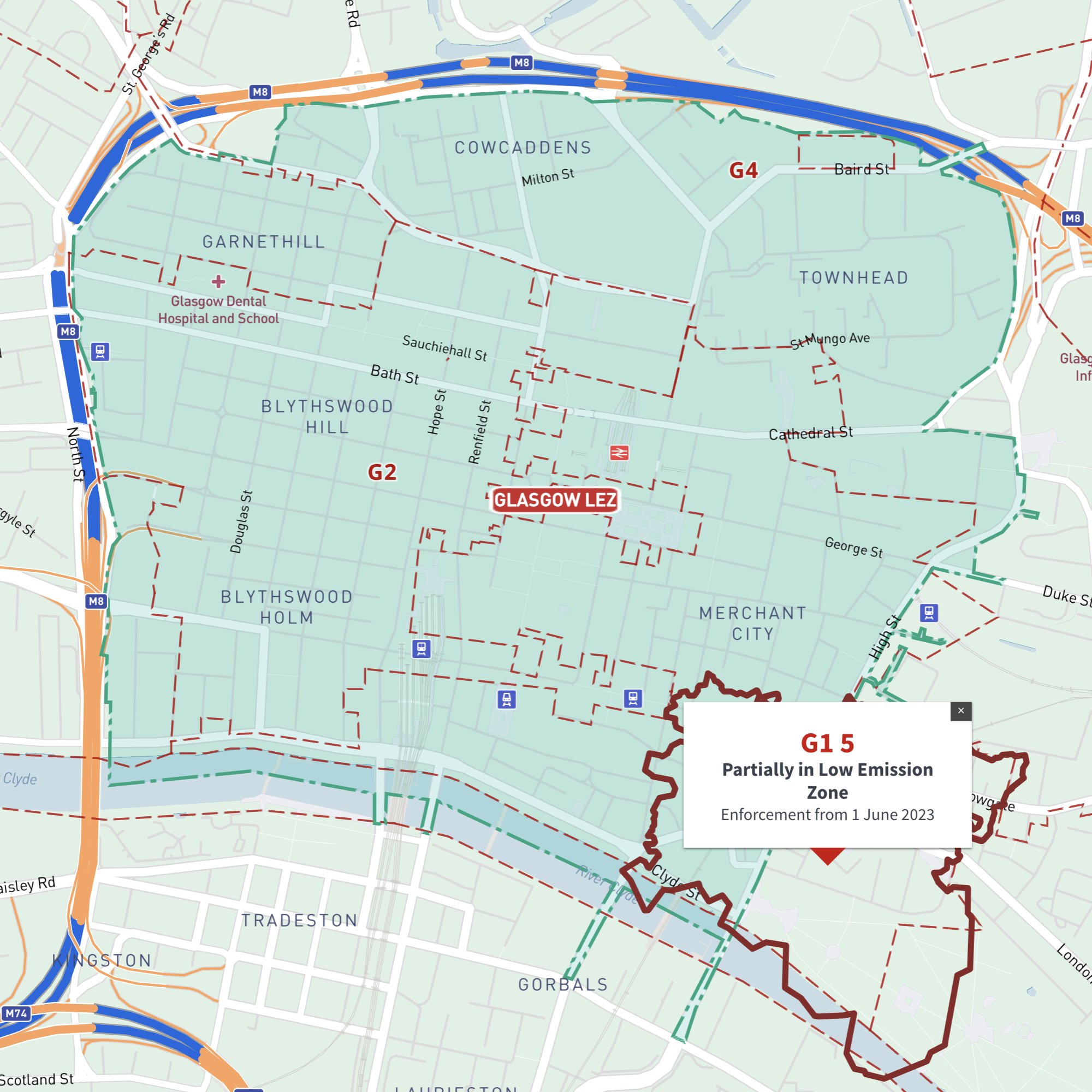
Interactive map of Glasgow Low Emission Zone and all G postcodes
£35.00Online deep-zoom map of Glasgow Low Emission Zone (LEZ) with G postcode districts, sectors and units available in the Dynamic Mapping Suite
-

Glasgow Street Maps
£60.00Street maps of Glasgow city centre and environs reaching out to Glasgow Airport, Clydebank, Bearsden, Bishopbriggs, Lenzie, Rutherglen, Barrhead and Paisley. Subway stations are included.
PDFsSVGLayered AI file -
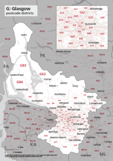
Map of G postcode districts – Glasgow
£15.00The G – Glasgow postcode districts scaled for A4+ printing
PDF