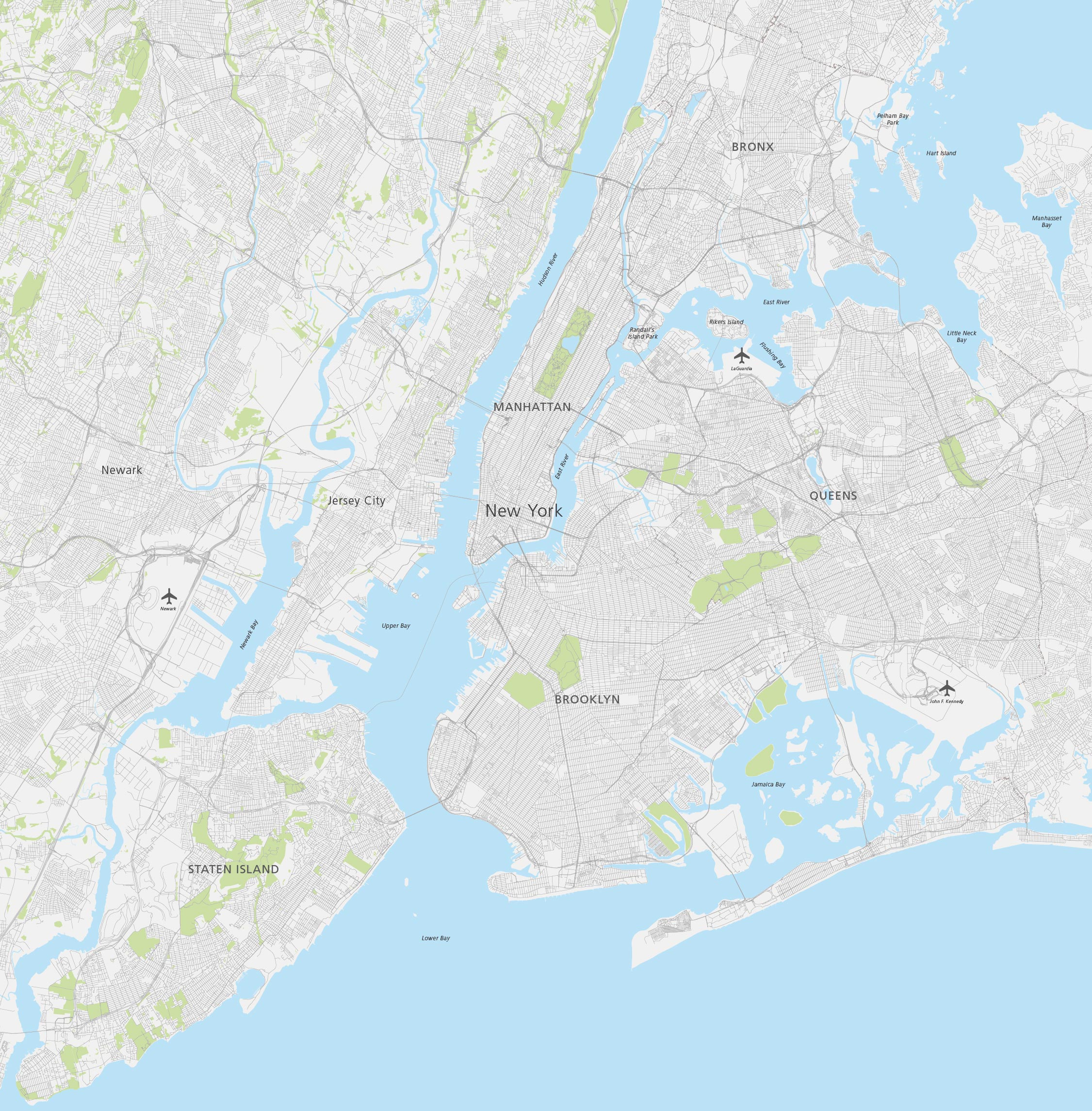
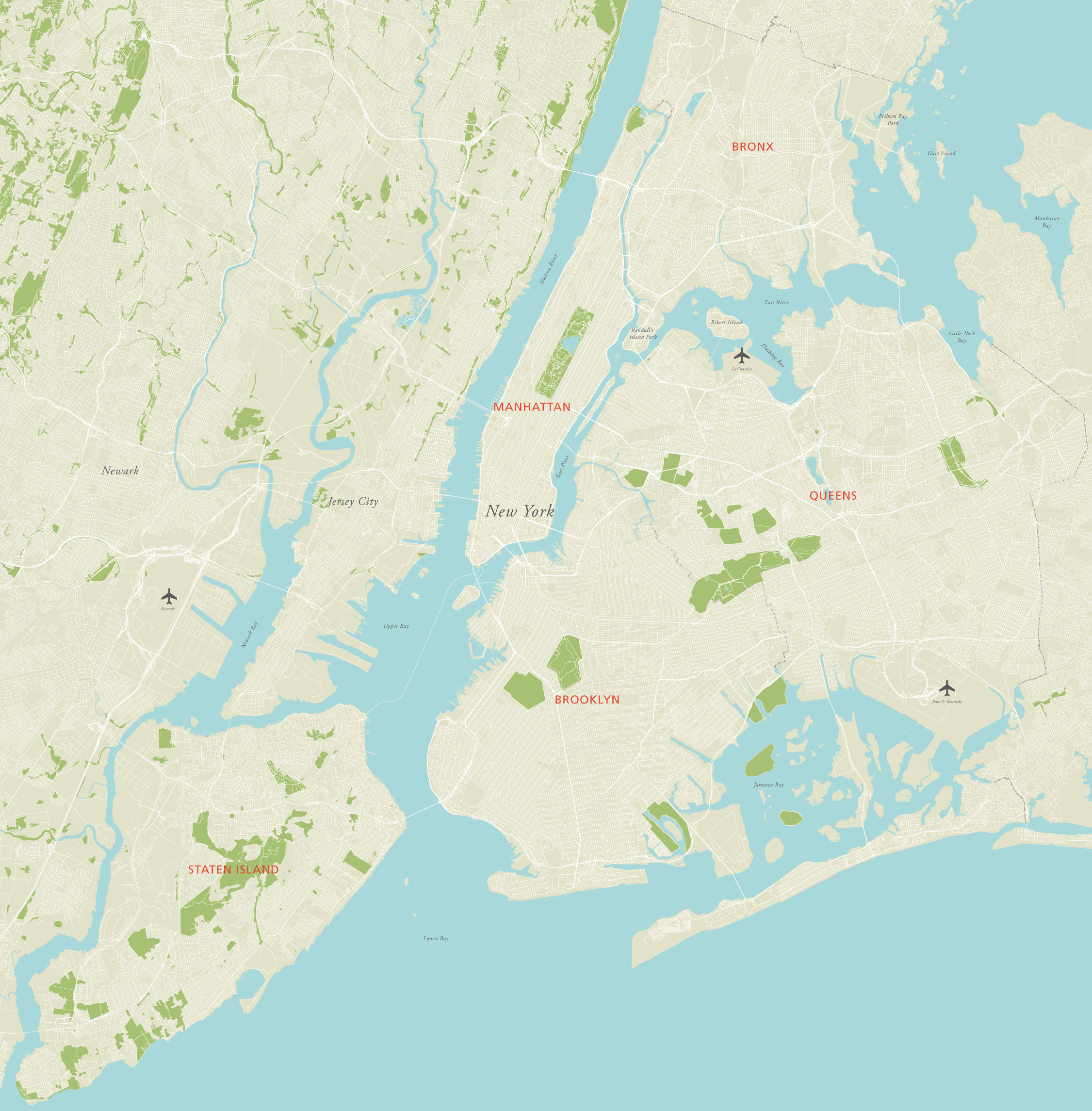
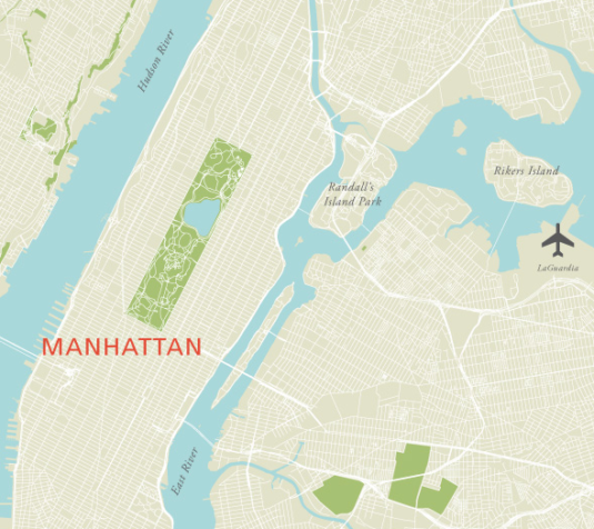
Maps of New York and environs
Downloadable royalty free vector artwork High-resolution PDFsSVGLayered Adobe Illustrator filePrice £75.00
Zoom preview showing full area of coverage (low-resolution)

Pan to zoom / click or tap to switch
Examples of styling in the zoom previews are included as ready to use high-resolution PDF files in the download package. You can edit all colours, fonts and other elements using Adobe Illustrator or other SVG editing software.
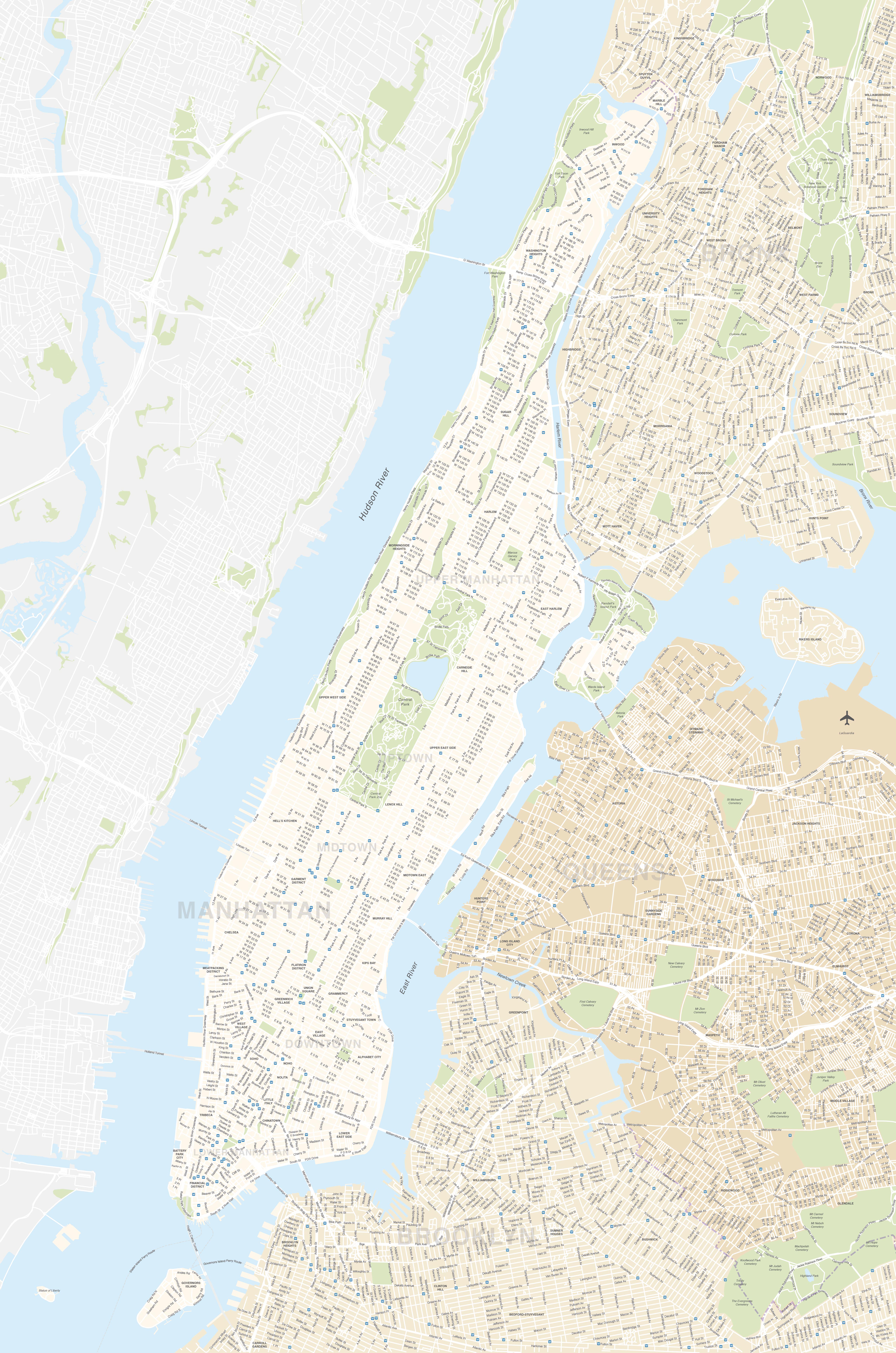
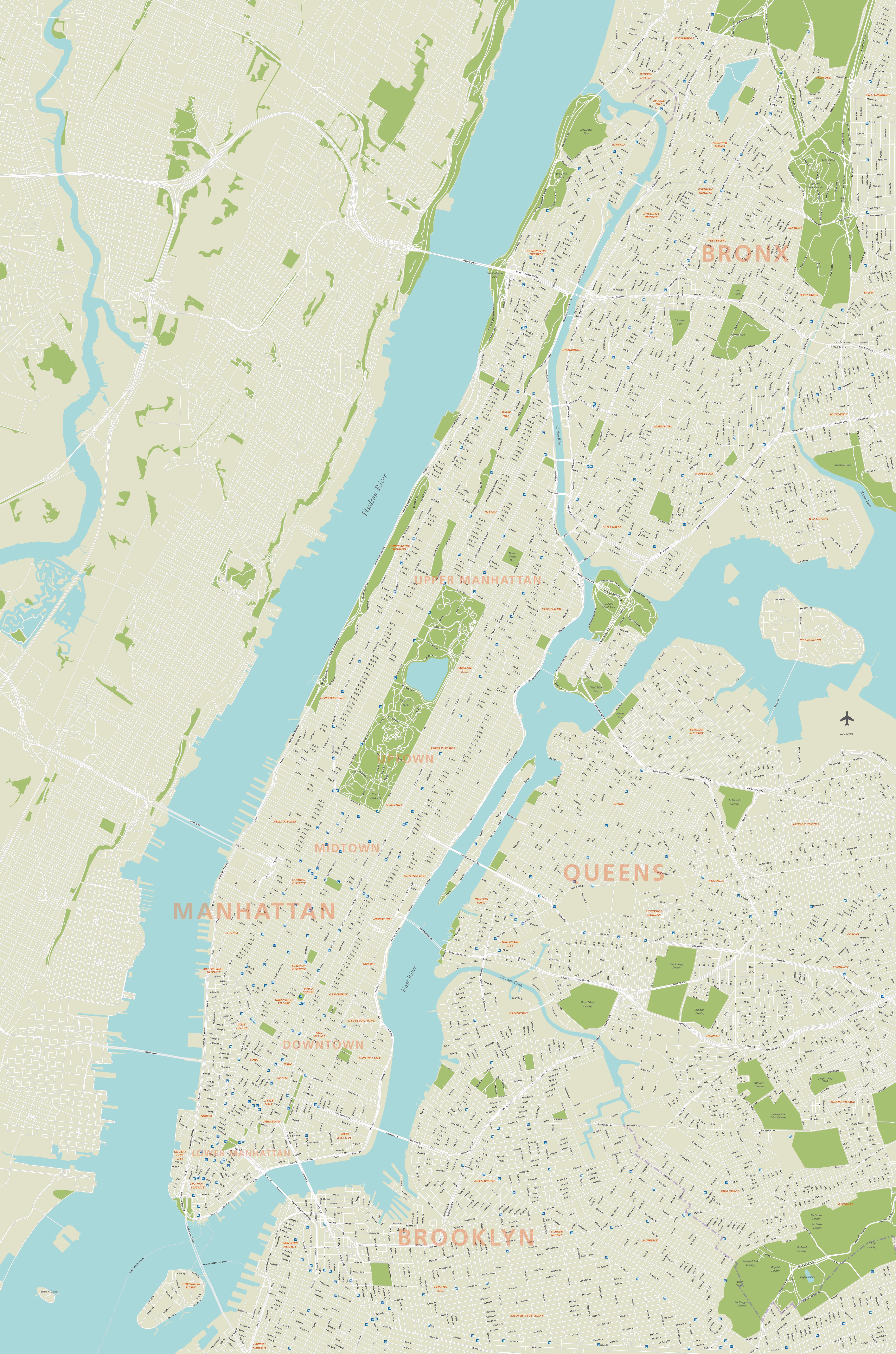
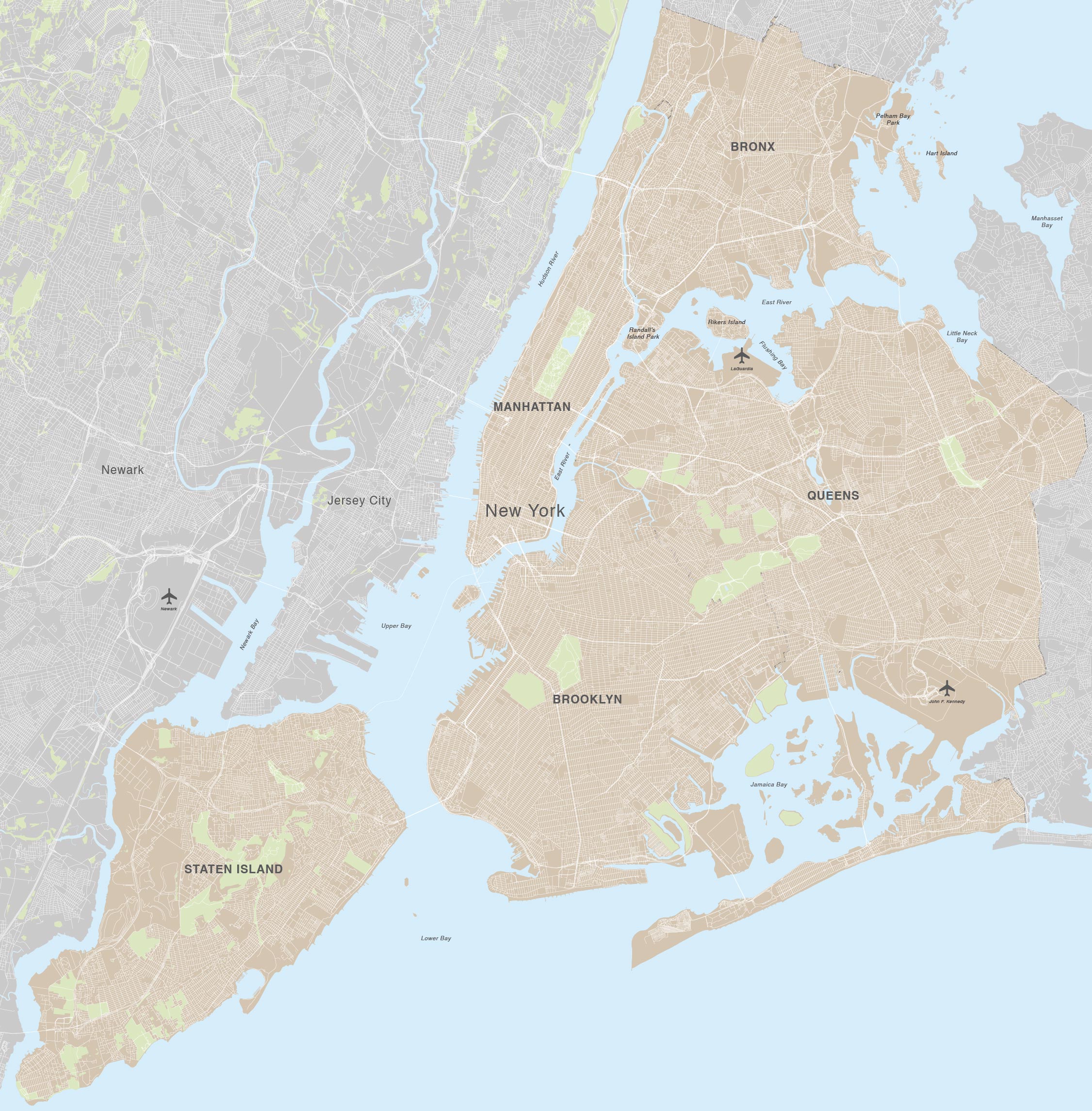
Maproom’s editable vector map bases for New York City include a base showing all the boroughs in their entirety – Manhattan, Brooklyn, Queens, Bronx and Staten Island – plus the neighbouring area of New Jersey when cropped with a natural north-alignment map projection. A second base map zooms into central New York – Manhattan and environs – on the same projection, with extra details in the form of districts, road names, and subway / metro stations.

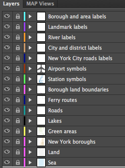
Styling options in the form of PDFs and JPEGs are included alongside fully editable Adobe Illustrator and SVG files. All the paths and fonts are live in the vector files, so you can substitute your own fonts, change all the colours and add extra labels as you want.
Specifications
Licensing terms
This editable map base is suitable for commercial and professional uses
See standard royalty free terms for downloadable maps
How to edit
Adobe Illustrator, CorelDRAW, PDF editors etc
Vector map layers in Illustrator