Downloadable UK postcode maps
These maps are available as downloadable PDFs which can be edited by graphic designers. They are all bundled with a free 7-Day Full Pass for dynamic online postcode maps.
Purchasing multiple postcode maps? Use coupon code multibuy-postcodes at checkout to get 50% discount on two or more downloadable postcode maps.
Showing all 6 results
-

UK Local Authorities + Postcodes Map from April 2023
£60.00UK Local Authorities juxtaposed with postcodes districts, plus a Limited Free Pass for the Dynamic Mapping Suite giving access to online Local Authority maps and mapping tools.
PDFSVGLayered AI file -
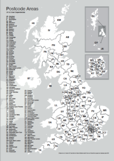
UK postcode areas map for printing “A” format
£15.00Scaled for printing at A4 and above, this map has white postcode areas specially for sales & marketing folk to scribble over with colour pens. Professional designers can edit it too and print it as a wall poster.
PDFs -
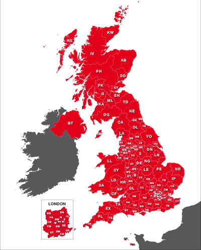
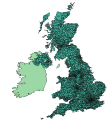
Maps of UK postcode areas
£20.00All the UK two-character postcode areas – 124 areas in total – in five ready-to-use PDF styles, plus access to dynamic postcodes. A bestselling bundle!
PDFsSVGLayered AI file -
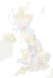
Best UK postcodes map with all the postcode districts, post towns and major roads
£75.00Our most detailed downloadable single-image UK postcodes map at a bargain price. Shows all the 4-digit postcode districts in context with post towns, major roads and counties. Five styles are included, or you can use your own colours and fonts.
PDFsSVGLayered AI file -
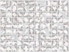
UK postcode maps for easy A4 printing – FULL SET with 126 maps
£125.00Full set of the “A” format postcode district maps – 126 maps in total at a huge discount.
PDFs -
UK postcodes – Esri shapefiles and geojson sets for postcode areas and districts
£1,000.00All the UK postcode areas, districts, sectors and units in formats for developers and geocoders. A valuable and comprehensive GIS dataset that is capable of deep zooming down to street level. Includes Northern Ireland. Licensing restrictions apply.