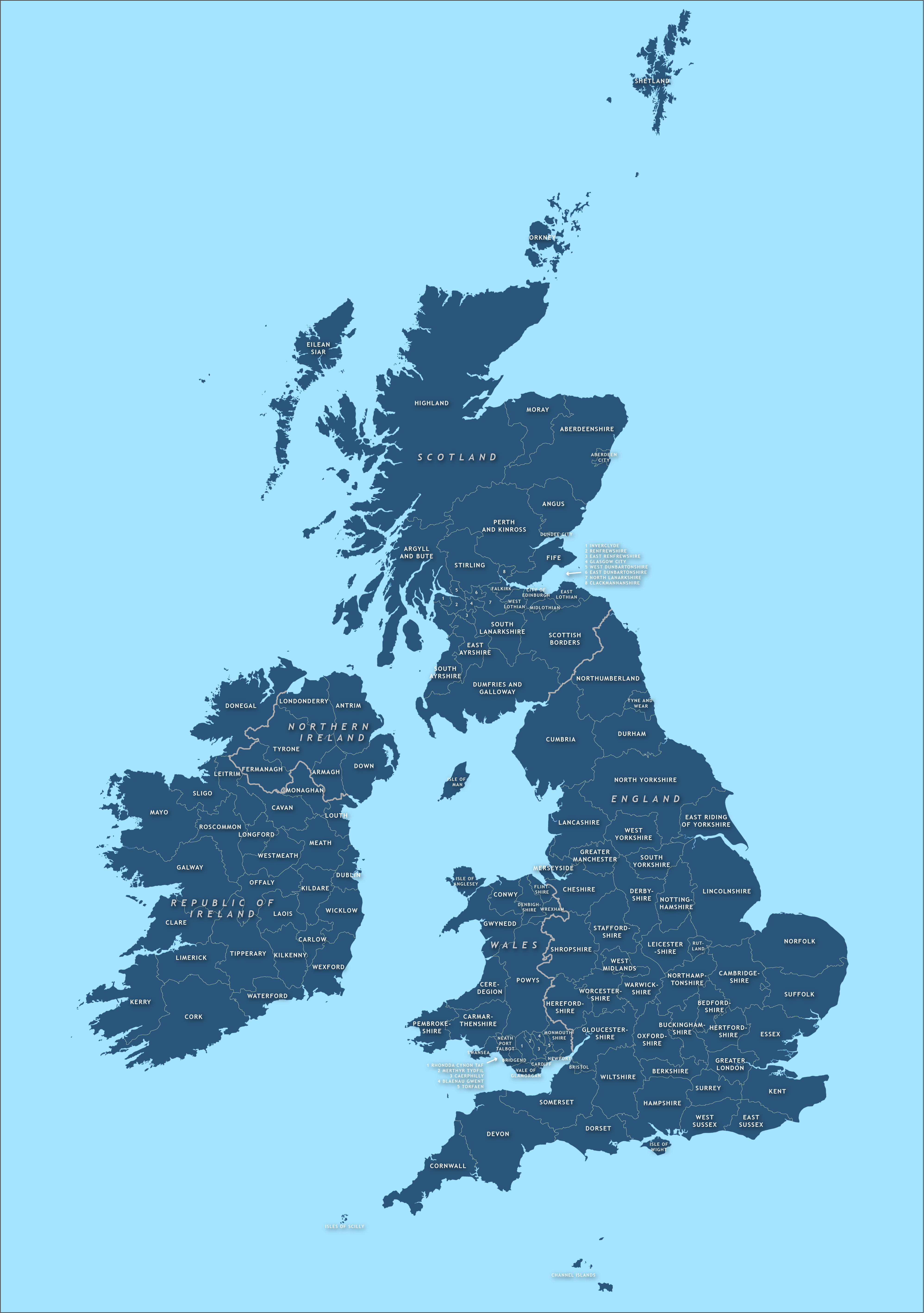
County maps of Britain and Ireland
Downloadable royalty free vector artwork High-resolution PDFsSVGLayered Adobe Illustrator file Bundled with 7-Day Pass for Dynamic Mapping Suite iPrice £45.00
Zoom preview showing full area of coverage (low-resolution)

Pan to zoom / click or tap to switch
Examples of styling in the zoom previews are included as ready to use high-resolution PDF files in the download package. You can edit all colours, fonts and other elements using Adobe Illustrator or other SVG editing software.
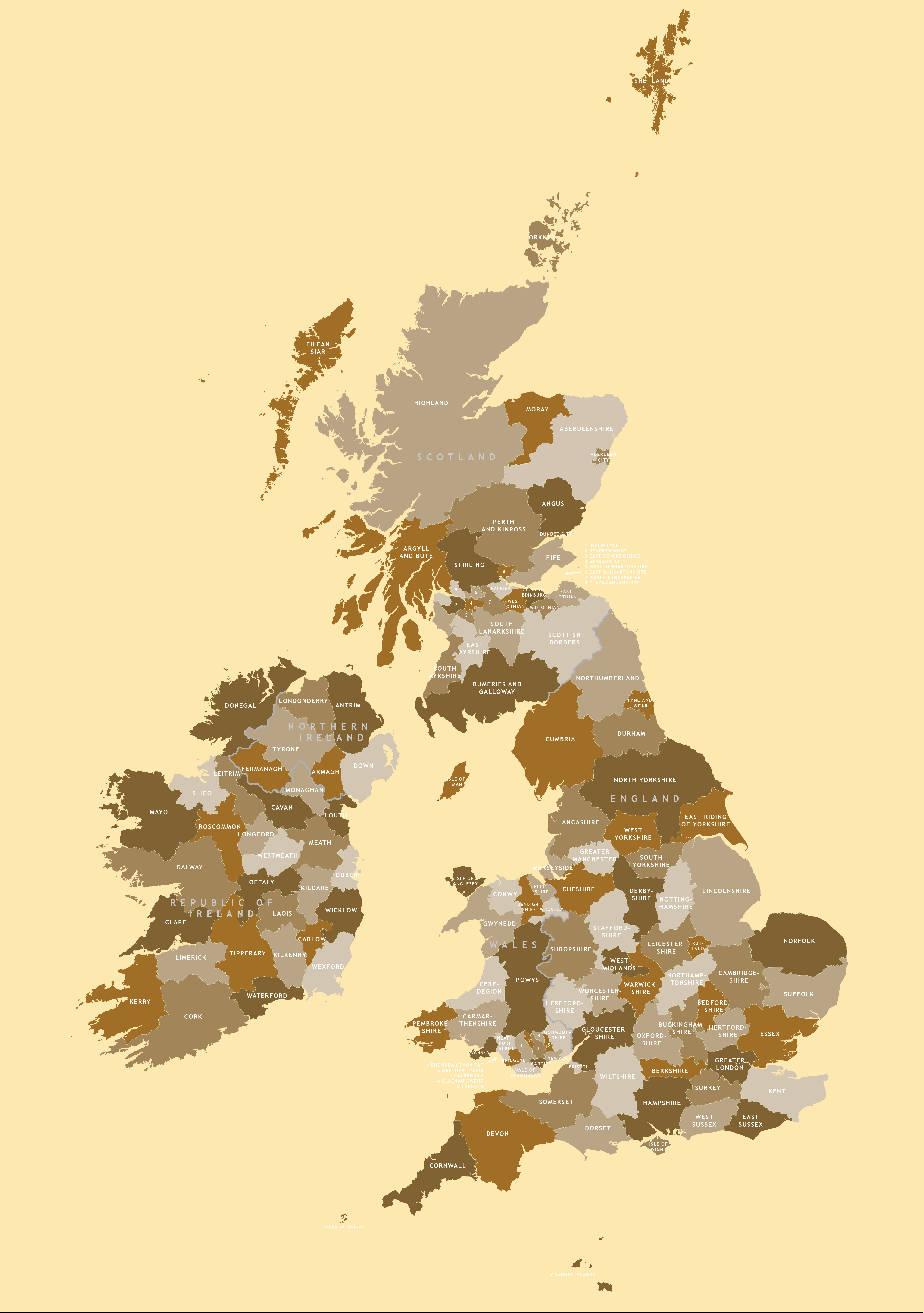
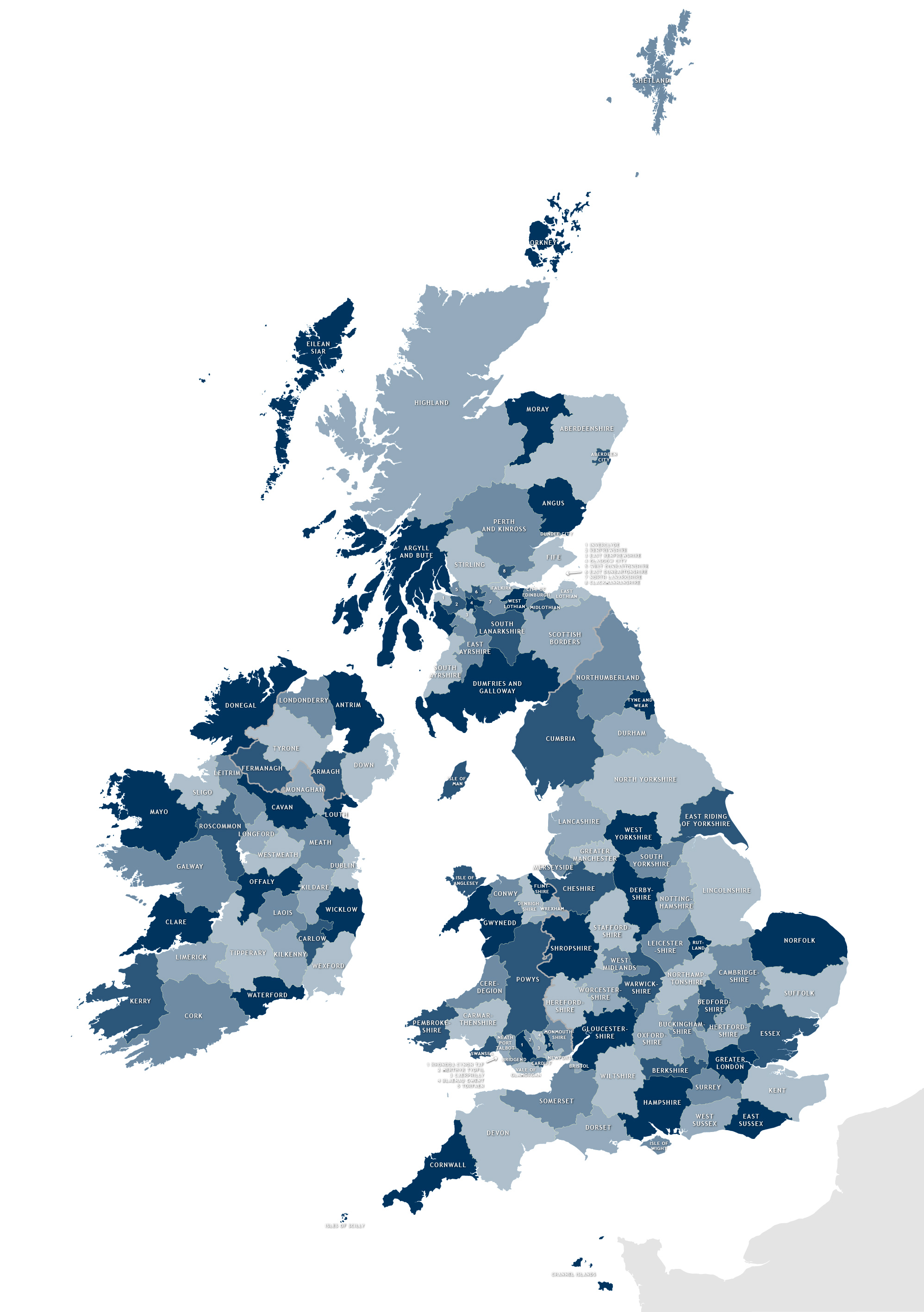
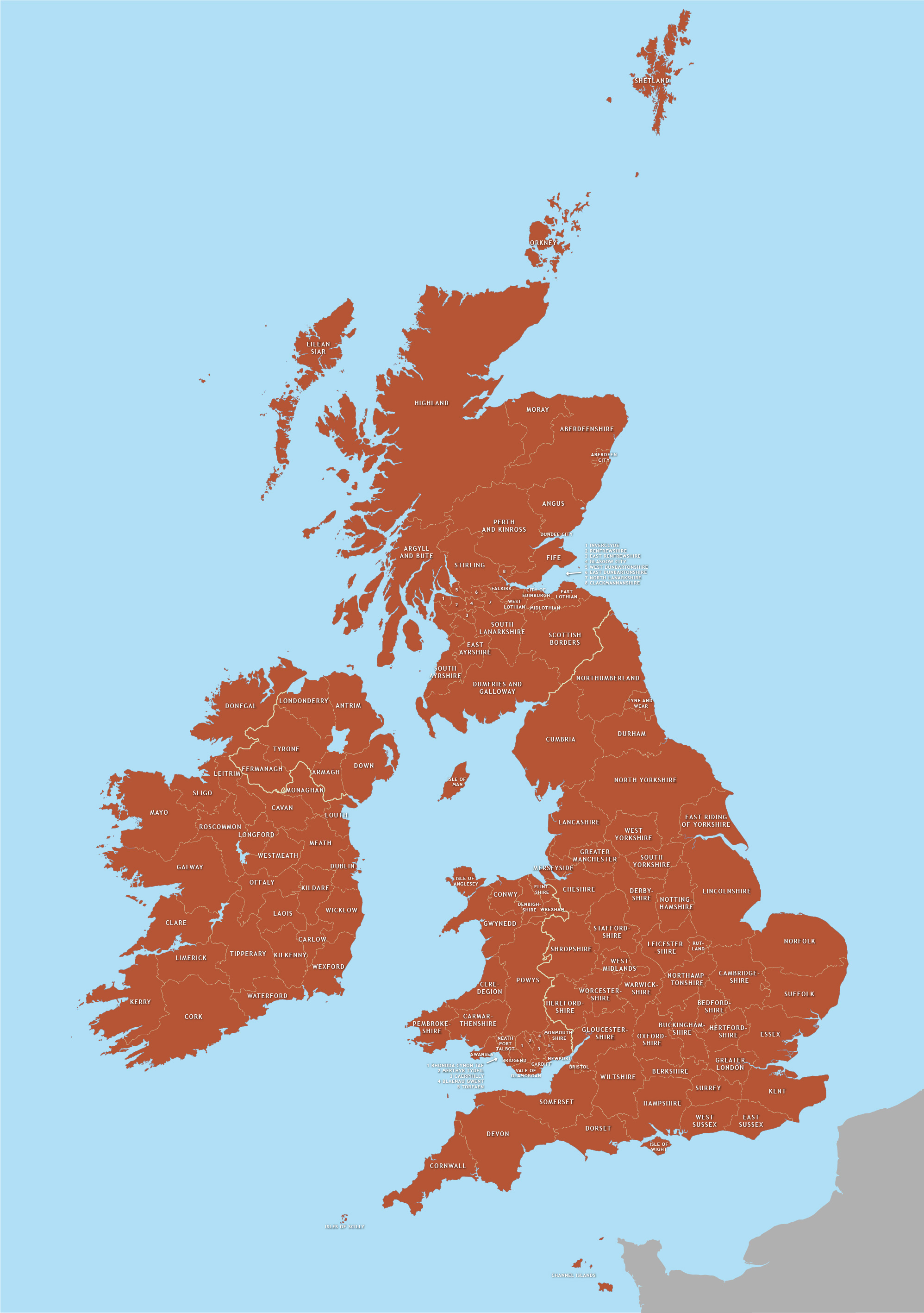
One of our bestselling map bundles! There are downloadable vector art maps with all the counties of England, Scotland, Wales, Northern Ireland and the Republic of Ireland, plus a Single Month Premium Pass for the Dynamic Mapping Suite in which you will find interactive county and unitary authority maps plus online mapping tools for colouring and plotting locations against a county map backdrop.
The downloadable maps include fully editable Illustrator and SVG formats, as well as with some ready to use JPEGs and a PDF in different colours. Our royalty free terms allow the downloadable country map bases to be used for any commercial purposes with no limit on print run or page views.
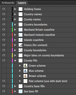
We know that you might want to highlight counties with different fill colours as well as showing county boundaries, so we have created paths and layers that make this tricky task easy. Four colour schemes are included, which you can refine as you please.
The paths fit perfectly together, like a jigsaw. You can scale the live vector Illustrator or SVG formats to whatever size you want – from thumbnail up to poster or even billboard size – without any loss of resolution.
If you’re looking for just the Irish counties, see the Map of Irish counties.
Want town names, transport and other data as well as the counties?
See the political map of the British Isles.
Specifications
Price £45.00
Product code: MR102
Licensing terms
This editable map base is suitable for commercial and professional uses
See standard royalty free terms for downloadable maps
How to edit
Adobe Illustrator, CorelDRAW, PDF editors etc
See how to edit the downloadable maps
Recommended scaling
Thumbnail up to poster size at 100%
For more guidance see scaling recommendations
Access to Dynamic Mapping Suite
A 7-Day Full Pass for the Dynamic Mapping Suite is bundled with this map. The Dynamic Mapping Suite is a separate system that includes a set of online mapping tools geared to visualising data for UK administrative areas.
Vector map layers in Illustrator