Showing all 11 results
-
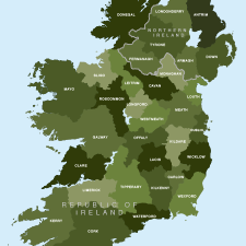
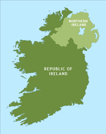
Map of Irish counties
£40.00All the counties in the Republic of Ireland and Northern Ireland
PDFsSVGLayered AI file -
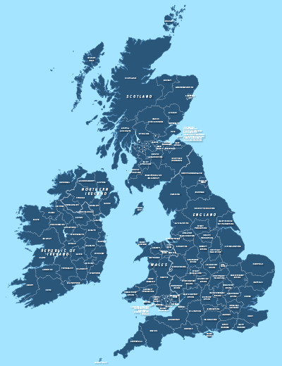
County maps of Britain and Ireland
£45.00Shows all the counties of Britain and Ireland and includes option layers for changing the colour fills and showing county boundaries.
PDFsSVGLayered AI file -
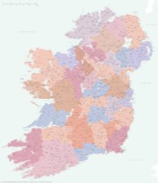
Best detailed map of Ireland
£70.00Approximately 1,400 towns and villages, 17,000+ roads, all the counties and a huge wealth of coastal detail, rivers, urban backdrop and green areas are plotted on our most detailed map of Ireland.
PDFsSVGLayered AI file -
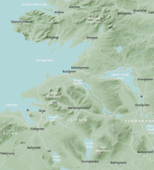
Britain and Ireland physical map with hillshading / relief layer (high-resolution)
£60.00Detailed map of Britain and Ireland with a hillshading / relief layer giving a beautiful sculpted backdrop for the landmass. Every part of the map is editable and suitable for high-resolution professional printing up to A0 poster size.
PDFsSVGLayered AI file -

Detailed outline map of Britain and Ireland (British Isles)
£20.00Superb coastline detail with literally hundreds of islands. Scale it from thumbnail up to poster size if you want.
PDFsSVGLayered AI file -

Map of Britain and Ireland with cities and roads
£25.00A great value map showing the cities, major towns and arterial routes of Britain and Ireland.
PDFsSVGLayered AI file -
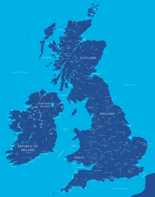
Map of British and Irish rivers and lakes
£20.00Hundreds of lakes and rivers, plus coastal features. Good for educational materials and water-activity themes.
PDFsSVGLayered AI file -
Outline map of Ireland
£15.00An outline map of Ireland with exceptional detail on the coastlines. Includes the border between the Republic and Northern Ireland.
PDFsSVGLayered AI file -
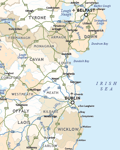
Political map of Ireland
£40.00Shows all the counties plus the principal towns and transport systems across both the Republic of Ireland and Northern Ireland.
PDFsSVGLayered AI file -
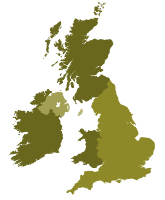
Simple outline map of Britain and Ireland
£15.00A simple outline map of Britain and Ireland with the main islands of the British Isles. Looks elegant and accurate when used as a small image up to about A5.
PDFsSVGLayered AI file -

Touring / physical map of Britain and Ireland (low-resolution)
£30.00Perfect for tourist industry projects with its coastal features, lakes, rivers, national parks, historic towns and resorts.
PDFsSVGLayered AI file