Interactive map of London Low and Ultra-low Emission Zones (LEZ / ULEZ), Congestion Charge Zone (CCZ), with all postcodes
London’s vehicle zones juxtaposed with all postcodes, boroughs and local authority boundaries – this interactive online map is aimed primarily at businesses needing help to plan service areas, deliveries, driving routes and sales territories through and around Greater London.
The interactive map is available in our Dynamic Mapping Suite and shows every postcode centroid juxtaposed with the vehicle zones, together with nested postcode listings and postcode search functions. The video below is a quick demo of how you can search and select postcodes to see how they relate to the LEZ, DVS, ULEZ and CCZ zones.
This is the most detailed map of London’s vehicle zones in conjunction with postcodes and local authorities available anywhere. It gives more information than Transport for London’s maps of the zones which do not include postcode boundaries. It also shows the same level of detail for other cities with clean air and low emission zones including Birmingham, Bristol, Bath, Sheffield, Glasgow, Greater Manchester and others.
Postcodes fully or partially in the zones
BR (Bromley), CR (Croydon), DA (Dartford), E and EC (East London), EN (Enfield), HA (Harrow), IG (Ilford), KT (Kingston-upon-Thames), N (North London), NW (North West London), RM (Romford), SE (South East London), SM (Sutton), SW (South West London), TN (Tonbridge), TW (Twickenham), UB (Southall), W and WC (West London), WD (Watford).
Congestion Charge Zone (CCZ)
This is the inner London zone in which most vehicles are subject to a daily charge. For details about charges, see Congestion Charge on the Transport for London website.
Ultra Low Emission Zone (ULEZ)
Extra charges apply if a vehicle does not meet the ULEZ standards. The ULEZ currently covers the area reaching the North Circular (A406) and South Circular (A205). For details about charges, see Ultra Low Emission Zone on the Transport for London website.
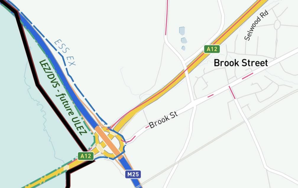
ULEZ expansion from 29 August 2023 to the Greater London LEZ / DVS / HGV Safety Permit Zone
The current Low Emission Zone (LEZ) is almost the same as London’s boroughs, but does not follow the borough boundaries in all places. It is largely inside the M25, except for a small portion beyond the M25 to the east. Some primary roads, such as the A3, have through access or turnaround points before, as detailed in popup info boxes on the map. The current LEZ is also the Driver Vision Standard (DVS) and HGV Safety Permit Zone and is due to be the ULEZ zone from 29 August 2023. For details about charges, see Low Emission Zone and Direct Vision Standard & HGV Safety Permit on the Transport for London website.
Postcode districts and local authority boundaries
In some parts of the capital, the vehicle zone boundaries tie in with the boundaries of London’s postcode districts and boroughs, but in many other parts they differ. The interactive map in our Dynamic Mapping Suite shows all the boundaries so you have essential visual reference when planning deliveries based on postcode or local authority.
Learn more about this map and the Dynamic Mapping Suite

Try the Dynamic Mapping Suite
No payment card required. Access all mapping tools in Test Mode.
£45.00