These maps include a Single Month Premium Pass for the Dynamic Mapping Suite
Showing all 16 results
-

Interactive map of London Low and Ultra-low Emission Zones (LEZ / ULEZ), Congestion Charge Zone (CCZ), with all postcodes
£45.00London’s Low Emission Zone and Driver Vision Standard (LEZ / DVS), Ultra-low Emission Zone (ULEZ), and Congestion Charge Zone (CCZ) juxtaposed with postcodes and local authority / London borough boundaries – this interactive online map is aimed primarily at businesses needing help to plan deliveries, driving routes and sales territories through and around London.
-

Buckinghamshire county map
£40.00The ceremonial county of Buckinghamshire is highlighted along with towns, villages, roads, railway lines, lakes, rivers, woodland and green spaces. Scaled for A3+ printing
PDFSVGLayered AI file -
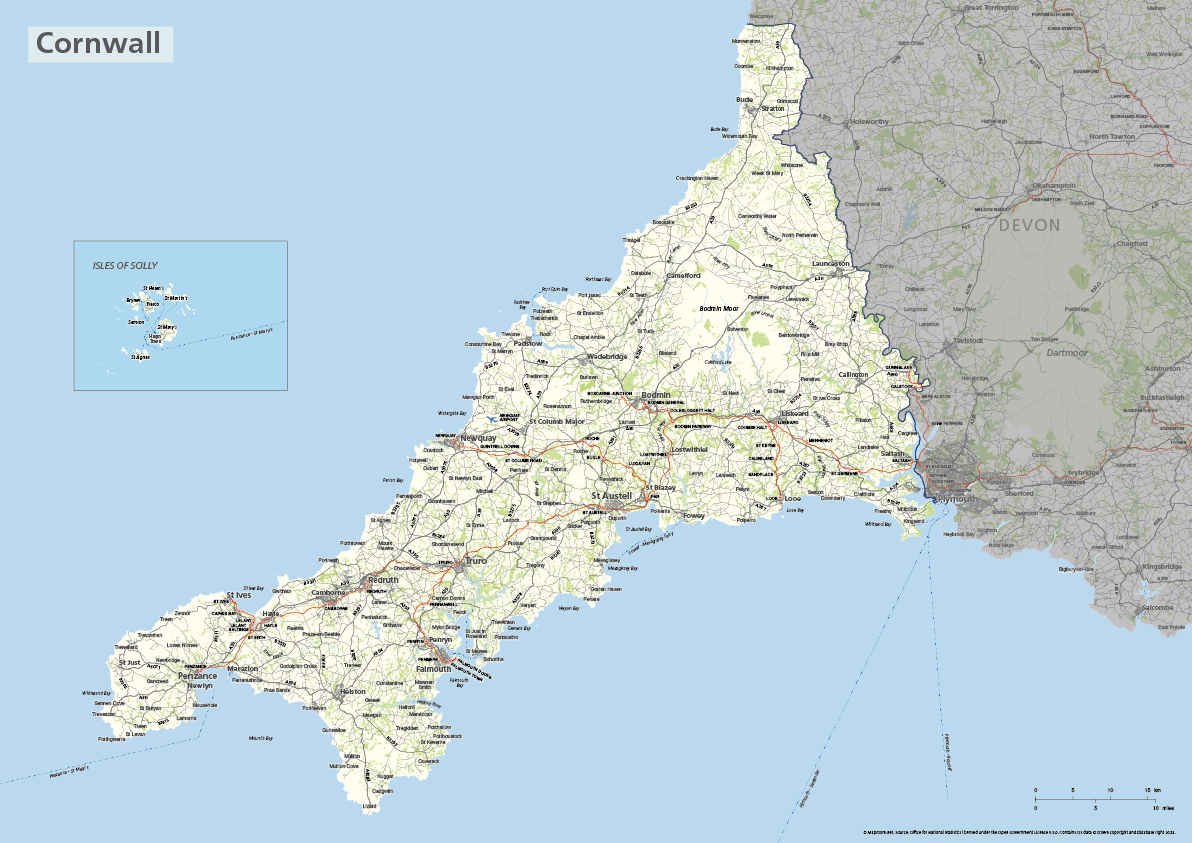
Cornwall county map with Isles of Scilly
£40.00The ceremonial county of Cornwall is highlighted along with towns, villages, roads, railway lines, lakes, rivers, woodland and green spaces. The Isles of Scilly are optionally shown in their natural geographic position or in an inset box. Scaled for A3+ printing
PDFSVGLayered AI file -
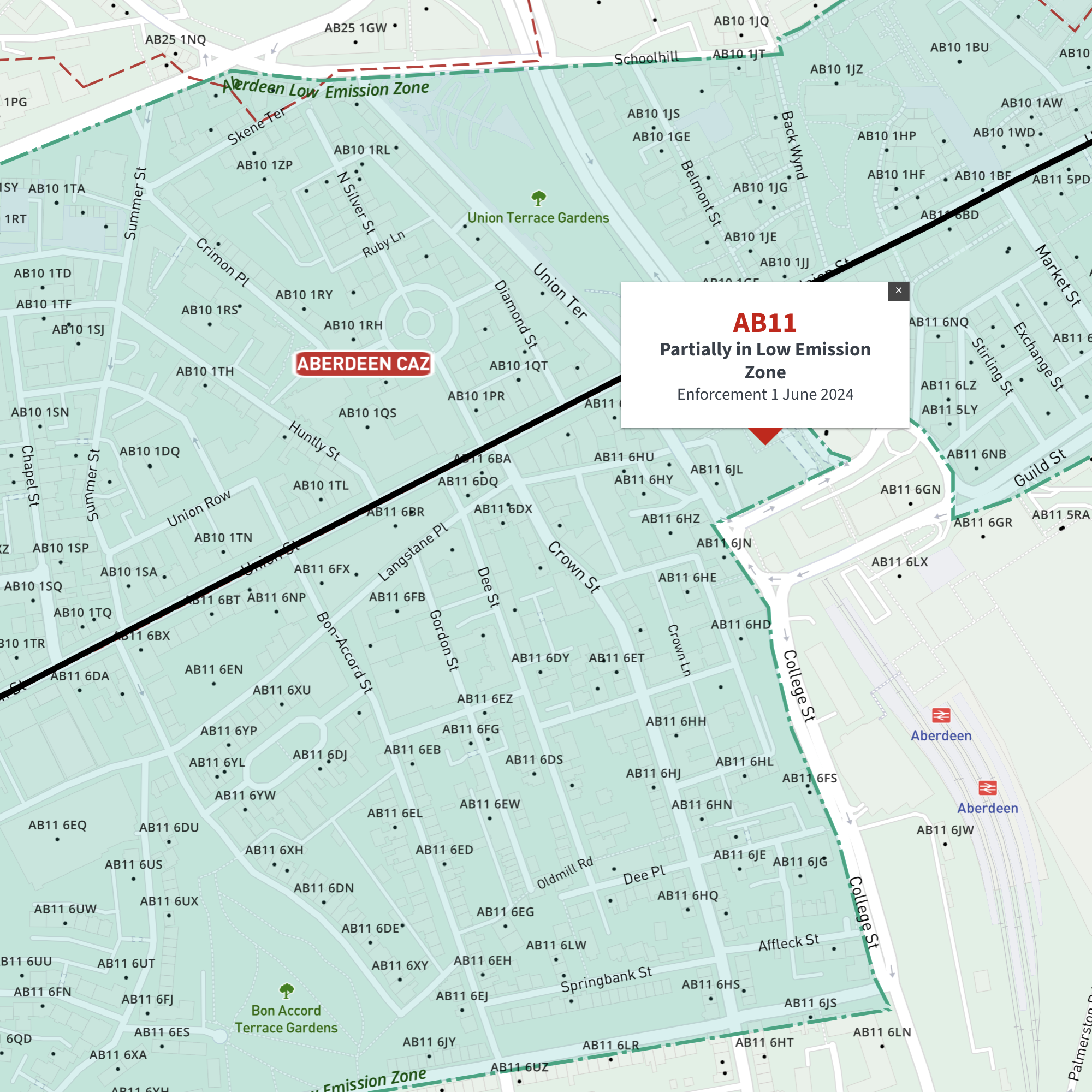
Interactive map of Aberdeen Low Emission Zone and all AB postcodes
£35.00Online deep-zoom map of Aberdeen Low Emission Zone (LEZ) with AB postcode districts, sectors and units available in the Dynamic Mapping Suite
-
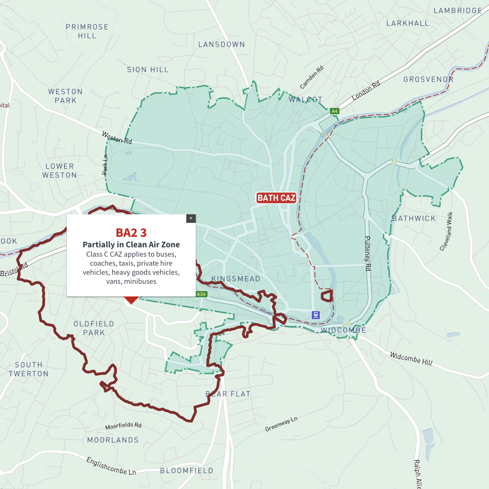
Interactive map of Bath Clean Air Zone and all BA postcodes
£35.00Online deep-zoom map of Bath Clean Air Zone (CAZ) with BA postcode districts, sectors and units available in the Dynamic Mapping Suite
-
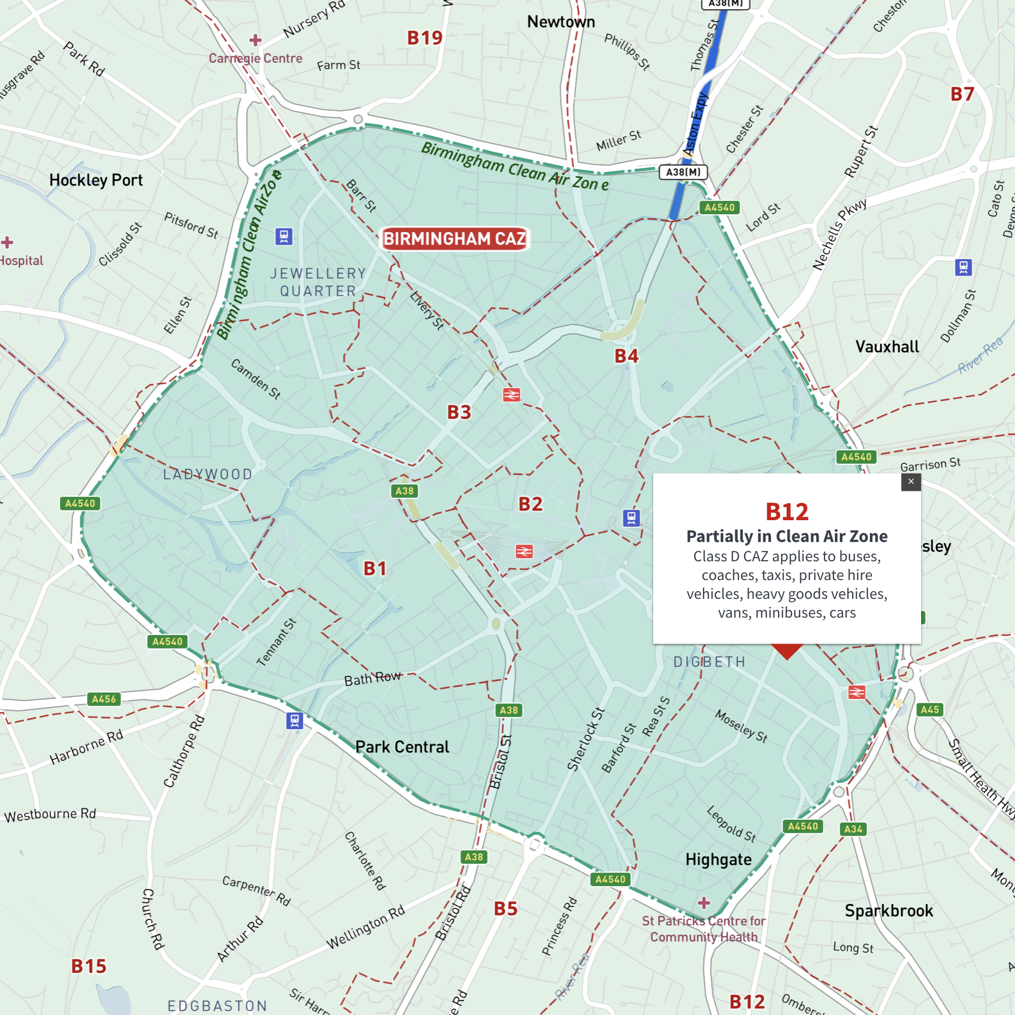
Interactive map of Birmingham Clean Air Zone with postcodes
£35.00This interactive street map of Birmingham has overlays and popups showing the Clean Air Zone juxtaposed with postcodes. It is aimed primarily at businesses needing reference to plan deliveries, driving routes and sales territories in and around Birmingham’s Clean Air Zone.
-
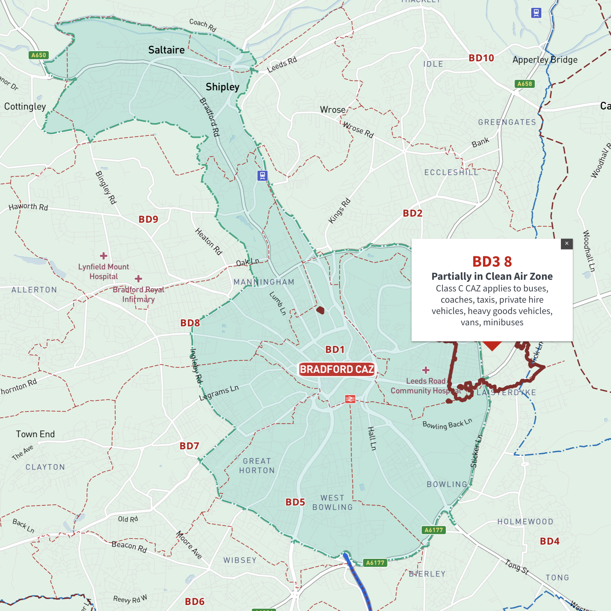
Interactive map of Bradford Clean Air Zone and all BD postcodes
£35.00Online deep-zoom map of Bradford Clean Air Zone (CAZ) with BD postcode districts, sectors and units available in the Dynamic Mapping Suite
-
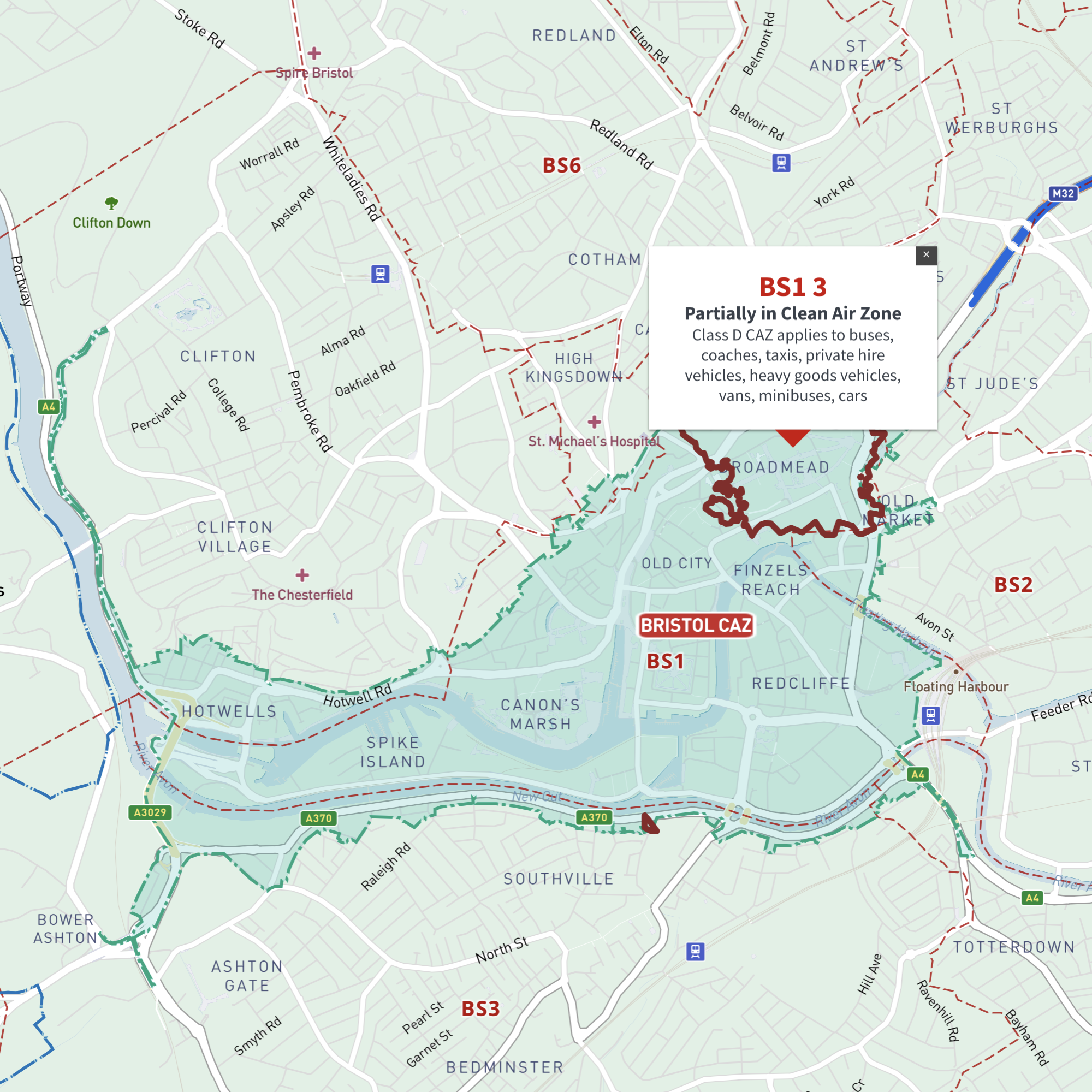
Interactive map of Bristol Clean Air Zone and all BS postcodes
£35.00Online deep-zoom map of Bristol Clean Air Zone (CAZ) with BS postcode districts, sectors and units available in the Dynamic Mapping Suite
-
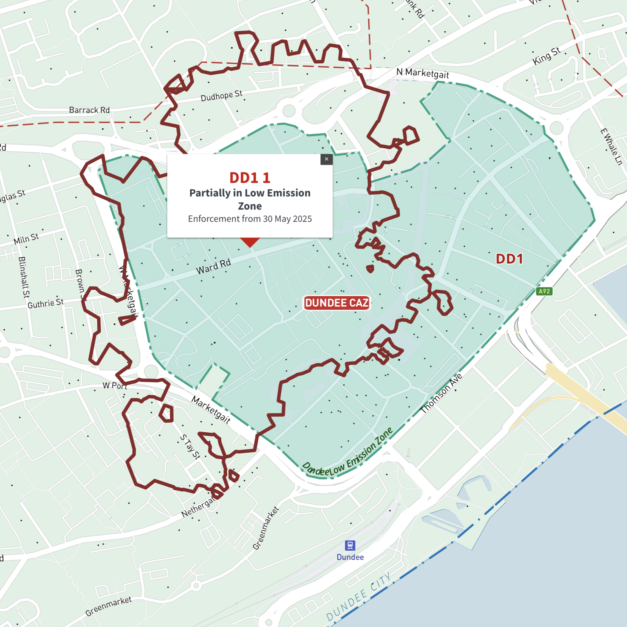
Interactive map of Dundee Low Emission Zone and all DD postcodes
£35.00Online deep-zoom map of Dundee Low Emission Zone (LEZ) with DD postcode districts, sectors and units available in the Dynamic Mapping Suite
-
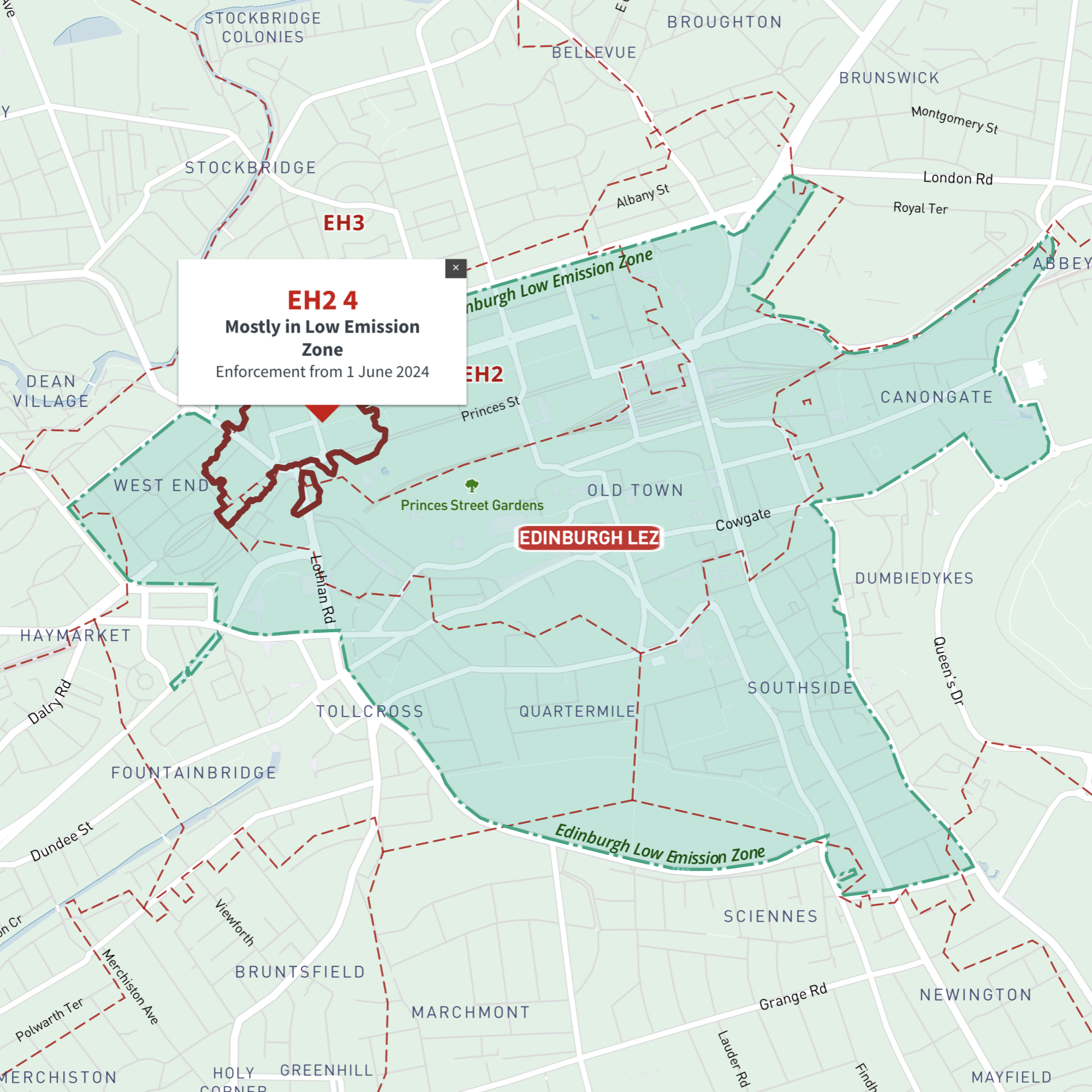
Interactive map of Edinburgh Low Emission Zone and all EH postcodes
£35.00Online deep-zoom map of Edinburgh Low Emission Zone (LEZ) with EH postcode districts, sectors and units available in the Dynamic Mapping Suite
-
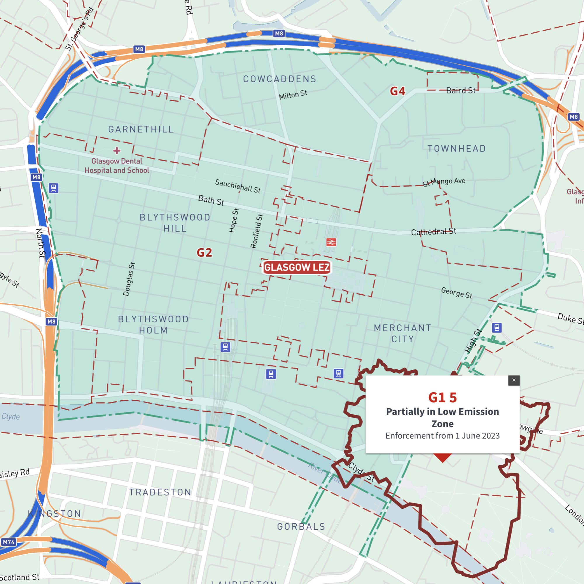
Interactive map of Glasgow Low Emission Zone and all G postcodes
£35.00Online deep-zoom map of Glasgow Low Emission Zone (LEZ) with G postcode districts, sectors and units available in the Dynamic Mapping Suite
-

Interactive map of Greater Manchester Clean Air Zone and all M, BL, OL, SK, WA and WN postcodes
£35.00Online deep-zoom map of Greater Manchester Clean Air Zone (CAZ) with M, BL, OL, SK, WA and WN postcode districts, sectors and units available in the Dynamic Mapping Suite
-
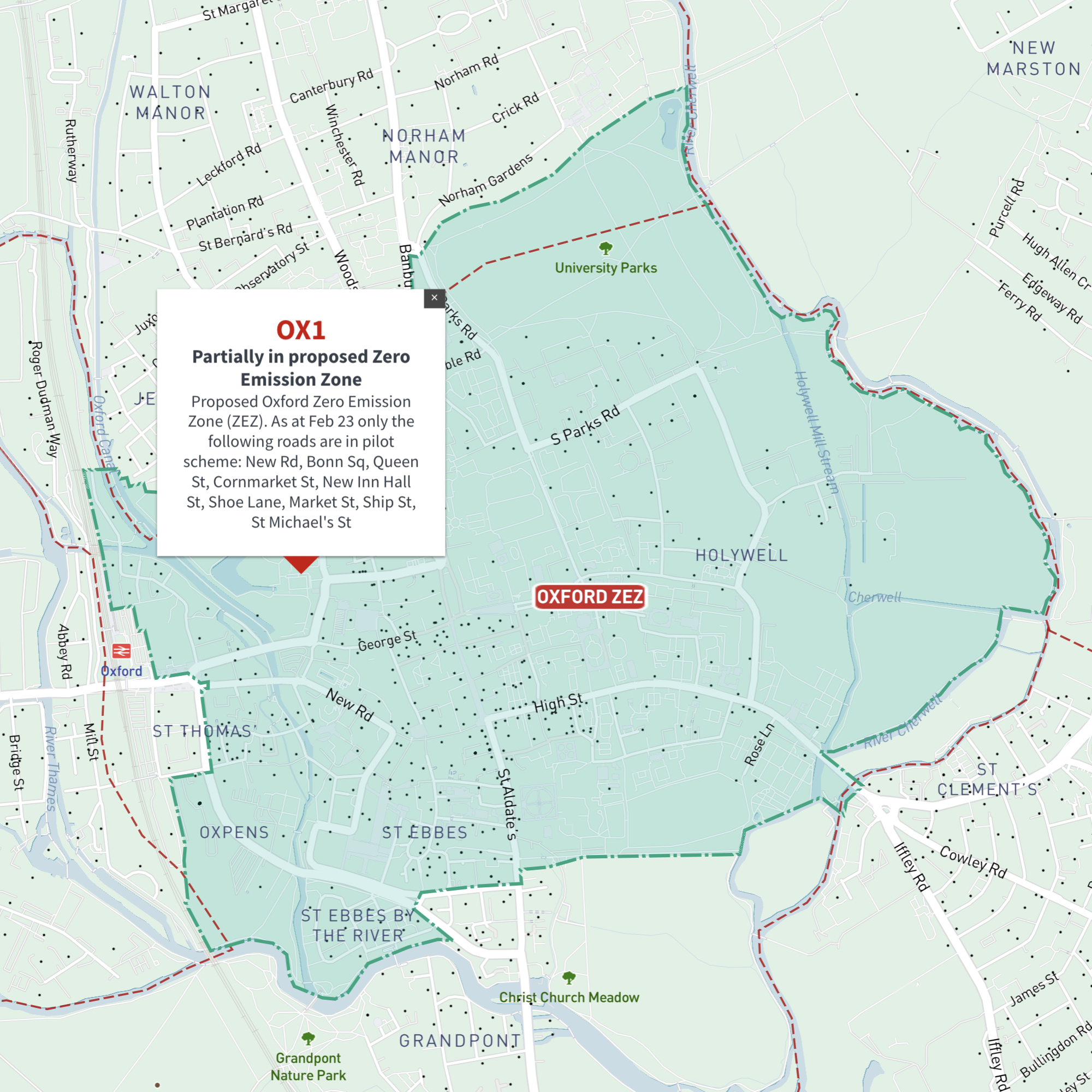
Interactive map of Oxford Zero Emission Zone and all OX postcodes
£35.00Online deep-zoom map of Oxford Zero Emission Zone (ZEZ) with OX postcode districts, sectors and units available in the Dynamic Mapping Suite
-

Interactive map of Portsmouth Clean Air Zone and all PO postcodes
£35.00Online deep-zoom map of Portsmouth Clean Air Zone (CAZ) with PO postcode districts, sectors and units available in the Dynamic Mapping Suite
-
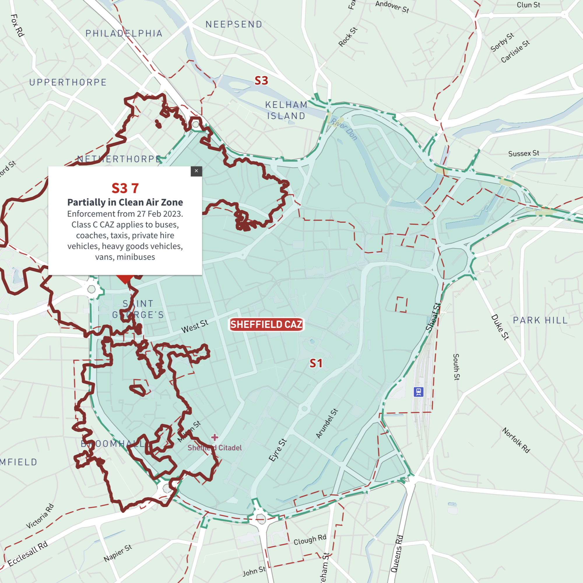
Interactive map of Sheffield Clean Air Zone and all S postcodes
£35.00Online deep-zoom map with S postcode districts, sectors and units available in the Dynamic Mapping Suite
-
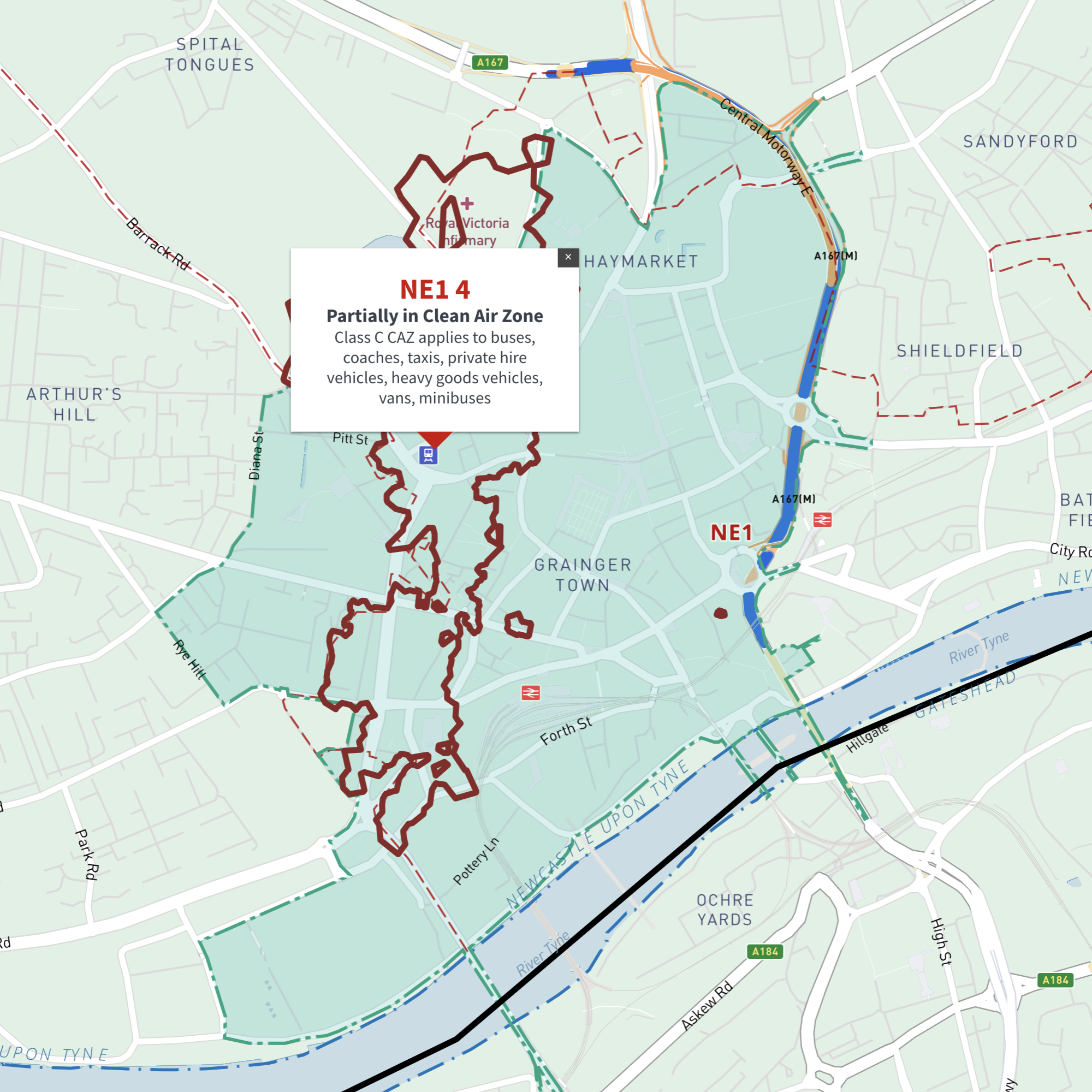
Interactive map of Tyneside (Newcastle and Gateshead) Clean Air Zone and all NE postcodes
£35.00Online deep-zoom map of Newcastle and Gateshead / Tyneside Clean Air Zone (CAZ) with NE postcode districts, sectors and units available in the Dynamic Mapping Suite