Maproom

Editable & interactive maps

  • about us
  • blog
  • contact
  • 0 items
LOGIN | DYNAMIC MAPPING SUITE
  • Britain & Ireland maps
    • Britain and Ireland
    • UK - United Kingdom
    • Ireland
    • England
    • Scotland
    • Wales
    • Northern Ireland
    • Isle of Man
    • Channel Islands
  • City maps
    • Birmingham
    • Brighton
    • Bristol
    • Cardiff
    • Edinburgh
    • Glasgow
    • Liverpool
    • London
    • Manchester
    • New York
    • Oxford
  • ONS & admin maps
    • Office for National Statistics (ONS) maps
    • Local authority maps
    • County maps
    • Census 2021 maps
  • Postcode maps
    • Overview
    • Downloadable postcode maps
    • Dynamic online postcode maps
  • World maps
    • World maps
    • Europe maps
    • Map of EU countries after Brexit
    • Maps of France
    • Maps of Germany
    • Maps of New York and environs
  • Dynamic maps
    • Dynamic Maps Showcase
    • Dynamic Mapping Suite
  • Go bespoke
    • Bespoke mapping services
    • Examples of bespoke mapping
    • Demo of a bespoke dynamic map
    • Get quote for a bespoke dynamic map

Showing the single result

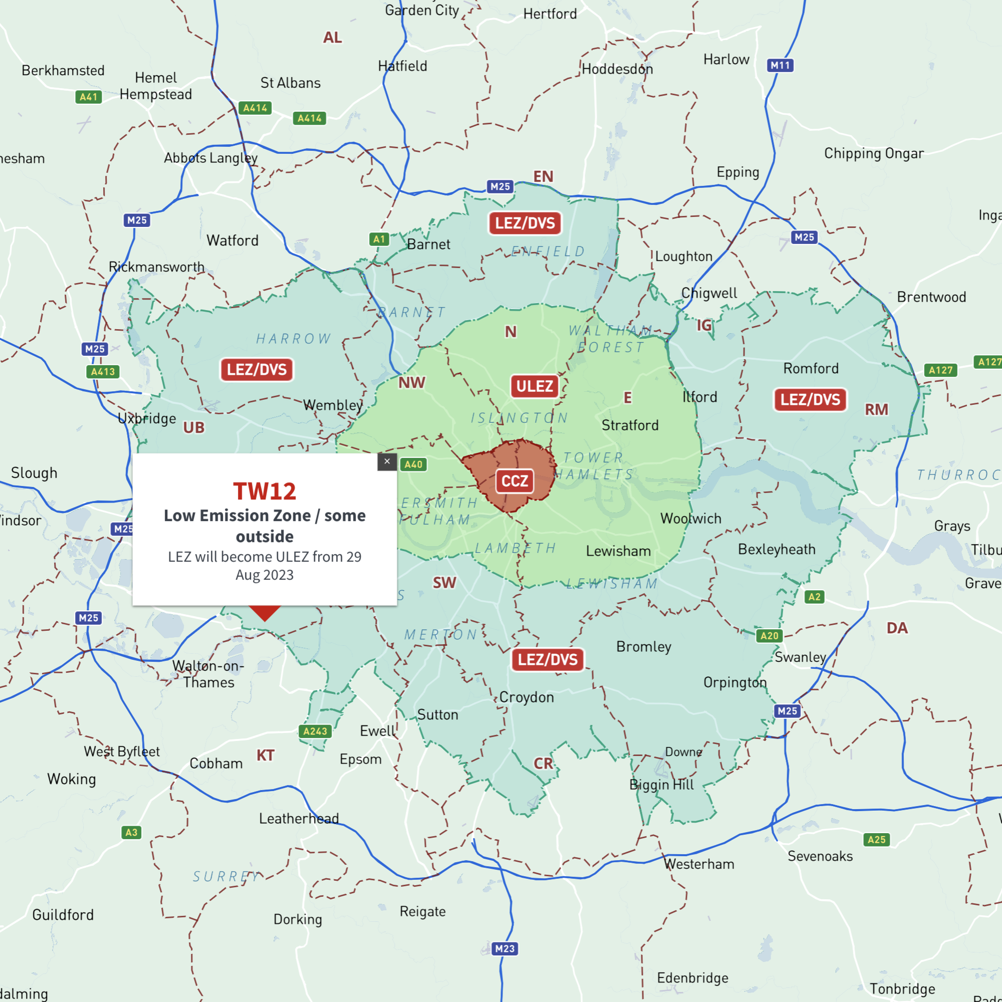
  • Map of London Low Emission Zone / DVS / ULEZ extension / Congestion Charge Zone / CCZ

    Maps of London Low Emission Zone (LEZ), Driver Vision Standard (DVS), ULEZ, Congestion Charge Zone (CCZ) with postcodes

    £40.00

    London’s vehicle zones juxtaposed with postcodes and local authority boundaries – these maps are aimed primarily at businesses needing help to plan deliveries, driving routes and sales territories through and around London.

  • Standard royalty free terms for downloadable maps
  • Licensing terms for downloadable postcode maps
  • Licensing terms for dynamic online maps
  • How to edit the downloadable maps
  • Pricing & refund policies
  • Privacy & cookies

All content © Maproom at Thameside Media · Award winning media projects