Birmingham Street Maps
Downloadable royalty free vector artwork High-resolution PDFsSVGLayered Adobe Illustrator filePrice £60.00
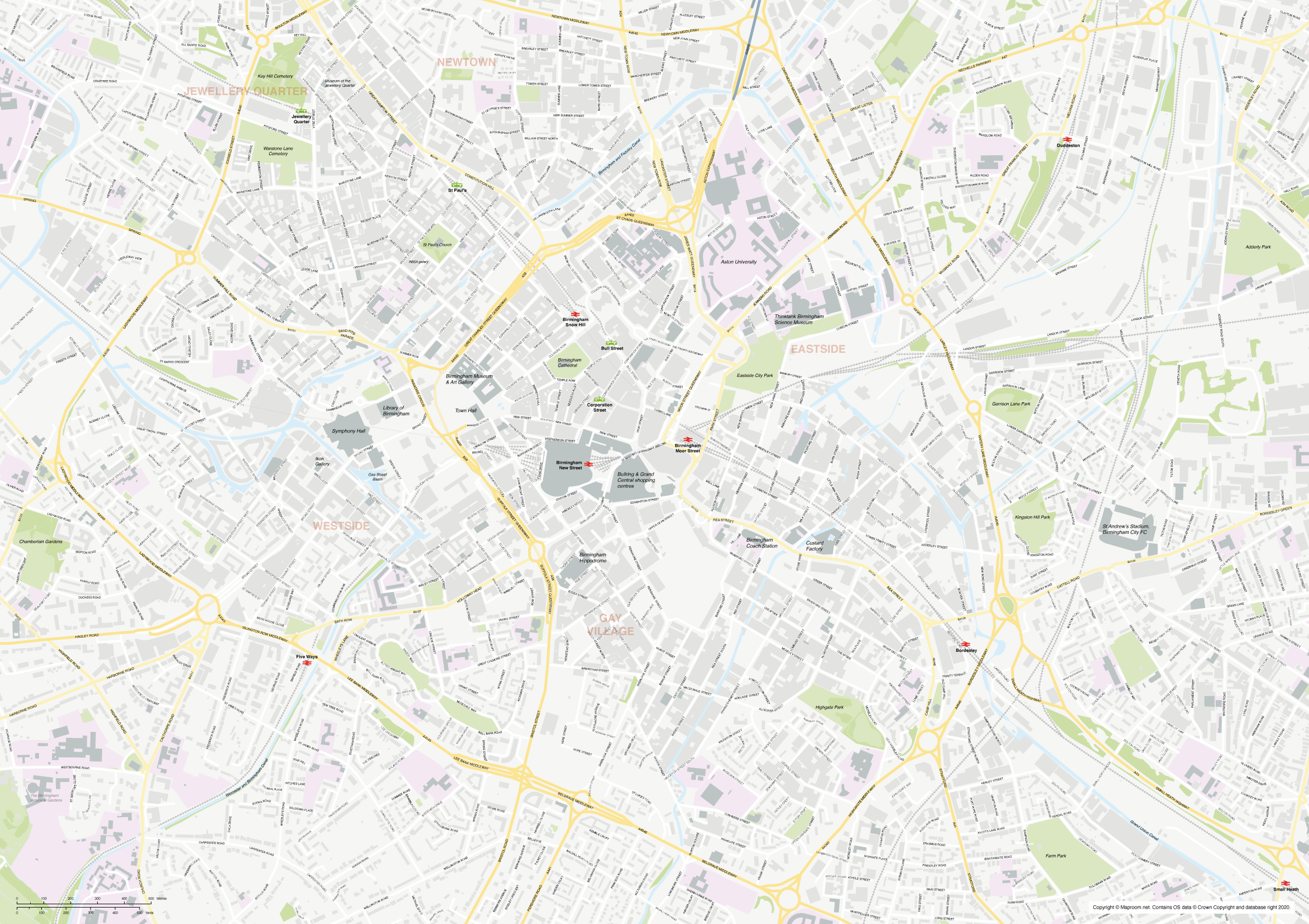
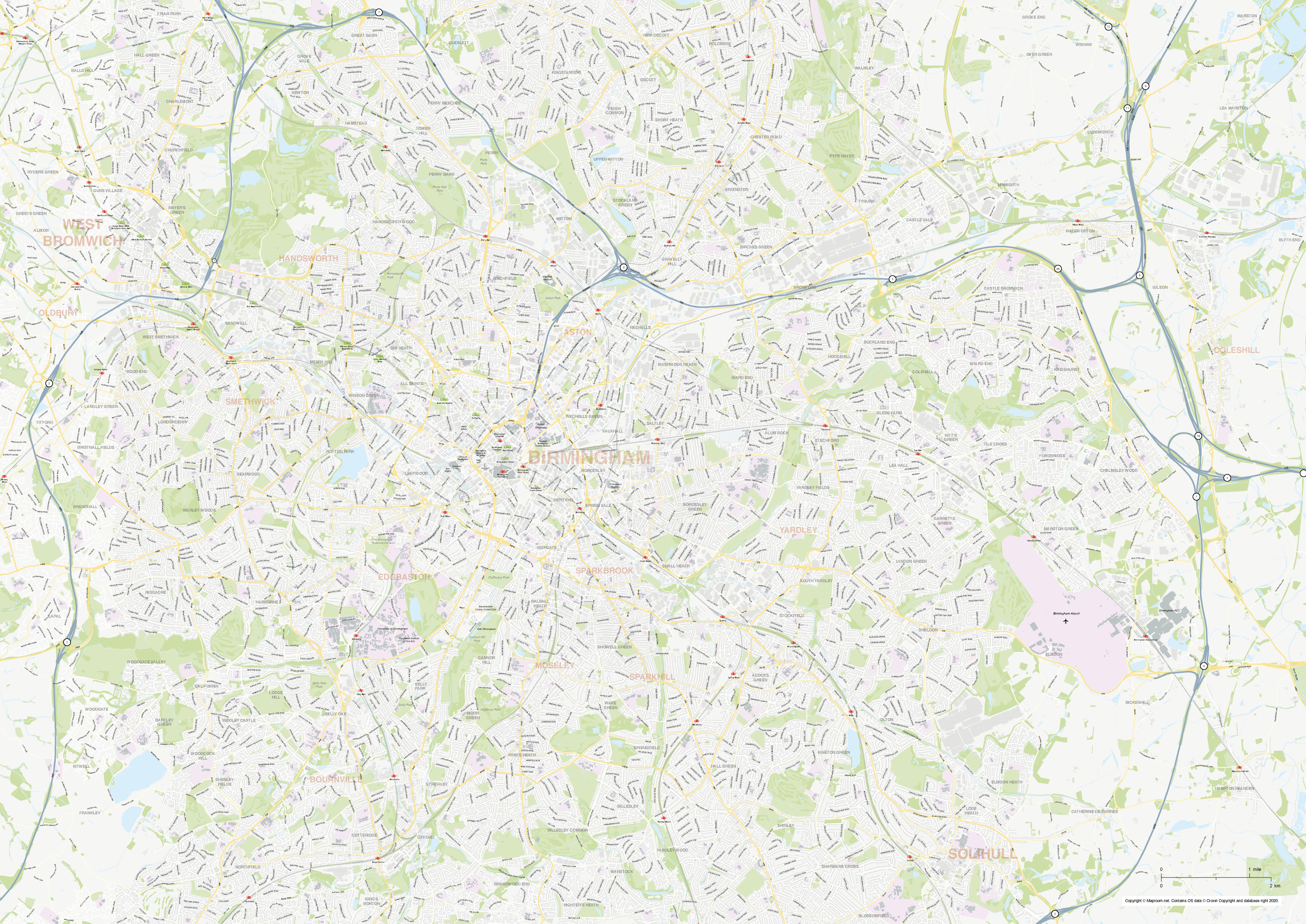
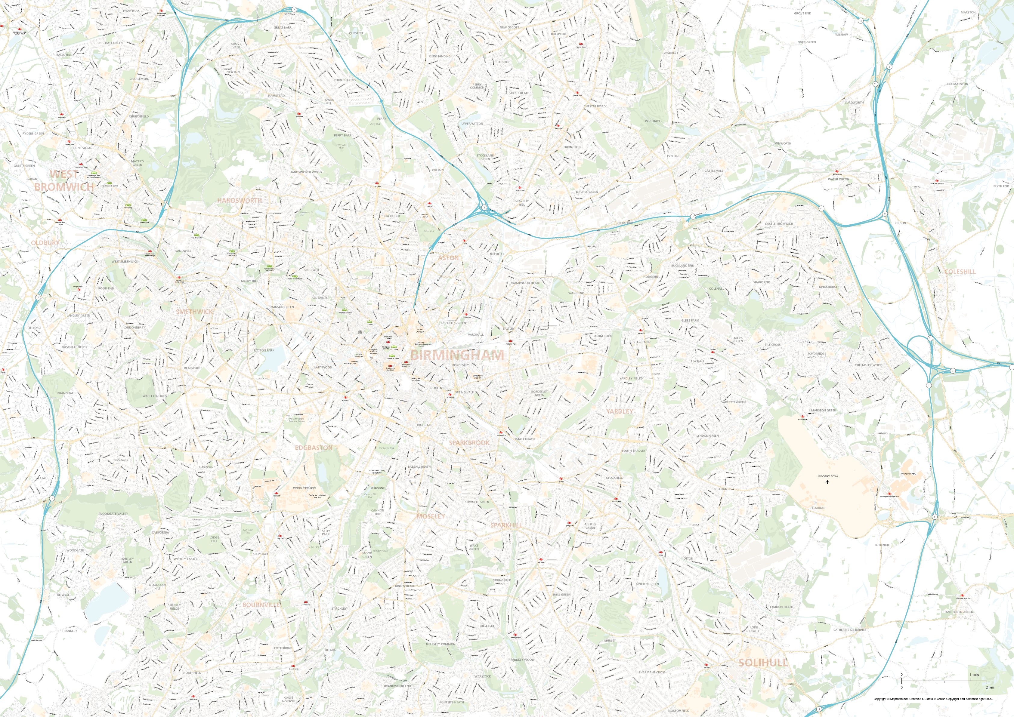
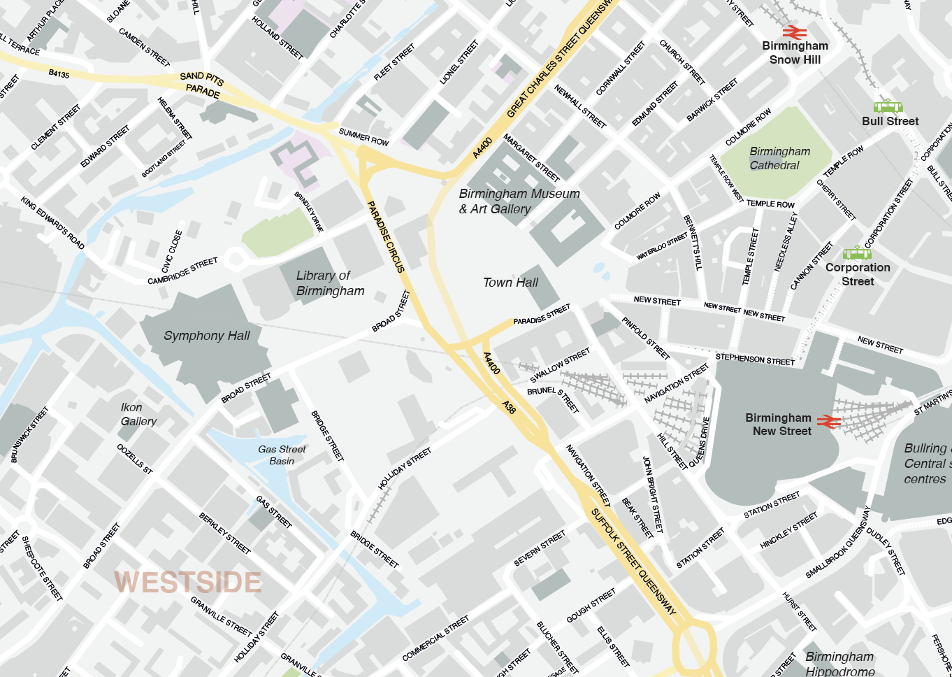
Zoom preview showing full area of coverage (low-resolution)
Pan to zoom / click or tap to switch
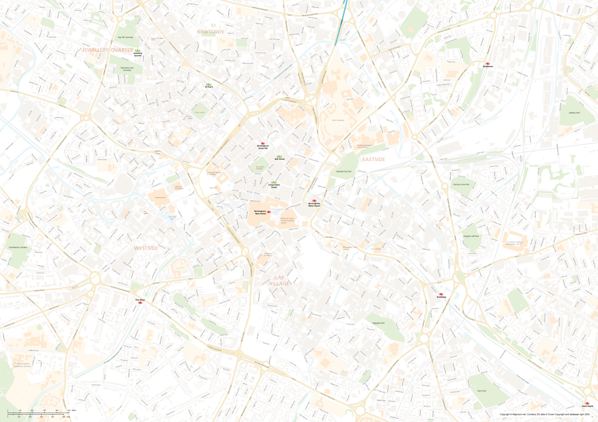
Examples of styling in the zoom previews are included as ready to use high-resolution PDF files in the download package. You can edit all colours, fonts and other elements using Adobe Illustrator or other SVG editing software.
Our city street maps of Birmingham and environs are built specially for businesses, graphic designers and other professionals who need a detailed base map of Birmingham city that can be manipulated and used for commercial purposes. You can use the high-resolution PDFs supplied for the Birmingham street maps as they are, or edit the artwork with Adobe Illustrator software, for a wide range of marketing, commerce, research and display projects without restrictions on print run with our standard royalty free licence.
We include two map bases in the download package: one street map of Birmingham city centre scaled for A1 in its opening state; this covers central Birmingham out to the Jewellery Quarter, Birmingham Botanical Gardens, Small Heath station and Duddeston. The second map base is scaled for A0 in its opening state and covers a larger Birmingham environs area out to West Bromwich, Coleshill, Birmingham Airport, Solihull and Bournville. Check the zoom previews on this page to see the full areas of coverage.
Please note, the zoom previews on this web page are limited by the maximum size possible for web preview, but the files included in the download package are fully zoomable and suitable for high-resolution output and printing. The Illustrator PDFs can be used as they are, or form a starting point for your own customised version. You can crop or zoom in to the map artwork at any scale you want, and the detail will be sharp at every level on the scalable vector artwork.
All of Birmingham’s roads, buildings, rivers, canals, parks and transport hubs are all plotted in detail from Ordnance Survey open data.

We recommend Adobe Illustrator for easy editing of colours and fonts, and if you want to plot your own locations. The Illustrator layers are ordered with graphic designers in mind so that you can quickly change colours and stroke widths for any layer. In Illustrator you can also turn off entire layers with a single click, if, for example, you don’t want the woodland areas to show.

Files included in the Birmingham street map download bundle include layered Illustrator CC and Illustrator CS versions, SVG and EPS. There are also two styling examples as high-resolution PDFs, as seen in the previews on this page.
Download sample strips from the layered PDF files here
The Birmingham street maps use Ordnance Survey open data and must include the copyright attribution in the bottom right corner of the map when printed or used commercially, though you can restyle and move the attribution.
Specifications
Licensing terms
This editable map base is suitable for commercial and professional uses
See standard royalty free terms for downloadable maps
How to edit
Adobe Illustrator, CorelDRAW, PDF editors etc
See how to edit the downloadable maps
Recommended scaling
A1, A0+, zoomed sections or tiles
For more guidance see scaling recommendations
Vector map layers in Illustrator