Showing all 16 results
-
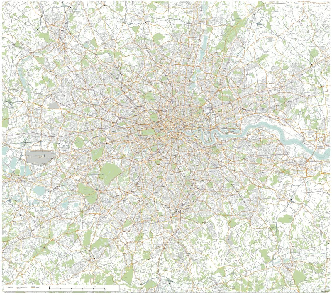
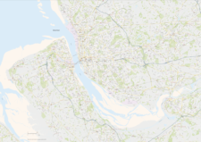
Greater London detailed map with all roads, transport, institutions, green areas
£150.00Detailed vector map of the whole of Greater London – all roads, stations, airports, rivers, green areas. A fantastic resource for professional designers and commercial projects. Provided in 2 versions for different scaling needs.
PDFsSVGLayered AI file -
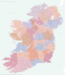
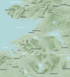
Best detailed map of Ireland
£70.00Approximately 1,400 towns and villages, 17,000+ roads, all the counties and a huge wealth of coastal detail, rivers, urban backdrop and green areas are plotted on our most detailed map of Ireland.
PDFsSVGLayered AI file -
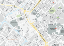
Birmingham Street Maps
£60.00Editable street maps of Birmingham city centre and environs reaching out to West Bromwich and Solihull. Supplied as PDF examples and fully layered Illustrator and SVG formats. The map bases include a wealth of detail including roads, railway and tram lines, canals, parks and building shapes.
PDFsSVGLayered AI file -
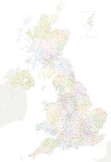
Best UK postcodes map with all the postcode districts, post towns and major roads
£75.00Our most detailed downloadable single-image UK postcodes map at a bargain price. Shows all the 4-digit postcode districts in context with post towns, major roads and counties. Five styles are included, or you can use your own colours and fonts.
PDFsSVGLayered AI file -
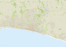
Brighton and Hove Street Map
£60.00Highly detailed layered vector artwork street map of Brighton and Hove. Includes all local roads and building shapes, with all elements fully editable in Adobe Illustrator.
PDFsSVGLayered AI file -
Bristol Street Maps
£60.00These editable street maps of Bristol and environs are for professional and commercial uses. All of Bristol’s roads, buildings, rivers, parks and transport hubs are plotted in detail. The wealth of detail extends out to Avonmouth and Bristol Airport.
PDFsSVGLayered AI file -
Britain and Ireland physical map with hillshading / relief layer (high-resolution)
£60.00Detailed map of Britain and Ireland with a hillshading / relief layer giving a beautiful sculpted backdrop for the landmass. Every part of the map is editable and suitable for high-resolution professional printing up to A0 poster size.
PDFsSVGLayered AI file -
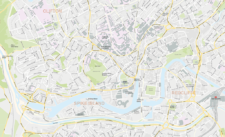
Edinburgh Street Maps
£60.00Street maps of Edinburgh and its environs including Edinburgh Airport, Leith, Queensferry and Musselburgh, with a huge amount of detail including the full road network and building shapes.
PDFsSVGLayered AI file -
Liverpool Street Maps
£60.00Street maps of Liverpool city centre and environs taking in the whole Wirral Peninsula, Ellesmere Port, Liverpool Airport, Runcorn, Frodsham, Widnes, St Helens, Haydock, Kirkby, Bootle and Crosby
PDFsSVGLayered AI file -

Manchester Street Maps
£60.00Editable street map of the city of Manchester, perfect for graphic designers using Illustrator. Includes neighbouring Salford and environs, all roads, railway and tram lines, building shapes.
PDFsSVGLayered AI file -

Map of Britain and Ireland with cities and roads
£25.00A great value map showing the cities, major towns and arterial routes of Britain and Ireland.
PDFsSVGLayered AI file -

Oxford Street Maps
£60.00Street maps of Oxford city centre and environs reaching out to Headington, Cowley, Cumnor, Kidlington and Oxford Airport
PDFsSVGLayered AI file -
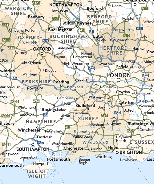
Political map of England
£40.00Shows all the counties of England, plus the principal towns and transport network.
PDFsSVGLayered AI file -
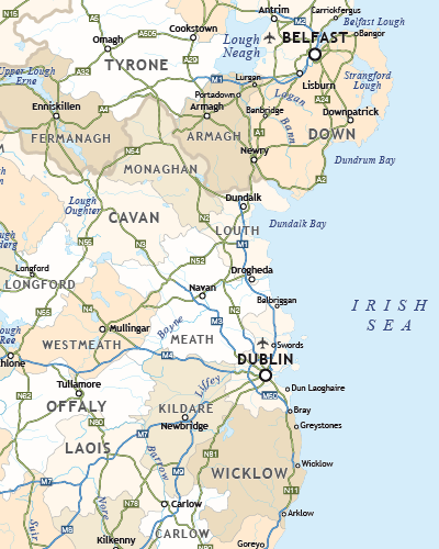
Political map of Ireland
£40.00Shows all the counties plus the principal towns and transport systems across both the Republic of Ireland and Northern Ireland.
PDFsSVGLayered AI file -
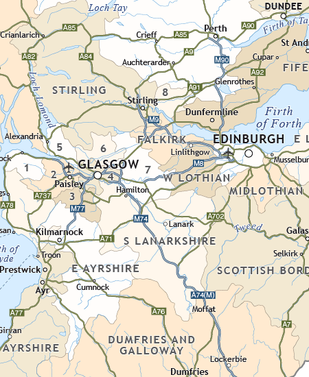
Political map of Scotland
£40.00Includes all the modern counties of Scotland, plus the principal towns and transport network.
PDFsSVGLayered AI file -

Touring / physical map of Britain and Ireland (low-resolution)
£30.00Perfect for tourist industry projects with its coastal features, lakes, rivers, national parks, historic towns and resorts.
PDFsSVGLayered AI file