Edinburgh Street Maps
Downloadable royalty free vector artwork High-resolution PDFsSVGLayered Adobe Illustrator filePrice £60.00
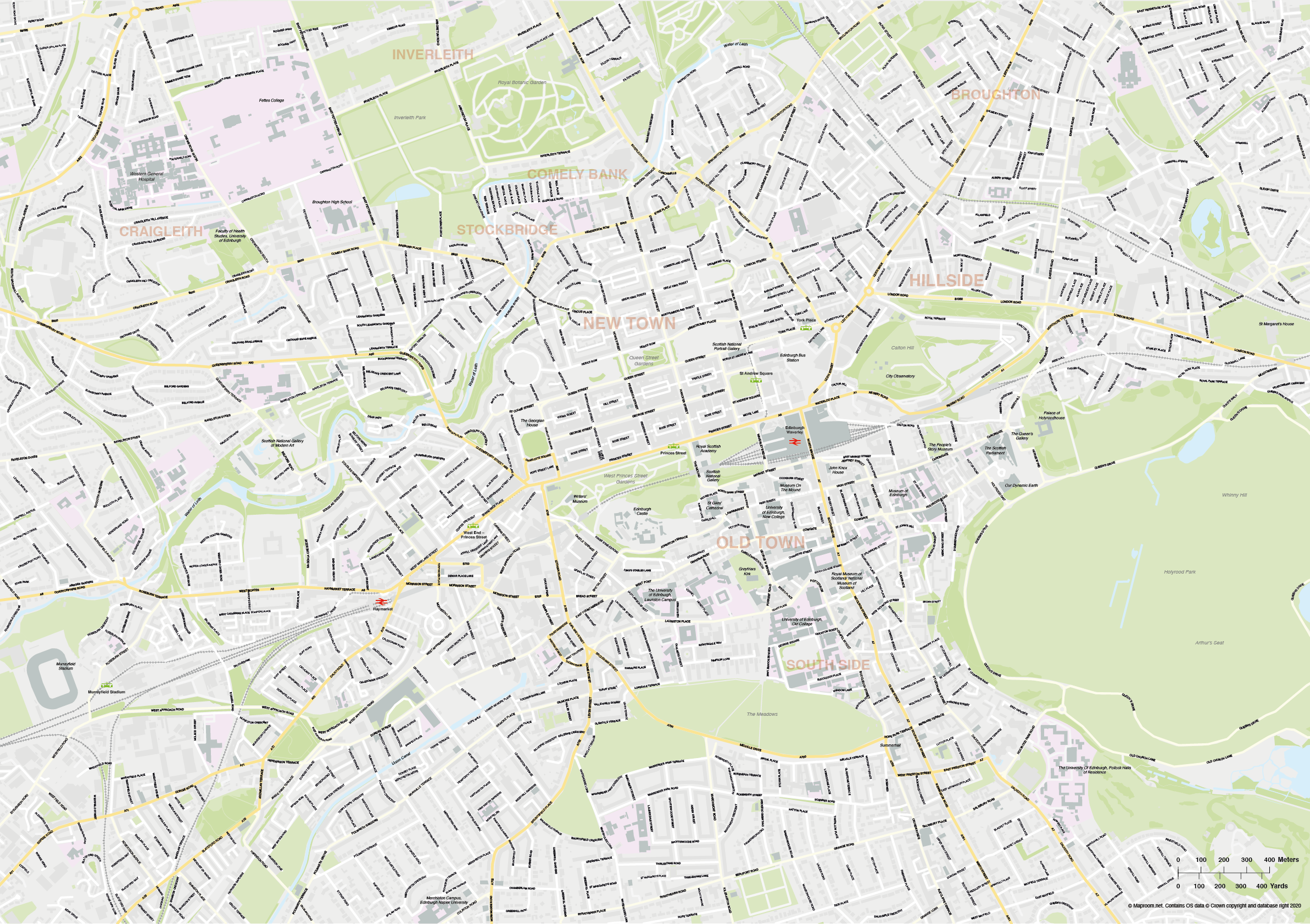
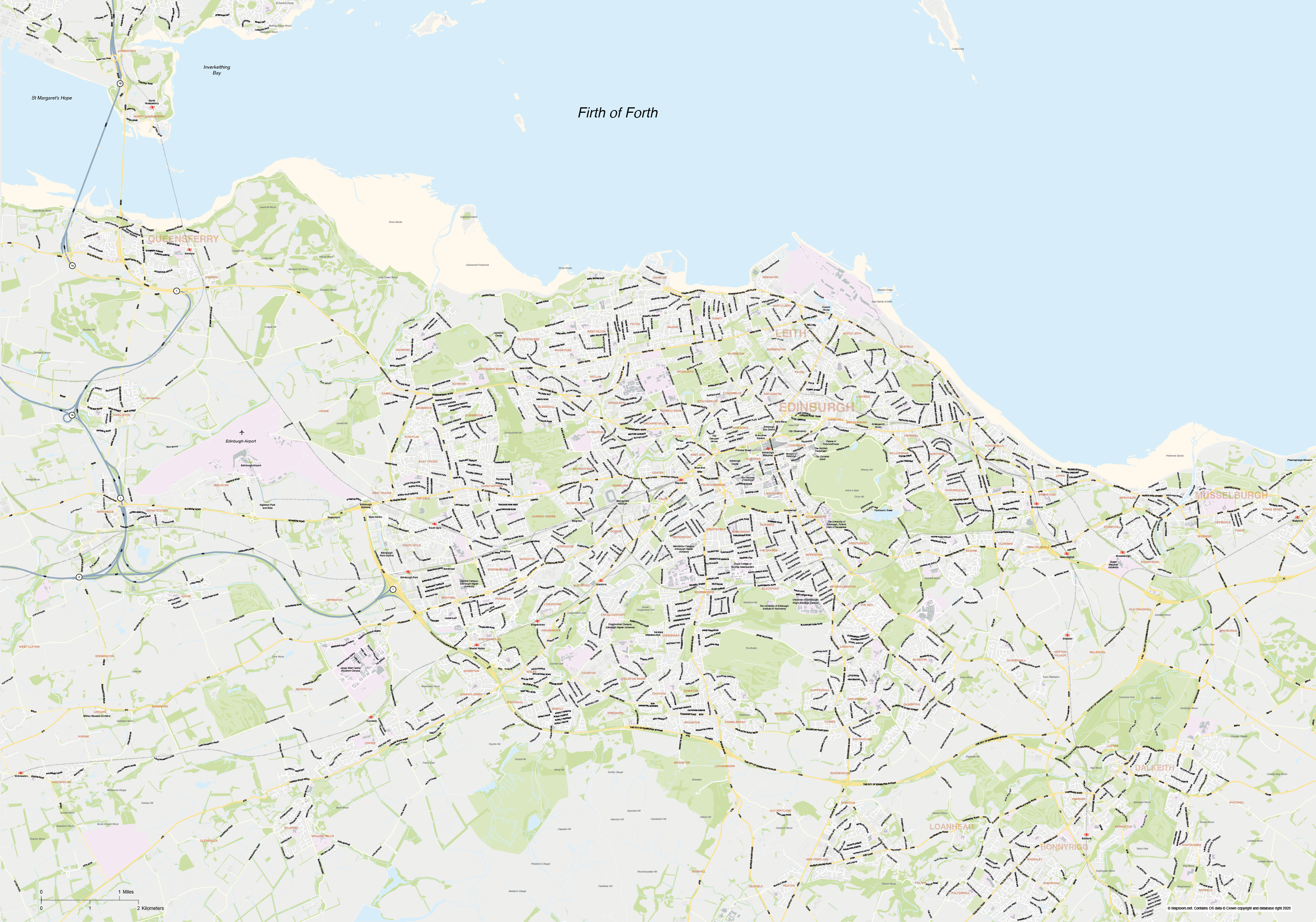
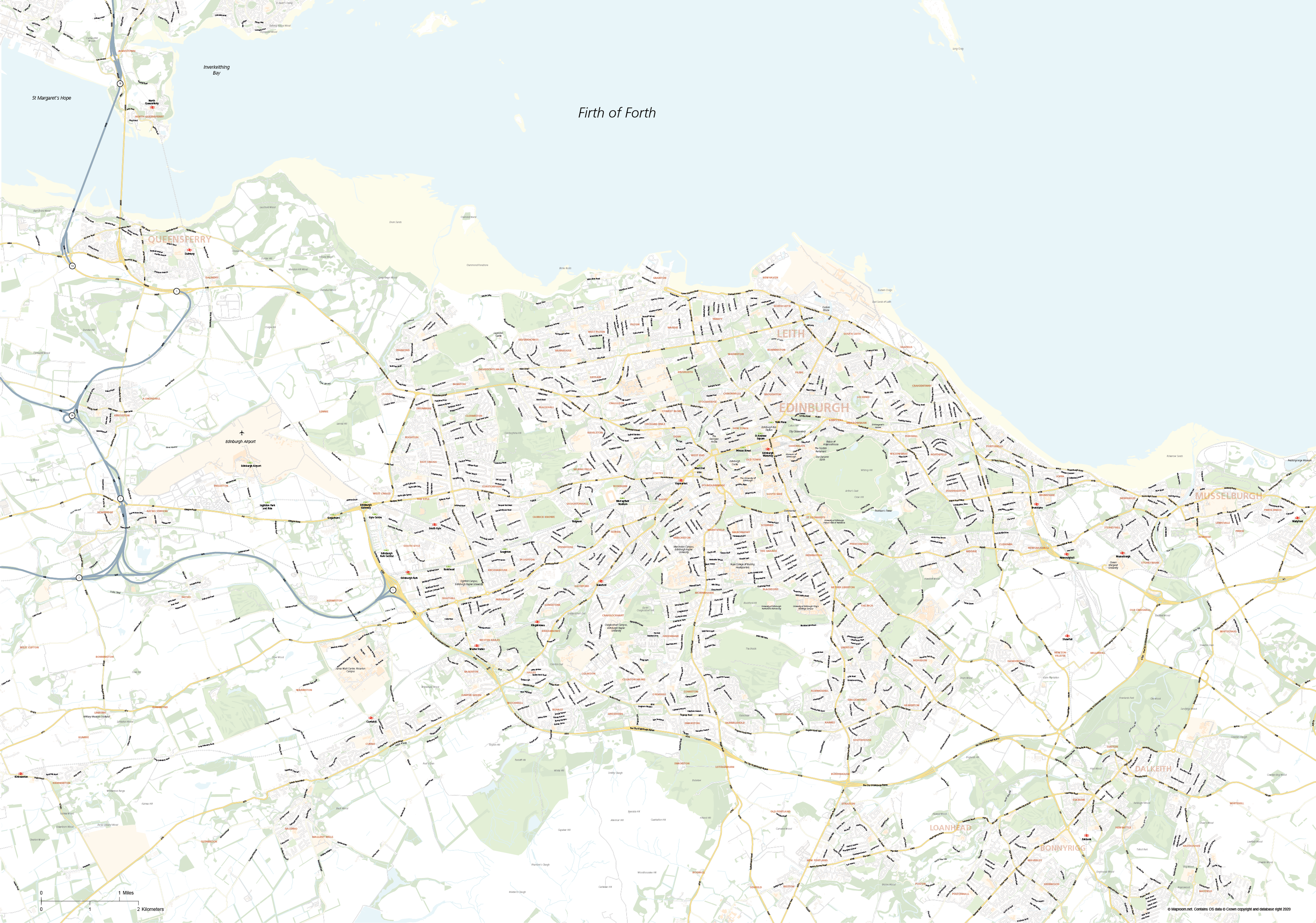
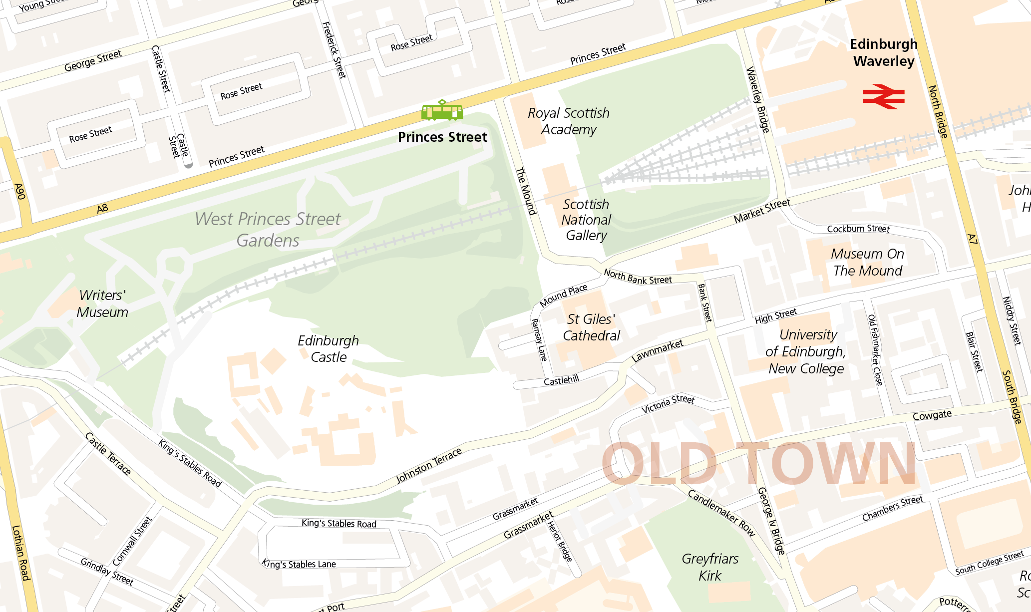
Zoom preview showing full area of coverage (low-resolution)
Pan to zoom / click or tap to switch
Examples of styling in the zoom previews are included as ready to use high-resolution PDF files in the download package. You can edit all colours, fonts and other elements using Adobe Illustrator or other SVG editing software.
These editable street maps of Edinburgh and environs are suitable for business and commercial uses. The download bundle are high-resolution layered PDFs ready for high-quality printing as they are, or fully editable for graphic designers using Adobe Illustrator. The SVG format can be manipulated by developers.
We include two map bases in the download package: one street map of Edinburgh city scaled for legibility at A1 in its opening state; this covers the area from Murrayfield Stadium in the west over to Arthur’s Seat in the east, and Inverleith in the north to Merchiston Campus, Edinburgh Napier University in the south. The second map base is scaled for legibility at A0 in its opening state and covers a much larger Edinburgh environs area out to the Firth of Forth, Queensferry, Leith, Edinburgh Airport, Musselburgh and Bonnyrigg. Check the zoom previews on this page to see the full areas of coverage.
Please note, the zoom previews on this web page are limited by the maximum size possible for web preview, but the files included in the download package are fully zoomable and suitable for all high-resolution output and printing. The Illustrator PDFs can be used as they are, or can form a starting point for your own customised version. You can crop or zoom in to the map artwork at any scale you want. For example you can zoom right in to Edinburgh city centre at roughly A4 size, or you can rescale the maps entirely for any other dimensions. The detail will be sharp at every level of usage on the scalable vector artwork.

All of Edinburgh roads, buildings, rivers, parks and transport hubs are plotted in detail from Ordnance Survey open data. You must include the OS copyright attribution in the bottom right corner of the map when printed or used commercially, though you can restyle and move the attribution.
Files included in the Edinburgh and environs street maps download bundle include layered Illustrator CC and Illustrator CS versions, SVG and EPS. There are also two styling examples as high-resolution PDFs, as seen in the previews on this page.
Specifications
Licensing terms
This editable map base is suitable for commercial and professional uses
See standard royalty free terms for downloadable maps
How to edit
Adobe Illustrator, CorelDRAW, PDF editors etc
See how to edit the downloadable maps
Recommended scaling
A1, A0+, zoomed sections or tiles
For more guidance see scaling recommendations
Vector map layers in Illustrator