Dartmoor National Park map
Downloadable royalty free vector artwork High-resolution PDFsSVGLayered Adobe Illustrator filePrice £60.00
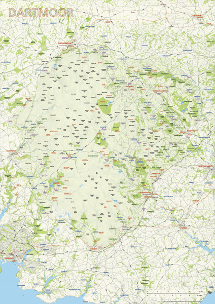
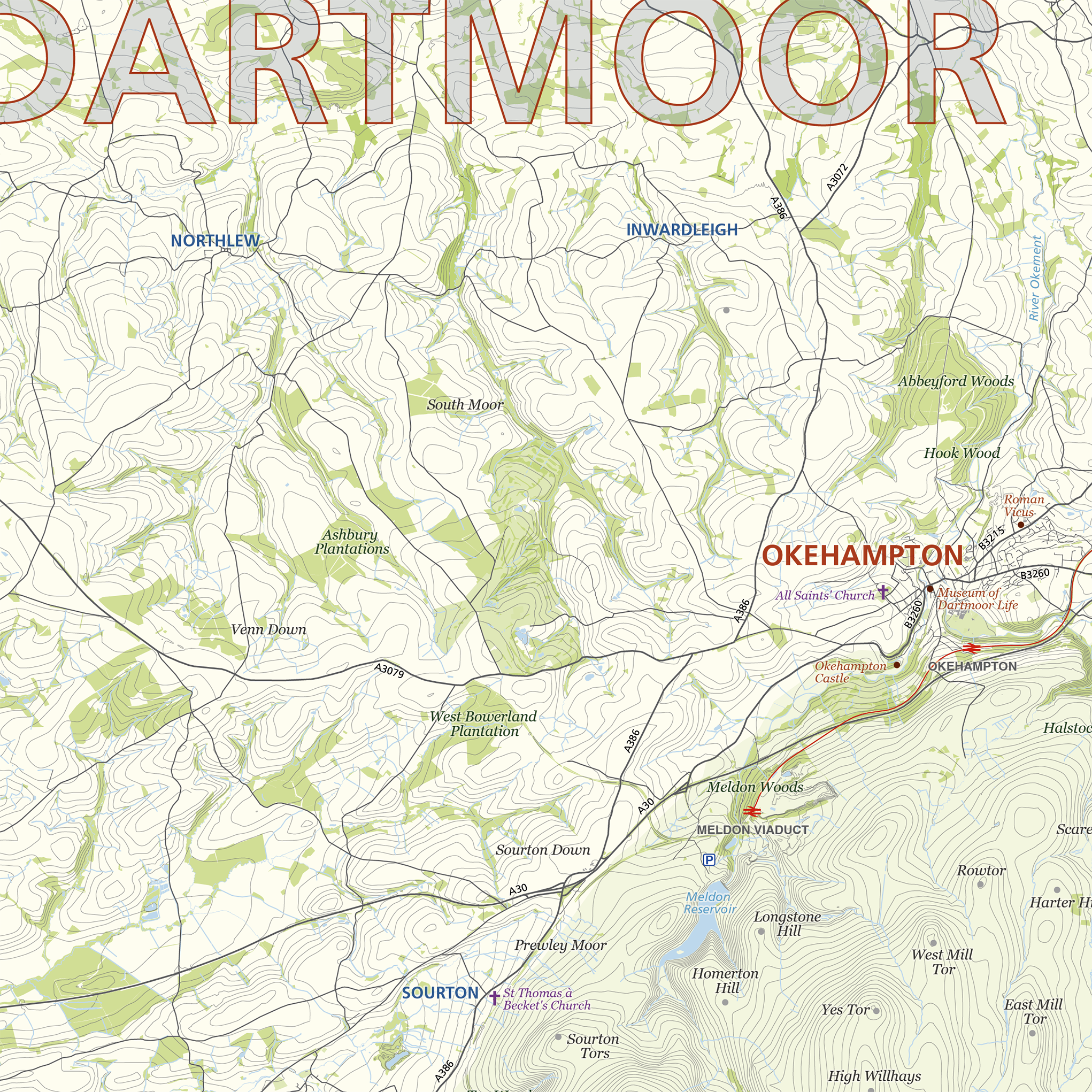
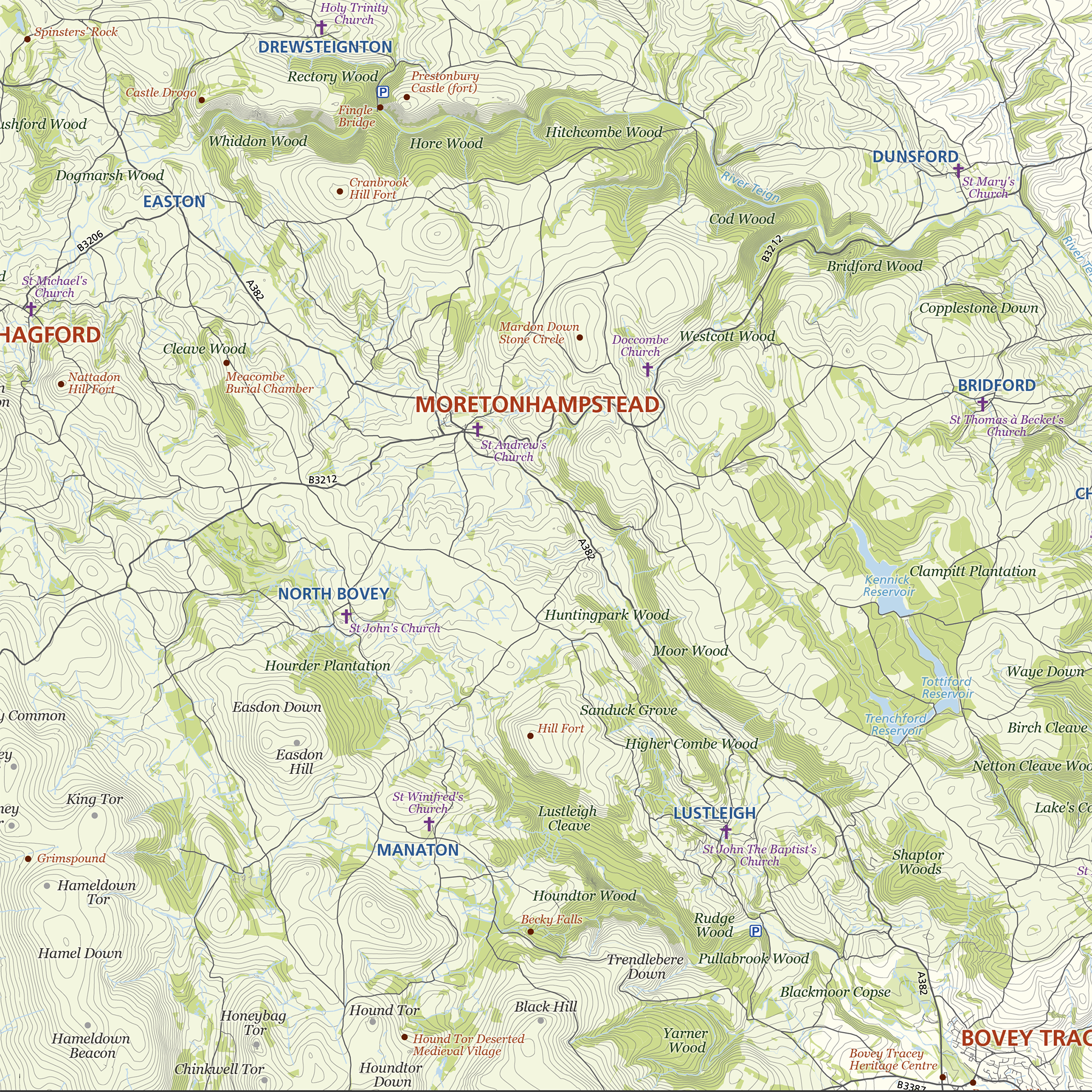
Dartmoor National Park is highlighted on this editable vector art map. The towns, villages, roads, railway lines, lakes, rivers, woodland and green spaces of the park and its environs are all included in an easy-to-read neutral colour scheme. Natural features, such as tors, downs, and commons, are labelled too, as well as the principal archaeological and historical sites and churches on Dartmoor. Also plotted are the park’s principal car parks. This map also includes a layer for contour lines, which give a sense of the high ground and valleys of this landscape.
This map is offered in a print-ready pdf format, if you are looking for a high-quality print of Dartmoor, and as a layered vector file format, suitable for a wide variety of uses in graphic design, marketing, planning and other applications where a bespoke map is required.
The product bundle includes a print-ready high-resolution PDF scaled for A1 format printing, with the smallest labels legible when printed at A1 or bigger.
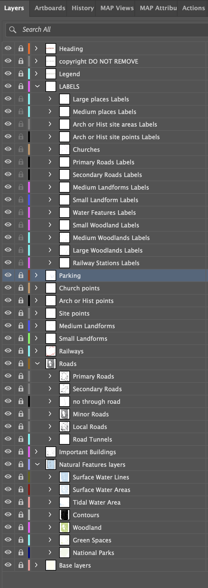
Also in the bundle are Adobe Illustrator, SVG and layered PDF file formats suitable for editing in standard vector art software (see how to edit).
A test strip of the map, with active editable layers, can be downloaded here
Specifications
Licensing terms
This editable map base is suitable for commercial and professional uses
See standard royalty free terms for downloadable maps
How to edit
Adobe Illustrator, CorelDRAW, PDF editors etc
See how to edit the downloadable maps
Recommended scaling
A1, A1+
For more guidance see scaling recommendations
Vector map layers in Illustrator