London map with roads, buildings, districts, boroughs, transport, landmarks
Downloadable royalty free vector artwork High-resolution PDFsLayered Adobe Illustrator filePrice £100.00
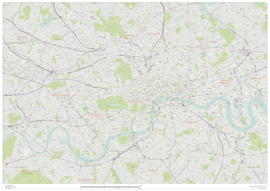
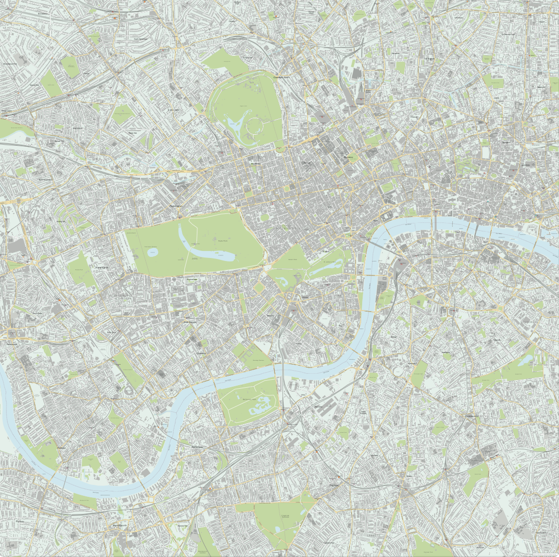
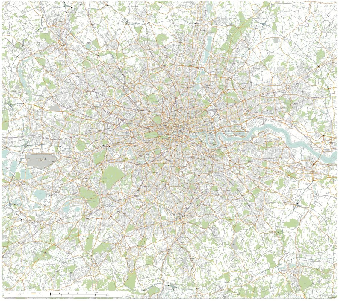
Revised in 2024, our principal London map for designers now covers a much broader swathe of London, from Richmond, Gunnersbury Park and Wembley on its western fringe to Greenwich, Stratford and Leytonstone on its eastern edge. It is scaled for legibility at A0 if printing in its entirety.
It is a superb general purpose, editable map of London, with a wealth of detail, including a full road network down to local and semi-pedestrianised roads, and building shapes. The primary roads and important connecting roads are labelled. Boroughs are labelled and their boundaries marked, and the map includes a full network of rail and Tube stations (including the DLR), as well as River Bus piers. Major landmarks (cultural and sporting) are marked and labelled, as too are the main parks and waterways.
There is a lot of detail on this London map base – it is one of the more complex maps we offer for download – and we recommend that customers use an advanced vector editing software program such as Adobe Illustrator for editing it (not supplied, see advice on getting a free trial of Illustrator in how to customise).
Three ready-to-use versions
Westminster detail as seen in version 1
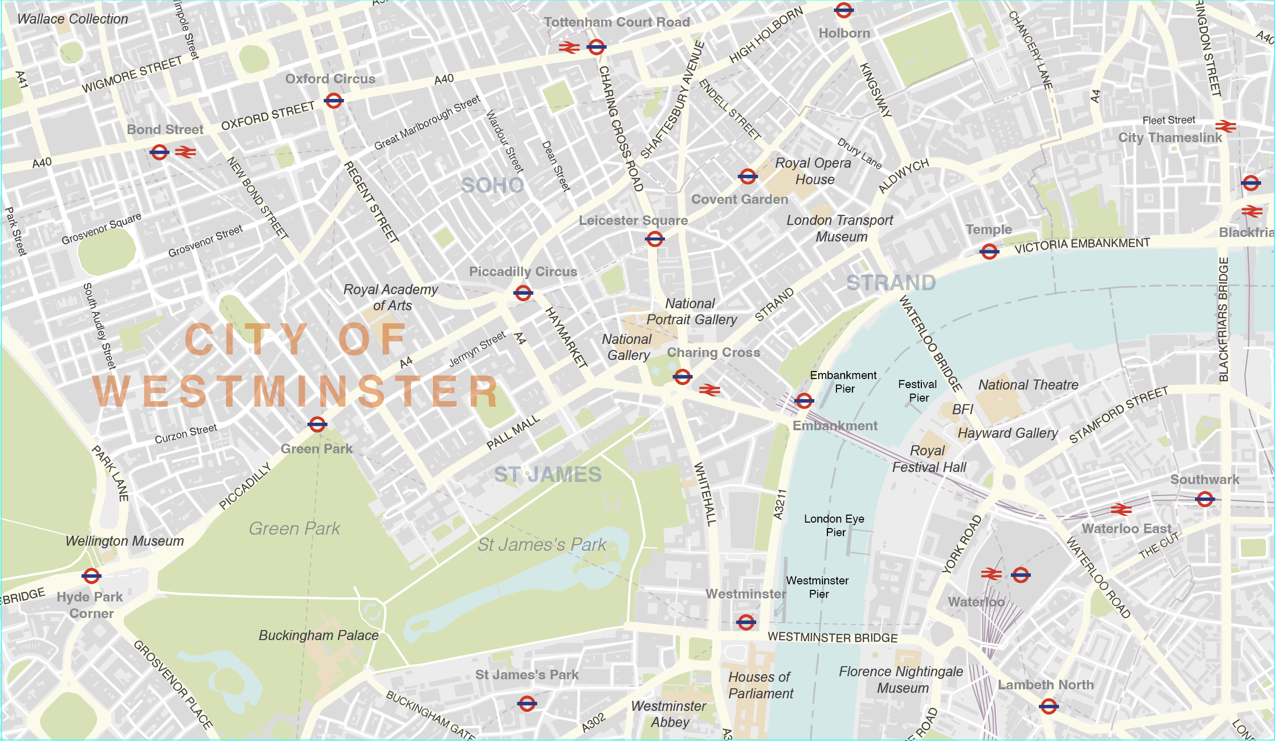
Full zoomable watermarked preview of version 1
Westminster detail as seen in version 2
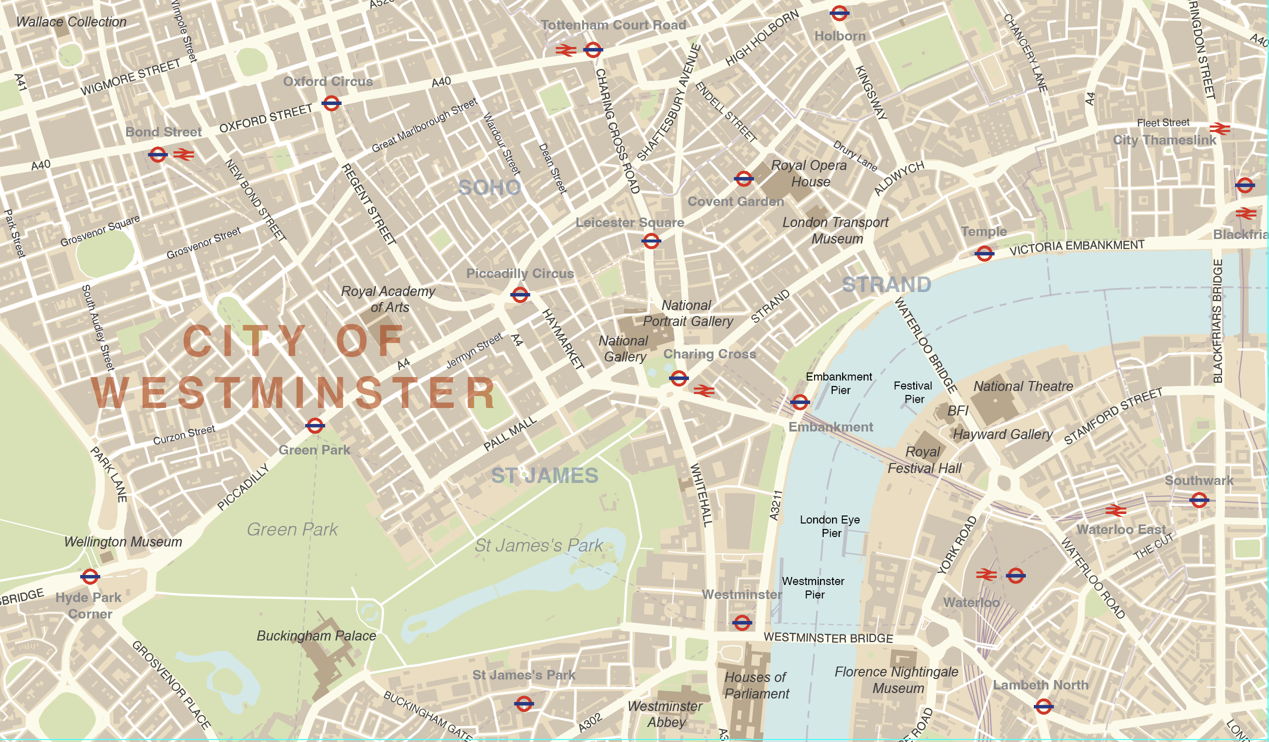
Full zoomable watermarked preview of version 2
Westminster detail as seen in version 3
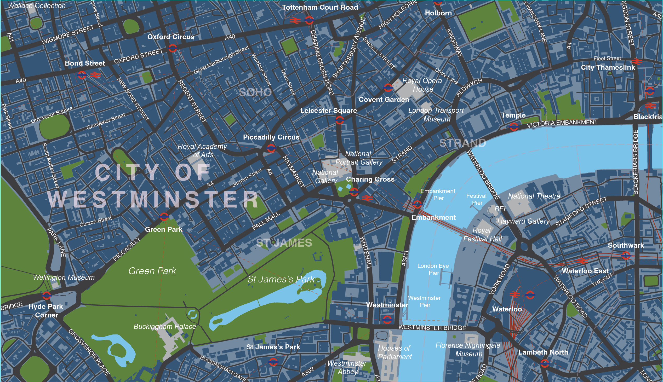
Full zoomable watermarked preview of version 3
Using this London map base
As it covers such a large area of London, the map is best output either as a PDF or at poster size, or tiled or zoomed into with a series of smaller images, in order to see the detail and read the road names etc.
You can crop the map, change the colours and add your own details as wanted. The road names can be edited using Adobe Illustrator’s Type on a Path tool, which means the fonts can be substituted and the names shifted along the paths with relative ease.
Specifications
Licensing terms
This editable map base is suitable for commercial and professional uses
See standard royalty free terms for downloadable maps
How to edit
Adobe Illustrator, CorelDRAW, PDF editors etc
See how to edit the downloadable maps
Recommended scaling
PDF, A0+ poster, tiled or zoomed areas
For more guidance see scaling recommendations
Vector map layers in Illustrator

You may also like…
-
Central London detailed street map
£75.00Our most detailed map of central London, including buildings and street names across a large area
PDFsSVGLayered AI file -
Greater London detailed map with all roads, transport, institutions, green areas
£150.00Detailed vector map of the whole of Greater London – all roads, stations, airports, rivers, green areas. A fantastic resource for professional designers and commercial projects. Provided in 2 versions for different scaling needs.
PDFsSVGLayered AI file