Maproom

Editable & interactive digital maps

  • about
  • news & blog
  • contact
  • 0 items
Log in
    • Home
  • Britain & Ireland maps
    • Britain and Ireland
    • UK - United Kingdom
    • Ireland
    • England
    • Scotland
    • Wales
    • Northern Ireland
    • Isle of Man
    • Channel Islands
  • City maps
    • Birmingham
    • Brighton
    • Bristol
    • Cardiff
    • Edinburgh
    • Exeter
    • Glasgow
    • Liverpool
    • London
    • Manchester
    • Oxford
  • Postcode maps
    • Overview
    • Dynamic postcode mapping tools
    • Downloadable postcode maps
  • Admin / region maps
    • UK administrative regions
    • County maps
    • Local authority maps
    • London borough maps
    • Transport maps
    • National park maps
  • World maps
    • World maps
    • Europe maps
    • Map of EU countries 2026
    • Maps of France
    • Maps of Germany
    • Maps of New York and environs
  • DYNAMIC MAPPING
    • Showcase
    • Dynamic Mapping Suite info
    • PASS PRICING
  • BESPOKE

Maps of Exeter

Showing all 2 results
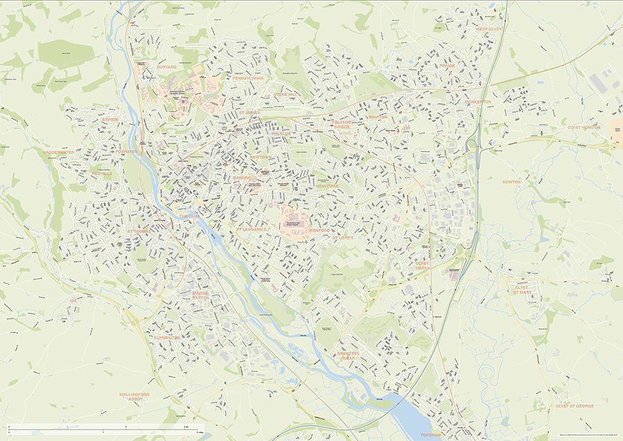
  • Exeter city map

    Exeter Street Maps

    £60.00

    Editable street maps of Exeter and of Exeter and its environs (including Topsham, Exmouth and Dawlish). Supplied as flattened PDFs for immediate printing, and fully layered Illustrator, PDF and SVG formats. The map bases include a wealth of detail, including the full road network, railway lines, canals and rivers, parks and building shapes.

    PDFsSVGLayered AI file
  • EX postcode districts map preview

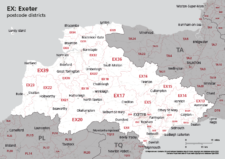
    Map of EX postcode districts – Exeter

    £25.00

    The EX – Exeter postcode districts scaled for A4+ printing

    PDF
  • Standard royalty free terms for downloadable maps
  • Licensing terms for downloadable postcode maps
  • Licensing terms for dynamic online maps
  • How to edit the downloadable maps
  • Refund, tax and pricing policies
  • Privacy & cookies

All content © Maproom at Blue Island Media · Award winning media projects