View full size map See our showcase of dynamic, interactive online maps for more about this type of route map that we can build for you.

![]()
Interactive & editable digital maps
View full size map See our showcase of dynamic, interactive online maps for more about this type of route map that we can build for you.

Hugely upgraded Locations Plotter and Quick Select Postcodes now with Sector colouring. Live Views can be shared with password protection.
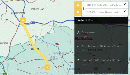
We’ve added an auto-calculating A to B driving route plotter with directions for businesses that need to calculate service charge areas and delivery routes in and around the UK’s Low Emission Zones. See at a glance if your customer’s postcode is in a Low Emission Zone and / or if your route takes you into …READ MORE…
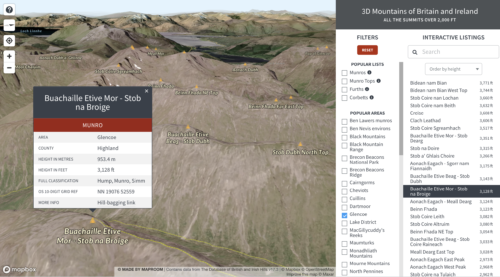
Mapbox – our favourite dynamic mapping base system – released a new system based on Maxar satellite imagery last year, whereby geospatial developers such as us can tap into elevation and projection for satellite views layered with our own points, lines and polygons. We have experimented with the new 3d system in conjunction with our …READ MORE…
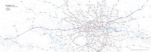
We were surprised to be contacted by quite a few people requesting a map showing the Elizabeth Line in geographical context. Like all of the UK’s official free rail maps, Transport for London’s map of the Elizabeth Line, available here, is meant for schematic visual clarity in route planning. It doesn’t attempt to show distances …READ MORE…
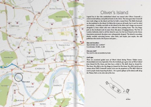
Maproom recently had the pleasure of providing map bases for a delightful new travel guide in the creative and distinctive Carl Goes series. The book, called Carl Goes London Islands, tells stories of the islands and islanders of the River Thames. With Maproom’s parent company being Thameside Media, the River Thames is close to our studio …READ MORE…

Maproom’s parent company, Thameside Media, is closely associated with illustrated travel guides, having produced dozens of travel guides for different publishers over the years, including Eyewitness Japan, Blue Guide India, Real City Barcelona and Top 10 Algarve. This is why we were especially delighted and only too pleased to oblige when Duncan J.D. Smith, knowledgeable author …READ MORE…