Maproom

Interactive & editable digital maps

  • about
  • news
  • contact
  • 0 items
Log in
  • Britain & Ireland maps
    • Britain and Ireland
    • Ireland
    • UK - United Kingdom
    • England
    • Scotland
    • Wales
    • Northern Ireland
    • Isle of Man
    • Channel Islands
  • City maps
    • Birmingham
    • Brighton
    • Bristol
    • Cardiff
    • Edinburgh
    • Exeter
    • Glasgow
    • Liverpool
    • London
    • Manchester
    • Oxford
  • Postcode maps
    • Overview
    • Dynamic postcode mapping tools
    • Downloadable postcode maps
  • Thematic maps
    • UK administrative regions
    • County maps
    • Local authority maps
    • London borough maps
    • River maps
    • National park maps
    • Transport maps
  • World maps
    • World maps
    • Europe maps
    • Map of EU countries 2026
    • Maps of France
    • Maps of Germany
    • Maps of New York and environs
  • DYNAMIC MAPPING
    • Showcase
    • Dynamic Mapping Suite intro
    • PRICING / GET A PASS
  • BESPOKE

Bespoke Mapping Samples

In need of specialist help?

Below are some public examples of bespoke maps using our specialised software and techniques. Most of our work is for British and Irish clients, but we can cover anywhere in the world. Contact us today to discuss your mapping project.

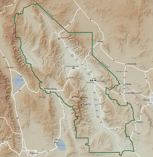
Death Valley National Park map shows our desert hillshading technique using Copernicus elevation data

6 November 2026

Copernicus is the Earth observation component of the European Union’s Space programme. We used Copernicus’s DEM (Digital Elevation Model) data at 30-metre intervals, processing and colourising the data points with our specialist GIS (Geospatial Information Systems) software to create the desert hillshading backdrop for this map of Death Valley National Park.
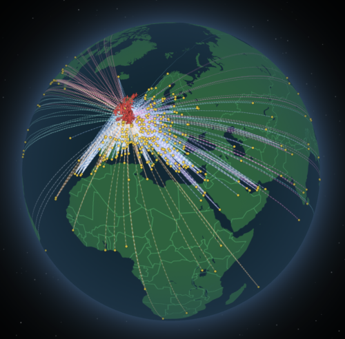
static preview of animated flight routes map

Spinning globe with animated UK & Ireland flight routes

11 March 2026

Filterable flow routes similar to private maps built for Seraphim venture capital company investing in space startups

Mill Hill map preview

Mill Hill Preservation Society map

We use Ordnance Survey data to make neighbourhood maps like this, tailored to the area and features specified by the client. Labelling is usually the most time-consuming part of the job.

caravan map sample

Caravan and Motorhome Club fold-out map sample

The Caravan and Motorhome Club provides a printed fold-out map with their directory of member sites. This is a small sample of the map with two types of plotted sites and grid references.

SW flood and coastal preview

South West Flood & Coastal Erosion Risk Management map

Interactive map showing flood defences risk on the south west coast created in our Dynamic Mapping Suite and displayed publicly on client’s website. Uses a local authorities base map.

Polling data

FocalData feed for map used by animal welfare consortium

Balfour Beatty project map

Balfour Beatty project map

Balfour Beatty map in collaboration with Scape Civil Engineering and the North Norfolk District Council.

Critical charity map preview

Emergency responders coverage

Interactive map attached to a spreadsheet created for the Critical charity in the Republic of Ireland. The map is embedded on the client’s website, and the team updates its spreadsheet periodically, with changes feeding instantly to the live map.

bespoke Integrated Care Boards map

Integrated Care Boards map for Diabetes UK

A region map with branding colours for Diabetes UK showing the Integrated Care Boards boundaries defined by the NHS.

route plotting map example

Marathon route plotting

The brief was to supply layered, editable Illustrator files for the client to use as the base for other graphics and participant and neighbourhood travel information, to be used in printed materials and online.

Ancient history map example

History maps

A few examples of history maps we have produced for SPCK publishers.

Political map quiz game

This map was created as a game for testing pundits at the financial predictions company Smarkets knowledge of the 650 parliamentary constituencies.

Locality detail

Locality detail for client near Manchester Airport

Pin marker, road detail and colours as specified by client.

Find a Funeral Director map preview

Find a Funeral Director dynamic map

Two separate lists, branding colours, specially created icons, and a tailored image upload area for multiple company logos. The map is embedded on the client’s website.

swipe map

Dulwich Estate boundaries satellite/streets swipe map and localised search

Estate boundaries created from meticulous study of multiple historic maps georeferenced and overlaid onto modern digital maps.

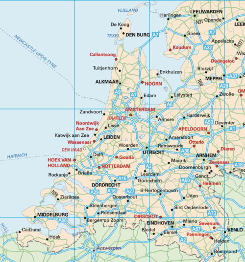
Netherlands example

Map of the Netherlands for motoring guide to Europe

This map of the Netherlands is one of dozens of Europe maps we have updated for the Caravan and Motorhome Club’s Touring Europe directory, with over 3,200 campsites plotted across Europe.

Irish in Britain map preview

Irish in Britain heat map with constituency data

Data supplied by the Irish in Britain charity and fed to our 2024 constituencies dataset with switch between 2011 and 2021 census data built in. The map is embedded on the client’s website.

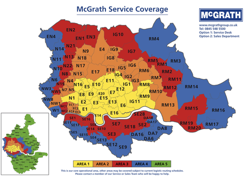
Postcodes service coverage map

Schematic postcode zones reference for the McGrath Group.

Delivery map example

Delivery postcodes including town names

Another postcodes example, this one styled up for CPA Horticulture with national coverage and scaled for A0 poster printing.

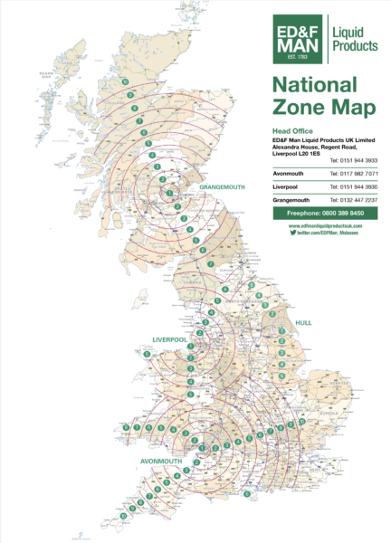
Liquid Products transportation map

Transportation zone map for commodities company

The marketing company for commodities company ED&F Man needed our assistance when asked to include a map showing multiple overlapping transportation zones radiating from the ports at Liverpool, Avonmouth, Hull and Grangemouth.

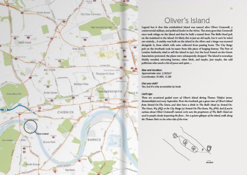
Maps for Carl Goes London Islands

Maps for travel guide to islands in the River Thames

21 August 2018

Maproom had the pleasure of providing map bases for a delightful new travel guide in the creative and distinctive Carl Goes series. The book, called Carl Goes London Islands, tells stories of the islands and islanders of the River Thames.

Pin markers on a regions backdrop for Open Property Group

The property company updates its portfolio each year, providing a list of postcode locations which we import to the bespoke map base we created for them.

Cardiovascular funding map preview

British Heart Foundation – NIHR cardiovascular research funding maps

We built two interactive maps natively on the NIHR Biomedical Research Centre: Oxford website, showing complex funding information for the British Heart Foundation – NIHR partnership.

water utilities map example

Water utilities maps

Three variants of the water utilities for three different clients with individual specifications.

Historic parishes in Ireland

Isolated graphics of old Irish parishes for a historian who provided the reference source material.

Scotland maps in Betjeman's Best British Churches

2,500 map plottings for Betjeman’s Best British Churches

11 January 2012

One of our greatest projects for Harper Collins publishers involved the mapping and photography of churches around Britain. Altogether we plotted the location of 2,500 churches using GPS data and translating it onto printed maps.

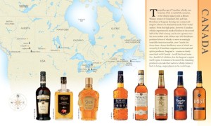
World Whisky Canada

Our World Whisky book wins prestigious award

10 January 2012

The owners of Maproom are proud to announce that our World Whisky project has won the IACP award for Best Cookbook. The publication, published by DK, involved us mapping all the whisky-producing nations of the world, as well as photographing literally hundreds of the finest whiskies ever produced.

  • Standard royalty free terms for downloadable maps
  • How to edit the downloadable maps
  • Licensing terms for dynamic online maps
  • Refund, tax and pricing policies
  • How to cancel or change a subscription
  • Privacy & cookies

All content © Maproom at Blue Island Media · Award winning media projects