
Maproom

Interactive & editable digital maps

  • about
  • news
  • contact
  • 0 items
Log in
  • Britain & Ireland maps
    • Britain and Ireland
    • Ireland
    • UK - United Kingdom
    • England
    • Scotland
    • Wales
    • Northern Ireland
    • Isle of Man
    • Channel Islands
  • City maps
    • Birmingham
    • Brighton
    • Bristol
    • Cardiff
    • Edinburgh
    • Exeter
    • Glasgow
    • Liverpool
    • London
    • Manchester
    • Oxford
  • Postcode maps
    • Overview
    • Dynamic postcode mapping tools
    • Downloadable postcode maps
  • Thematic maps
    • UK administrative regions
    • County maps
    • Local authority maps
    • London borough maps
    • River maps
    • National park maps
    • Transport maps
  • World maps
    • World maps
    • Europe maps
    • Map of EU countries 2026
    • Maps of France
    • Maps of Germany
    • Maps of New York and environs
  • DYNAMIC MAPPING
    • Showcase
    • Dynamic Mapping Suite intro
    • PRICING / GET A PASS
  • BESPOKE
← Previous sample
BESPOKE MAPPING SAMPLES
Next sample →

Marathon route plotting

Example of one of several marathon route maps we have plotted. The brief was to supply layered, editable Illustrator files for the client to use as the base for other graphics and participant and neighbourhood travel information, to be used in printed materials and online.
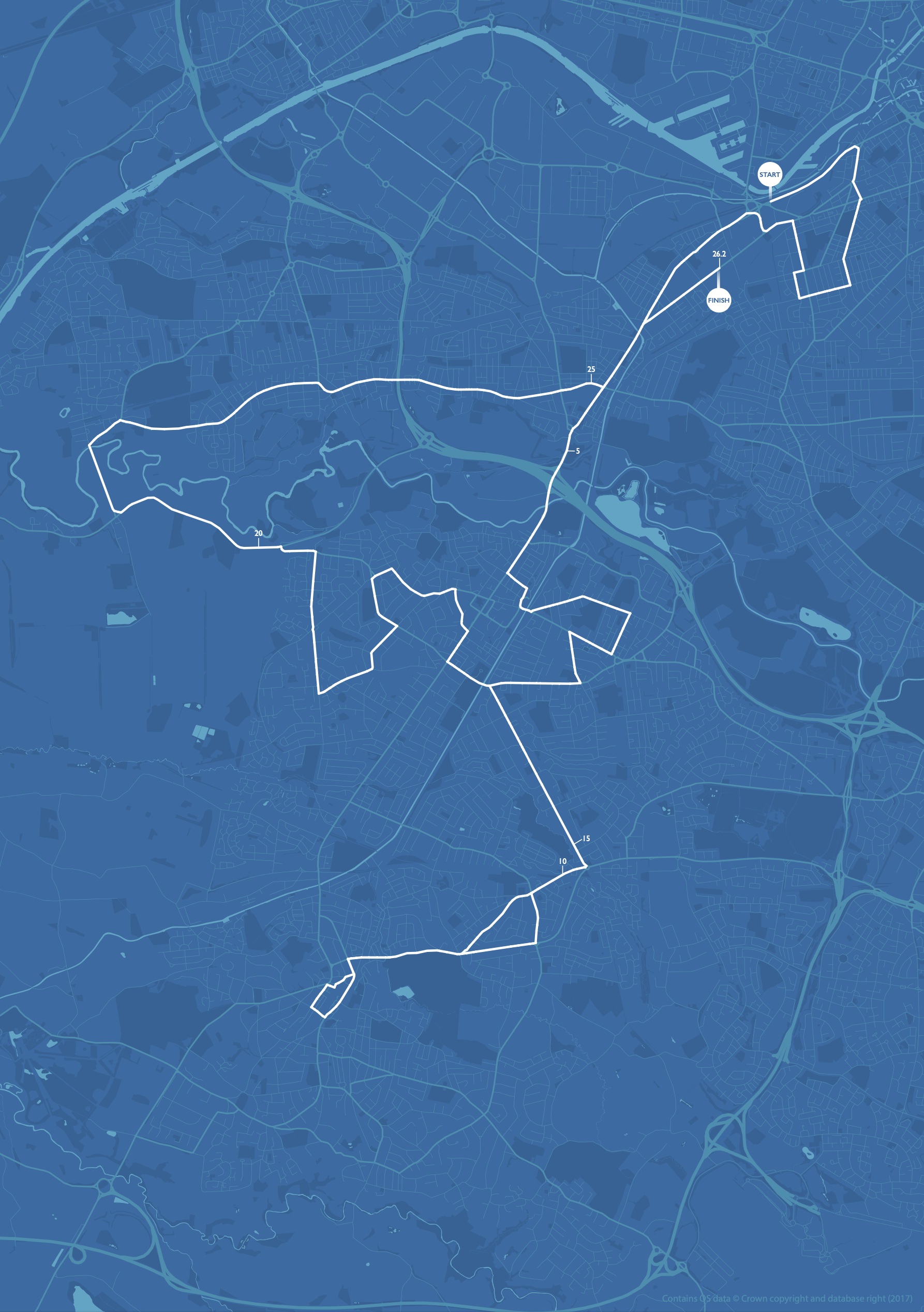
Marathon route map

Filed Under: Bespoke Mapping Samples, Travel Maps

MAPROOM NEWS
Previous Post ← New Local Authorities maps from April 2023 – Cumberland, Westmorland and Furness, North Yorkshire and Somerset
Next Post Integrated Care Boards map for Diabetes UK →
  • Standard royalty free terms for downloadable maps
  • How to edit the downloadable maps
  • Licensing terms for dynamic online maps
  • Refund, tax and pricing policies
  • How to cancel or change a subscription
  • Privacy & cookies

All content © Maproom at Blue Island Media · Award winning media projects