Maproom

Editable & interactive digital maps

MENUMENU
  • about
  • news & blog
  • contact
  • 0 items
LOGIN
    • Home
  • Britain & Ireland maps
    • Britain and Ireland
    • UK - United Kingdom
    • Ireland
    • England
    • Scotland
    • Wales
    • Northern Ireland
    • Isle of Man
    • Channel Islands
  • City maps
    • Birmingham
    • Brighton
    • Bristol
    • Cardiff
    • Edinburgh
    • Exeter
    • Glasgow
    • Liverpool
    • London
    • Manchester
    • Oxford
  • Postcode maps
    • Overview
    • Online postcode mapping tools
    • Downloadable postcode maps
  • Region maps
    • Region maps
    • County maps
    • Local authority maps
    • Transport maps
    • National park maps
  • World maps
    • World maps
    • Europe maps
    • Map of EU countries 2024
    • Maps of France
    • Maps of Germany
    • Maps of New York and environs
  • DYNAMIC
    • Showcase
    • Dynamic Mapping Suite information and demos
    • GET A PASS
  • BESPOKE
    • Bespoke mapping services
    • Bespoke static maps
    • Bespoke dynamic maps
    • Search

New Local Authorities maps from April 2023 – Cumberland, Westmorland and Furness, North Yorkshire and Somerset

3 April 2023
Filed Under: Maproom News

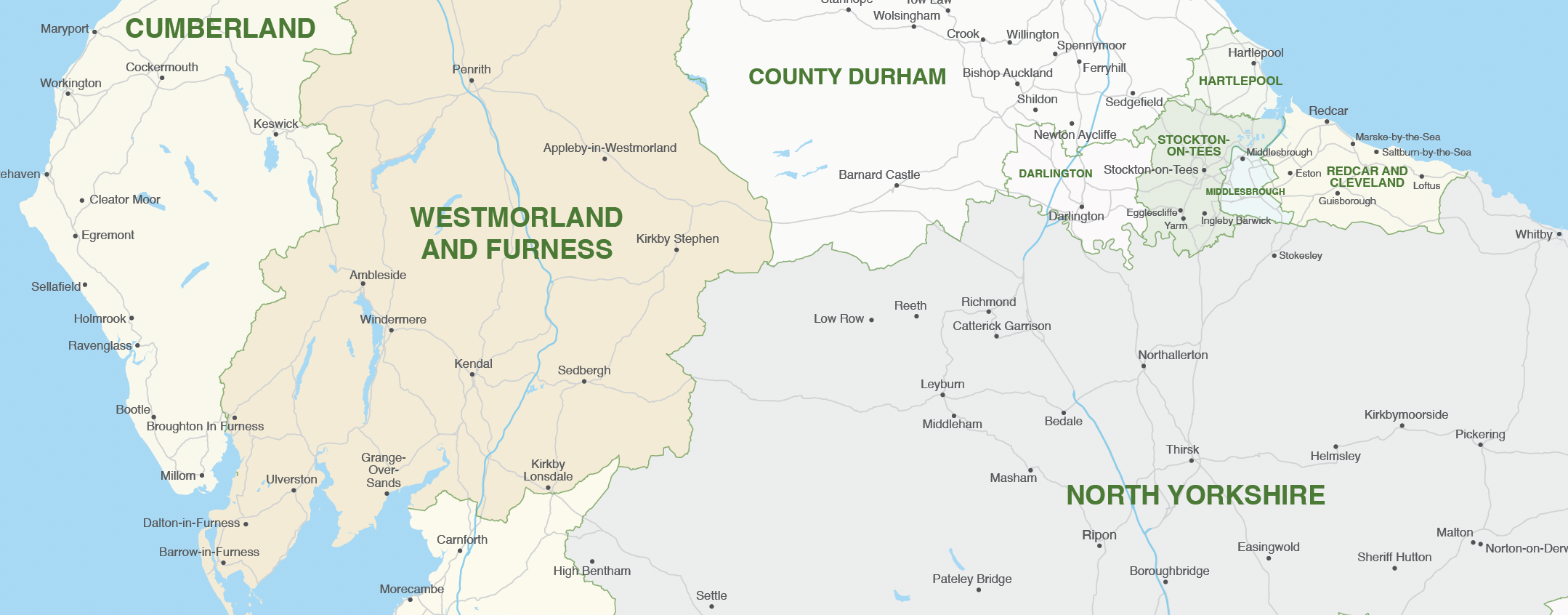
We have updated all our Local Authority map bases in line with changes that have come into effect on 1 April 2023. As far as we can see, we have actually beaten the Government itself in issuing the new boundary data!

Detail from one of the new Local Authority maps showing part of the new Authorities in Cumbria and Yorkshire

The changes are as follows:

Cumberland – formerly Allerdale, Carlisle, Copeland

Westmorland and Furness – formerly Barrow-in-Furness, Eden, South Lakeland

North Yorkshire – formerly Craven, Hambleton, Harrogate, Richmondshire, Ryedale, Scarborough, Selby

Somerset – formerly Mendip, Sedgemoor, Somerset West and Taunton, South Somerset

We sell two vector art packages for the Local Authorities: one juxtaposed with postcodes and the other without. Both are bundled with a premium pass for the Dynamic Mapping Suite, which contains interactive online maps of the new Local Authorities with advanced search. Users can colour and caption the Local Authorities online with their own data.

If you have data you want to feed to the old Local Authorities, before the April 2023 mergers in Cumbria, Yorkshire and Somerset, we have included an older version in both the download package and in the spreadsheets to polygons system in the Dynamic Mapping Suite. This is handy if, for example, your data relates to the 2021 census.

For more details see UK local authorities maps.

  • Standard royalty free terms for downloadable maps
  • Licensing terms for downloadable postcode maps
  • Licensing terms for dynamic online maps
  • How to edit the downloadable maps
  • Pricing & refund policies
  • Privacy & cookies

All content © Maproom at Blue Island Media · Award winning media projects