London Borough maps
Editable base maps of the London boroughs, showing roads and the shape of the boundaries. Scaled for A1 poster printing.
Showing all 35 results
-

Map of London boroughs
£25.00All the London boroughs with options for showing the Thames.
PDFsSVGLayered AI file -
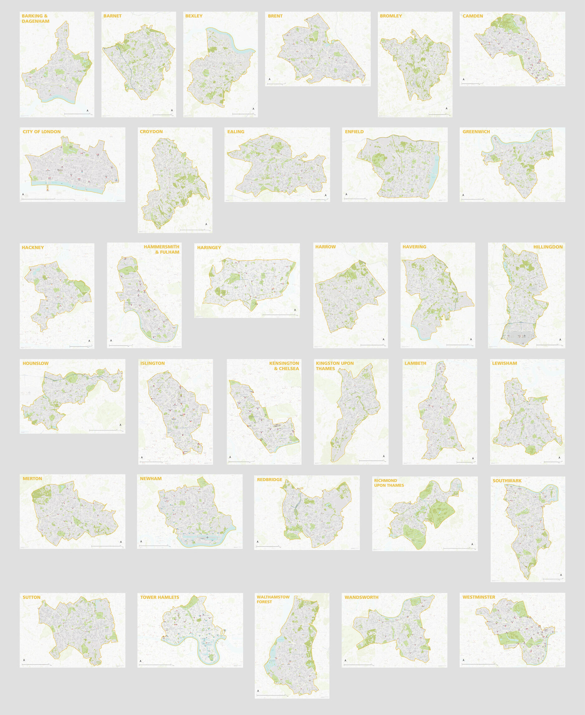
London Borough Maps: FULL SET of 34 maps
£300.00PDFsSVGLayered AI file -
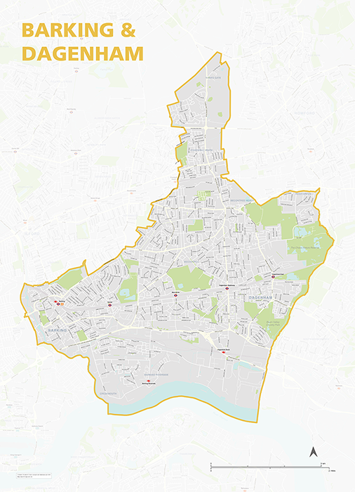
Barking & Dagenham – London borough map
£40.00Map of the London Borough of Barking and Dagenham, detailing the road and public transport network, as well as parks and other open areas. Designed for A1+ printing or editing for other uses.
PDFSVGLayered AI file -
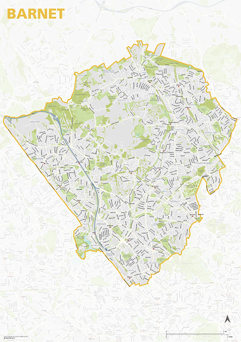
Barnet – London borough map
£40.00Map of the London Borough of Barnet, detailing the road and public transport network, as well as parks and other open areas. Designed for A1+ printing or editing for other uses.
PDFSVGLayered AI file -
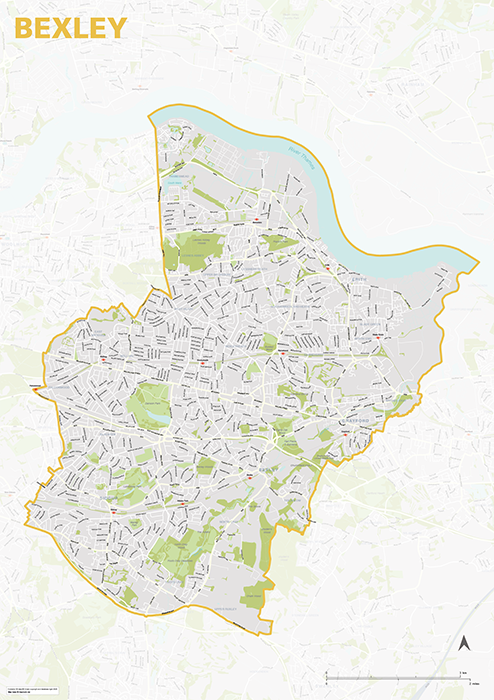
Bexley – London borough map
£40.00Map of the London Borough of Bexley, detailing the road and public transport network, as well as parks and other open areas. Designed for A1+ printing or editing for other uses.
PDFSVGLayered AI file -
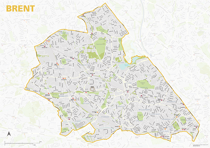
Brent – London borough map
£40.00Map of the London Borough of Brent, detailing the road and public transport network, as well as parks and other open areas. Designed for A1+ printing or editing for other uses.
PDFSVGLayered AI file -
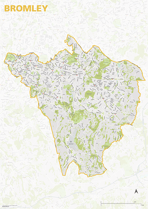
Bromley – London borough map
£40.00Map of the London Borough of Brent, detailing the road and public transport network, as well as parks and other open areas. Designed for A1+ printing or editing for other uses.
PDFSVGLayered AI file -

Camden – London borough map
£40.00Map of the London Borough of Camden, detailing the road and public transport network, as well as parks and other open areas. Designed for A1+ printing or editing for other uses.
PDFSVGLayered AI file -
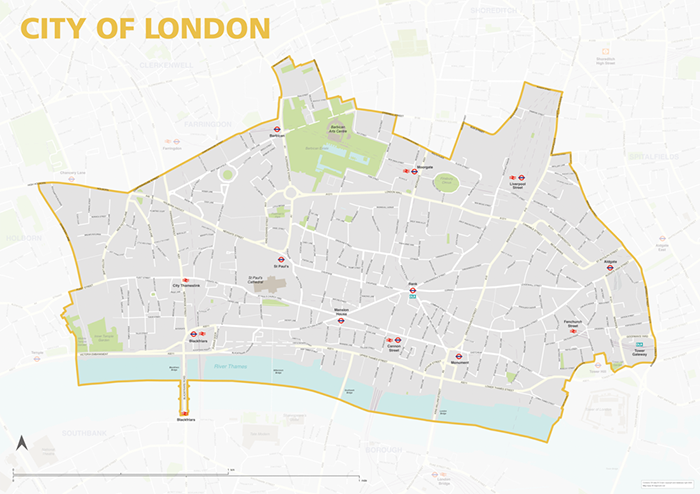
City of London – borough style map
£40.00Map of the City of London, detailing the road and public transport network, as well as park squares and other open areas. Designed for A1+ printing or editing for other uses.
PDFSVGLayered AI file -
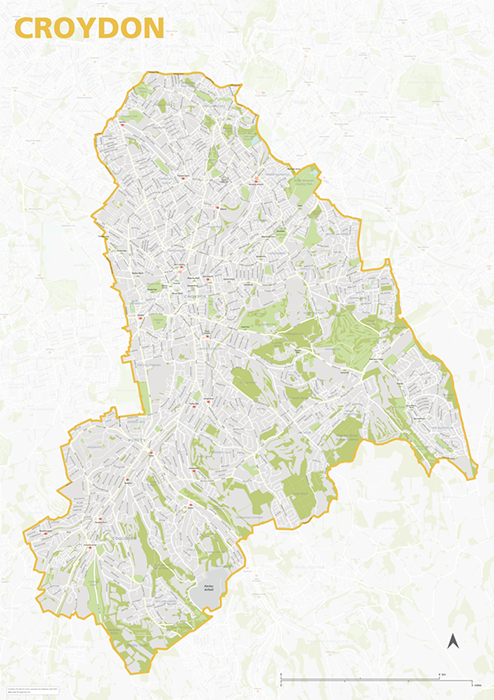
Croydon – London borough map
£40.00Map of the London Borough of Croydon, detailing the road and public transport network, as well as parks and other open areas. Designed for A1+ printing or editing for other uses.
PDFSVGLayered AI file -
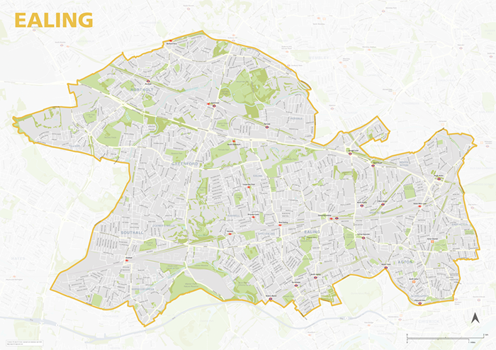
Ealing – London borough map
£40.00Map of the London Borough of Ealing, detailing the road and public transport network, as well as parks and other open areas. Designed for A1+ printing or editing for other uses.
PDFSVGLayered AI file -
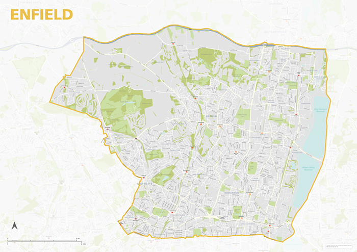
Enfield – London borough map
£40.00Map of the London Borough of Enfield, detailing the road and public transport network, as well as parks and other open areas. Designed for A1+ printing or editing for other uses.
PDFSVGLayered AI file -
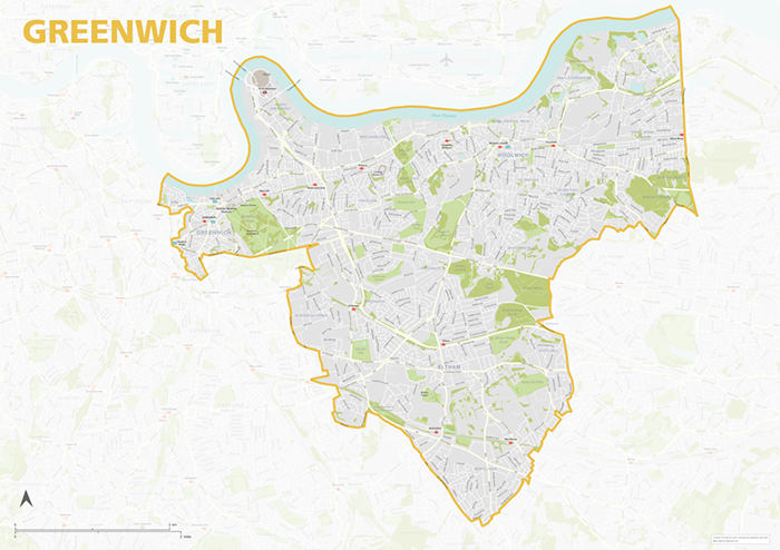
Greenwich – London borough map
£40.00Map of the London Borough of Greenwich, detailing the road and public transport network, as well as parks and other open areas. Designed for A1+ printing or editing for other uses.
PDFSVGLayered AI file -
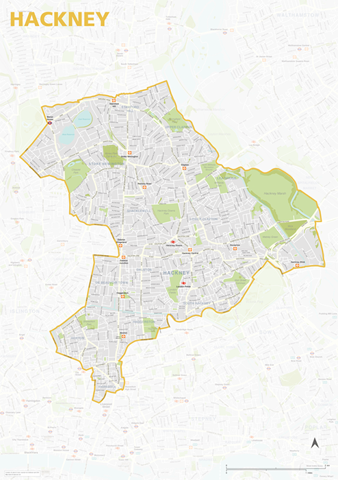
Hackney – London borough map
£40.00Map of the London Borough of Hackney, detailing the road and public transport network, as well as parks and other open areas. Designed for A1+ printing or editing for other uses.
PDFSVGLayered AI file -
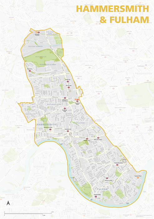
Hammersmith & Fulham – London borough map
£40.00Map of the London Borough of Hammersmith & Fulham, detailing the road and public transport network, as well as parks and other open areas. Designed for A1+ printing or editing for other uses.
PDFSVGLayered AI file -
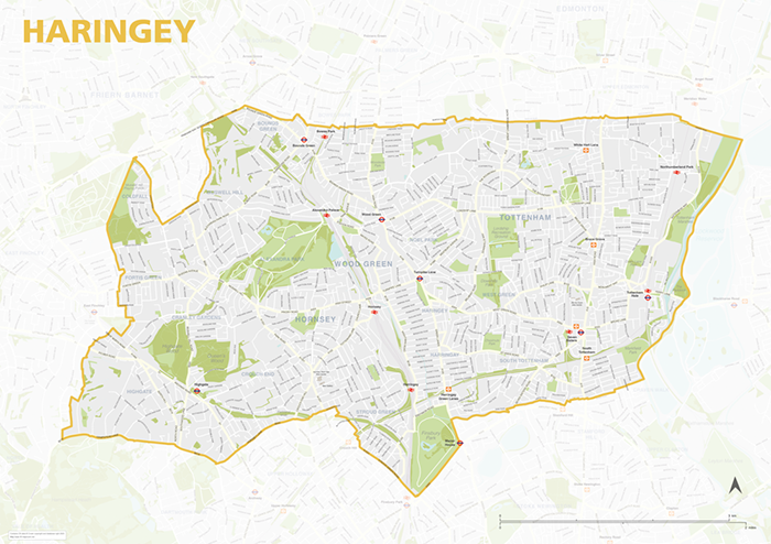
Haringey – London borough map
£40.00Map of the London Borough of Haringey, detailing the road and public transport network, as well as parks and other open areas. Designed for A1+ printing or editing for other uses.
PDFSVGLayered AI file -
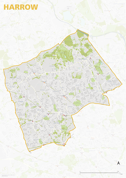
Harrow – London borough map
£40.00Map of the London Borough of Harrow, detailing the road and public transport network, as well as parks and other open areas. Designed for A1+ printing or editing for other uses.
PDFSVGLayered AI file -
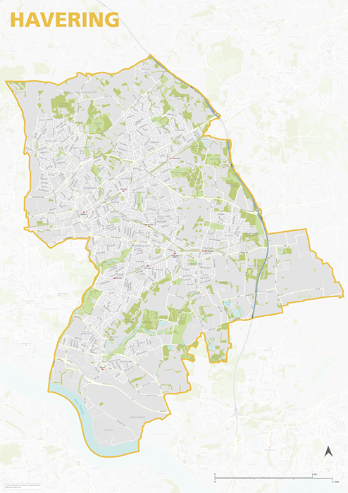
Havering – London borough map
£40.00Map of the London Borough of Havering, detailing the road and public transport network, as well as parks and other open areas. Designed for A1+ printing or editing for other uses.
PDFSVGLayered AI file -
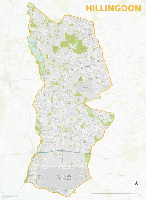
Hillingdon – London borough map
£40.00Map of the London Borough of Hillingdon, detailing the road and public transport network, as well as parks and other open areas. Designed for A1+ printing or editing for other uses.
PDFSVGLayered AI file -
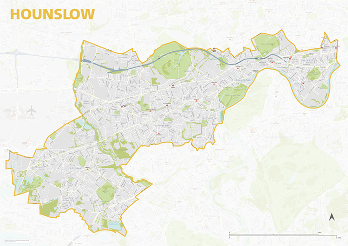
Hounslow – London borough map
£40.00Map of the London Borough of Hounslow, detailing the road and public transport network, as well as parks and other open areas. Designed for A1+ printing or editing for other uses.
PDFSVGLayered AI file -
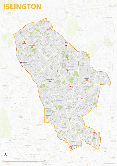
Islington – London borough map
£40.00Map of the London Borough of Islington, detailing the road and public transport network, as well as parks and other open areas. Designed for A1+ printing or editing for other uses.
PDFSVGLayered AI file -
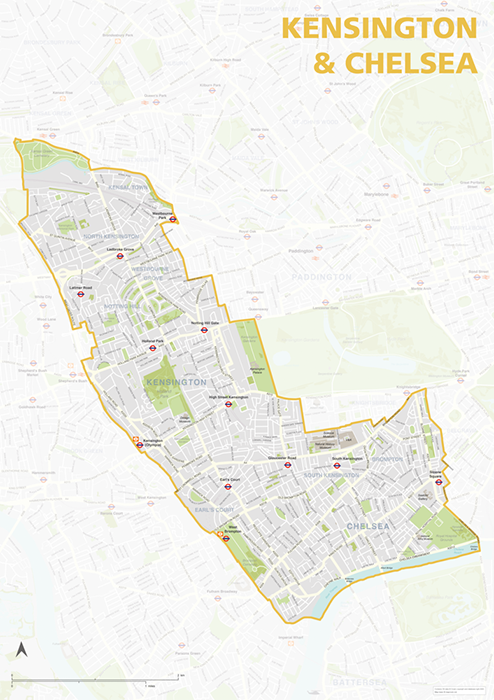
Kensington & Chelsea – London borough map
£40.00Map of the London Borough of Kensington & Chelsea, detailing the road and public transport network, as well as parks and other open areas. Designed for A1+ printing or editing for other uses.
PDFSVGLayered AI file -
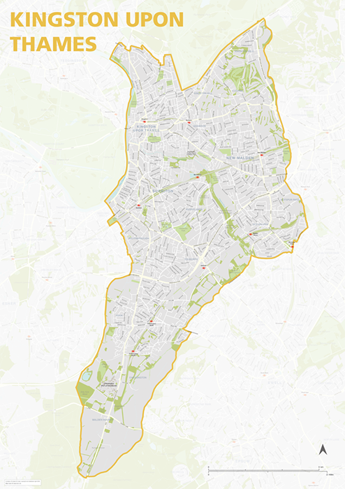
Kingston upon Thames – London borough map
£40.00Map of the London Borough of Kingston upon Thames, detailing the road and public transport network, as well as parks and other open areas. Designed for A1+ printing or editing for other uses.
PDFSVGLayered AI file -
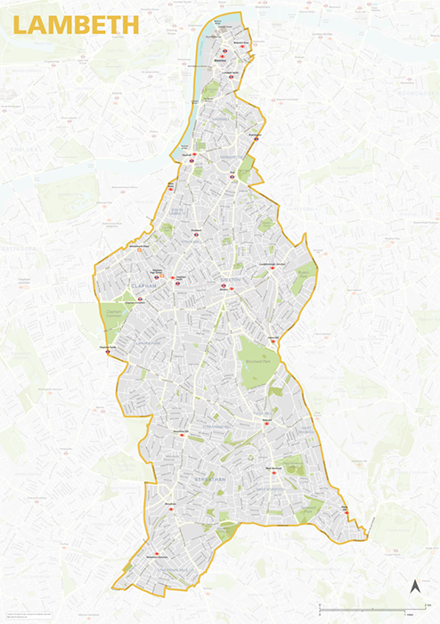
Lambeth – London borough map
£40.00Map of the London Borough of Lambeth, detailing the road and public transport network, as well as parks and other open areas. Designed for A1+ printing or editing for other uses.
PDFSVGLayered AI file -
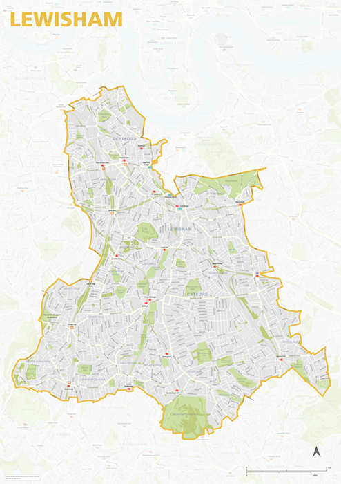
Lewisham – London borough map
£40.00Map of the London Borough of Lewisham, detailing the road and public transport network, as well as parks and other open areas. Designed for A1+ printing or editing for other uses.
PDFSVGLayered AI file -
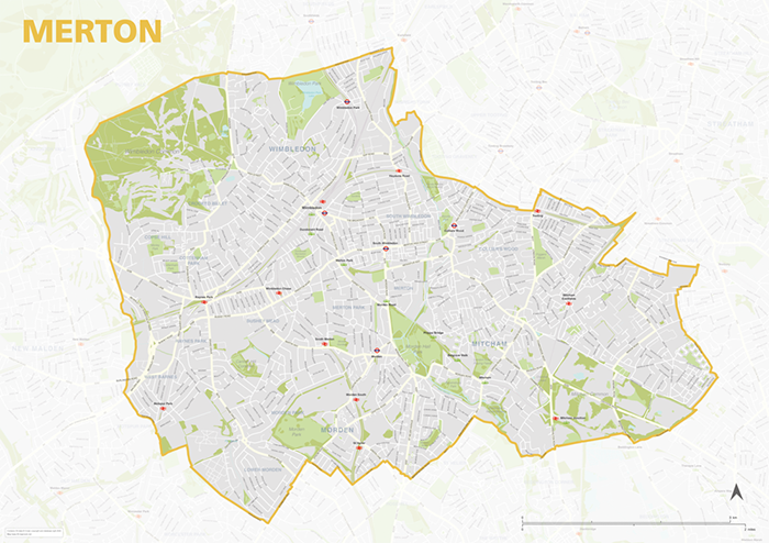
Merton – London borough map
£40.00Map of the London Borough of Merton, detailing the road and public transport network, as well as parks and other open areas. Designed for A1+ printing or editing for other uses.
PDFSVGLayered AI file -
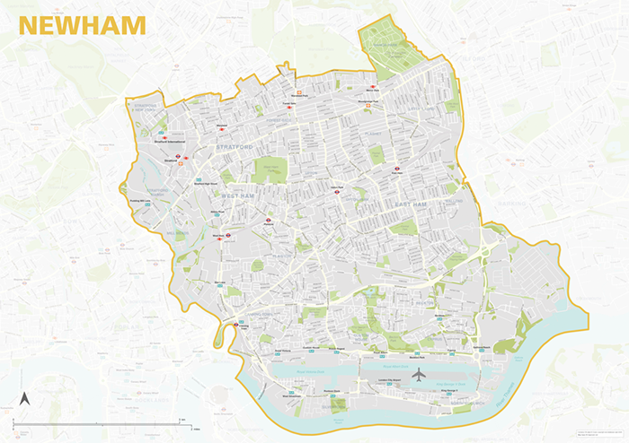
Newham – London borough map
£40.00Map of the London Borough of Newham, detailing the road and public transport network, as well as parks and other open areas. Designed for A1+ printing or editing for other uses.
PDFSVGLayered AI file -
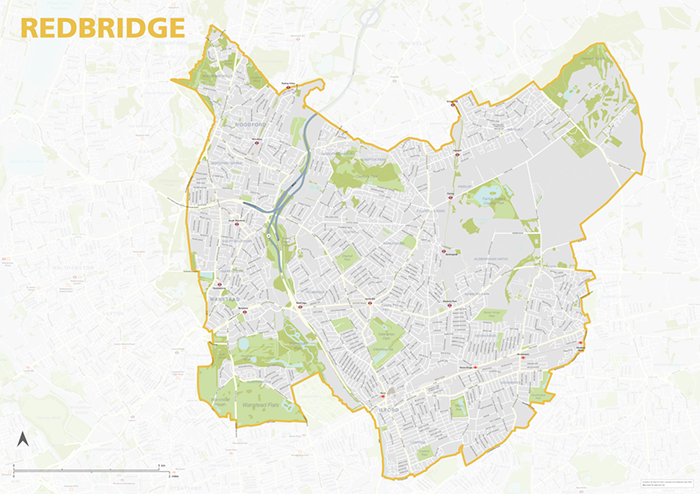
Redbridge – London borough map
£40.00Map of the London Borough of Redbridge, detailing the road and public transport network, as well as parks and other open areas. Designed for A1+ printing or editing for other uses.
PDFSVGLayered AI file -
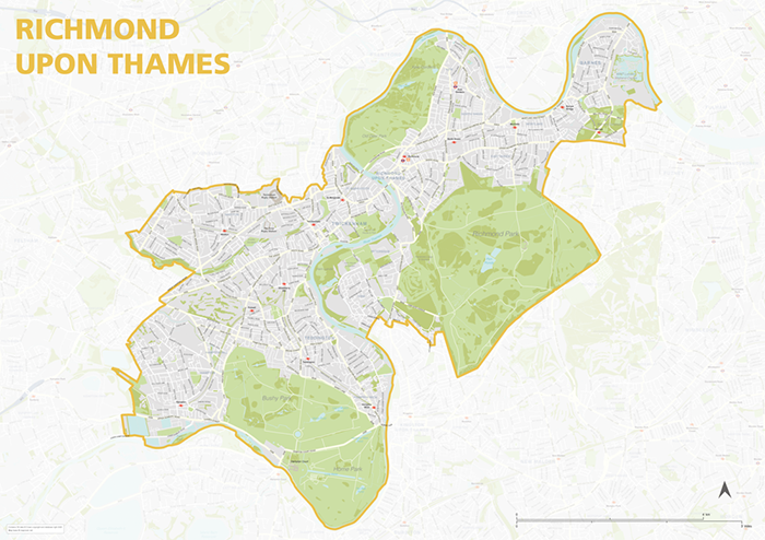
Richmond upon Thames – London borough map
£40.00Map of the London Borough of Richmond upon Thames, detailing the road and public transport network, as well as parks and other open areas. Designed for A1+ printing or editing for other uses.
PDFSVGLayered AI file -
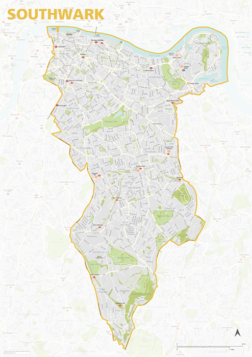
Southwark – London borough map
£40.00Map of the London Borough of Southwark, detailing the road and public transport network, as well as parks and other open areas. Designed for A1+ printing or editing for other uses.
PDFSVGLayered AI file -
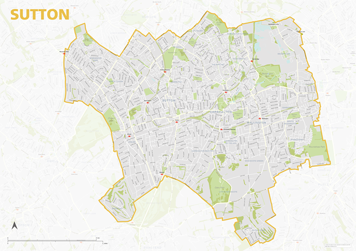
Sutton – London borough map
£40.00Map of the London Borough of Sutton, detailing the road and public transport network, as well as parks and other open areas. Designed for A1+ printing or editing for other uses.
PDFSVGLayered AI file -
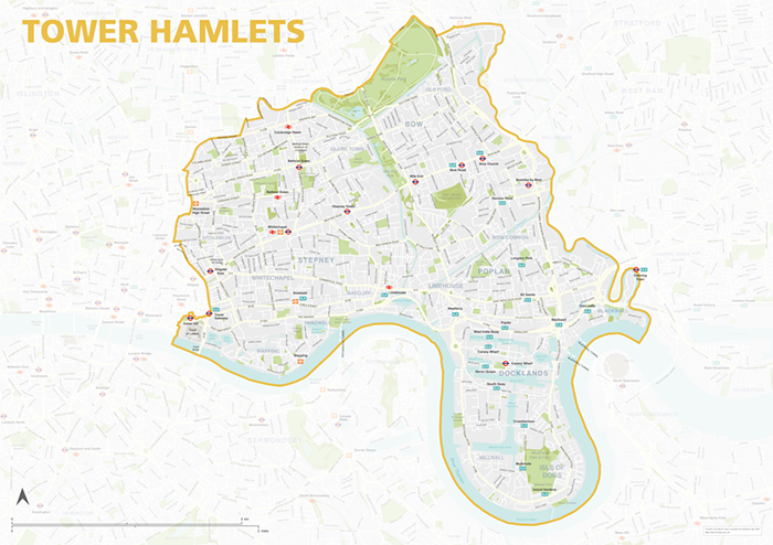
Tower Hamlets – London borough map
£40.00Map of the London Borough of Tower Hamlets, detailing the road and public transport network, as well as parks and other open areas. Designed for A1+ printing or editing for other uses.
PDFSVGLayered AI file -
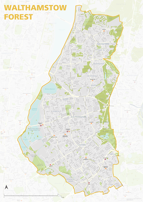
Waltham Forest – London borough map
£40.00Map of the London Borough of Tower Hamlets, detailing the road and public transport network, as well as parks and other open areas. Designed for A1+ printing or editing for other uses.
PDFSVGLayered AI file -
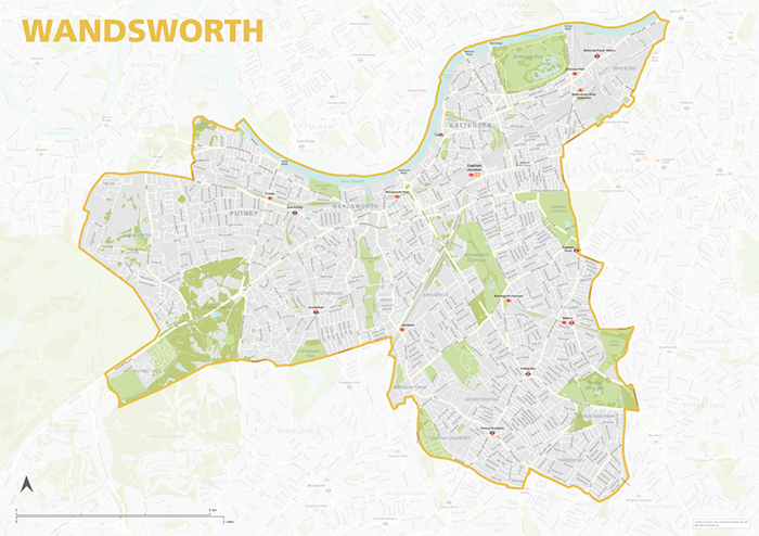
Wandsworth – London borough map
£40.00Map of the London Borough of Wandsworth, detailing the road and public transport network, as well as parks and other open areas. Designed for A1+ printing or editing for other uses.
PDFSVGLayered AI file -
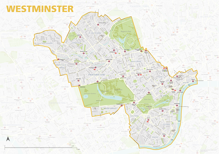
Westminster – London borough map
£40.00Map of the London Borough of Westminster, detailing the road and public transport network, as well as parks and other open areas. Designed for A1+ printing or editing for other uses.
PDFSVGLayered AI file