City of London – borough style map
Downloadable royalty free vector artwork High-resolution PDFSVGLayered Adobe Illustrator file Bundled with 7-Day Pass for Dynamic Mapping Suite iPrice £40.00
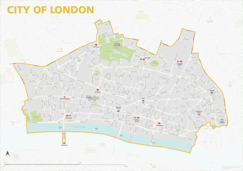
The City of London map focuses on this local authority district in London. It is one of 33 local authority districts in London that make up the full administrative area of Greater London. Our maps of these boroughs can be purchased individually or as an entire set of 33 maps.
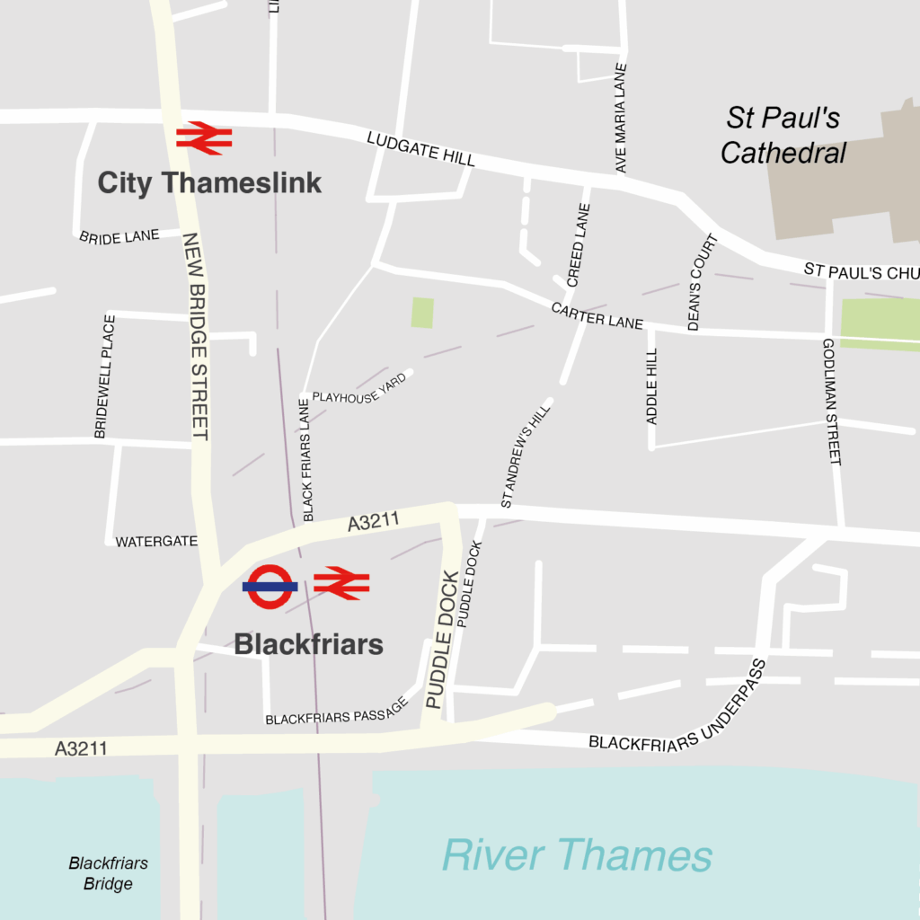
The City of London map includes the full road network, the railway lines, and all underground and overground stations. All primary, secondary and minor roads are labelled, as well as the majority of local roads. Prominent open areas, such as park squares and gardens, are also shown and labelled, as is the Thames river. The road network, stations and labelling in the neighbouring boroughs is included, but knocked back behind a semi opaque layer to more clearly focus on just the City of London. Like any other layer, this can be altered or removed entirely when using the editable versions of the map (see below).
The map is offered in a print-ready format (A1 or larger is recommended), if you are looking for a high-quality print of the City of London, and a layered vector file format, suitable for a wide variety of uses in graphic design, marketing, planning and other applications where a bespoke map is required.
The product bundle includes a print-ready high-resolution PDF scaled for A1+ format printing, with the smallest labels legible when printed at A1 or bigger.
Also in the bundle are Adobe Illustrator, SVG and layered PDF file formats suitable for editing in standard vector art software such as Illustrator (see how to edit).
Furthermore, this great value bundle comes with a Limited Free Pass for Maproom’s Dynamic Mapping Suite, which contains online maps and mapping tools. This is a separate system in which you can plot your own locations of interest and feed data dynamically to the City of London, plus other boroughs, local government and postcode boundary maps.
Specifications
Price £40.00
Product code: MR325
Licensing terms
This editable map base is suitable for commercial and professional uses
See standard royalty free terms for downloadable maps
How to edit
Adobe Illustrator, CorelDRAW, PDF editors etc
See how to edit the downloadable maps
Recommended scaling
A1 or bigger for road labels legibility
For more guidance see scaling recommendations
Access to Dynamic Mapping Suite
A 7-Day Full Pass for the Dynamic Mapping Suite is bundled with this map. The Dynamic Mapping Suite is a separate system that includes a set of online mapping tools geared to visualising data for UK administrative areas.
Vector map layers in Illustrator