Maproom

Editable & interactive digital maps

MENUMENU
  • about
  • news & blog
  • contact
  • 0 items
LOGIN
    • Home
  • Britain & Ireland maps
    • Britain and Ireland
    • UK - United Kingdom
    • Ireland
    • England
    • Scotland
    • Wales
    • Northern Ireland
    • Isle of Man
    • Channel Islands
  • City maps
    • Birmingham
    • Brighton
    • Bristol
    • Cardiff
    • Edinburgh
    • Exeter
    • Glasgow
    • Liverpool
    • London
    • Manchester
    • Oxford
  • Postcode maps
    • Overview
    • Online postcode mapping tools
    • Downloadable postcode maps
  • Region maps
    • Region maps
    • County maps
    • Local authority maps
    • Transport maps
    • National park maps
  • World maps
    • World maps
    • Europe maps
    • Map of EU countries 2024
    • Maps of France
    • Maps of Germany
    • Maps of New York and environs
  • DYNAMIC
    • Showcase
    • Dynamic Mapping Suite information and demos
    • GET A PASS
  • BESPOKE
    • Bespoke mapping services
    • Bespoke static maps
    • Bespoke dynamic maps
    • Search

Mapping the Elizabeth Line

14 July 2022
Filed Under: Maproom News

We were surprised to be contacted by quite a few people requesting a map showing the Elizabeth Line in geographical context. Like all of the UK’s official free rail maps, Transport for London’s map of the Elizabeth Line, available here, is meant for schematic visual clarity in route planning. It doesn’t attempt to show distances or other geospatial relationship. However, for town planners, property developers, marketeers and numerous other businesspeople and public sector organisations, it is useful to see the fuller picture of the Elizabeth Line. We have made the map for such people, and we have made it editable (ideally with Adobe Illustrator) and royalty free to use.

Purchase the new map on this product page: Elizabeth Line map with rail and road networks.
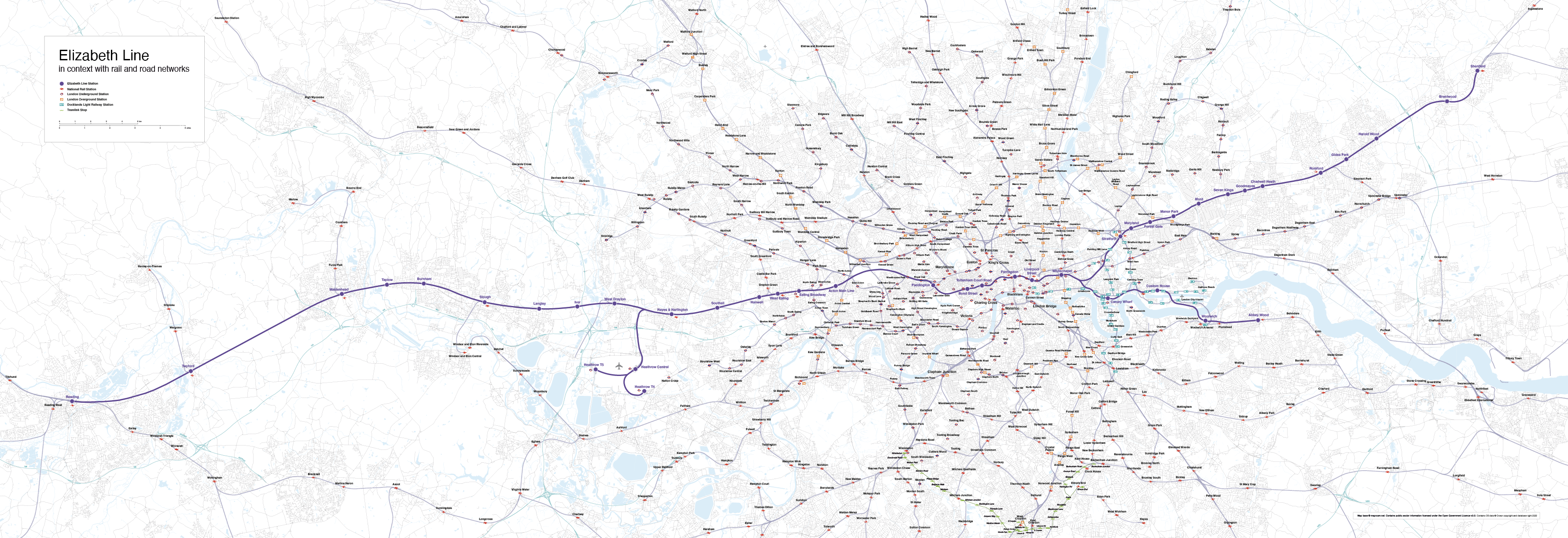
Elizabeth Line map with rail and road networks low-resolution preview
Preview image of our Elizabeth Line map showing geographical context all the way from Reading in the west to Shenfield in the east
  • Standard royalty free terms for downloadable maps
  • Licensing terms for downloadable postcode maps
  • Licensing terms for dynamic online maps
  • How to edit the downloadable maps
  • Pricing & refund policies
  • Privacy & cookies

All content © Maproom at Blue Island Media · Award winning media projects