Showing the single result
-
Bristol Street Maps
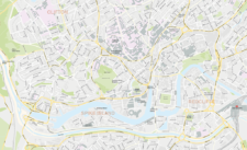
£60.00These editable street maps of Bristol and environs are for professional and commercial uses. All of Bristol’s roads, buildings, rivers, parks and transport hubs are plotted in detail. The wealth of detail extends out to Avonmouth and Bristol Airport.
PDFsSVGLayered AI file