Showing all 4 results
-
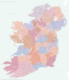
Best detailed map of Ireland
£70.00Approximately 1,400 towns and villages, 17,000+ roads, all the counties and a huge wealth of coastal detail, rivers, urban backdrop and green areas are plotted on our most detailed map of Ireland.
PDFsSVGLayered AI file -
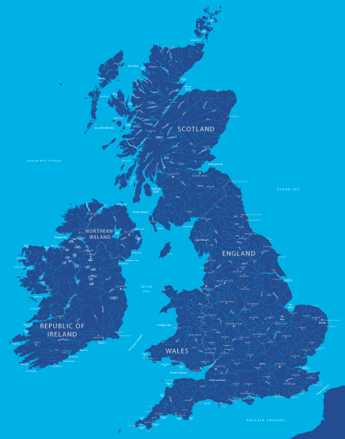
Map of British and Irish rivers and lakes
£20.00Hundreds of lakes and rivers, plus coastal features. Good for educational materials and water-activity themes.
PDFsSVGLayered AI file -
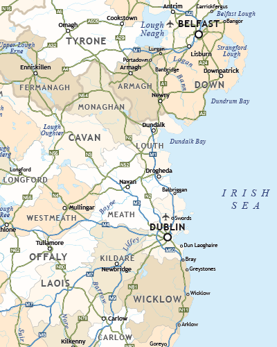
Political map of Ireland
£40.00Shows all the counties plus the principal towns and transport systems across both the Republic of Ireland and Northern Ireland.
PDFsSVGLayered AI file -

Touring / physical map of Britain and Ireland (low-resolution)
£30.00Perfect for tourist industry projects with its coastal features, lakes, rivers, national parks, historic towns and resorts.
PDFsSVGLayered AI file