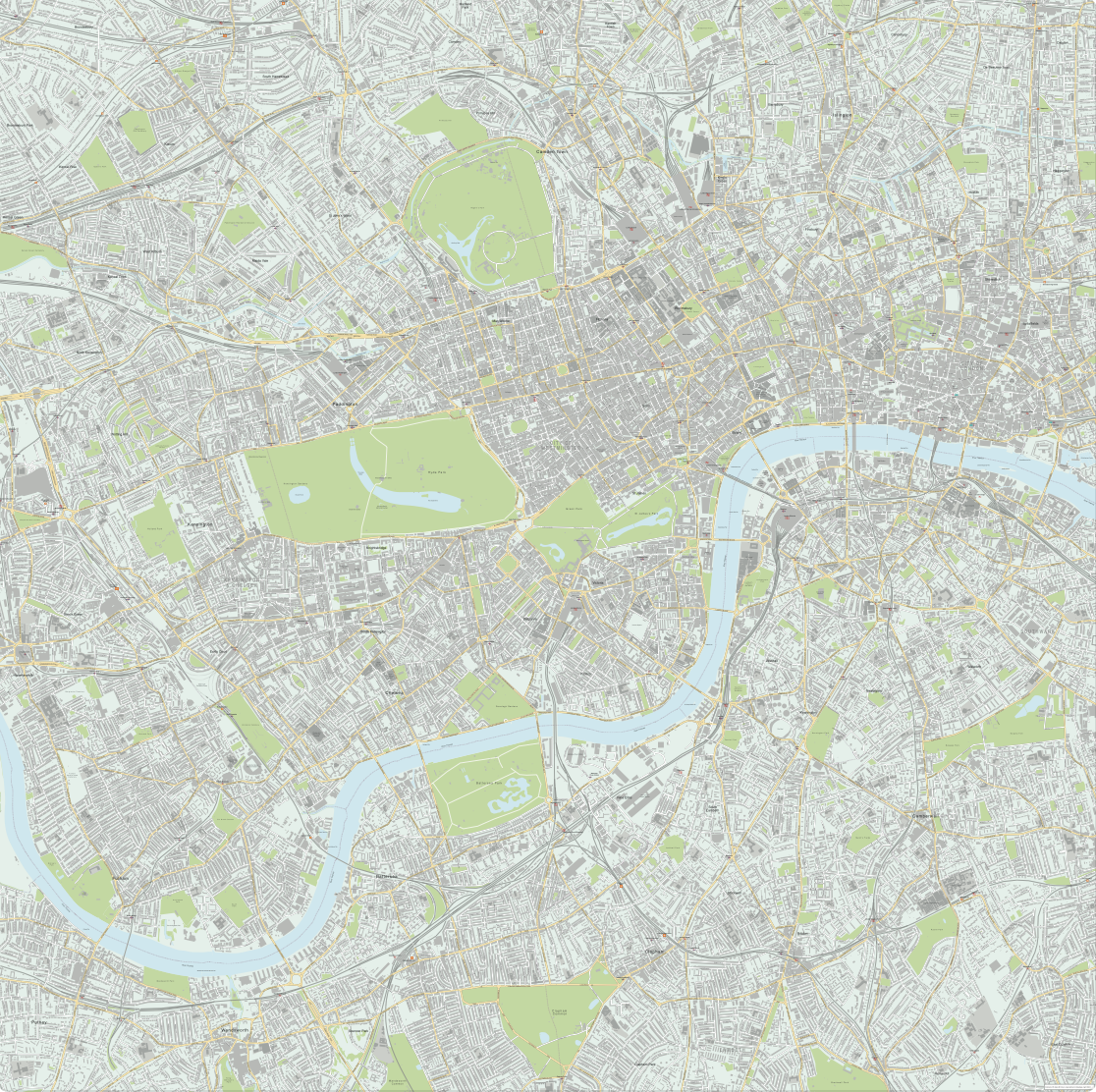
Central London detailed street map
Downloadable royalty free vector artwork High-resolution PDFsSVGLayered Adobe Illustrator filePrice £75.00
This professional vector street map of central London is perfect for graphic designers and cartographers working in Adobe Illustrator or SVG software. Example PDFs with different styling, as shown in the zoom examples, are included in the download bundle and can be used royalty-free as they are by non-designers.
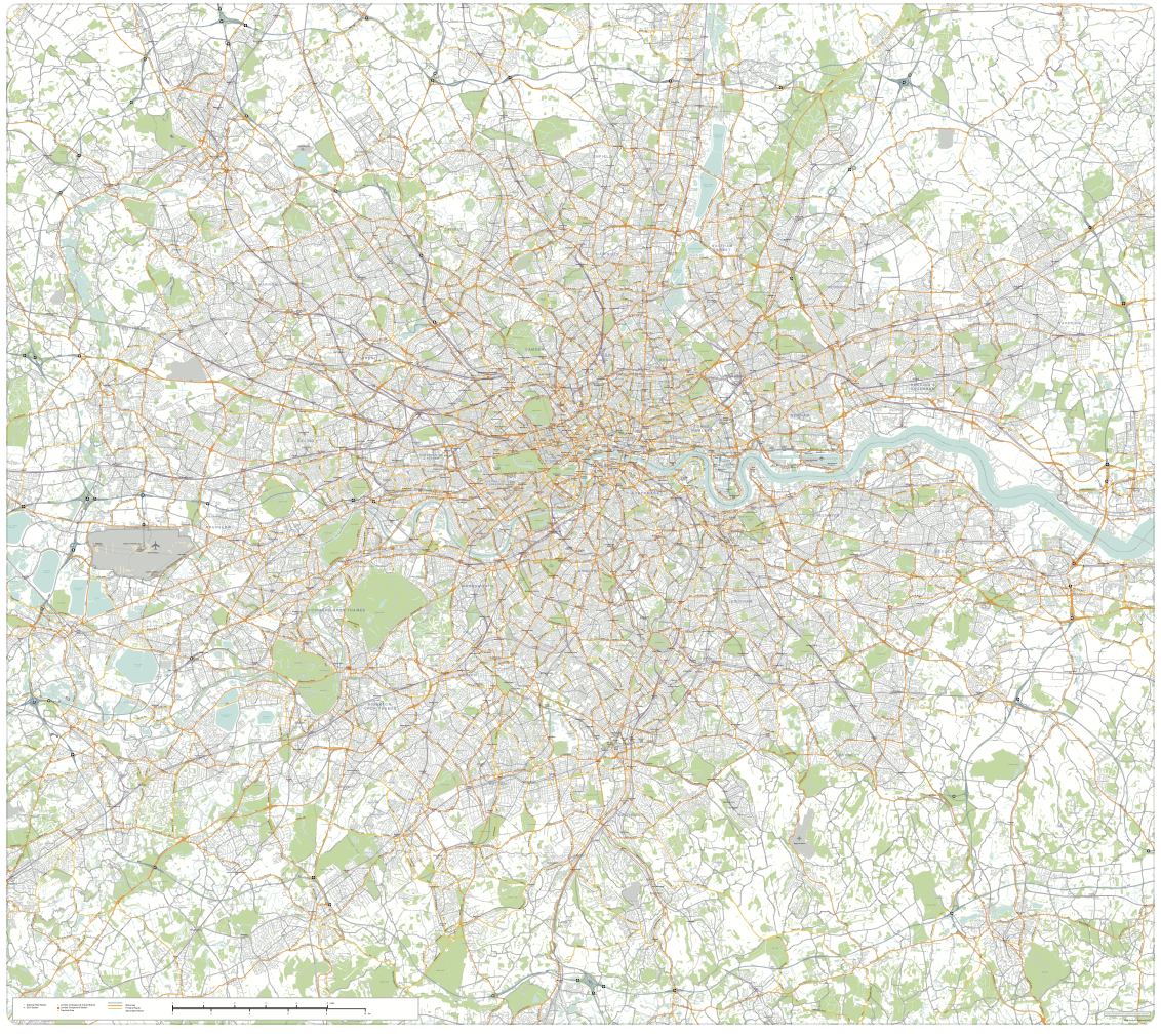
The detailed London street map covers a square area of London stretching from Hammersmith in the west to Aldgate in the east, and Highbury in the north to Clapham in the south. The map base includes building shapes and all of central London’s roads plotted and labelled with live text.
There is superb detail including urban shading, prominent institutions, railway lines and garden areas. Tube stations, National Rail stations, Overground stations, river piers, borough boundaries, parks, major landmarks and water features are all plotted and labelled. Every individual element is editable on the Illustrator file so you can change colours, move the position of labels, delete features you don’t want, and add your own landmarks to tailor this base map of London for your own project.
All the labels can be easily edited and substituted with changes of font, text size and case, and the colouring of all elements can be changed with a few clicks.
Please note that there is so much detail on this map that you need to use it at poster size, tiled over several pages or zoom into areas of it in order for the road names and landmark labels to be legible. The map is nominally a huge 166cm x 166cm at 100% in its opening state, with more than half a million anchor points. This is about as much detail for a city map that can be handled in a single file in vector editing software such as Adobe Illustrator. The smallest text is legible from 100% upwards at this scale.
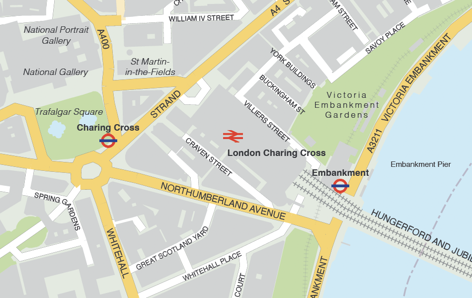
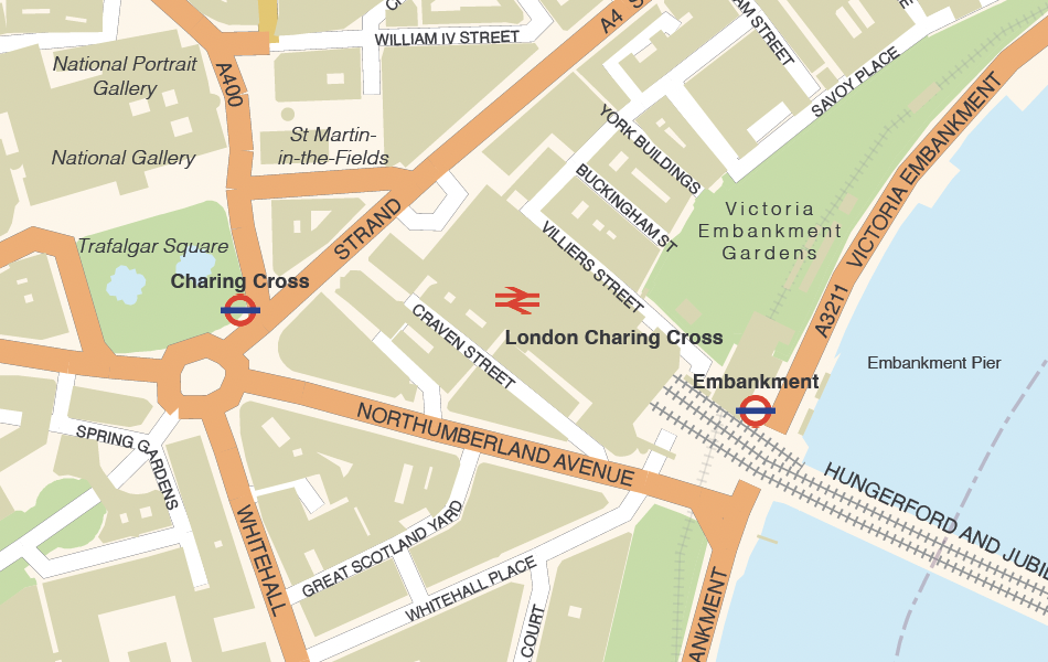
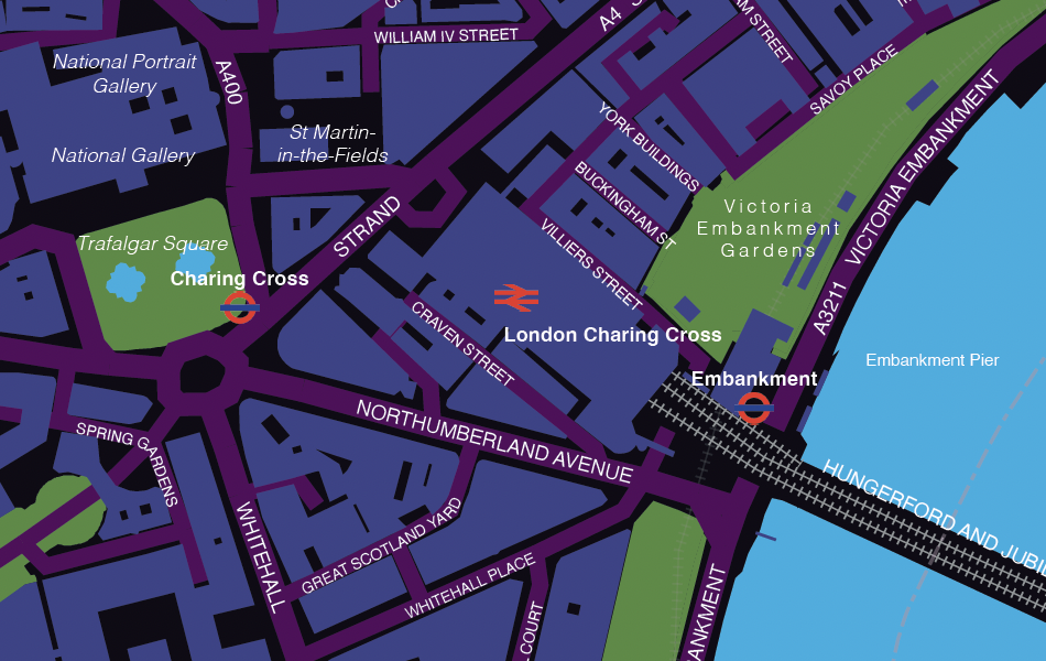
4 sample styles
Using Illustrator, the map can be rapidly styled in different colours and fonts for different layers. Four styling versions are included as high-resolution layered PDFs in the package. These can be used as they are, or as the starting point for further changes. The tiny detail of Charing Cross is shown below in the four sample styles.
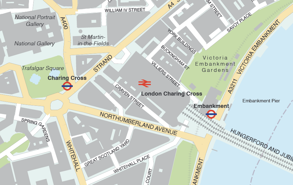
Full zoomable watermarked preview of version 1
Full zoomable watermarked preview of version 2
Full zoomable watermarked preview of version 3
Full zoomable watermarked preview of version 4
Our London street map base includes Ordnance Survey data for accurately plotted roads and buildings, and the OS Crown copyright notice must be retained on final output. The OS copyright notice is found in the bottom right corner of the map in its opening state, although it can be moved and restyled.
Alternative London maps
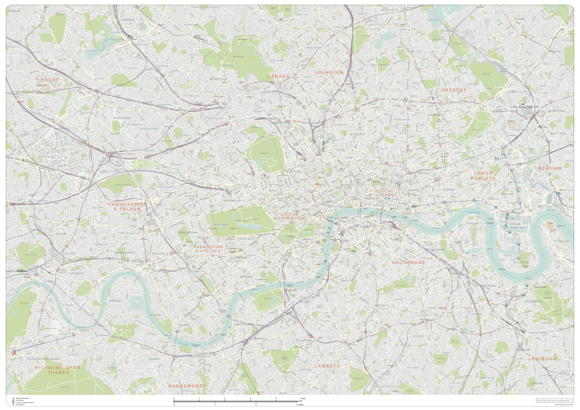
If you require a larger area of London, look at our Greater London detailed map with all roads, transport, institutions, green areas. Or if you don’t need all the road detail, check other maps of London, or contact us if you want a bespoke base map for any part of London.
Specifications
Licensing terms
This editable map base is suitable for commercial and professional uses
See standard royalty free terms for downloadable maps
How to edit
Adobe Illustrator, CorelDRAW, PDF editors etc
See how to edit the downloadable maps
Recommended scaling
PDF, poster, tiled or zoomed areas
For more guidance see scaling recommendations
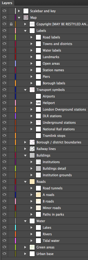
Vector map layers in Illustrator
You may also like…
-
Greater London detailed map with all roads, transport, institutions, green areas
£150.00Detailed vector map of the whole of Greater London – all roads, stations, airports, rivers, green areas. A fantastic resource for professional designers and commercial projects. Provided in 2 versions for different scaling needs.
PDFsSVGLayered AI file -
London map with roads, buildings, districts, boroughs, transport, landmarks
£100.00A superb general purpose editable map of London, with a wealth of detail including buildings, roads, railway lines, train stations, borough boundaries, rivers, canals, parks and landmarks
PDFsLayered AI file