See our showcase of dynamic, interactive online maps for more about this type of route map that we can build for you.
Brilliant new tools including 3d maps, multiple radii, drawing tools and Live Views for the Dynamic Mapping Suite

Hugely upgraded Locations Plotter!
- Bulk plotting for postcodes and general addresses
- Multiple radii
- Drawing tools
- Colour and category filters
- Bulk editing screen
- Spreadsheet import, update and export
- Population and household calculations
- 3d base map options
- Add images and links to popups
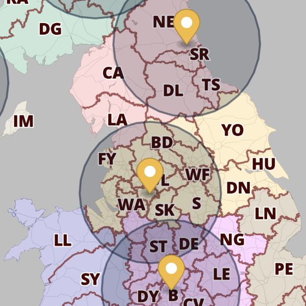
New in Quick Select Postcodes
- Now includes Sector colouring and labelling!
- Overlay markers and multiple radii
- Live View with interactive key and fly-tos
- Population and household calculations
- Spreadsheet import
Also new – Live Views for the Locations Plotter and Quick Select Postcodes can be shared with password protection.
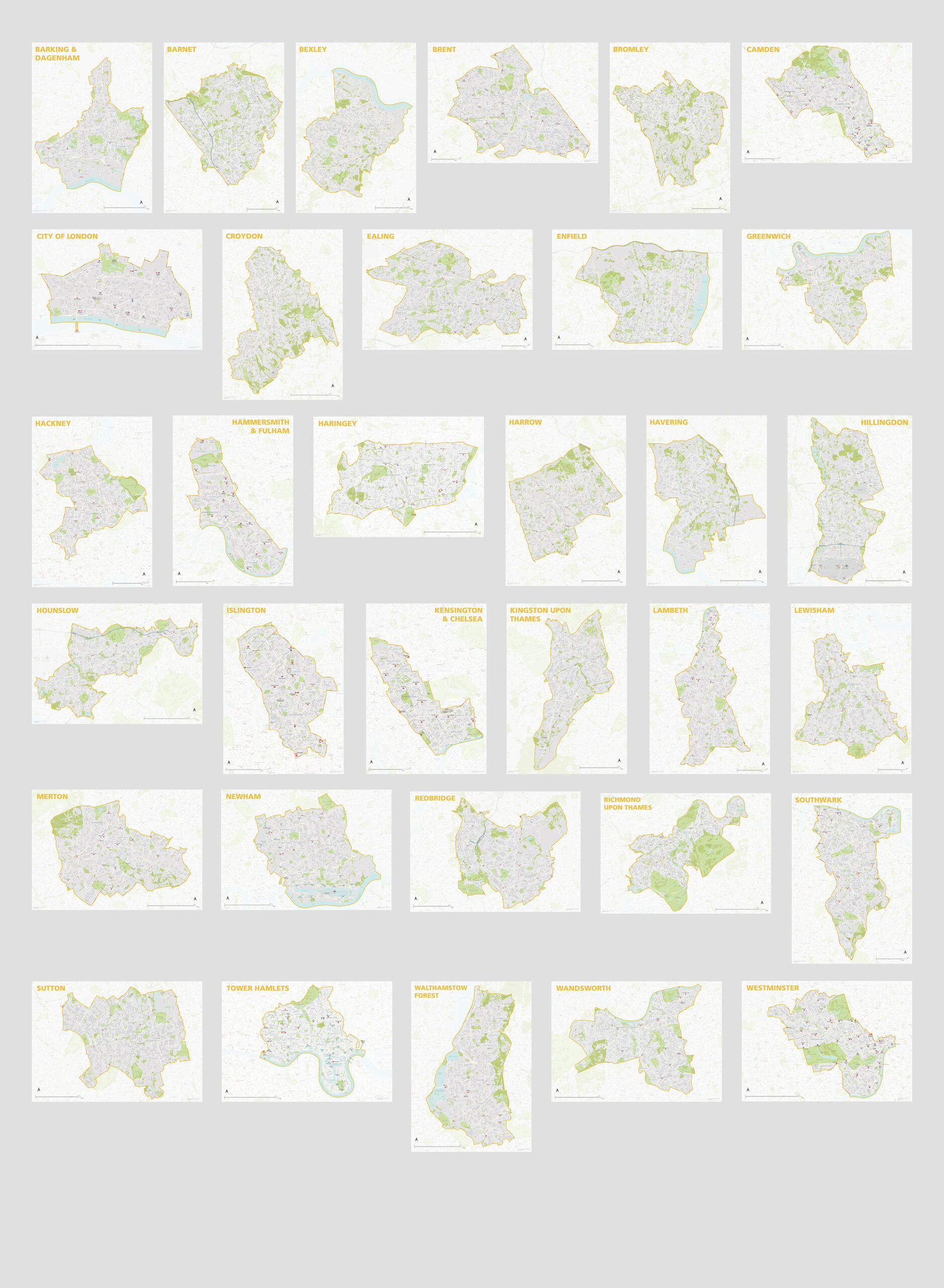
Full series of London borough maps now available
All 33 London borough maps are now available individually or in a discounted bundle set. Scaled for legibility at A1, they show a wealth of detail and isolate the shape of each borough with a semi-transparent mask. Supplied in PDF, SVG and Adobe Illustrator formats, they are perfect for use as they are, or for graphic designers to edit.
Greater London map used in Silent Witness
We were pleased to see Maproom’s Greater London map base put to good use within this week’s episode of Silent Witness. (All of our downloadable maps can be used for set dressing and TV graphics.) Here, the fictional pathologists are plotting points and trails in Southeast London to help catch a serial killer.

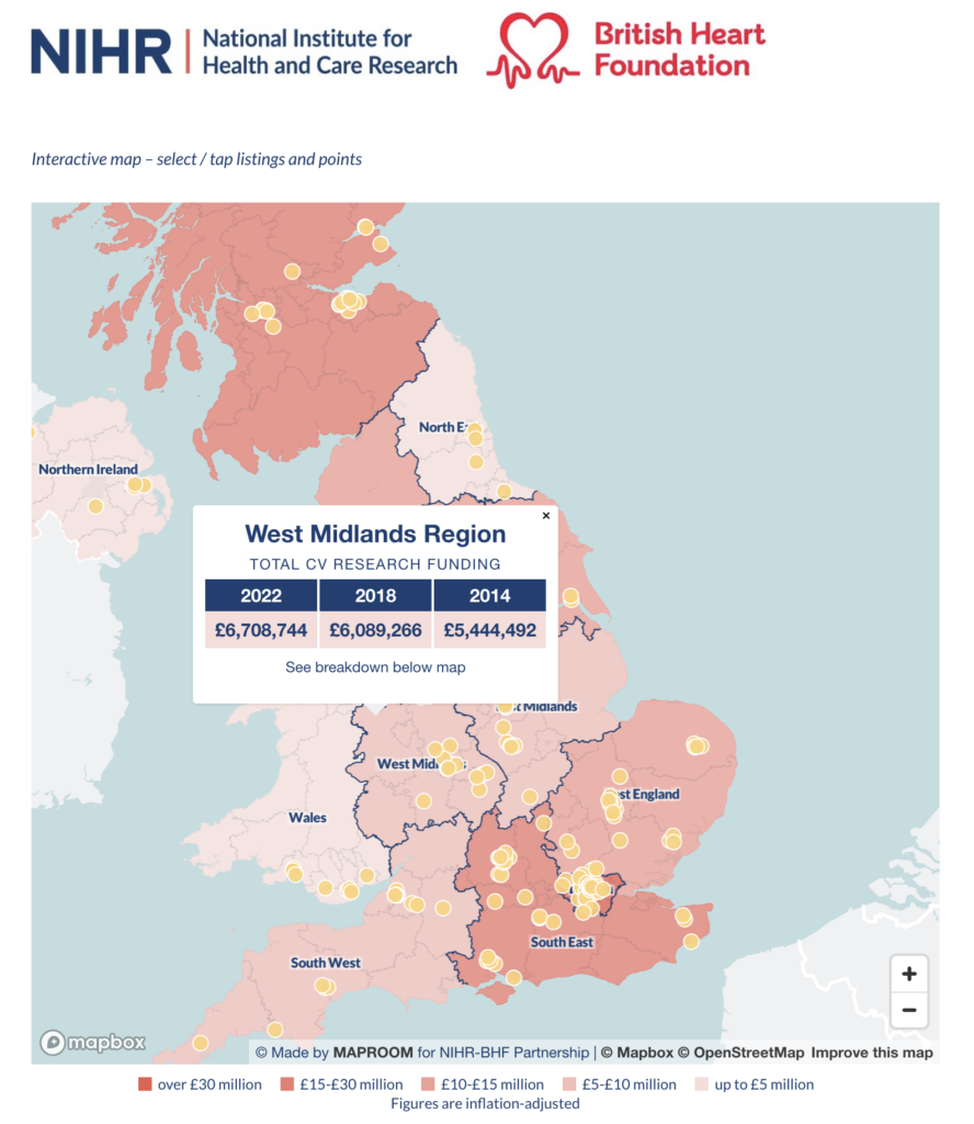
Interactive cardiovascular research maps for British Heart Foundation and NIHR
We are delighted to publish two bespoke interactive maps for the NIHR-British Heart Foundation Partnership, which show the funding regions and member centres for millions of pounds worth of cardiovascular research in the UK. The maps took several months to compile data for and programmed as native embeds on the Oxford Biomedical Research Centre website.
A to B driving route plotter added to our dynamic online Clean Air Zones map
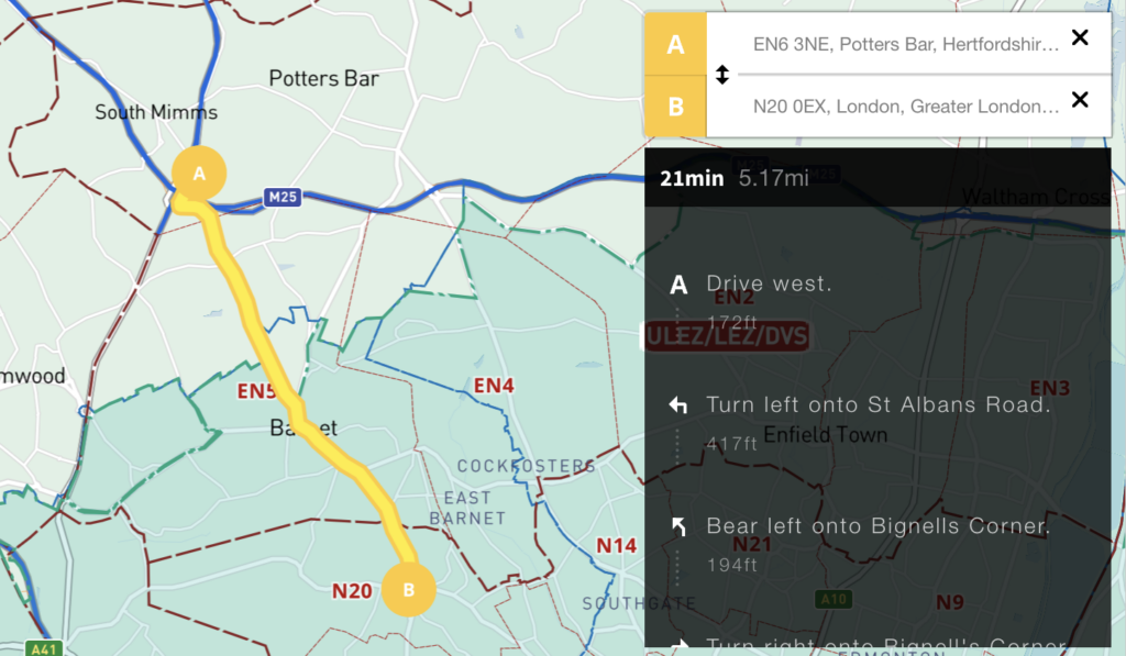
We’ve added an auto-calculating A to B driving route plotter with directions for businesses that need to calculate service charge areas and delivery routes in and around the UK’s Low Emission Zones. See at a glance if your customer’s postcode is in a Low Emission Zone and / or if your route takes you into Greater London’s ULEZ or 13 other Low Emission Zones around UK cities.
For more information and access to this map see Clean Air Zones / ULEZ / Low Emission / Congestion Charge + postcodes + live traffic interactive map