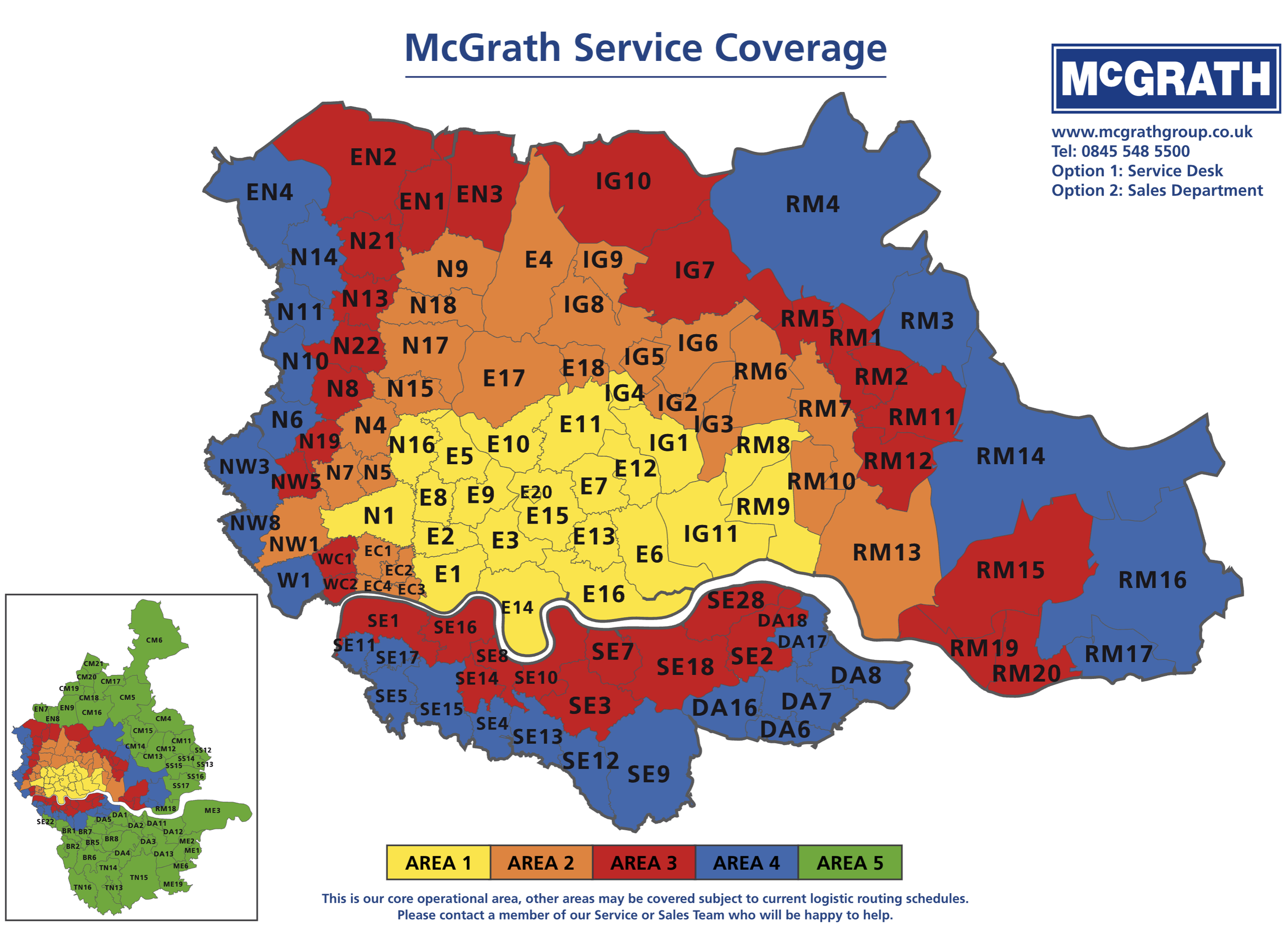
Schematic postcode zones reference for the McGrath Group.

Interactive & editable digital maps
Schematic postcode zones reference for the McGrath Group.
Another postcodes example, this one styled up for CPA Horticulture with national coverage and scaled for A0 poster printing.
The marketing company for commodities company ED&F Man needed our assistance when asked to include a map showing multiple overlapping transportation zones radiating from the ports at Liverpool, Avonmouth, Hull and Grangemouth.
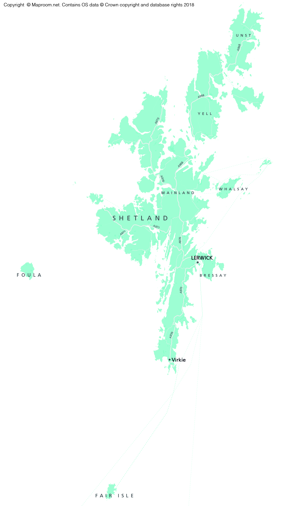
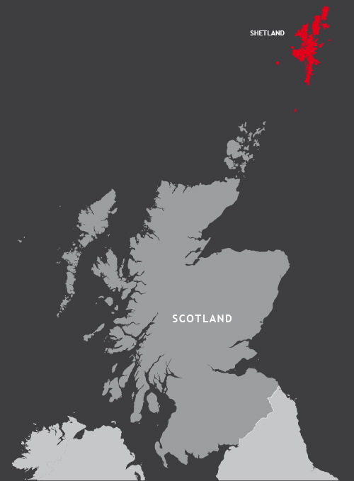
Today a new law brought by the Islands (Scotland) Bill has come into force to ban public bodies from using maps that display Shetland in a box rather than in its natural geographic position 150 miles north of the Scottish mainland.
The BBC article about the law, instigated by Islands Lib Dem MSP Tavish Scott and supported by many who live on the Shetland Islands, uses a version of Maproom’s Outline Map of Scotland to illustrate the news item. Now, whilst we are delighted to spot one of our maps getting a lot of attention, we want to point out that this map and most of our other Scotland and UK maps have always offered designers the option on whether to show Scotland in its accurate geographical position or in an inset box.

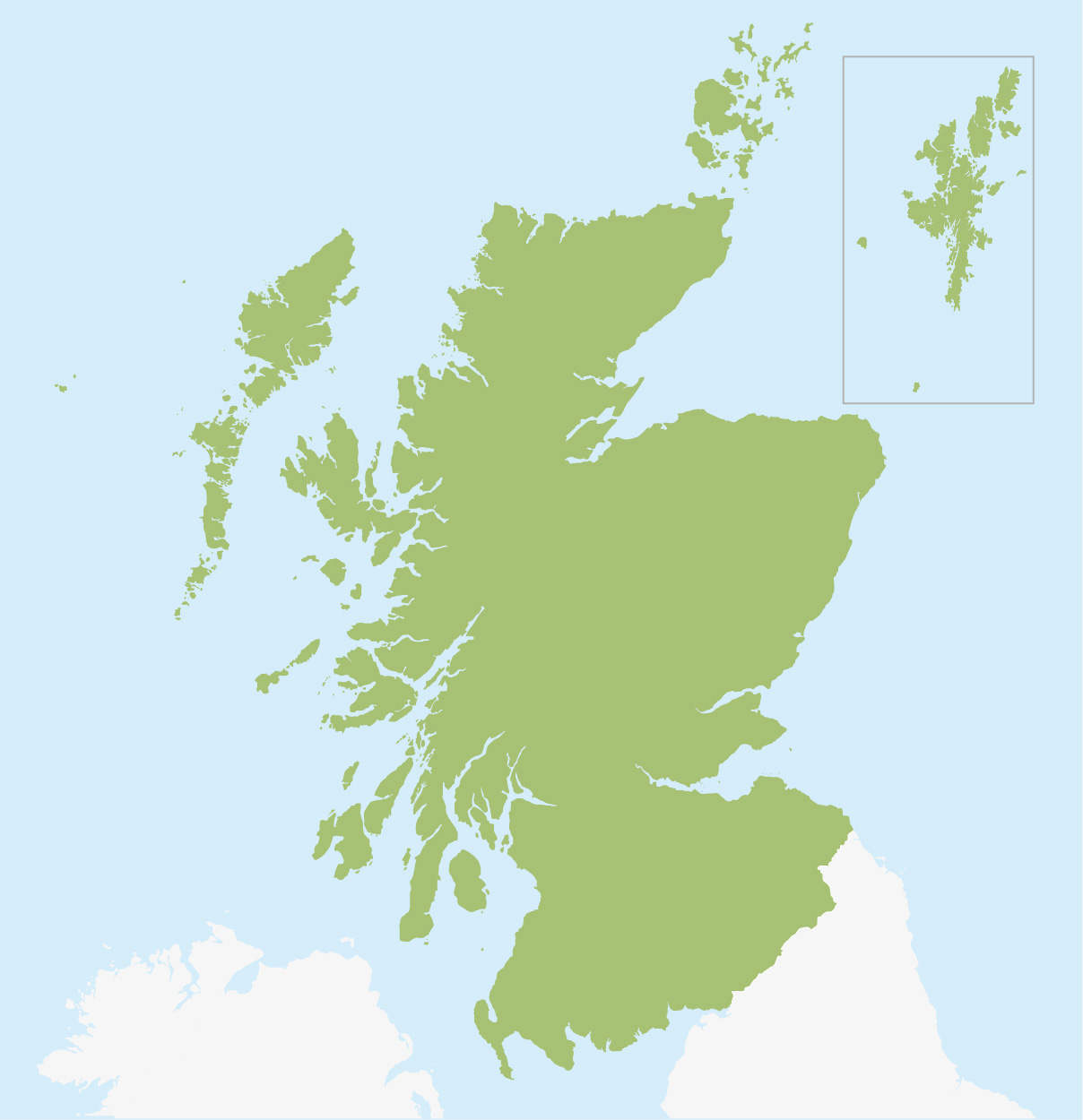
With a Maproom map you will usually find Shetland in its natural geographic position on the first artboard of the Illustrator file. Use this version if you want or need to. Then again, that’s a lot of empty sea top left that designers may find themselves itching to fill or crop out.
On the same Maproom base map file you will also often find a smaller artboard and easy select layer option for Shetland in an inset box. That’s going to be an easier scale and layout for many graphics projects. If working in Adobe Illustrator, you can turn on the Scotland inset with one click of a button. BUT THIS LAYOUT IS NO LONGER ALLOWED IF YOU ARE WORKING ON AN OFFICIAL DOCUMENT FOR A PUBLIC BODY.
On the one hand, we understand the annoyance felt by the 23,000+ inhabitants of Shetland when their islands are completely left off maps of Britain. Orkney and Na h-Eileanan Siar (the Outer Hebrides) are often left off too. We’ve seen maps that even leave off Skye and Mull. In fact, the main aim of the islanders in bringing this mapping requirement is specifically to show the remoteness of Shetland, which poses great challenges in transportation, communications and other aspects of the local economy.
On the other hand, the omission of Shetland from many maps is not surprising, not only because of its far distant location and the visual problems this poses for designers, but also because any graphic designer drawing up a map of the UK from scratch will find it takes 50 times as long to draw all those Scottish islands and serrated mainland coastline as it takes to draw an outline of England. Oh, the temptation to draw a solid blob for Shetland rather than its four main islands, 12 other inhabited islands and more than 250 smaller islands! Save yourself days of effort and buy one of our Scotland, UK or British Isles maps.
For customers who are required to abide by this directive, the Islands (Scotland) Act 2018 is available in full here. Section 17 is the relevant part and the wording is as follows:
(1) There is to be a Shetland mapping requirement.
(2) When publishing in any form a document that includes a map of Scotland, the Scottish Ministers, a local authority and any other Scottish public authority with mixed functions or no reserved functions must—
(a) comply with the Shetland mapping requirement, or
(b) where Ministers or, as the case may be, the authority consider that there are reasons not to comply, provide in such manner as they consider appropriate, information about those reasons.
(3) The Shetland mapping requirement is that, in any map of Scotland, the Shetland Islands must be displayed in a manner that accurately and proportionately represents their geographical location in relation to the rest of Scotland.
Maproom will be producing a special edition base map for official maps of Scotland with Shetland, plus secondary locator insets for all UK maps with a Shetland box option in due course. Please contact [email protected] if you require this urgently or if you have any requests for the mapping of Shetland and other Scottish islands.
Maproom maps are popular with TV production companies, and we were pleased to spot our London Street Map being used to good effect in the new BBC series Bodyguard last night.
Our map appears in a scene in which actor Gina McKee, playing Commander Anne Sampson of the Metropolitan Police’s Counter Terrorism Command, has a team tracking a terrorist cell online whilst police race through South London to try to stop the terrorists reaching a school.


The production team used one of our base map versions then added some moving coloured dots to signify the police car and terrorists’ van moving down Brixton Road.
The Bodyguard series is so far displaying itself a tightly woven fiction using many real locations, real BBC newscasters, and plausible events that echo the kind of real terrorist attacks we’ve experienced in the UK over the past decade. The tension ratcheting up in the first 20 minutes of Episode 1 made for compelling viewing, and we look forward to the rest of the series. We are hoping for further sightings of Maproom maps.

Maproom’s standard royalty free terms and conditions cover TV graphics, and we are generally able to sign release forms for specified TV and film titles at modest extra cost for administration time. Contact us if you want to commission a specific map base or need further guidance.
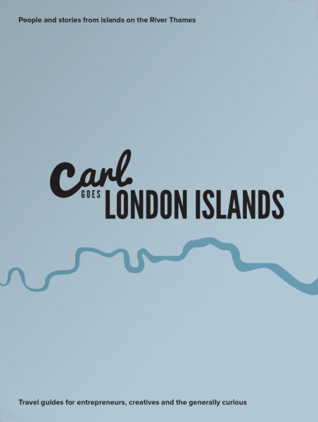
Maproom recently had the pleasure of providing map bases for a delightful new travel guide in the creative and distinctive Carl Goes series. The book, called Carl Goes London Islands, tells stories of the islands and islanders of the River Thames.
With Maproom’s parent company being Thameside Media, the River Thames is close to our studio literally and in our hearts. Not only that, we also have a special interest in travel guides, having published many ourselves over two decades (though never specifically for the Thames). Thus we were delighted to oblige when Sascha Mengerink, the Netherlands-based publisher of the Carl Goes series, asked Maproom if we could provide detailed map bases of the Thames Valley showing all the islands set within the River Thames between the mouth of the river at Canvey Island in Essex upriver through central London to the tiny eyots and aits in the Thames in Surrey and Berkshire. We were able to oblige with map bases using Ordnance Survey open data showing most of these small parcels of land overlooked by most other maps.

We were also excited to be invited to the book launch for Carl Goes London Islands, which was held – perfectly aptly – at the artists’ haunt of Eel Pie Island in the Thames by Twickenham. We met Sasha Arms, the affable, Esher-based author of Carl Goes London Islands, at the Open Day event, for which the artists based on Eel Pie Island welcome the public to visit their studios and purchase original artworks direct from source.
For Carl Goes London Islands, Sasha Arms spent months researching 65 islands along the River Thames. Many Londoners don’t know the islands exist, let alone that a number of them are inhabited. Home to musicians, artists, entrepreneurs, film industry experts, sports stars, business people – and many normal families too – the communities on London’s islands share something incredible. London’s islanders all have an affinity with the water and the drive to undertake an unconventional path in life.

Life by the river is revealed from shacks to mansions, with the life of idyll contrasting with the practical drawbacks, which can include having to park a long way from your house and, of course, flooding.
The Maproom and Thameside Media directors were already familiar with the Thames islands closest to our studio. Raven’s Ait at Surbiton is a familiar events venue, though we didn’t know its full history as covered in the book. We have skiffed past Boyle Farm Island, Swan Island and the residential Thames Ditton Island many times. One of our clients lives on a houseboat at Ash Island, where we discussed her business whilst being gently rocked by passing vessels. But the other 60+ islands in the Thames were a revelation to us reading the book. Indeed, we know of no other travel guide that includes these islands. Even the metadata on the OS base map that Maproom supplied for Carl Goes did not name some of the smallest islands in the Thames, so it was down to the publishers to identify the names of all the islands covered in this book.

Carl Goes London Islands is the sixth book in the Carl Goes series, following on from guides to Amsterdam, Berlin, Kassel, Leipzig and London.
Maproom sells editable vector artwork base maps on royalty free terms for digital and publishing projects. If you can’t find a suitable map base in our online shop, contact us for a bespoke map quote. We can supply a detailed map of any part of the UK and many other countries.