
Maproom

Interactive & editable digital maps

  • about
  • news
  • contact
  • 0 items
Log in
  • Britain & Ireland maps
    • Britain and Ireland
    • Ireland
    • UK - United Kingdom
    • England
    • Scotland
    • Wales
    • Northern Ireland
    • Isle of Man
    • Channel Islands
  • City maps
    • Birmingham
    • Brighton
    • Bristol
    • Cardiff
    • Edinburgh
    • Exeter
    • Glasgow
    • Liverpool
    • London
    • Manchester
    • Oxford
  • Postcode maps
    • Overview
    • Dynamic postcode mapping tools
    • Downloadable postcode maps
  • Thematic maps
    • UK administrative regions
    • County maps
    • Local authority maps
    • London borough maps
    • River maps
    • National park maps
    • Transport maps
  • World maps
    • World maps
    • Europe maps
    • Map of EU countries 2026
    • Maps of France
    • Maps of Germany
    • Maps of New York and environs
  • DYNAMIC MAPPING
    • Showcase
    • Dynamic Mapping Suite intro
    • PRICING / GET A PASS
  • BESPOKE

The Dulwich Estate goes live with a public swipe-comparison map we built for them

Much of our interactive mapping work commissioned by clients is private – intended for an organisation’s internal use and therefore not available to show off as our work. However, one of the interactive maps we have built for The Dulwich Estate in south London is now displayed publicly on their website. A deep-zoom swipe map, it is intended to show thousands of Dulwich residents which properties and land is covered by The Dulwich Estate’s Scheme of Management. You can view the map embedded on their website here or the full-size version here.

The Dulwich Estate boundaries are based on historic mapping data which we had to examine in great detail, overlaying scans of old maps onto new digital ones. Swipe-comparison maps are a good solution when you want to compare historic with now. Another example is our Then and Now map of Whitechapel.
27 May 2022
Filed Under: Interactive Mapping, Mapping the Past, Maproom News

Dulwich Estate boundaries satellite/streets swipe map and localised search

Estate boundaries created from meticulous study of multiple historic maps georeferenced and overlaid onto modern digital maps. The horizontal swipe action lets the user compare the boundaries over both satellite and street map views with ease. The map is publicly accessible and used by Dulwich Estate residents and the local authorities as essential reference in planning works. Maproom has been able to help revise the boundaries from time to time when disputes over historic boundaries have arisen.

View full size map

Filed Under: Bespoke Mapping Samples, Interactive Mapping, Mapping the Past

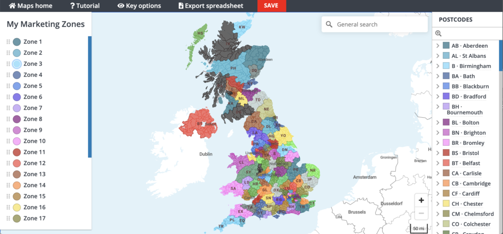
Try our new Quick Select online editing system to colour and caption postcode maps

If we hadn’t been so busy with the pandemic and Brexit-related work in 2020, we would have launched the new Quick Select editing system months ago! Anyhow, it’s finally landed – the ability to colour your postcode maps simply with point and click colouring. The system is available with a premium pass for our Dynamic Mapping Suite.

Go to the live demo of the Quick Select system to try out the tools.

Quick Select dynamic interactive postcode map colouring and labelling system

19 February 2021
Filed Under: Interactive Mapping, Maproom News

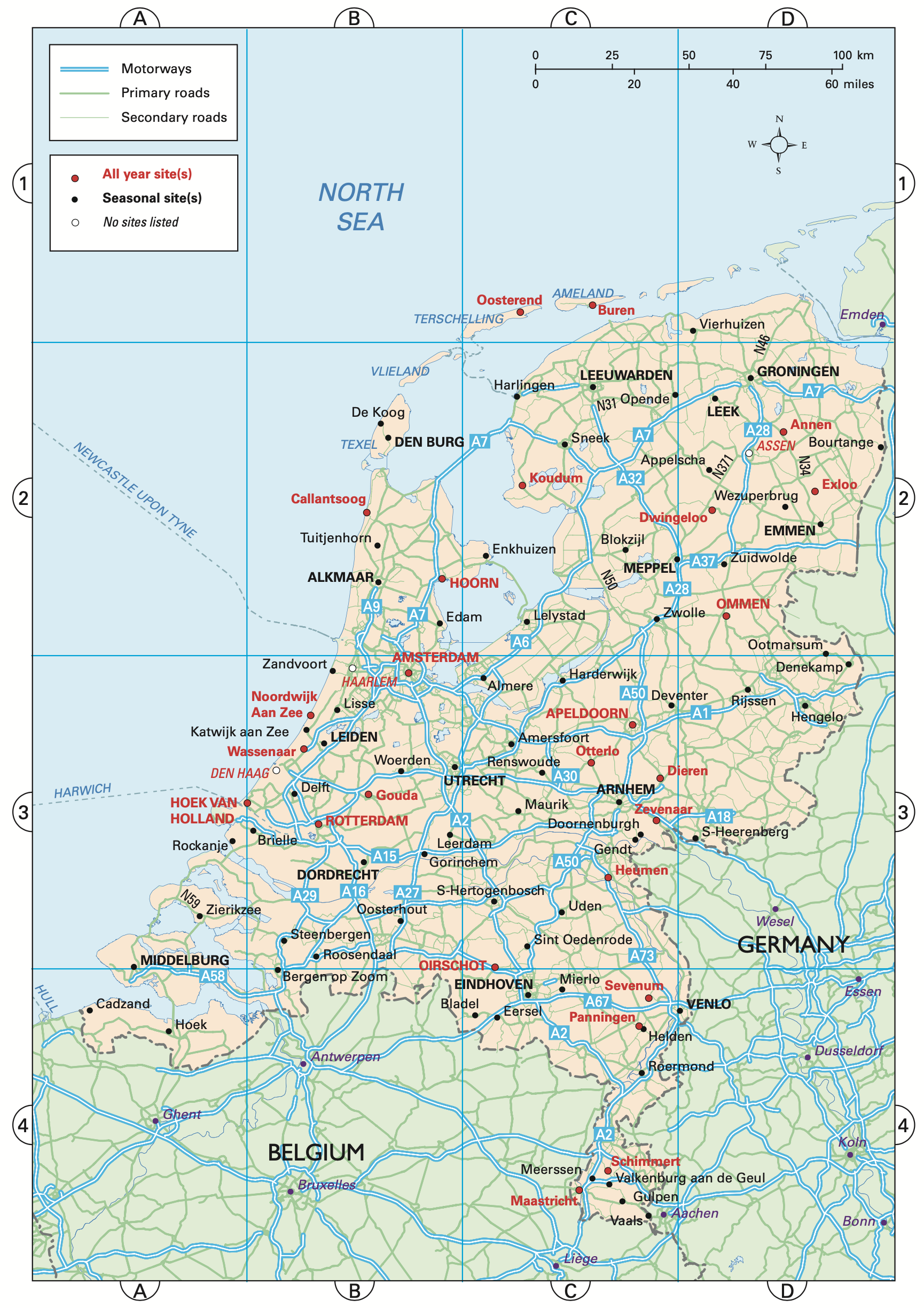
Map of the Netherlands for motoring guide to Europe

This map of the Netherlands is one of dozens of Europe maps we have updated for the Caravan and Motorhome Club’s Touring Europe directory, with over 3,200 campsites plotted across Europe.

Filed Under: Bespoke Mapping Samples, Travel Maps

New interactive online map published – Listed Buildings of Historic England

We’ve been busy in lockdown and built a wonderful interactive map of listed buildings in England.

The first thing we did after flowing in the data was to look up listed buildings in our own neighbourhood. What will you find in your own areas of interest?

Historic England listed buildings map preview

The map is a demo of how we can create a wonderfully detailed online map using a large dataset. Learn more

3 August 2020
Filed Under: Interactive Mapping, Maproom News

Irish in Britain heat map with constituency data

Data supplied by the Irish in Britain charity and fed to our 2024 constituencies dataset with switch between 2011 and 2021 census data built in. The map is embedded on the client’s website.

View full size map

Filed Under: Bespoke Mapping Samples, Interactive Mapping

« Previous Page
Next Page »
  • Standard royalty free terms for downloadable maps
  • How to edit the downloadable maps
  • Licensing terms for dynamic online maps
  • Refund, tax and pricing policies
  • How to cancel or change a subscription
  • Privacy & cookies

All content © Maproom at Blue Island Media · Award winning media projects