Maproom

Editable & interactive maps

MENUMENU
  • about
  • news
  • contact
  • 0 items
LOGIN
    • Home
  • Britain & Ireland maps
    • Britain and Ireland
    • UK - United Kingdom
    • Ireland
    • England
    • Scotland
    • Wales
    • Northern Ireland
    • Isle of Man
    • Channel Islands
  • City maps
    • Birmingham
    • Brighton
    • Bristol
    • Cardiff
    • Edinburgh
    • Glasgow
    • Liverpool
    • London
    • Manchester
    • Oxford
  • Postcode maps
    • Overview
    • Online postcode mapping tools
    • Downloadable postcode maps
  • Boundary & transport maps
    • Boundary and ONS maps
    • Local authority maps
    • County maps
    • Transport maps
  • World maps
    • World maps
    • Europe maps
    • Map of EU countries 2023
    • Maps of France
    • Maps of Germany
    • Maps of New York and environs
  • DYNAMIC
    • Showcase
    • Dynamic Mapping Suite information and demos
    • GET A PASS
  • BESPOKE
    • Bespoke mapping services
    • Bespoke static maps
    • Bespoke dynamic maps
    • Search

Interactive Web Maps

Showing all 12 results

  • Aberdeen Low Emission Zone LEZ map + AB postcode boundaries interactive map preview

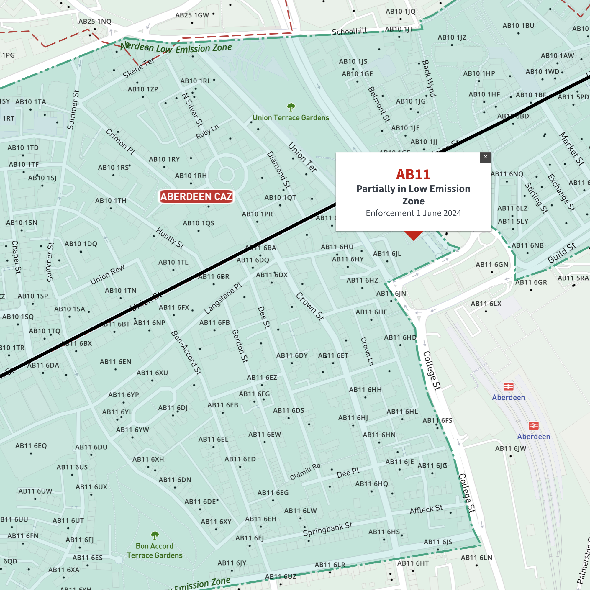
    Interactive map of Aberdeen Low Emission Zone and all AB postcodes

    £35.00

    Online deep-zoom map of Aberdeen Low Emission Zone (LEZ) with AB postcode districts, sectors and units available in the Dynamic Mapping Suite

    Dynamic Mapping Suite Premium Pass
  • Bath Clean Air Zone map with BA postcode boundaries - interactive map preview

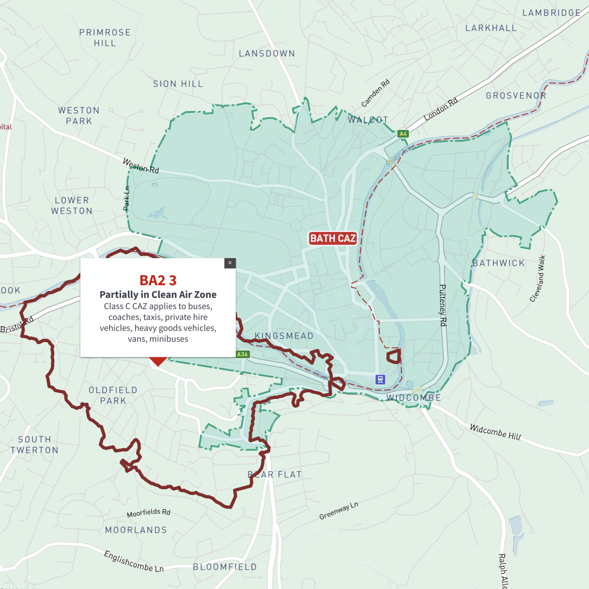
    Interactive map of Bath Clean Air Zone and all BA postcodes

    £35.00

    Online deep-zoom map of Bath Clean Air Zone (CAZ) with BA postcode districts, sectors and units available in the Dynamic Mapping Suite

    Dynamic Mapping Suite Premium Pass
  • Bradford Clean Air Zone map with BD postcode boundaries - interactive map preview

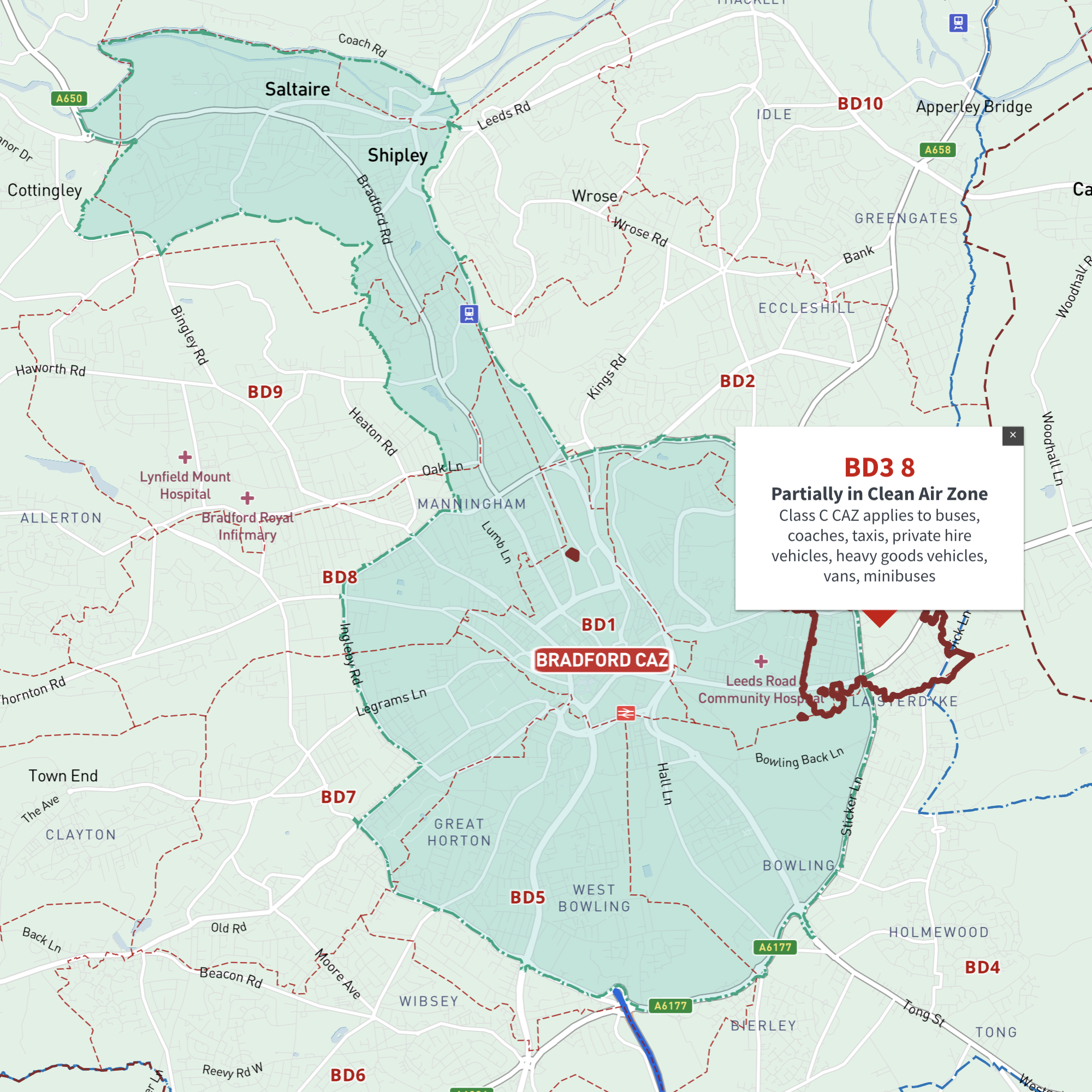
    Interactive map of Bradford Clean Air Zone and all BD postcodes

    £35.00

    Online deep-zoom map of Bradford Clean Air Zone (CAZ) with BD postcode districts, sectors and units available in the Dynamic Mapping Suite

    Dynamic Mapping Suite Premium Pass
  • Bristol Clean Air Zone map and BS postcode boundaries interactive map preview

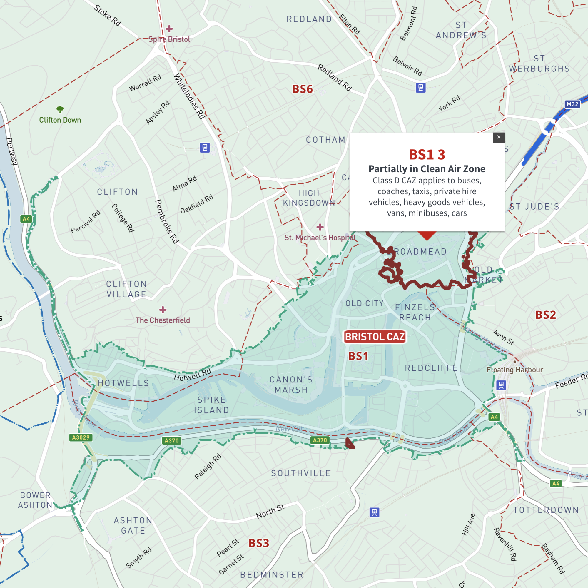
    Interactive map of Bristol Clean Air Zone and all BS postcodes

    £35.00

    Online deep-zoom map of Bristol Clean Air Zone (CAZ) with BS postcode districts, sectors and units available in the Dynamic Mapping Suite

    Dynamic Mapping Suite Premium Pass
  • Dundee Clean Air Zone map with DD postcode boundaries - interactive map preview

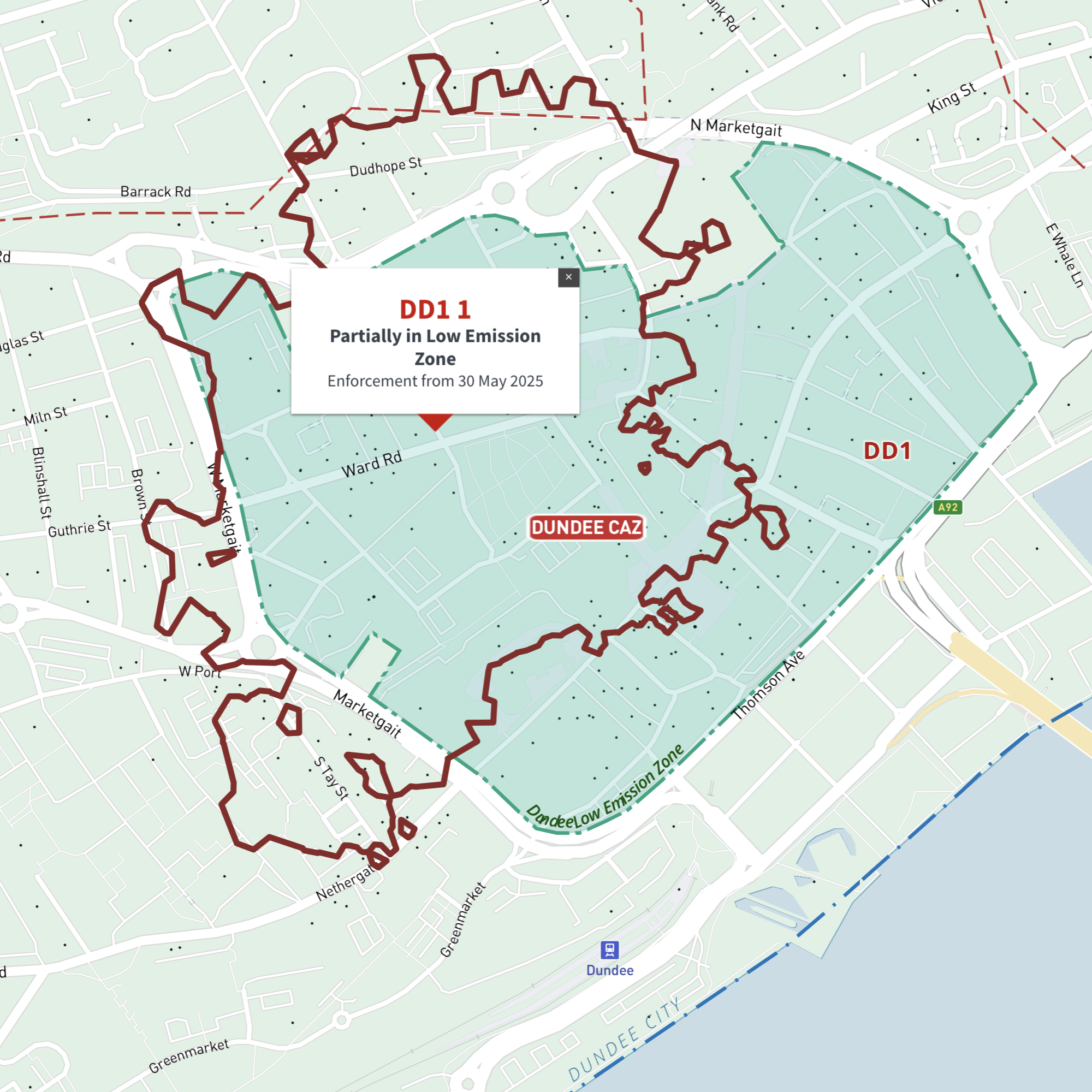
    Interactive map of Dundee Low Emission Zone and all DD postcodes

    £35.00

    Online deep-zoom map of Dundee Low Emission Zone (LEZ) with DD postcode districts, sectors and units available in the Dynamic Mapping Suite

    Dynamic Mapping Suite Premium Pass
  • Edinburgh Low Emission Zone map with interactive EH postcode boundaries preview

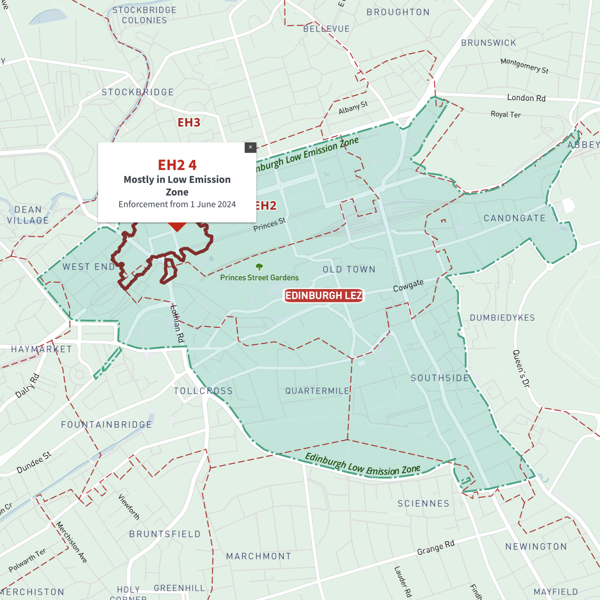
    Interactive map of Edinburgh Low Emission Zone and all EH postcodes

    £35.00

    Online deep-zoom map of Edinburgh Low Emission Zone (LEZ) with EH postcode districts, sectors and units available in the Dynamic Mapping Suite

    Dynamic Mapping Suite Premium Pass
  • Glasgow Low Emission Zone map LEZ with G postcodes - interactive map preview

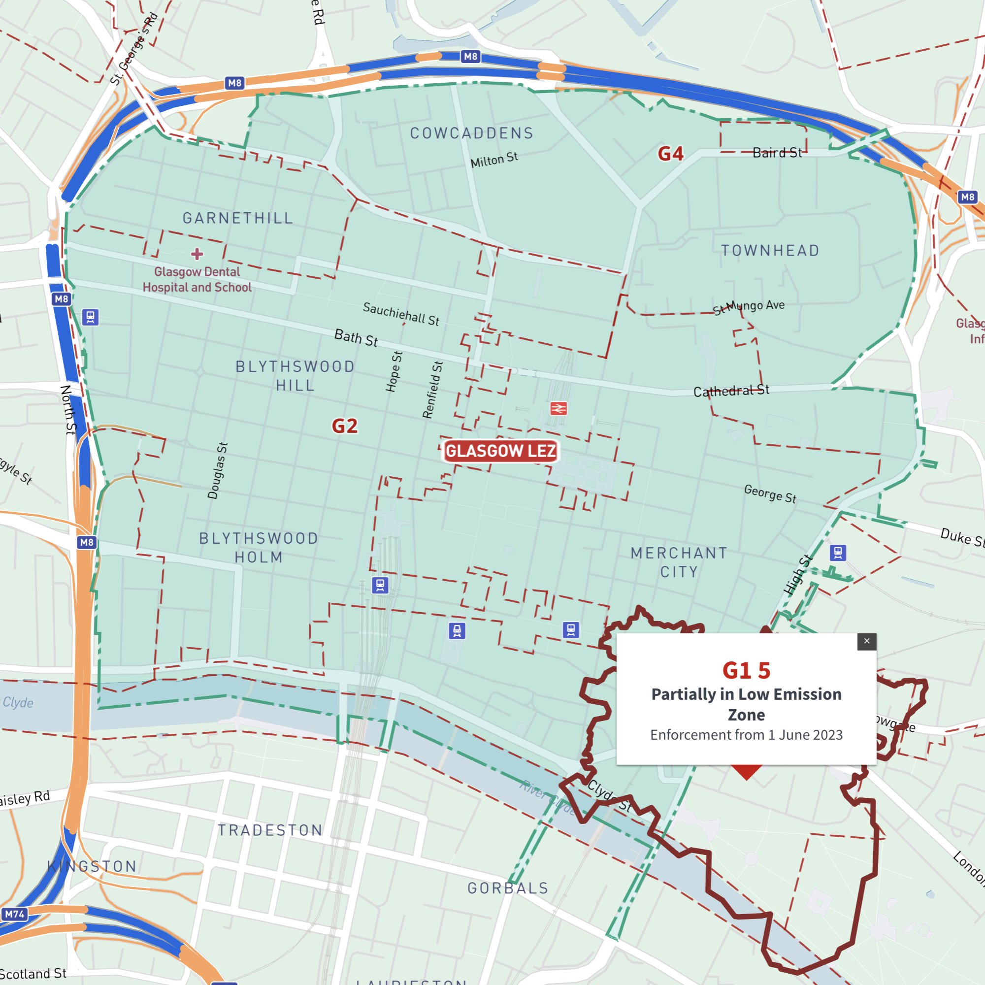
    Interactive map of Glasgow Low Emission Zone and all G postcodes

    £35.00

    Online deep-zoom map of Glasgow Low Emission Zone (LEZ) with G postcode districts, sectors and units available in the Dynamic Mapping Suite

    Dynamic Mapping Suite Premium Pass
  • Greater Manchester Clean Air Zone map with M, OL, BL, WN, WA, SK postcode boundaries - interactive map preview

    Interactive map of Greater Manchester Clean Air Zone and all M, BL, OL, SK, WA and WN postcodes

    £35.00

    Online deep-zoom map of Greater Manchester Clean Air Zone (CAZ) with M, BL, OL, SK, WA and WN postcode districts, sectors and units available in the Dynamic Mapping Suite

    Dynamic Mapping Suite Premium Pass
  • Oxford proposed Zero Emission Zone ZEZ map and OX postcode boundaries interactive map preview

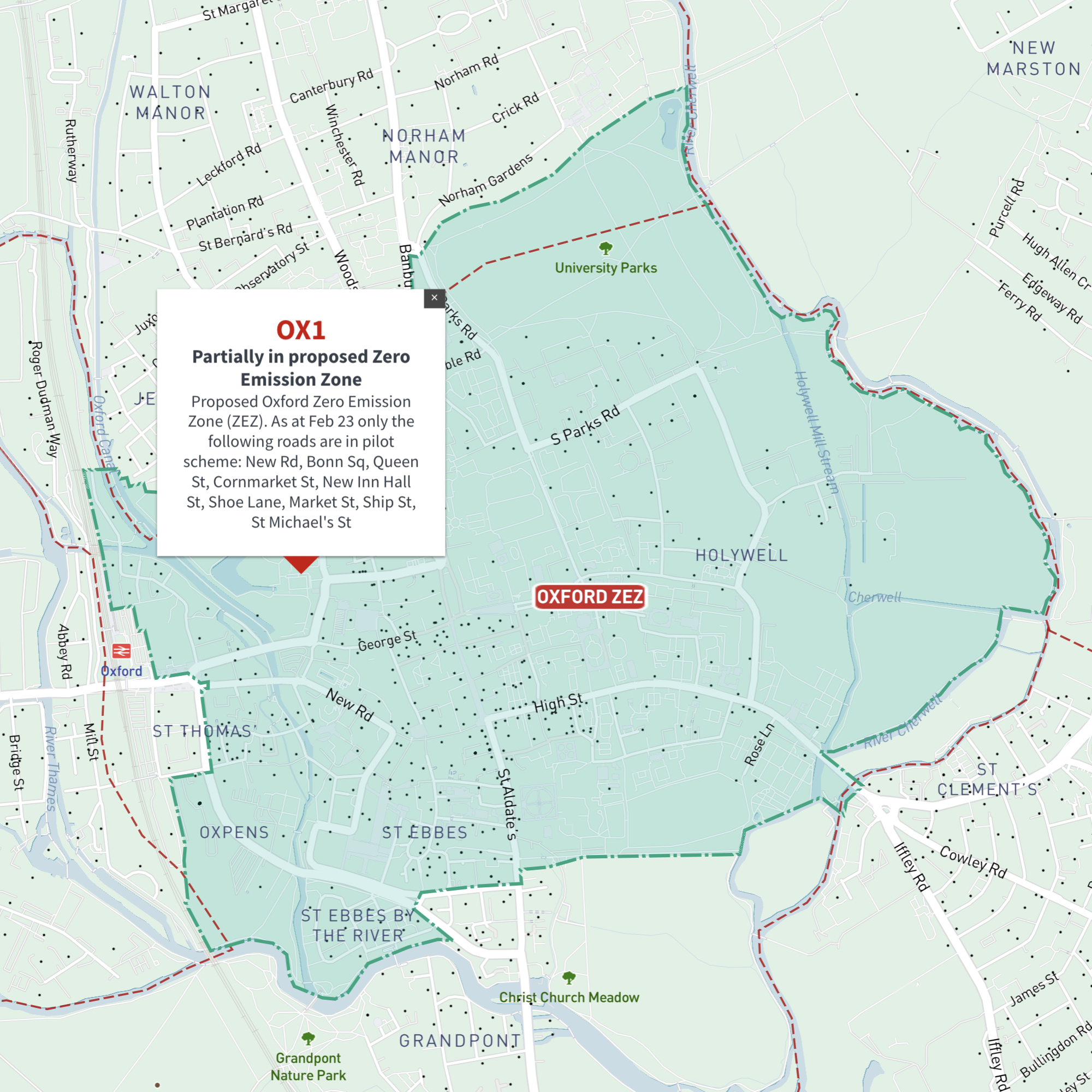
    Interactive map of Oxford Zero Emission Zone and all OX postcodes

    £35.00

    Online deep-zoom map of Oxford Zero Emission Zone (ZEZ) with OX postcode districts, sectors and units available in the Dynamic Mapping Suite

    Dynamic Mapping Suite Premium Pass
  • Portsmouth Clean Air Zone map with PO postcode boundaries - interactive map preview

    Interactive map of Portsmouth Clean Air Zone and all PO postcodes

    £35.00

    Online deep-zoom map of Portsmouth Clean Air Zone (CAZ) with PO postcode districts, sectors and units available in the Dynamic Mapping Suite

    Dynamic Mapping Suite Premium Pass
  • Sheffield Clean Air Zone map with S postcode boundaries - interactive map preview

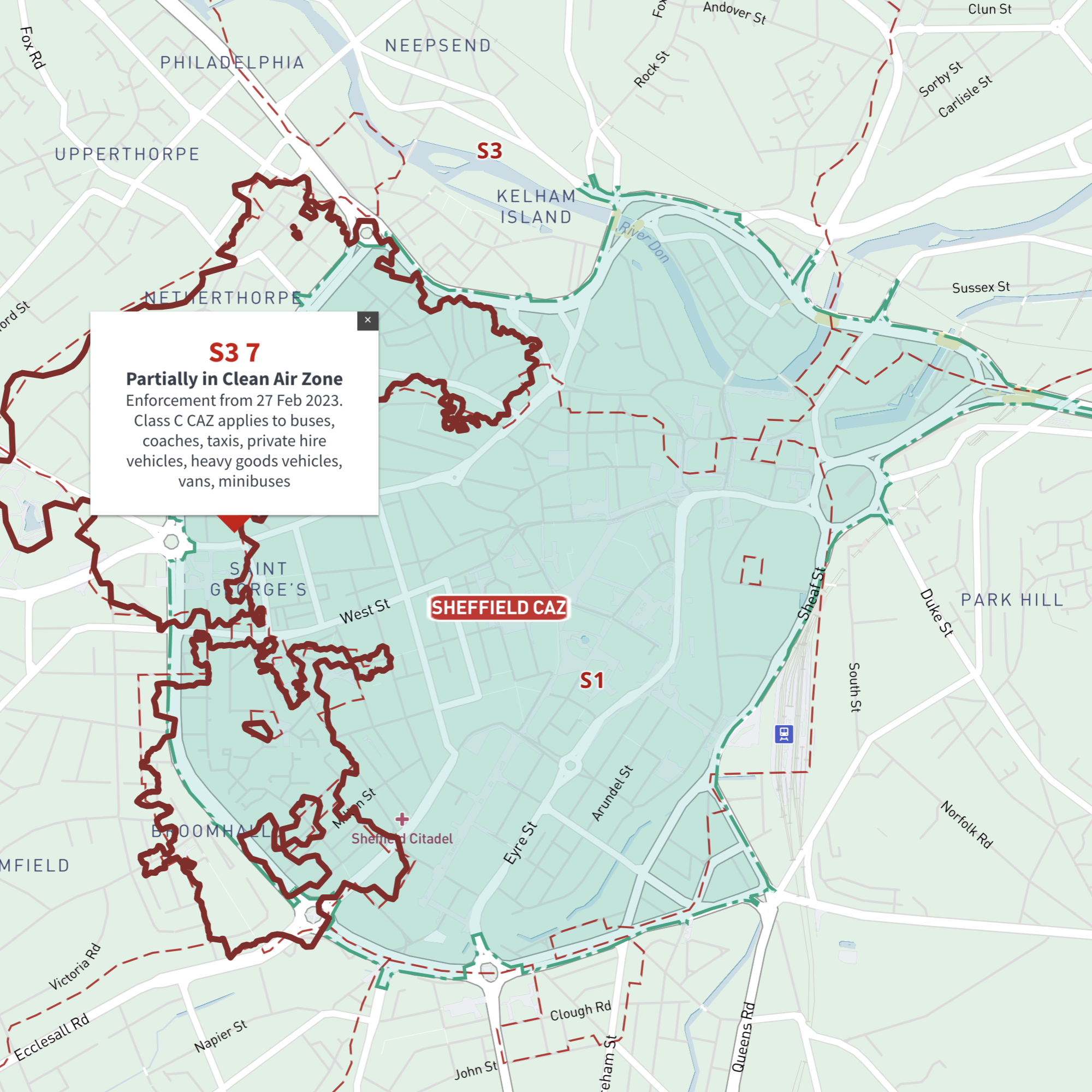
    Interactive map of Sheffield Clean Air Zone and all S postcodes

    £35.00

    Online deep-zoom map with S postcode districts, sectors and units available in the Dynamic Mapping Suite

    Dynamic Mapping Suite Premium Pass
  • Newcastle / Tyneside Clean Air Zone map with NE postcode boundaries - interactive map preview

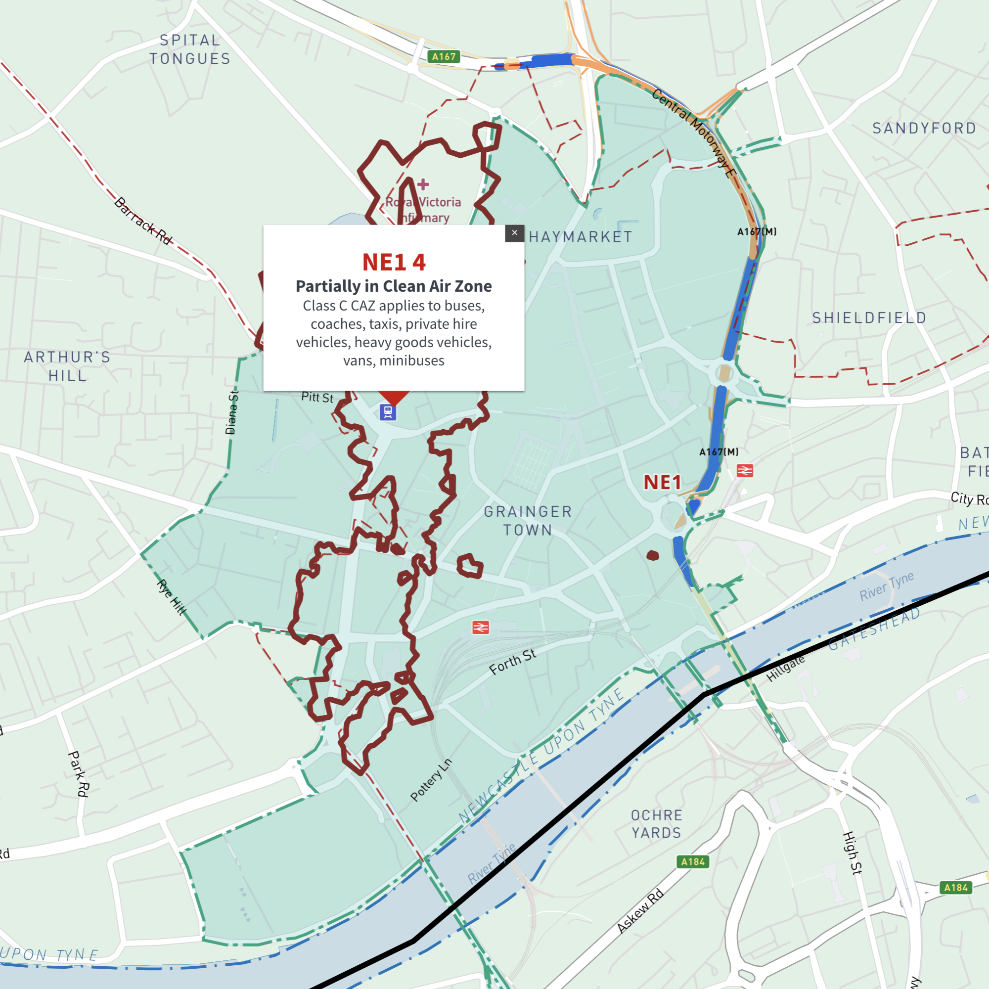
    Interactive map of Tyneside (Newcastle and Gateshead) Clean Air Zone and all NE postcodes

    £35.00

    Online deep-zoom map of Newcastle and Gateshead / Tyneside Clean Air Zone (CAZ) with NE postcode districts, sectors and units available in the Dynamic Mapping Suite

    Dynamic Mapping Suite Premium Pass
  • Standard royalty free terms for downloadable maps
  • Licensing terms for downloadable postcode maps
  • Licensing terms for dynamic online maps
  • How to edit the downloadable maps
  • Pricing & refund policies
  • Privacy & cookies
  • Maproom on Twitter

All content © Maproom at Thameside Media · Award winning media projects