Maproom

Editable & interactive digital maps

MENUMENU
  • about
  • news & blog
  • contact
  • 0 items
LOGIN
    • Home
  • Britain & Ireland maps
    • Britain and Ireland
    • UK - United Kingdom
    • Ireland
    • England
    • Scotland
    • Wales
    • Northern Ireland
    • Isle of Man
    • Channel Islands
  • City maps
    • Birmingham
    • Brighton
    • Bristol
    • Cardiff
    • Edinburgh
    • Exeter
    • Glasgow
    • Liverpool
    • London
    • Manchester
    • Oxford
  • Postcode maps
    • Overview
    • Online postcode mapping tools
    • Downloadable postcode maps
  • Region maps
    • Region maps
    • County maps
    • Local authority maps
    • Transport maps
    • National park maps
  • World maps
    • World maps
    • Europe maps
    • Map of EU countries 2024
    • Maps of France
    • Maps of Germany
    • Maps of New York and environs
  • DYNAMIC
    • Showcase
    • Dynamic Mapping Suite information and demos
    • GET A PASS
  • BESPOKE
    • Bespoke mapping services
    • Bespoke static maps
    • Bespoke dynamic maps
    • Search

Maps of Ireland

Showing all 6 results

  • Irish counties map

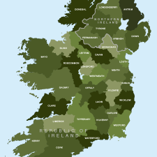
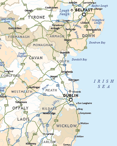
    Map of Irish counties

    £40

    All the counties in the Republic of Ireland and Northern Ireland

    PDFsSVGLayered AI file
  • Detailed map of Ireland preview v5

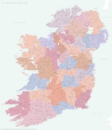
    Best detailed map of Ireland

    £70

    Approximately 1,400 towns and villages, 17,000+ roads, all the counties and a huge wealth of coastal detail, rivers, urban backdrop and green areas are plotted on our most detailed map of Ireland.

    PDFsSVGLayered AI file
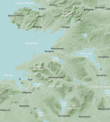
  • Britain and Ireland physical map with hillshading / relief layer (high-resolution)

    £60

    Detailed map of Britain and Ireland with a hillshading / relief layer giving a beautiful sculpted backdrop for the landmass. Every part of the map is editable and suitable for high-resolution professional printing up to A0 poster size.

    PDFsSVGLayered AI file
  • Britain rivers map

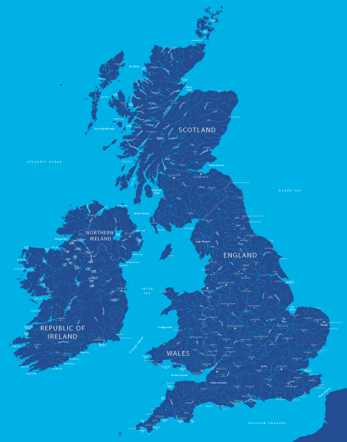
    Map of British and Irish rivers and lakes

    £20

    Hundreds of lakes and rivers, plus coastal features. Good for educational materials and water-activity themes.

    PDFsSVGLayered AI file
  • Ireland outline map

    Outline map of Ireland

    £15

    An outline map of Ireland with exceptional detail on the coastlines. Includes the border between the Republic and Northern Ireland.

    PDFsSVGLayered AI file
  • Ireland political map

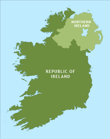
    Political map of Ireland

    £40

    Shows all the counties plus the principal towns and transport systems across both the Republic of Ireland and Northern Ireland.

    PDFsSVGLayered AI file
  • Standard royalty free terms for downloadable maps
  • Licensing terms for downloadable postcode maps
  • Licensing terms for dynamic online maps
  • How to edit the downloadable maps
  • Pricing & refund policies
  • Privacy & cookies

All content © Maproom at Blue Island Media · Award winning media projects