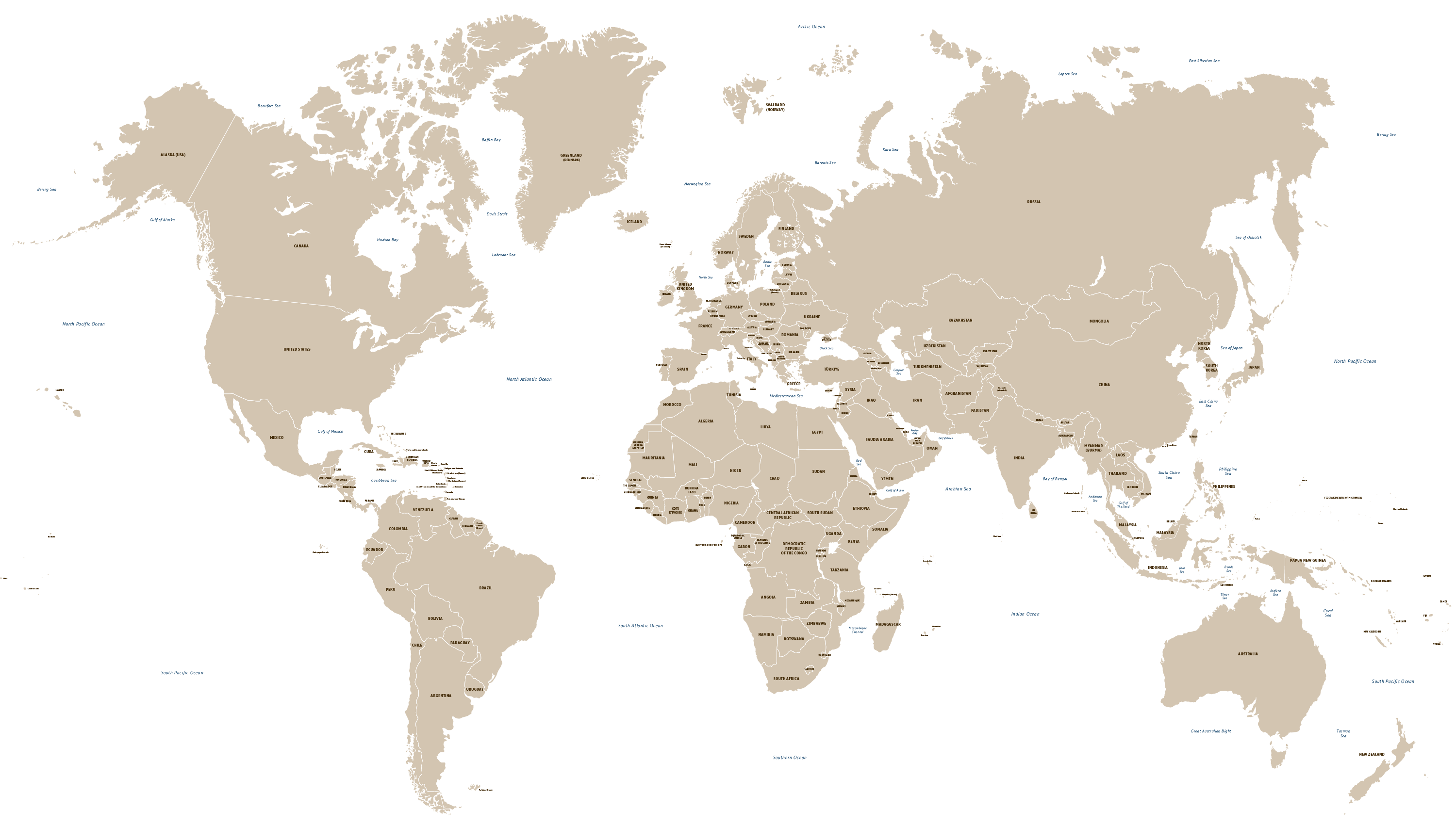
Vector World Map With All Countries
Downloadable royalty free vector artwork High-resolution PDFsSVGLayered Adobe Illustrator filePrice £25.00
Zoom preview showing full area of coverage (low-resolution)

Pan to zoom / click or tap to switch
Examples of styling in the zoom previews are included as ready to use high-resolution PDF files in the download package. You can edit all colours, fonts and other elements using Adobe Illustrator or other SVG editing software.
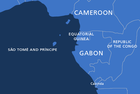
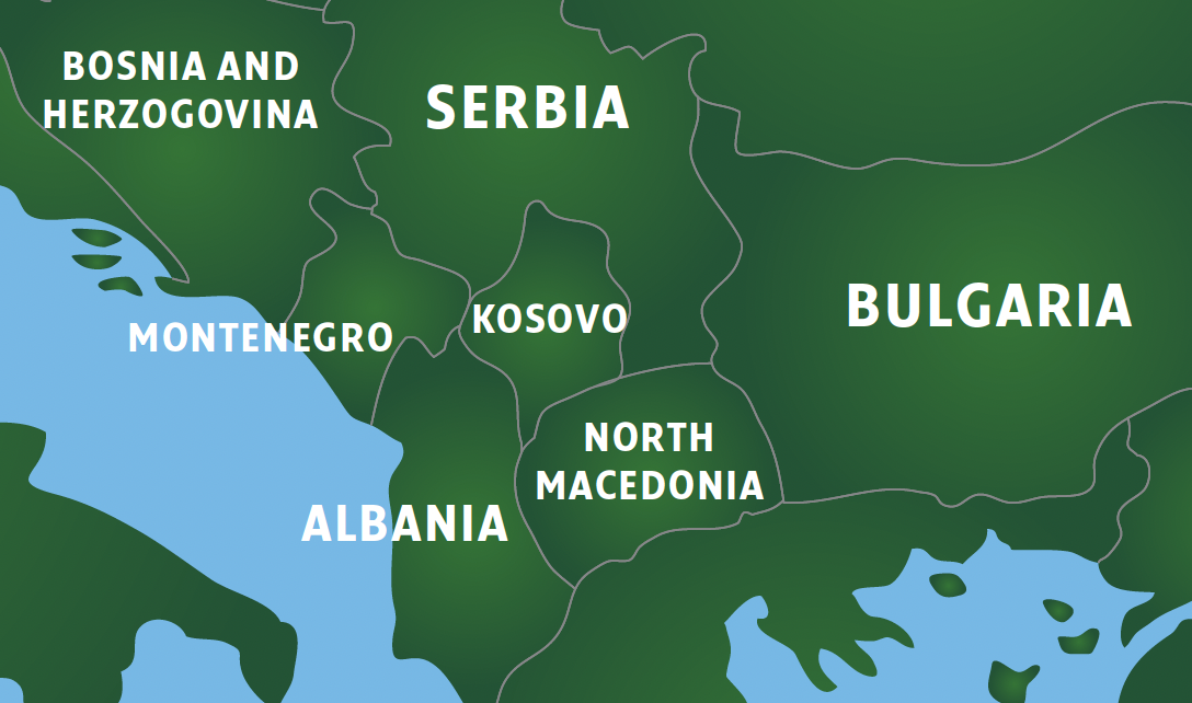
VIEW HIGH-RESOLUTION PREVIEW SAMPLE** Updated to show Türkiye (formerly Turkey) spelling accepted by United Nations in June 2022, and North Macedonia in June 2018 **
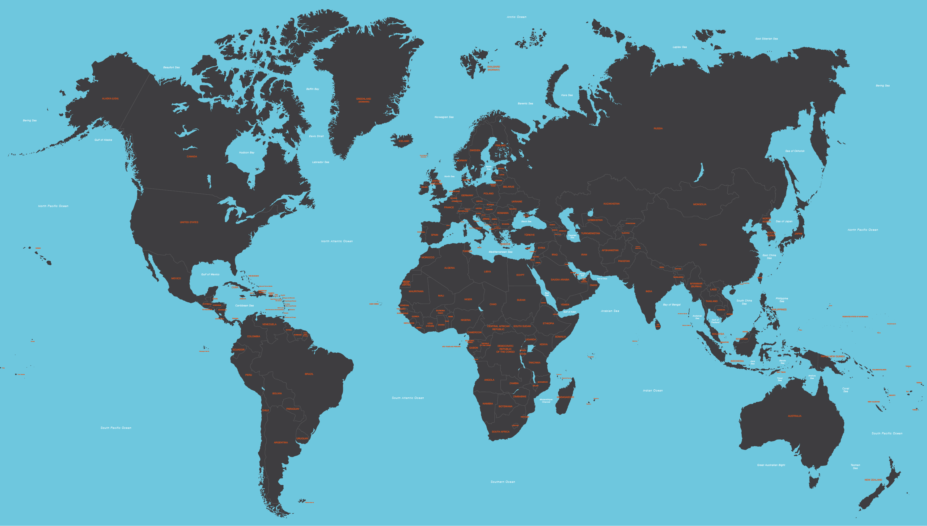
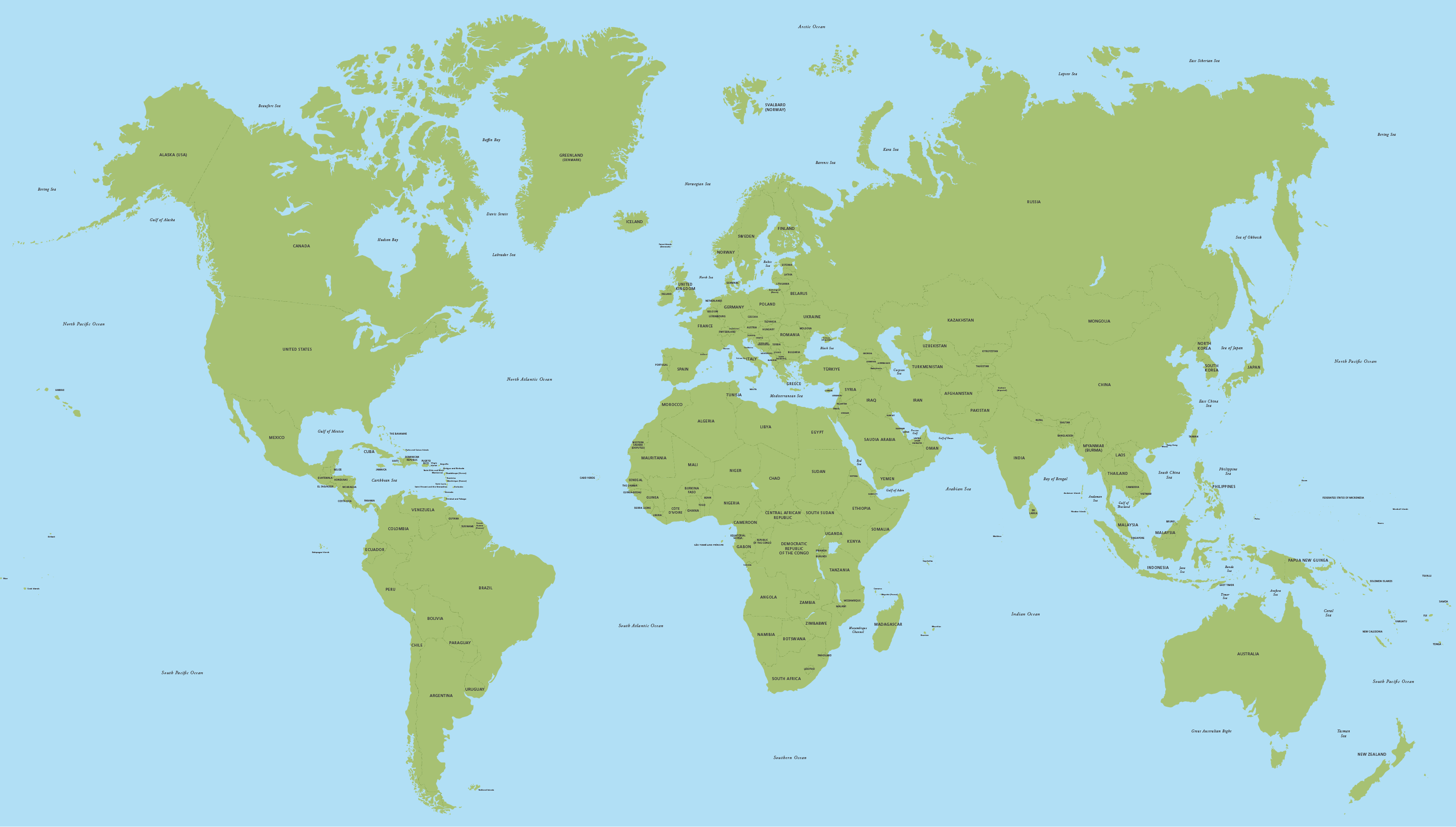
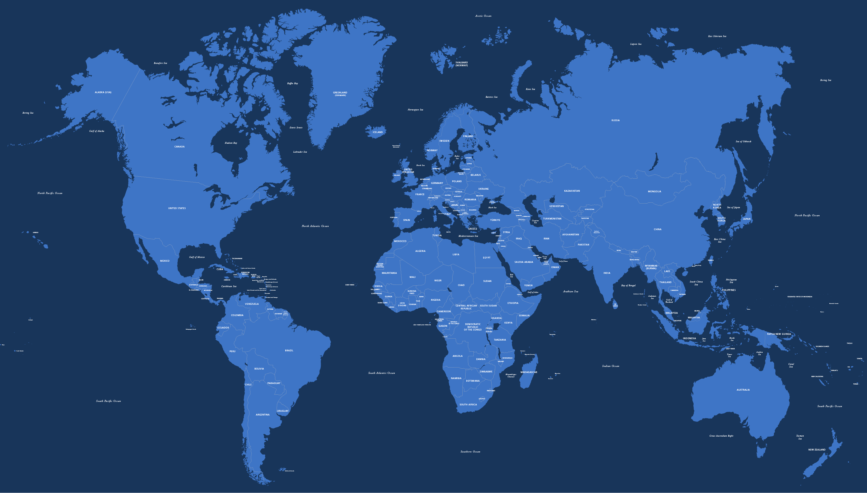
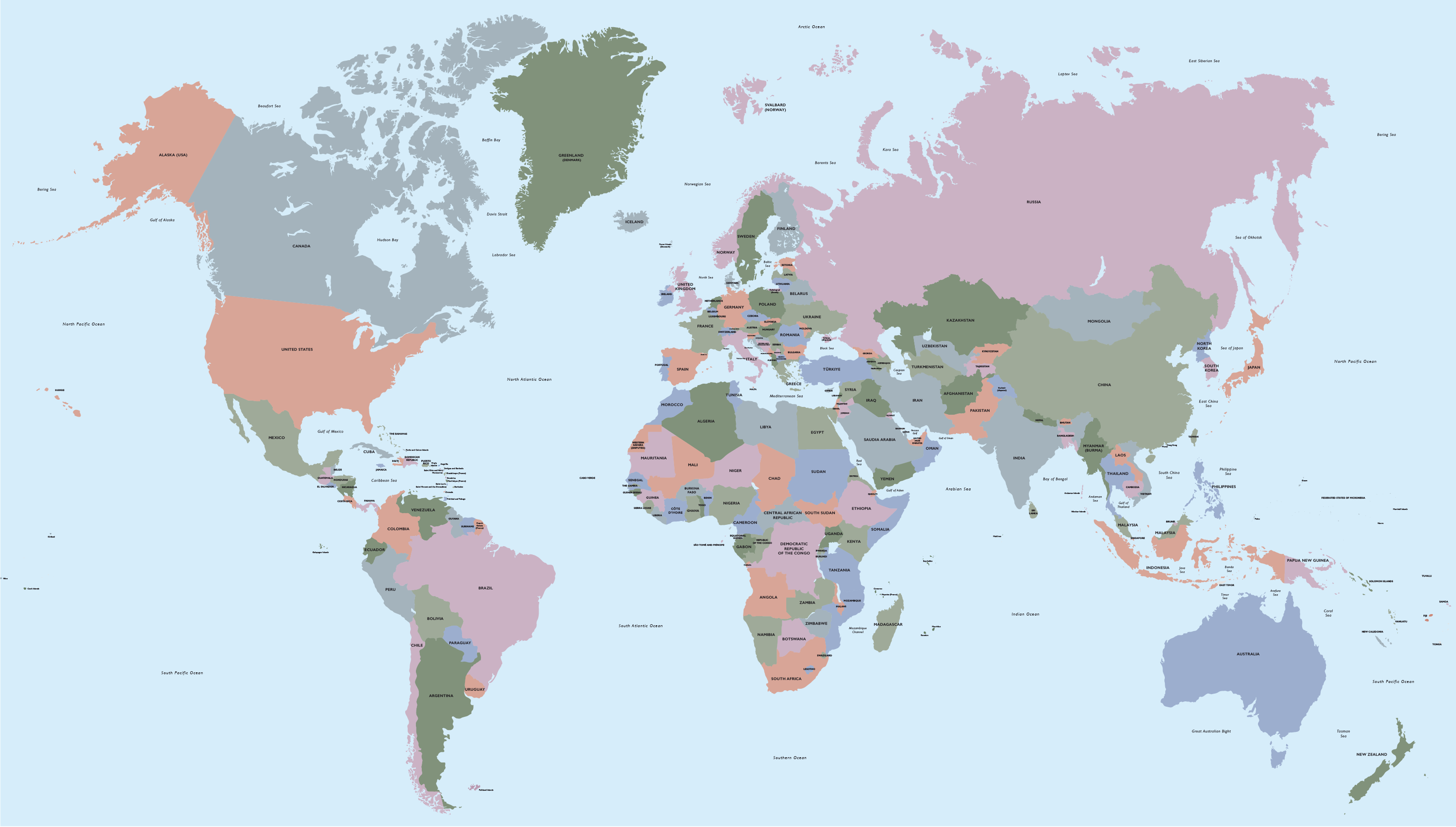
This versatile editable vector world map is especially useful for designers working in Adobe Illustrator. The fully editable vector layers are organised into distinct countries, making them very easy to select and colour, either with a single colour for the whole landmass, or different colours for each country.
Each country is labelled using editable live text, so the font can be substituted and scaled without limitations. You can change and add extra labels, scale the country labels individually, or turn off the entire labels layer with one click, depending on your needs.
A layer for land borderlines is included, which is very useful if you want to show a solid or dashed stroke line for the country land boundaries without affecting the depiction of coastlines, which often look too heavy with a boundary stroke. This rare feature is aimed at graphic designers who want a refined look for their world map.
Conflict zones on the world map
The Maproom world map is kept up to date with any new countries as they are formed, and also plots the major conflict zones, such as Palestine, Kashmir and Crimea. This means that you can choose how to depict the areas of conflict, either as an integral part of another country, or as a conflict zone without current political allegiance. Please note that Maproom is not responsible for the depiction of disputed territories in final outputs of this base map.
We offer customers the possibility to download new versions of this world map without extra charge whenever it is updated.
Note dated 25/5/18: we advise customers not to print or sell products with a world map in China. See our article: China is now censoring world maps.
Specifications
Licensing terms
This editable map base is suitable for commercial and professional uses
See standard royalty free terms for downloadable maps
How to edit
Adobe Illustrator, CorelDRAW, PDF editors etc
See how to edit the downloadable maps
Recommended scaling
Thumbnail to poster size
For more guidance see scaling recommendations
Vector map layers in Illustrator
