Best detailed map base of the UK / United Kingdom
Downloadable royalty free vector artwork High-resolution PDFsSVGLayered Adobe Illustrator file Limited Free Pass for Dynamic Mapping Suite iPrice £75
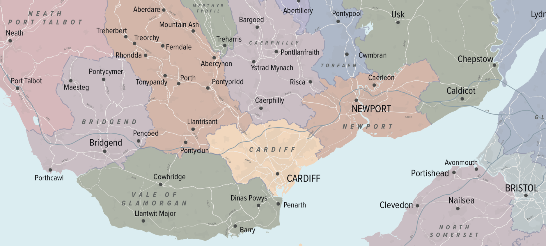
Zoom preview showing full area of coverage (low-resolution)


Pan to zoom / click or tap to switch
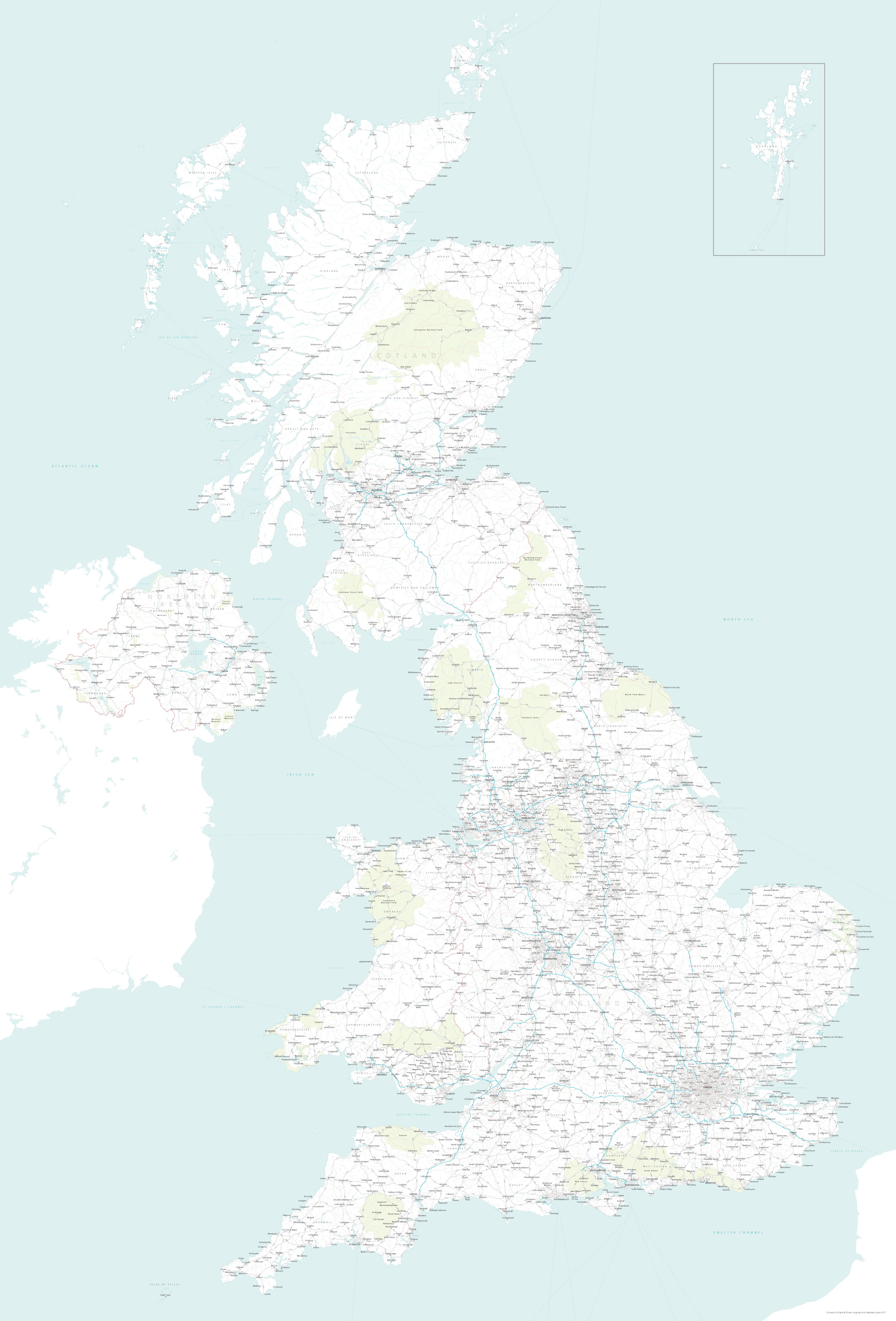
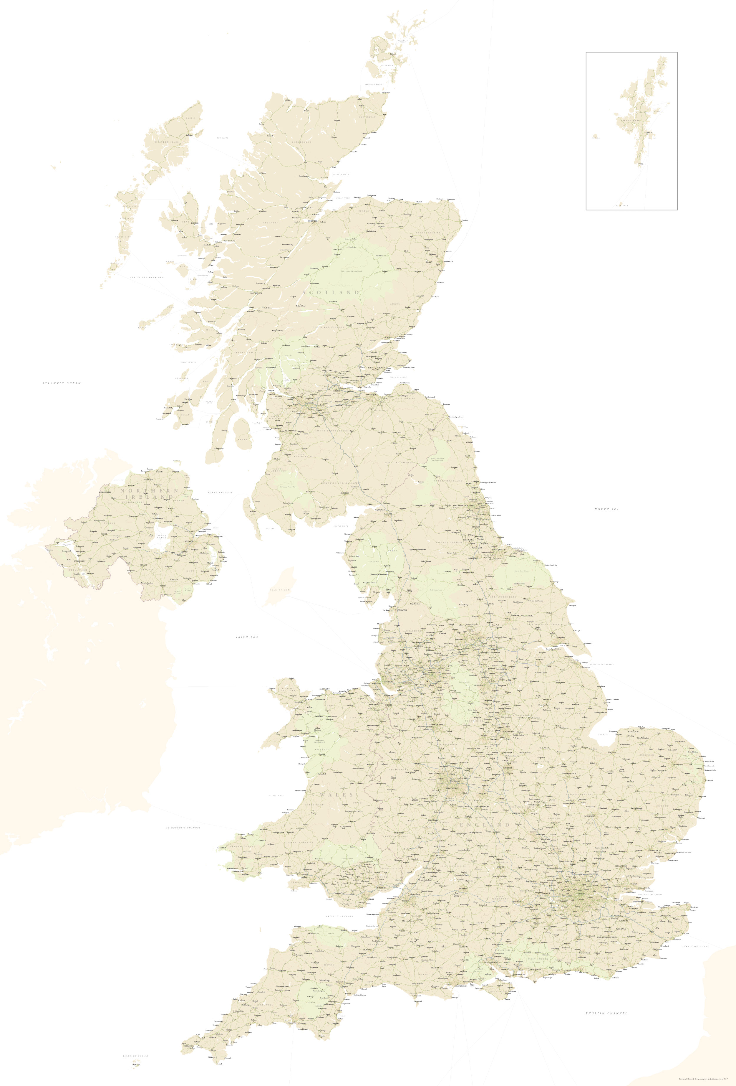
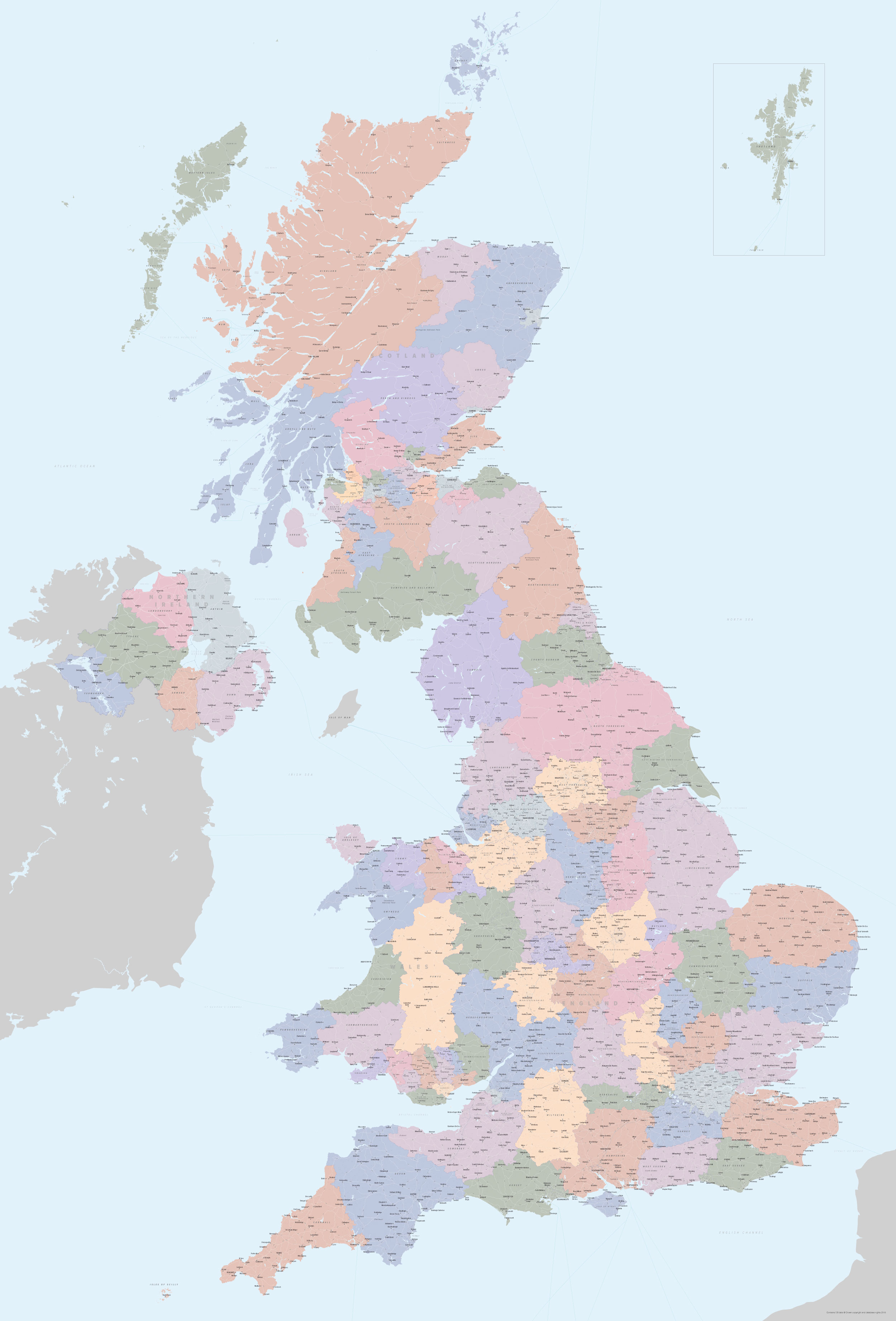
Examples of styling in the zoom previews are included as ready to use high-resolution PDF files in the download package. You can edit all colours, fonts and other elements using Adobe Illustrator or other SVG editing software.
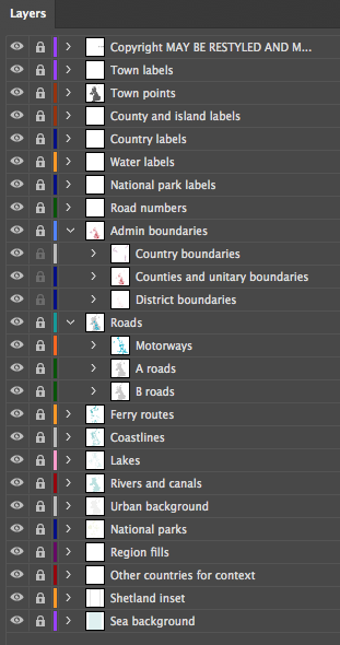
Perfect for graphic designers using Illustrator who need a detailed and versatile vector art base map of the UK, this professional map uses trustworthy Ordnance Survey GIS data organised with Maproom’s easy to style Illustrator layers. This is the most detailed base map of the UK that we sell in the Maproom shop, and it can be used in many applications. It includes approximately 1,850 town points, more than 5,500 major roads, including B roads, all the county and unitary authority administrative boundaries, and a wealth of natural features across the entire United Kingdom. Altogether there are more than 4.29 million vector anchor points.

The zoom previews on this page are limited by the maximum dimensions that can be handled by a web image viewer of this type, but the files included in the download package can be zoomed in so that every label is fully legible and sharp no matter what zoom level is used. All the fonts and paths are live and editable on the vector artwork.


Ways to use the UK base map
The Illustrator artboard is nominally at dimensions W 182cm x H 268 cm, which is larger than standard poster sizes. These dimensions and scaling are just a useful starting point for designers. You can print the map to cover an entire wall or scale it down to a thumbnail. The map view here is a screen grab scaled at just 4% of the total artwork size.
An inset of Shetland is contained within the artboard. However, when you open the vector files, you will find that there is a large area of artwork beyond the artboard, where Shetland appears again in its natural position. The Channel Islands are also included in their geographical location below the southern side of the initial artboard alongside the French coast. The Irish landmass is also included in its entirety.
Extending or reducing the initial artboard, or adding multiple artboards, gives designers immense flexibility on ways to use this versatile base map of the UK.
To use the map with Shetland in its natural geographical position, for example, simply extend the artboard northwards and delete or hide the Shetland inset.


If you want to print the entire map at a smaller size, you may want to suppress the smaller font layers, such as road numbers, as they may not be legible if scaled down. Alternatively, you can zoom into regions or add extra artboards to tile parts of the artwork at any scale.
This detailed vector map of the UK is sold on royalty-free terms, which means you can use it in different ways for multiple projects, making it a fantastic resource file for designers and developers, saving money and weeks of work. A copyright notice is included for the Ordnance Survey open data, which can be moved and restyled, though not removed. The full terms and conditions of the royalty-free license are listed here.
Please note that the files supplied in the download bundle are all high-resolution and will need to be converted to a smaller file size if you intend to use the artwork in a website. The Illustrator files are supplied in CC (recent Creative Cloud) and older CS versions to preserve layers. An included SVG file is useful for developers, and there is also an optional large (200mb) EPS file. Please contact us if you require other formats.
Specifications
Price £75
Product code: MR145
Licensing terms
This editable map base is suitable for commercial and professional uses
See standard royalty free terms for downloadable maps
How to edit
Adobe Illustrator, CorelDRAW, PDF editors etc
See how to edit the downloadable maps
Recommended scaling
Billboard, poster, tiles or zoomed areas
For more guidance see scaling recommendations
Access to Dynamic Mapping Suite
A Limited Free Pass for the Dynamic Mapping Suite is bundled with this map
Vector map layers in Illustrator