Exeter Street Maps
Downloadable royalty free vector artwork High-resolution PDFsSVGLayered Adobe Illustrator filePrice £60.00
This two-map bundle is a city map of Exeter and a second map encompassing the wider area, from the city to the Exe estuary.
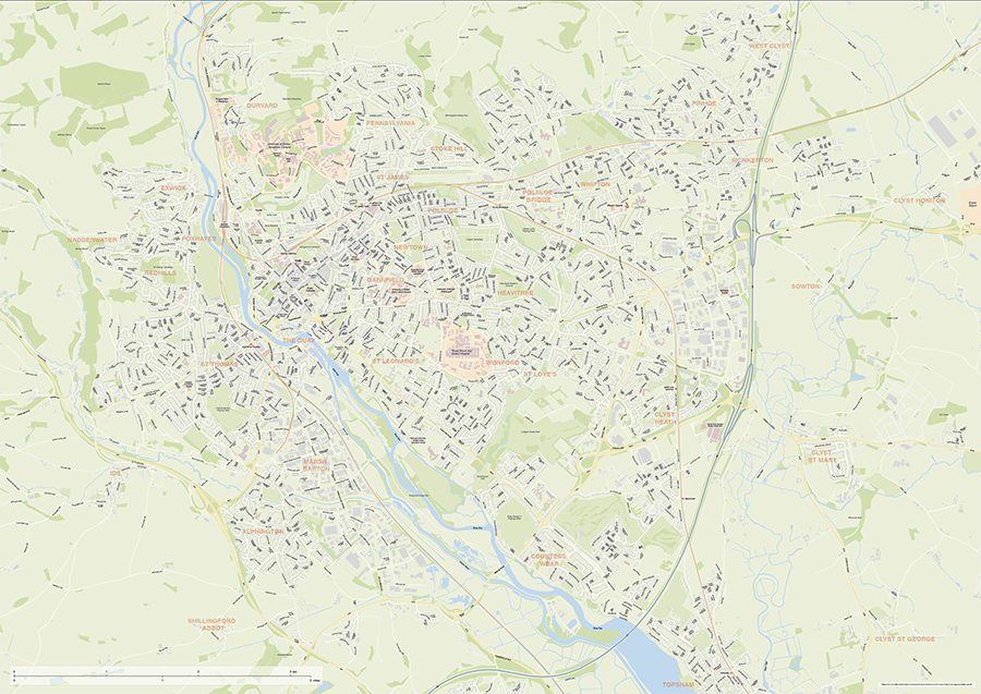
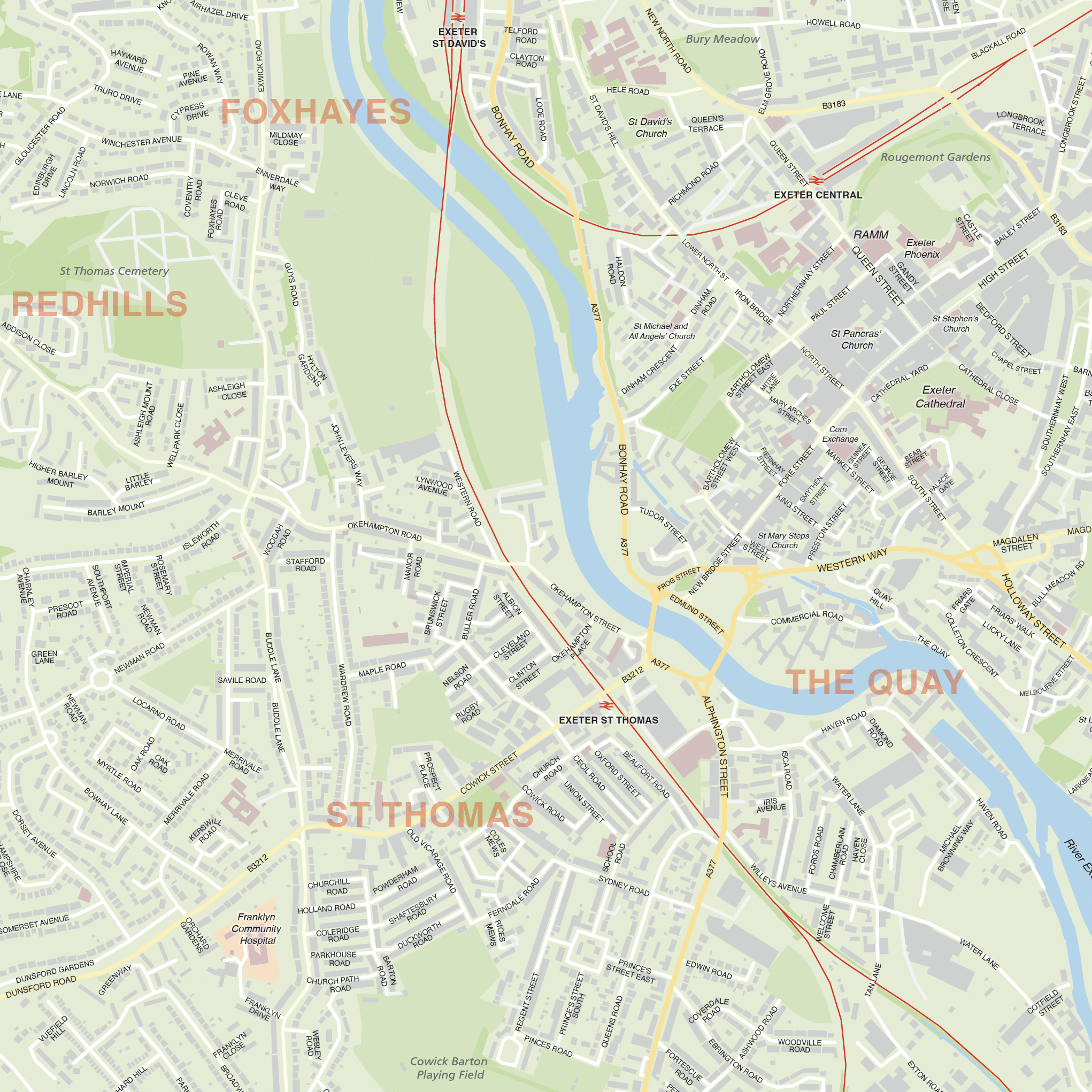
Exeter city map:
Editable street map of Exeter city centre and environs reaching out to the airport to the east, Topsham train station to the south, West Cyst to the northeast, and the villages of Ide and Shillingford Abbot to the southwest. Supplied as a PDF and fully layered Illustrator and SVG formats, the map base includes a wealth of detail, including the full road network (labelled down to nearly all local roads), railway lines, rivers and canals, parks and woodlands, university campuses, and building shapes.
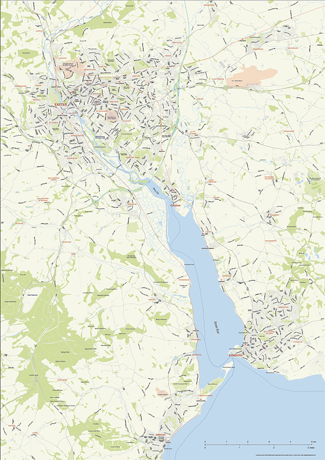
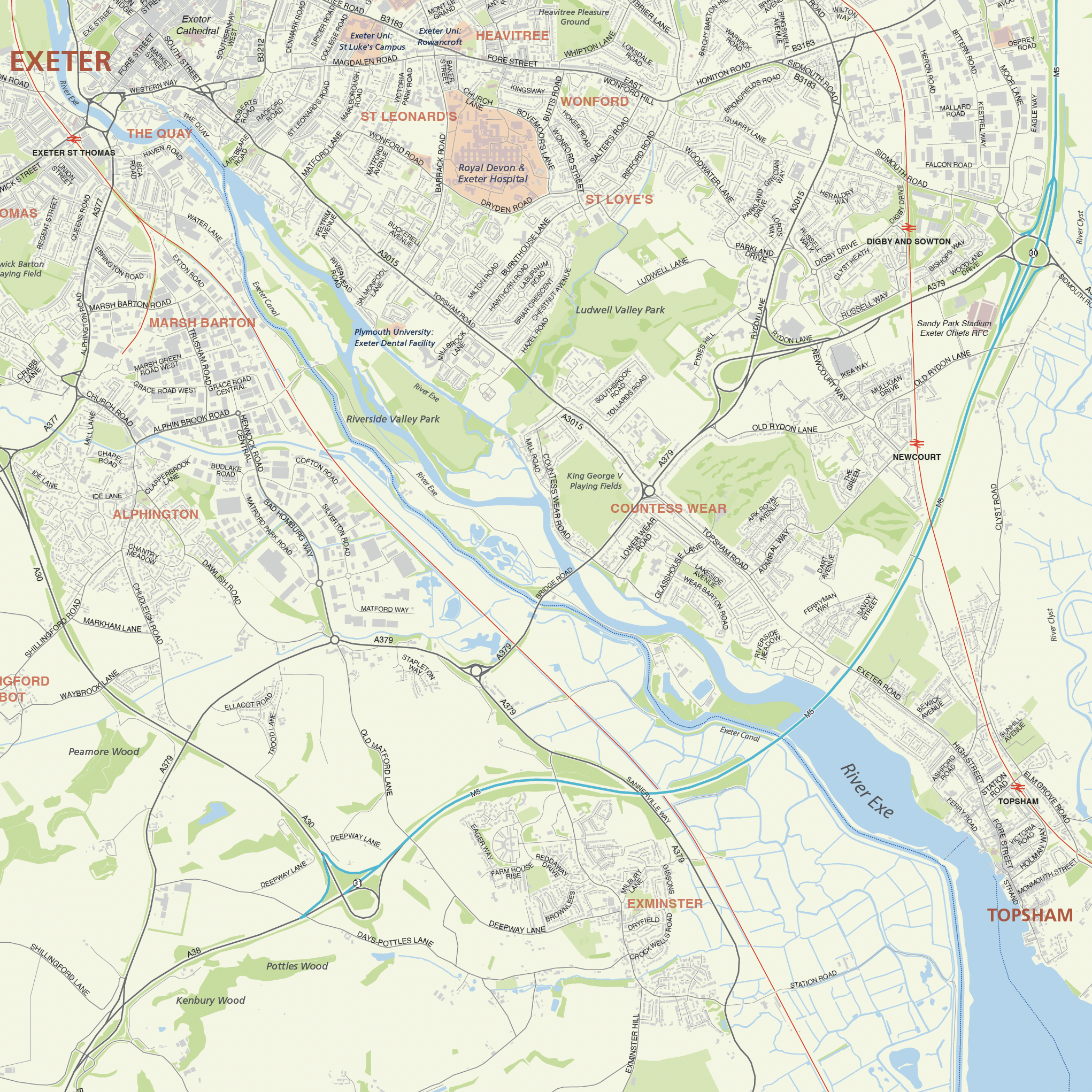
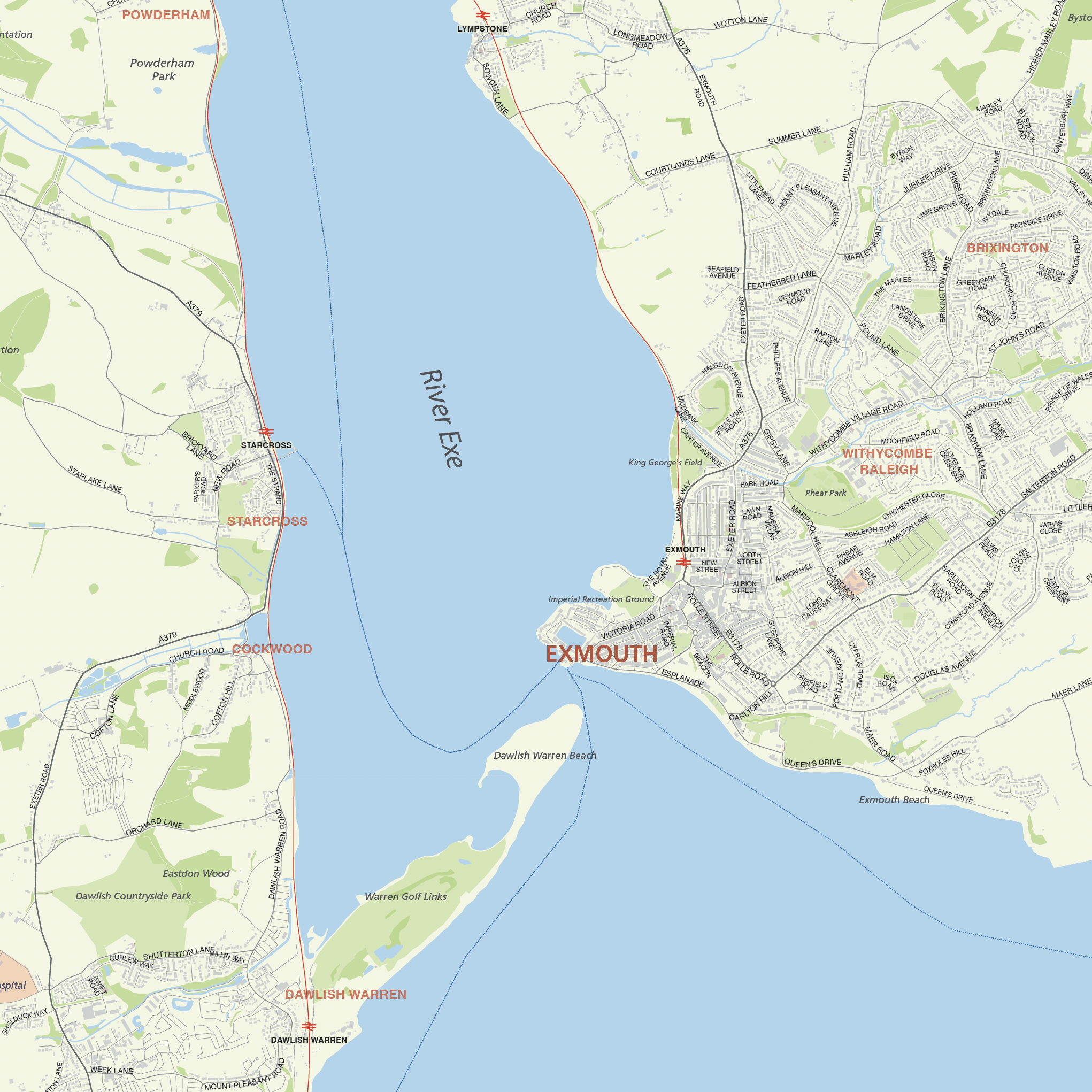
Exeter and the Exe Estuary map:
Editable street map of Exeter and its surrounding villages and towns, focusing on its southern environs reaching down to Exmouth and Dawlish. Supplied as a PDF and fully layered Illustrator and SVG formats, the map base includes the full road network, railway lines, rivers and canals, parks and woodlands, university campuses, and building shapes.
Using these maps
Our city street map of Exeter and the map of Exeter & the Exe Estuary are built specially for businesses, graphic designers and other professionals who need either a detailed base map of Exeter or a map base with a scope that includes the wider area around the Exe estuary. Both maps can be manipulated and used for commercial purposes, such as plotting specific sites – business premises, for example – or delineating areas, perhaps based on marketing focus. You can use the high-resolution PDFs supplied for the Exeter street map and Exe estuary map as they are, or edit the artwork with Adobe Illustrator software, for a wide range of marketing, commerce, research and display projects without restrictions on print run with our standard royalty-free licence.
We include two map bases in the download package. The street map of Exeter city is scaled for A0 printing (or larger). It covers the whole of Exeter city, including the airport. The second map base is scaled for A1 printing and covers Exeter, as well as its environs, focusing on the estuary, to the south of Exeter, down to and including the coastal towns of Exmouth and Dawlish.
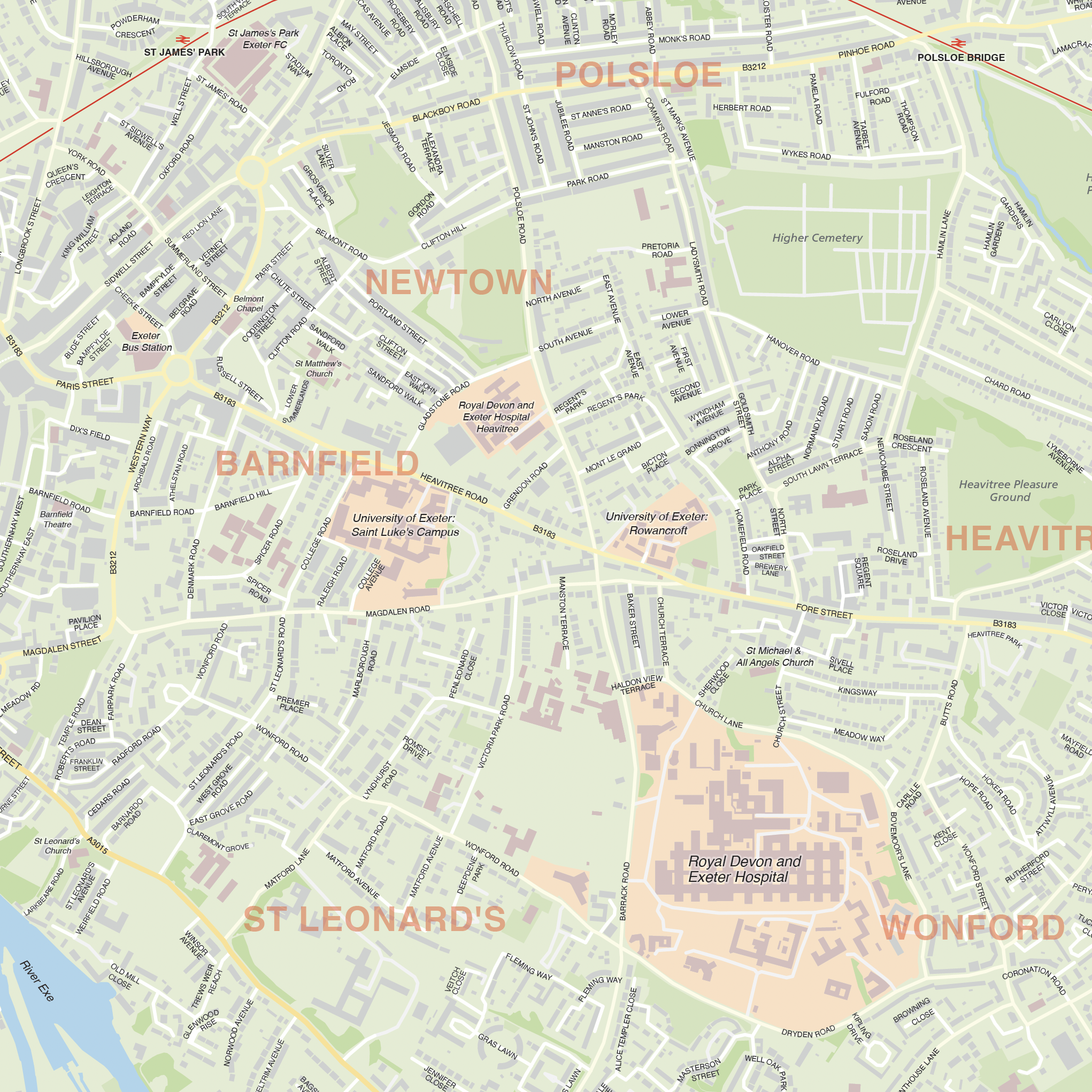
The Illustrator PDFs can be used as they are or as a starting point for your own customised version. You can crop or zoom in to the map artwork at any scale you want, and the detail will be sharp at every level on the scalable vector artwork.
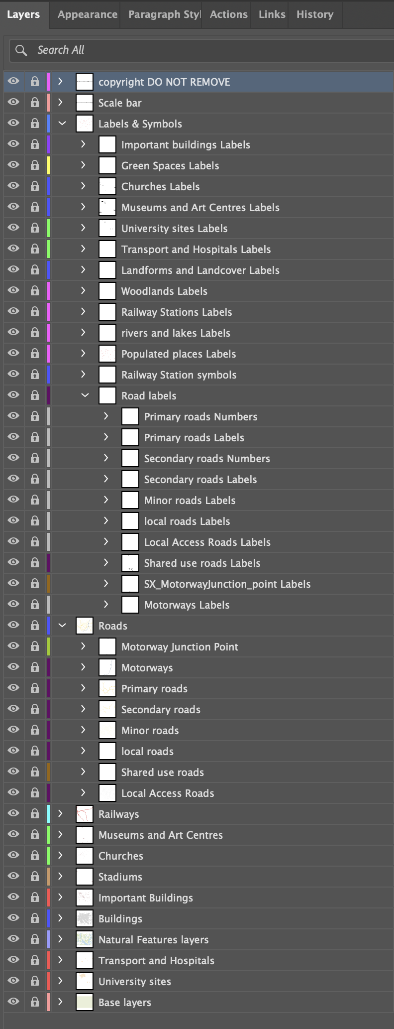
We recommend Adobe Illustrator for easy editing of colours and fonts, and if you want to plot your own locations. The Illustrator layers are ordered with graphic designers in mind so that you can quickly change colours and stroke widths for any layer. In Illustrator you can also turn off entire layers with a single click, if, for example, you don’t want the woodland areas to show.
Files included in the Exeter maps download bundle include layered Illustrator versions, SVG and PDFs (both layered and flattened versions).
The Exeter maps use Ordnance Survey open data and must include the copyright attribution in the bottom right corner of the map when printed or used commercially, though you can restyle and move the attribution if you wish.
Test strips of the two maps, with active editable layers, can be downloaded here.
Specifications
Licensing terms
This editable map base is suitable for commercial and professional uses
See standard royalty free terms for downloadable maps
How to edit
Adobe Illustrator, CorelDRAW, PDF editors etc
See how to edit the downloadable maps
Recommended scaling
Scaled for A0 and A1 printing, or bigger
For more guidance see scaling recommendations
Vector map layers in Illustrator