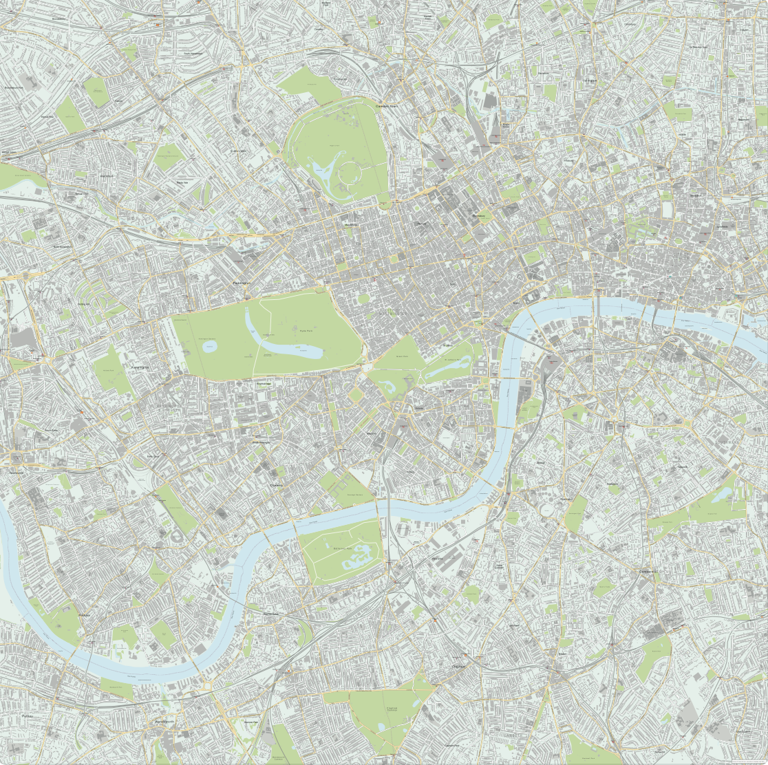
Greater London detailed map with all roads, transport, institutions, green areas
Downloadable royalty free vector artwork High-resolution PDFsSVGLayered Adobe Illustrator filePrice £150.00
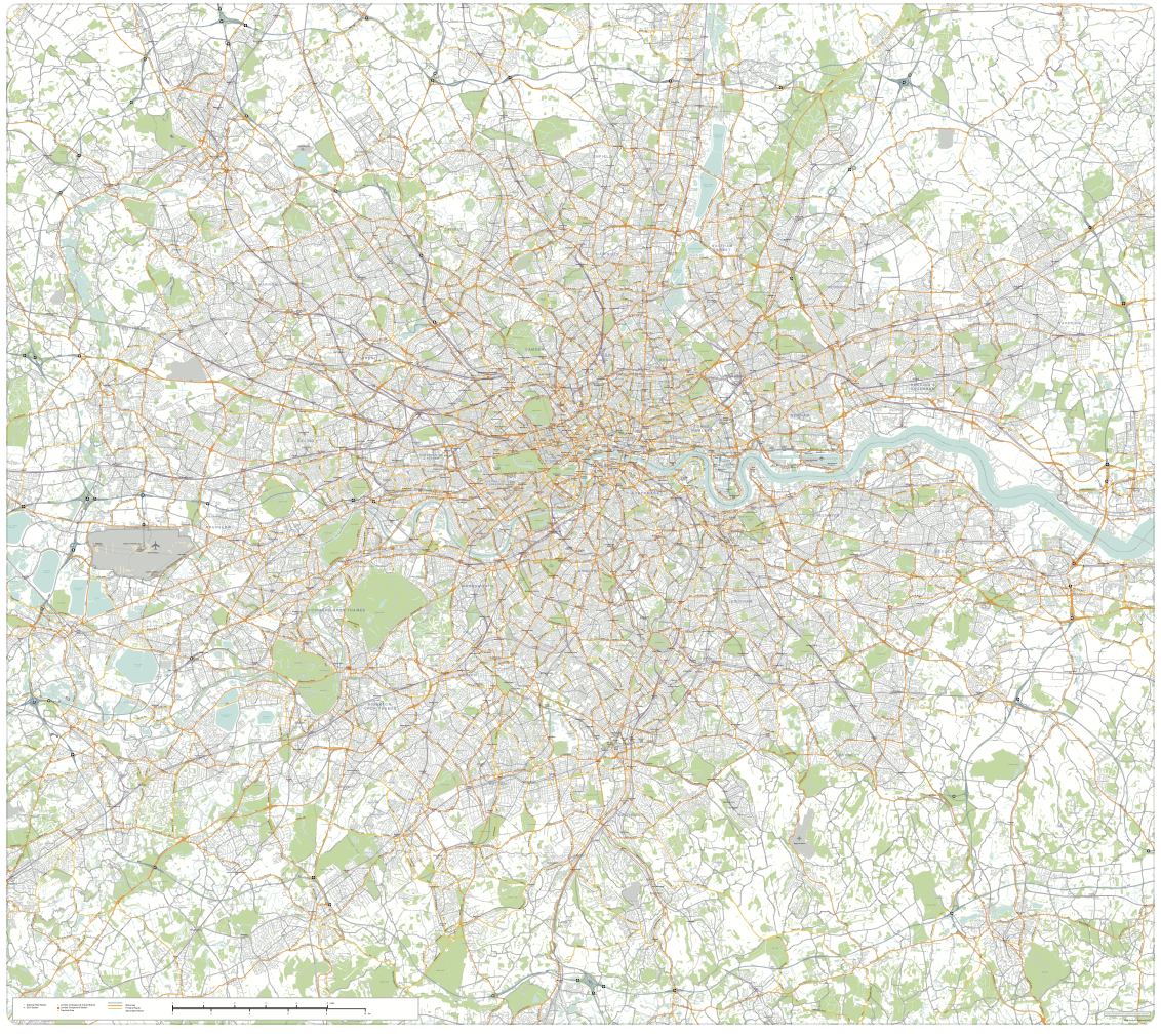
A superb resource for designers, this vector art map of Greater London is aimed squarely at professionals using Illustrator and other Adobe vector graphics software who need an accurate, editable road map base for the entirety of Greater London. It includes every district within the M25 and a few miles beyond, from Egham and Heathrow Airport in the west to Potters Bar in the north, Grays and Swanscombe in the east, and Leatherhead and Sevenoaks in the south. That’s about 60 km (38 miles) east to west, and a similar distance north to south.
The most notable feature about this resource map is that it contains the entire road network across Greater London. This includes all Motorways, Primary roads, Secondary Roads, Minor Roads, Local Roads, Restricted Access Roads and Multiple Use Roads (pedestrianised roads with restricted vehicle access). We have plotted all the 800+ stations for National Rail, London Underground, London Overground, DLR, Tramlink and the new Crossrail Elizabeth Line, using Transport for London’s official pictograms for the transport symbols. Water features, green areas and major landmarks (such as the Tower of London and British Museum) are also included to help with orientation. Altogether there are more than 4.2 million anchor points in this vector artwork.
The sheer scope of the full road network across Greater London accounts for the high cost of this base map compared with Maproom’s much cheaper Map of Greater London districts and boroughs, which shows only A roads, motorways, boroughs and town names. It should also be compared with the cheaper London Street Map, which also has the full road network and indeed greater detail for buildings and street names, but covers a much smaller area of London.
The map base contains trustworthy Ordnance Survey OpenData together with Maproom enhancements and styling, and available on Maproom’s standard royalty free licence. You can use this superb map resource in multiple ways for commercial projects ranging from TV and film graphics to printed billboards, posters, brochures, merchandise, websites, apps etc. It is suitable for using as a road map of Greater London as a whole or zooming into the detail of any part of the city.
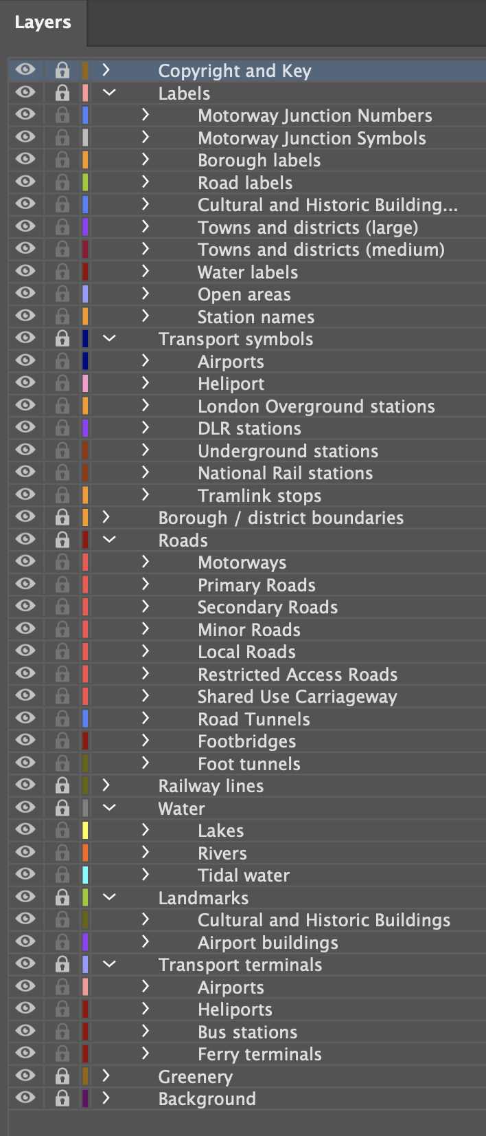
All the elements of the map can be edited using Adobe Illustrator. Colours can be changed very quickly. Live fonts can be substituted, labels moved, layers hidden or reorganised, and extra items plotted.
We have produced two styling versions in the Greater London package:
Version 1 scaling and labelling
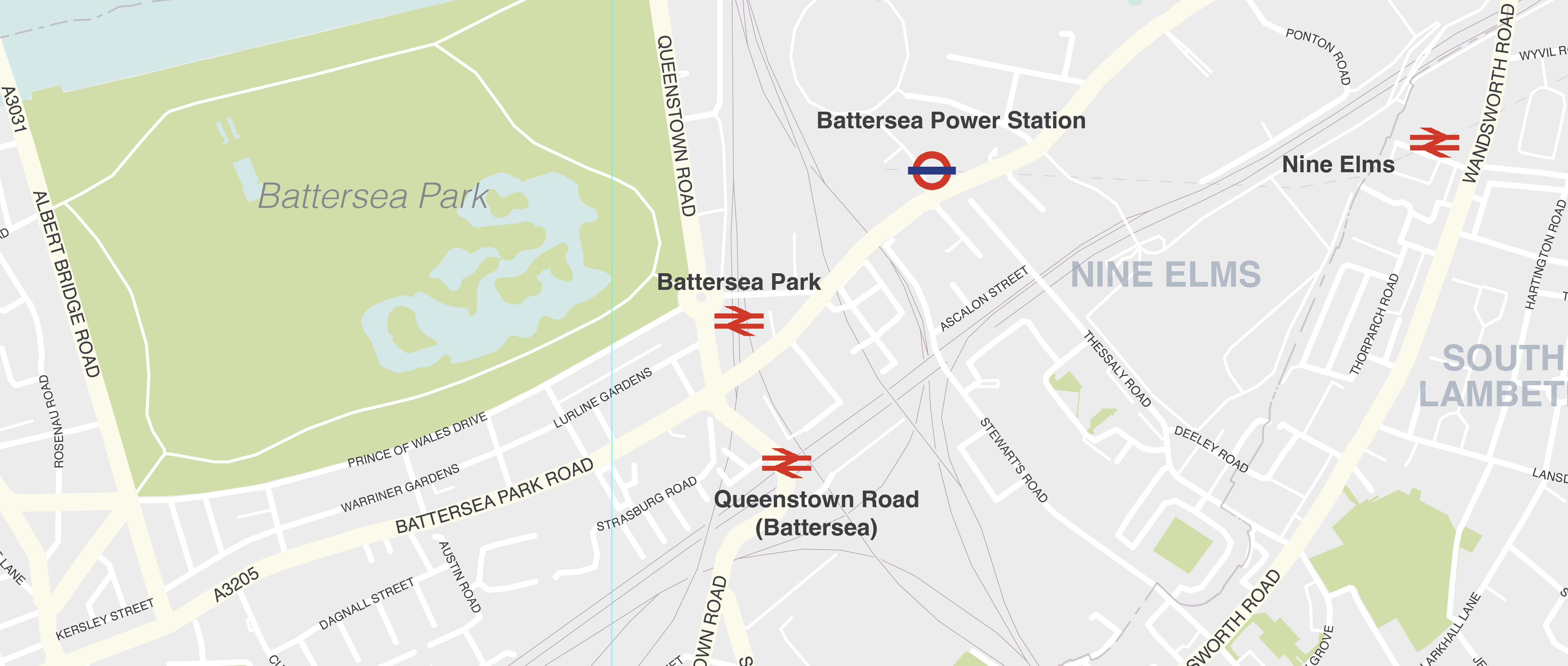
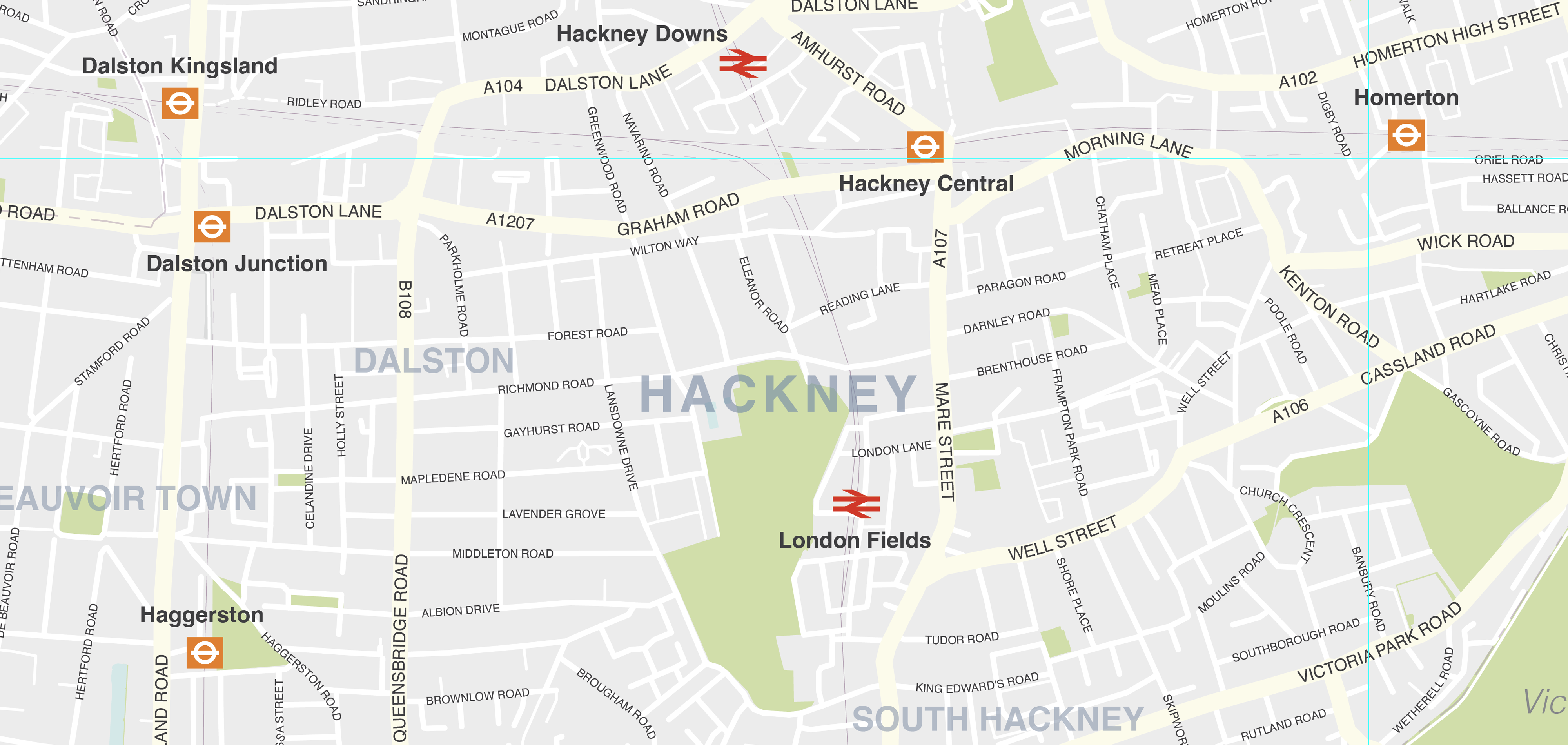
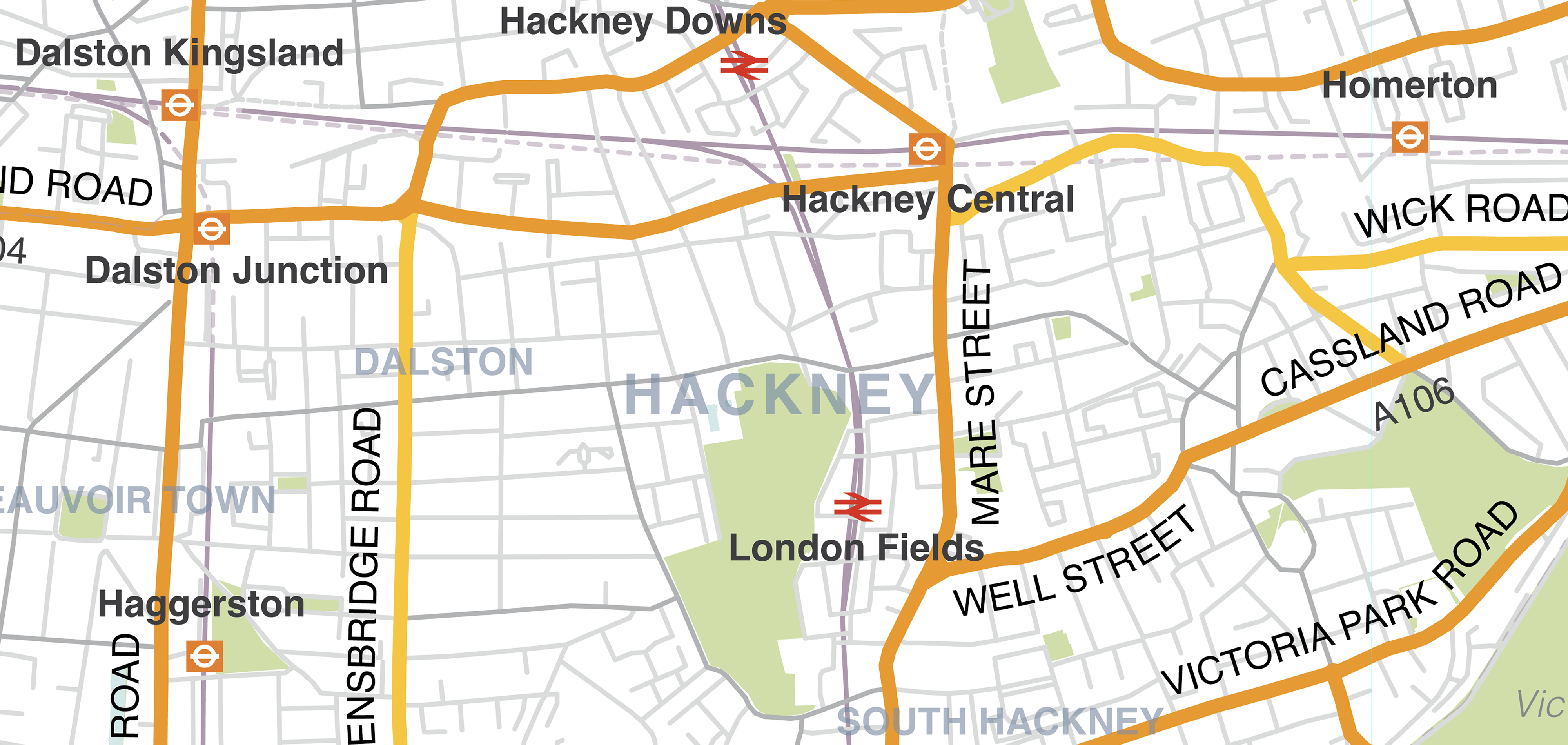
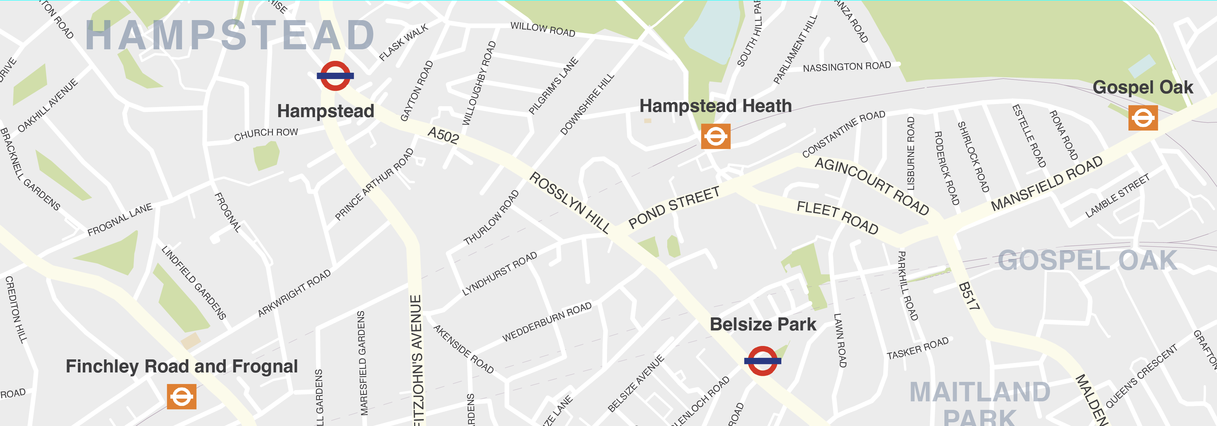
Version 1 is the most detailed and scaled to approximately 1: 14,000. If printed in its entirety this would be approximately 4m x 4m at 100%; at this scale, the labelling for local roads is 4pt (the minimum recommended size for printed maps), and even then only about 20% of London’s minor and local roads can be labelled in the available space. However all the main A and B roads are labelled, by name or road number.
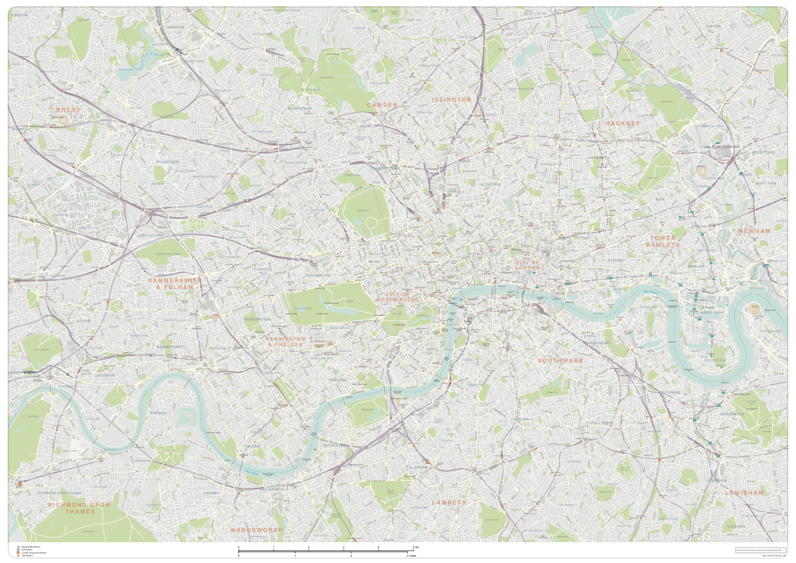
Version 2 scaling and labelling
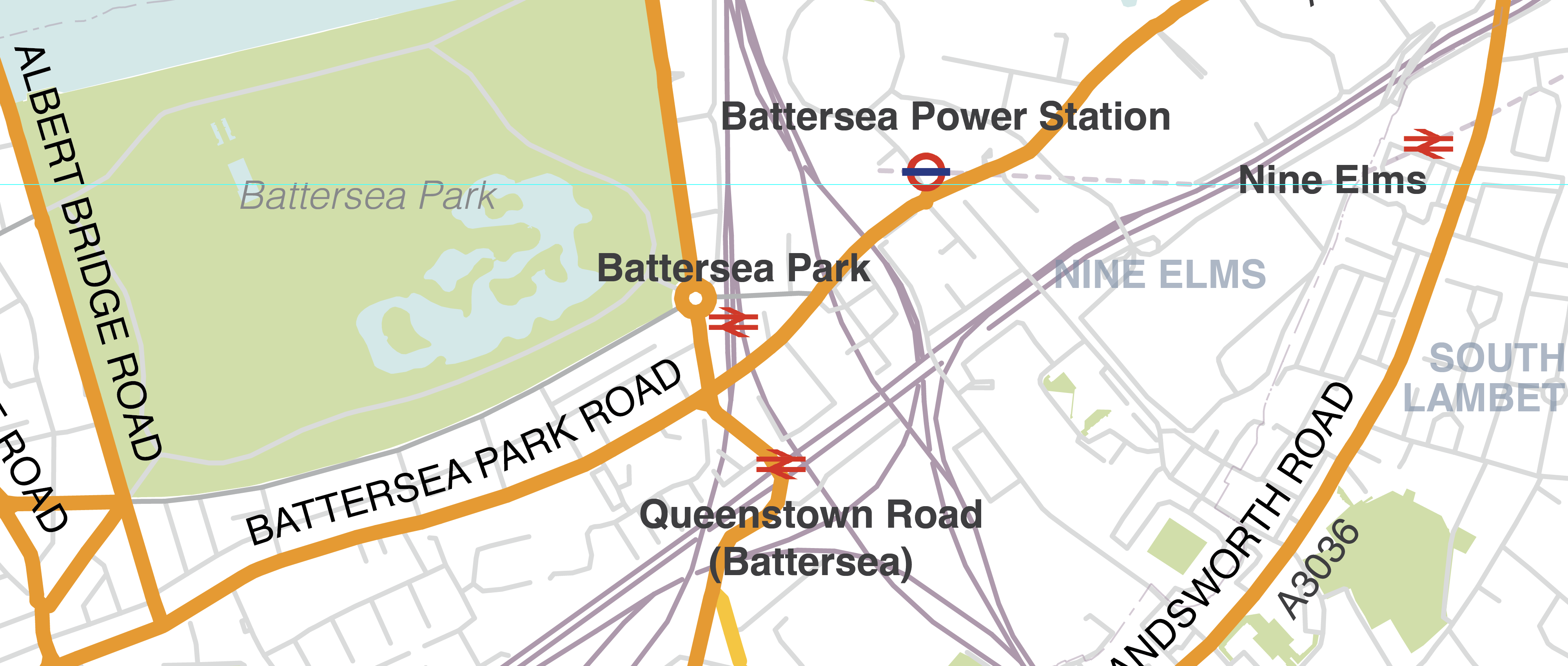
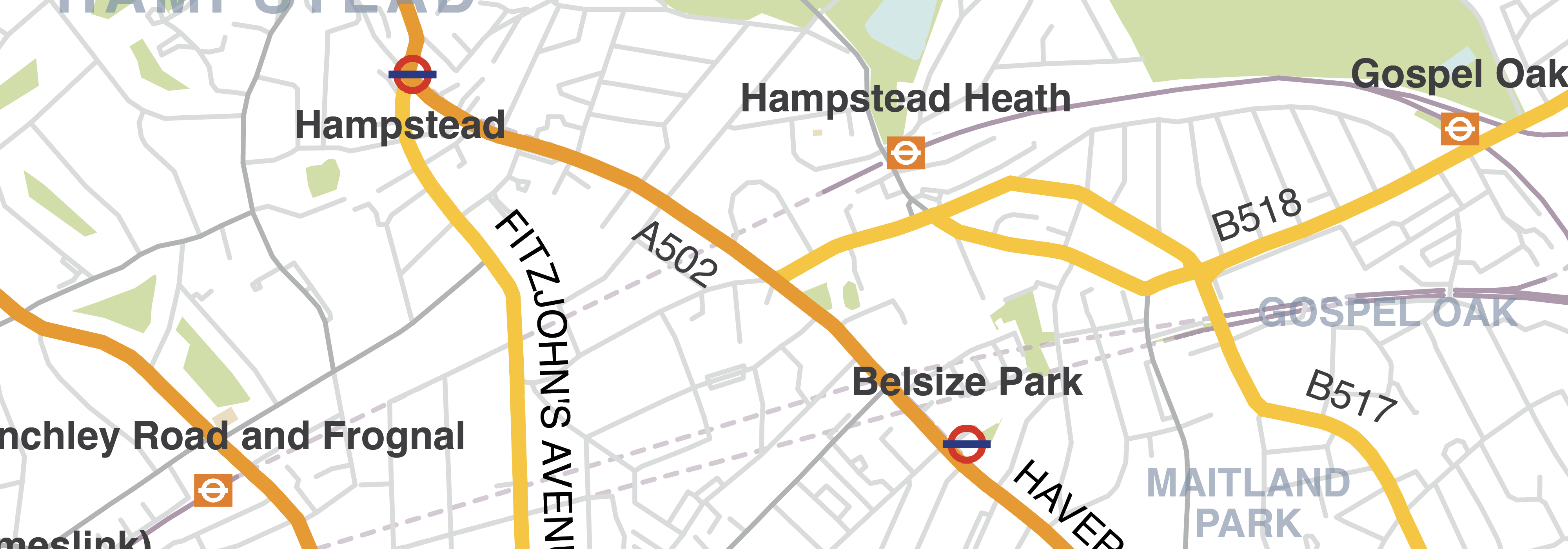
The second map in the package is scaled at circa 1: 50,000, and in its entirety could be printed within an A0 format. (Note, however, that the map is approximately square in composition, so would not fill the A0 format.) In this version the Primary and Secondary roads are more prominent visually, and these roads, along with the motorways are the only roads labelled. Minor, local, restricted access and combined use roads are plotted, however. It is a better map for looking at general navigation across London, but doesn’t have the detailed labelling and visual distinctions of roads on the larger map.
Version 1 Battersea detail
Version 2 Battersea detail
Version 1 Hackney detail
Version 2 Hackney detail
Version 1 Hampstead detail
Version 2 Hampstead detail
Full zoomable watermarked preview of version 1
Double-click or mouse scroll to zoom and pan / open full screen
Full zoomable watermarked preview of version 2
Double-click or mouse scroll to zoom and pan / open full screen
What you get in the Greater London map download package
Each version of the Greater London map is provided as a ready-to-use high-resolution PDF and a raw Illustrator file.
The raw Illustrator files are fully layered with live fonts for each version. The files are supplied in Illustrator Creative Cloud (CC) format.
Note: unlike many of Maproom’s other map bases, we have not output layered PDFs with Illustrator editing features retained, due to unwieldy supersized PDF formats. Nor have we supplied JPEGs or SVGs for this map, owing to the total unsuitability of those formats for supersize artwork of this nature.
All the artwork is supplied on Maproom’s standard royalty free terms and conditions.
Download sample layered Illustrator strips from the live files here

Loading time for the Greater London map artwork in Illustrator
Owing to the vast area of road network coverage for the whole of Greater London within this artwork, the amount of vector data in the file can take a while to load. Therefore, we recommend you use a reasonably powerful computer if you are planning to edit the artwork in Illustrator. Even a mid-range computer processor may take many seconds to load and perform editing functions. The slowest layers to work on are the road label layers. We recommend working in Illustrator’s isolation mode when editing, or turning off some other layers temporarily. If you want to focus on a smaller area of London, then it makes sense to crop the artwork first to reduce file size. However, even the standard Illustrator crop tools can be slow to perform a crop on so much data. Please contact us if you want us to check you have enough RAM processing power and technical ability to edit it before you buy.
Cropping, scaling and labelling service extras
For an extra fee we can scale and crop this artwork to specific dimensions of your choice, e.g. A0, A1 poster formats and advise about the legibility of labels at different scales. We can also add extra road names to smaller sections of this artwork. And finally, if you require additional layers, such as educational establishments or hospitals, we can add this to your version of the map – again, for an extra fee.
Please contact [email protected] if you wish to have a section of this base map tailored for your needs.
Specifications
Licensing terms
This editable map base is suitable for commercial and professional uses
See standard royalty free terms for downloadable maps
How to edit
Adobe Illustrator, CorelDRAW, PDF editors etc
See how to edit the downloadable maps
Recommended scaling
Billboard, large poster, tiles or zoomed areas
For more guidance see scaling recommendations
Vector map layers in Illustrator
You may also like…
-
Central London detailed street map
£75.00Our most detailed map of central London, including buildings and street names across a large area
PDFsSVGLayered AI file -
London map with roads, buildings, districts, boroughs, transport, landmarks
£100.00A superb general purpose editable map of London, with a wealth of detail including buildings, roads, railway lines, train stations, borough boundaries, rivers, canals, parks and landmarks
PDFsLayered AI file