Administrative maps
Showing 151–179 of 179 results
-
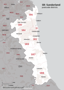
Map of SR postcode districts – Sunderland
£15.00The SR – Sunderland postcode districts scaled for A4+ printing
PDF -
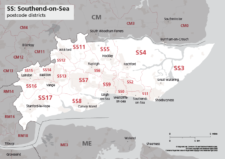
Map of SS postcode districts – Southend-on-Sea
£15.00The SS – Southend-on-Sea postcode districts scaled for A4+ printing
PDF -

Map of ST postcode districts – Stoke-on-Trent
£15.00The ST – Stoke-on-Trent postcode districts scaled for A4+ printing
PDF -
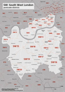
Map of SW postcode districts – South West London
£15.00The SW – South West London postcode districts scaled for A4+ printing
PDF -
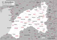
Map of SY postcode districts – Shrewsbury
£15.00The SY – Shrewsbury postcode districts scaled for A4+ printing
PDF -
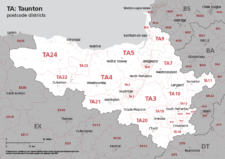
Map of TA postcode districts – Taunton
£15.00The TA – Taunton postcode districts scaled for A4+ printing
PDF -
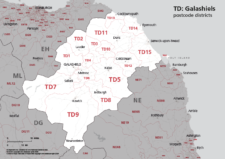
Map of TD postcode districts – Galashiels / Tweeddale
£15.00The TD – Galshiels postcode districts scaled for A4+ printing
PDF -
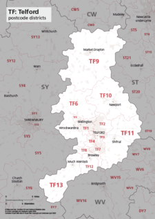
Map of TF postcode districts – Telford
£15.00The TF – Telford postcode districts scaled for A4+ printing
PDF -
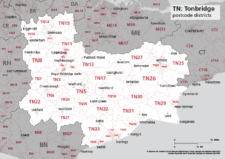
Map of TN postcode districts – Tonbridge
£15.00The TN – Tonbridge postcode districts scaled for A4+ printing
PDF -
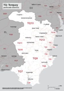
Map of TQ postcode districts – Torquay
£15.00The TQ – Torquay postcode districts scaled for A4+ printing
PDF -
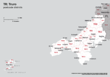
Map of TR postcode districts – Truro
£15.00The TR – Truro postcode districts scaled for A4+ printing
PDF -
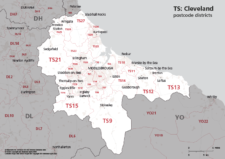
Map of TS postcode districts – Cleveland / Teesside
£15.00The TS – Cleveland postcode districts scaled for A4+ printing
PDF -
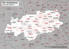
Map of TW postcode districts – Twickenham
£15.00The TW – Twickenham postcode districts scaled for A4+ printing
PDF -
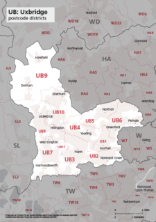
Map of UB postcode districts – Uxbridge / Southall
£15.00The UB – Uxbridge postcode districts scaled for A4+ printing
PDF -
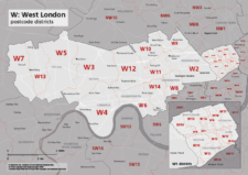
Map of W postcode districts – West London
£15.00The W – West London postcode districts scaled for A4+ printing
PDF -
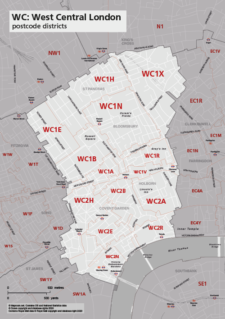
Map of WC postcode districts – West Central London
£15.00The WC – West Central London postcode districts scaled for A4+ printing
PDF -
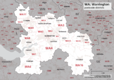
Map of WA postcode districts – Warrington
£15.00The WA – Warrington postcode districts scaled for A4+ printing
PDF -
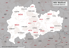
Map of WD postcode districts – Watford
£15.00The WD – Watford postcode districts scaled for A4+ printing
PDF -
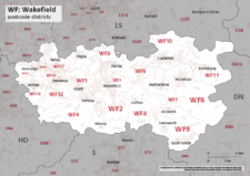
Map of WF postcode districts – Wakefield
£15.00The WF – Wakefield postcode districts scaled for A4+ printing
PDF -
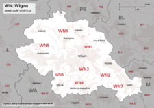
Map of WN postcode districts – Wigan
£15.00The WN – Wigan postcode districts scaled for A4+ printing
PDF -
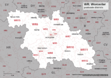
Map of WR postcode districts – Worcester
£15.00The WR – Worcester postcode districts scaled for A4+ printing
PDF -
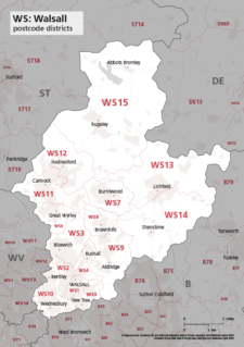
Map of WS postcode districts – Walsall
£15.00The WS – Walsall postcode districts scaled for A4+ printing
PDF -
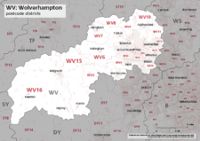
Map of WV postcode districts – Wolverhampton
£15.00The WV – Wolverhampton postcode districts scaled for A4+ printing
PDF -
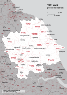
Map of YO postcode districts – York
£15.00The YO – York postcode districts scaled for A4+ printing
PDF -

Map of ZE postcode districts – Lerwick
£15.00The ZE – Lerwick postcode districts scaled for A4+ printing
PDF -
Political map of England
£40.00Shows all the counties of England, plus the principal towns and transport network.
PDFsSVGLayered AI file -
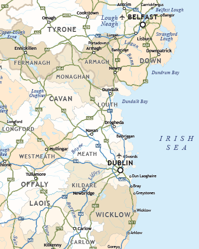
Political map of Ireland
£40.00Shows all the counties plus the principal towns and transport systems across both the Republic of Ireland and Northern Ireland.
PDFsSVGLayered AI file -
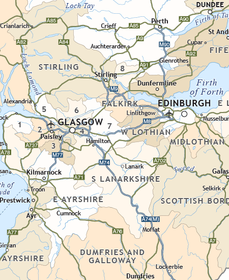
Political map of Scotland
£40.00Includes all the modern counties of Scotland, plus the principal towns and transport network.
PDFsSVGLayered AI file -
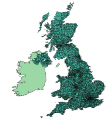
UK postcodes – Esri shapefiles and geojson sets for postcode areas and districts
£1,000.00All the UK postcode areas, districts, sectors and units in formats for developers and geocoders. A valuable and comprehensive GIS dataset that is capable of deep zooming down to street level. Includes Northern Ireland. Licensing restrictions apply.