Maproom

Editable & interactive digital maps

MENUMENU
  • about
  • news & blog
  • contact
  • 0 items
LOGIN
    • Home
  • Britain & Ireland maps
    • Britain and Ireland
    • UK - United Kingdom
    • Ireland
    • England
    • Scotland
    • Wales
    • Northern Ireland
    • Isle of Man
    • Channel Islands
  • City maps
    • Birmingham
    • Brighton
    • Bristol
    • Cardiff
    • Edinburgh
    • Exeter
    • Glasgow
    • Liverpool
    • London
    • Manchester
    • Oxford
  • Postcode maps
    • Overview
    • Online postcode mapping tools
    • Downloadable postcode maps
  • Region maps
    • Region maps
    • County maps
    • Local authority maps
    • Transport maps
    • National park maps
  • World maps
    • World maps
    • Europe maps
    • Map of EU countries 2024
    • Maps of France
    • Maps of Germany
    • Maps of New York and environs
  • DYNAMIC
    • Showcase
    • Dynamic Mapping Suite information and demos
    • GET A PASS
  • BESPOKE
    • Bespoke mapping services
    • Bespoke static maps
    • Bespoke dynamic maps
    • Search

DYNAMIC MAPS SHOWCASE

  • Showcase introduction
  • Constituencies and MPs
  • 3d mountains exploration
  • Listed buildings
  • Minimalist churches
  • Then and now comparison
  • Choropleth heat map

Related

  • Dynamic Mapping Suite introduction
  • Examples of bespoke dynamic maps

3d mountains exploration

Preview of 3d mountains map

Open map

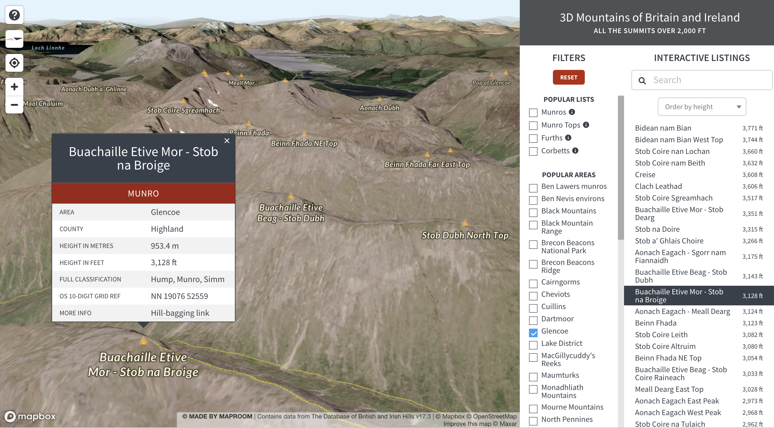
This map is an absolute show-off in multiple ways. Its 3d clarity alone is immersive enough to explore happily for ages, especially if you want to plan or recreate a leisure walk in the great outdoors. Unlike most of our other dynamic maps, which are 2d, this one lets you tilt the horizon and change your bearing to face any point of the compass, like in a video game. Then, on top of that, we have fed in the data for 3,658 mountains which you can interact with in various ways through direct tap of summits on the map or using a multitude of filters for listings in the side panel. Oh, and you can search for any mountain by name and choose to see listings alphabetically or by height.

We’ve made this demo for two reasons: one is because we like hill-walking and think this is a genuinely useful map for it, and the other is to try to persuade more clients to use 3d mapping and understand how filters might be deployed with their own data whether in 2d or 3d.

Below is a view of the spreadsheet feeding data directly to the 3d mountains map. (The original data comes from the Database of British and Irish Hills.) The filters are created by our programming for content in the Range and Classification columns.

Open full size map and start exploring the landscape and filters!

If you like the 3d effect, also check out our schematic 3d urban exploration

  • Standard royalty free terms for downloadable maps
  • Licensing terms for downloadable postcode maps
  • Licensing terms for dynamic online maps
  • How to edit the downloadable maps
  • Pricing & refund policies
  • Privacy & cookies

All content © Maproom at Blue Island Media · Award winning media projects