Maproom

Interactive & editable digital maps

  • about
  • news
  • contact
  • 0 items
Log in
  • Britain & Ireland maps
    • Britain and Ireland
    • UK - United Kingdom
    • Ireland
    • England
    • Scotland
    • Wales
    • Northern Ireland
    • Isle of Man
    • Channel Islands
  • City maps
    • Birmingham
    • Brighton
    • Bristol
    • Cardiff
    • Edinburgh
    • Exeter
    • Glasgow
    • Liverpool
    • London
    • Manchester
    • Oxford
  • Postcode maps
    • Overview
    • Dynamic postcode mapping tools
    • Downloadable postcode maps
  • Admin / region maps
    • UK administrative regions
    • County maps
    • Local authority maps
    • London borough maps
    • Transport maps
    • National park maps
  • World maps
    • World maps
    • Europe maps
    • Map of EU countries 2026
    • Maps of France
    • Maps of Germany
    • Maps of New York and environs
  • DYNAMIC MAPPING
    • Showcase
    • Dynamic Mapping Suite info
    • PASS PRICING
  • BESPOKE

DYNAMIC MAPS SHOWCASE

  • Showcase introduction
    • Spinning globe with animated routes
    • Constituencies and MPs
    • 3d mountains exploration
    • Listed buildings
    • Minimalist churches
    • Then and now comparison

DYNAMIC MAPPING SUITE

  • Dynamic Mapping Suite introduction
    • Locations Plotter examples
    • Radius plotting
    • Quick Select Postcodes
    • Bulk postcodes plotting
    • Mapping with spreadsheets
    • Dynamic postcodes with census data
    • Dynamic UK administrative maps
    • Choropleth heat maps
    • Dynamic maps for MRP polling data
    • Clean Air Zones + route planning
  • Pass pricing for the Dynamic Mapping Suite

Example of a map created with the Bulk Postcodes Plotter

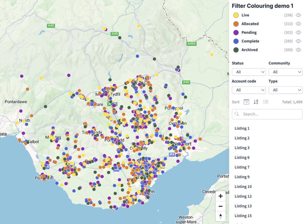
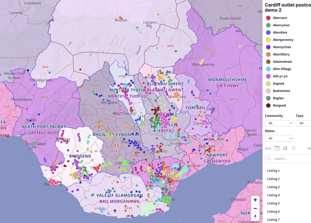
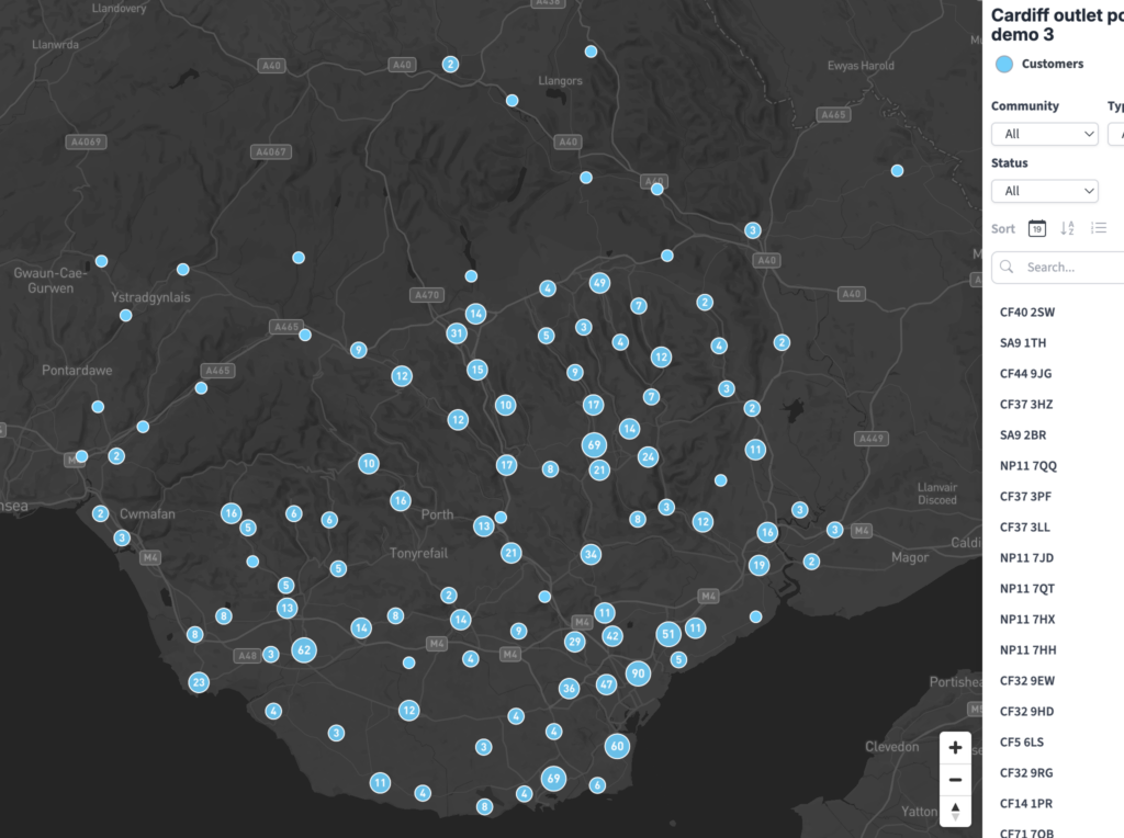
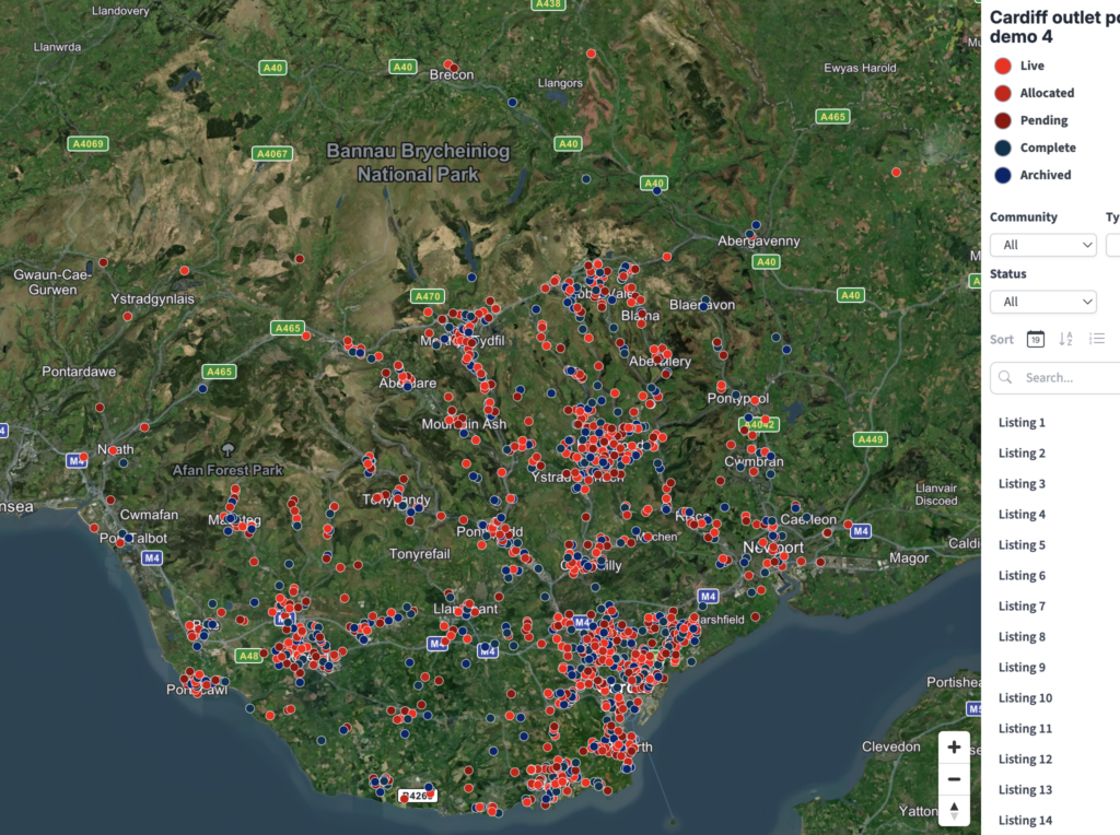
Our Bulk Postcodes tool in the Locations Plotter in the Dynamic Mapping Suite lets you plot hundreds or even thousands of postcodes in a single batch. The tool is brilliantly easy to use: simply copy your list of postcodes (one per line) into the Add a List > Postcodes box, or import a spreadsheet with postcodes and other location data, and they will be plotted within seconds as you watch. There’s a choice of backdrops including monochrome, colour, satellite, postcode boundaries, counties, local authorities, and constituencies. Every point and every listing is automatically interactive. You can also have filters and auto-colouring directly applied on import.

Tap the interactive points, filters and side listings
Demo postcodes are randomly generated and do not contain real personal data

View full size map

The same Cardiff postcodes data can be displayed easily with different filter columns, colours and base maps. Tap image previews to open full size.

Try the Dynamic Mapping Suite

GET TEST PASS

No payment card required. Access all mapping tools in Test Mode.

Or buy a full pass for £45 / month

  • Standard royalty free terms for downloadable maps
  • Licensing terms for downloadable postcode maps
  • Licensing terms for dynamic online maps
  • How to edit the downloadable maps
  • Refund, tax and pricing policies
  • Privacy & cookies

All content © Maproom at Blue Island Media · Award winning media projects